
![]()
Yewbarrow (North Top)
616m (2023ft)
The Western Fells, The Lake District, Cumbria, England

Not familiar with this top?
You can walk/hike to the top of Yewbarrow (North Top) by using any of these 3 easy‑to‑follow route maps:
Walk c386 Yewbarrow from Wasdale Head, Wast Water
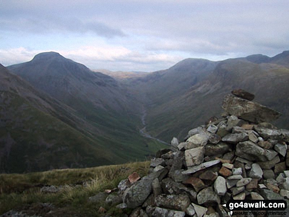
Very steep ascent up to Dore Head - pick a nice day
   |
|---|
Vital Statistics:
| Length: | 5.25ml (8.5km) |
|---|---|
| Ascent: | 2,123ft (647m) |
| Time: | 4 hrs |
| Grade: |  (Moderate) (Moderate) |

Route Summary:
Wasdale Head - Mosedale Beck - Dore Head - Yewbarrow (North Top) - Yewbarrow - Bell Rib - Dropping Crag - Over Beck - Overbeck Bridge - Wasdale Head - Wast Water.
Walk c101 Pillar and Little Scoat Fell from Wasdale Head, Wast Water
One of Lakeland's finest walks - unmissable
|
|---|
Vital Statistics:
| Length: | 11ml (17.5km) |
|---|---|
| Ascent: | 4,782ft (1,457m) |
| Time: | 8.75hrs |
| Grade: |  (Hard) (Hard) |

Route Summary:
Wasdale Head - Mosedale Beck - Black Sail Pass - Looking Stead (Pillar) - High Level Route - Robinson's Cairn - Pillar - Wind Gap - Black Crag (Pillar) - Scoat Fell (Little Scoat Fell) - Steeple - Red Pike (Wasdale) - Dore Head - Yewbarrow (North Top) - Yewbarrow - Dropping Crag - Bell Rib - Over Beck - Wasdale Head - Wast Water.
Walk c133 The Netherbeck Round from Greendale
Superb mountain walk on less crowded fells
|
|---|
Vital Statistics:
| Length: | 11.25ml (18km) |
|---|---|
| Ascent: | 5,100ft (1,554m) |
| Time: | 9.25hrs |
| Grade: | (Hard) |

Route Summary:
Greendale Farm - Middle Fell (Wasdale) - Seatallan - Pots of Ashness - Gowder Crag - Haycock - Great Scoat Fell - Steeple - Scoat Fell (Little Scoat Fell) - Red Pike (Wasdale) - Dore Head - Yewbarrow (North Top) - Yewbarrow - Bell Rib - Dropping Crag - Overbeck Bridge - Wast Water - Greendale Farm
See Yewbarrow (North Top) and the surrounding tops on our free-to-access 'Google Style' Peak Bagging Maps:
The Western Fells of The Lake District National Park
Less data - quicker to download
The Whole of The Lake District National Park
More data - might take a little longer to download
See Yewbarrow (North Top) and the surrounding tops on our unique, downloadable, PDF Peak Bagging Maps:

NB: Whether you print off a copy or download it to your phone, these PDF Peak Baggers' Maps might prove incredibly useful when your are up there on the tops and you cannot get a phone signal.
*This version is marked with the walk routes you need to follow to Walk all 214 Wainwrights in just 59 walks.
You can find Yewbarrow (North Top) & all the walks that climb it on these unique free-to-access Interactive Walk Planning Maps:
1:25,000 scale OS Explorer Map (orange/yellow covers):
1:50,000 scale OS Landranger Map (pink/magenta covers):
 Fellow go4awalkers who have already walked, climbed, scaled, summited, hiked & bagged Yewbarrow (North Top)
Christina Lander walked up Yewbarrow (North Top) on June 4th, 2021 [from/via/route] Wasdale Head - Kirk Fell - Pillar - Yewbarrow North Top - Yewbarrow - Wasdale Head [with] Dick [weather] A beautiful, sunny day - During our holiday staying at Station House, Troutbeck, Penrith
Kevin Foster climbed it on July 7th, 2022 [from/via/route] Wasdale Head [with] By myself. [weather] Dry & sunny. - After a substantial drop off from Red Pike the sun was out again. The route up Yewbarrow to the North top involved easy scrambling past Stirrup Crag.
Paul Macey bagged it on August 16th, 2021 [from/via/route] C101
Christine Shepherd hiked Yewbarrow (North Top) on October 29th, 2009 [from/via/route] Used walk c386 from Wasdale Head Climbed again on 23.08.21 adding Yewbarrow to the end of walk c240. [with] On my own [weather] Mixed but fine views
Caroline Winter summited on August 3rd, 2020 [from/via/route] Overbeck bridge, Yewbarrow Bell rib scramble, North top (Stirrup crag), Dore Head, Red Pike, Black Crag, Pillar, Little Scoat Fell, Haycock, Nether Beck [with] Becky [weather] Clear & warm - Pleasant, easy scramble up Yewbarrow. Retreated to easy path to Dore Head. 3 x Bob Graham competitors arrived at Pillar, as we finished lunch. Squeezed in Haycock before long tiring descent of Beck. Picquesque water falls heading down
To add (or remove) your name and experiences on this page - Log On and edit your Personal Mountain Bagging Record
. . . [see more walk reports]
More Photographs & Pictures of views from, on, or of, Yewbarrow (North Top)

Snow on Yewbarrow (North Top) left, Red Pike (centre right) and the shoulder or Kirk Fell (right) tower above Wasdale from near Sty Head
Send us your photographs and pictures on, of, or from Yewbarrow (North Top)
If you would like to add your walk photographs and pictures to this page, please send them as email attachments (configured for any computer) along with your name to:
and we shall do our best to publish them.
(Guide Resolution = 300dpi. At least = 660pixels (wide) x 440 pixels (high).)

You can also submit photos via our Facebook Page.
NB. Please indicate where each photo was taken and whether you wish us to credit your photos with a Username or your First Name/Last Name.


