![]()
Calf Top
609m (2000ft)
The Southern Dales Area, The Yorkshire Dales, Cumbria, England
Tap/mouse over a coloured circle (1-3 easy walks, 4-6 moderate walks, 7-9 hard walks) and click to select.
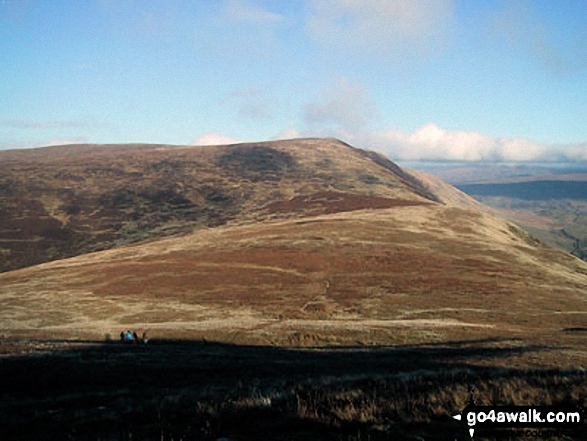
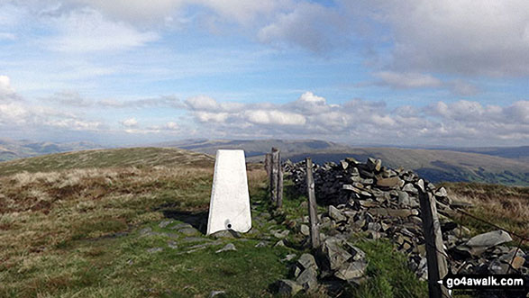
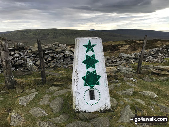
The summit of Calf Top is marked by an Ordnance Survey Trig Point.
Calf Top was reclassified from a 'Dewey' to a Mountain (Hewitt) and 'Nuttall' in September 2016. Formerly thought to be fractionally under the 609.6m (2000ft) required for mountain status, the Ordnance Survey recalculated the height of the mountain using the OSTN15/OSGM15 transformation to a height of 609.606m (2000ft and 1/4 inch).
Not familiar with this top?
   |
|---|
Vital Statistics:
| Length: | 13.5ml (21.5km) |
|---|---|
| Ascent: | 2,317ft (706m) |
| Time: | 7.25hrs |
| Grade: |  (Hard) (Hard) |
Route Summary:
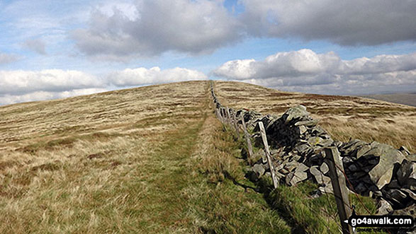
Hodge Bridge - Barbon - Thorn Moor - Eskholme Pike - Castle Knott - Calf Top - Barkin Top - Longbank Peat Moss - Long Bank - Fellside Farm - River Lune - Low Waterside Farm - Middleton Hall Bridge - Stockdale Beck - Applegarth - Borwens - Eller Beck - Barbon - Hodge Bridge
See Calf Top and the surrounding tops on our free-to-access 'Google Style' Peak Bagging Maps:
The Southern Dales Area of The Yorkshire Dales National Park
Less data - quicker to download
The Whole of The Yorkshire Dales National Park
More data - might take a little longer to download
See Calf Top and the surrounding tops on our downloadable Peak Bagging Map in PDF format:

NB: Whether you print off a copy or download it to your phone, this PDF Peak Baggers' Map might prove incredibly useful when your are up there on the tops and you cannot get a phone signal.
You can find Calf Top & all the walks that climb it on these unique free-to-access Interactive Walk Planning Maps:
1:25,000 scale OS Explorer Map (orange/yellow covers):
1:50,000 scale OS Landranger Map (pink/magenta covers):
 Fellow go4awalkers who have already walked, climbed, summited & bagged Calf Top
Adrian Howard walked up Calf Top on November 9th, 2020 [from/via/route] From Blindbeck Bridge, East of Barbon, to Castle Knott then onto Calf top. Same route back.
Alan Sutherland climbed it on September 15th, 2020 [from/via/route] Bardon [weather] Sunny
Margaret Richards bagged it on August 29th, 2018 [from/via/route] From Barbon [with] Don [weather] Misty at first, then sunny & clear - Great views
Caroline Winter hiked Calf Top on October 21st, 2017 [from/via/route] Short Gill Bridge in Barbondale via Hanging Stone to Calf Top [with] Becky [weather] Good visibility to Irish Sea, but low cloud over Crag Hill. Drizzle on return. High winds & gusts 40mph- SW - Saw 6 mice running into hides on the grsssy slope
Kevin Foster summited on August 15th, 2017 [from/via/route] Barbon [with] Henry [weather] Low cloud just covering summits with light rain morning. Clearing out & sunny afternoon. - The highlight of this walk for me, apart from climbing England's newest mountain at 2000ft & a 1/4 inch! was dropping down off the ridge to the lower cairn above Combe Scar for a late lunch break. You get a superb aerial view of the length of Dentdale. I could have sat there all day (and would have) if I didn't have to descend down Long Bank & then face a 5 mile walk along the Lune valley back to my car parked at Hodge bridge just outside Barbon village.
To add (or remove) your name and experiences on this page - Log On and edit your Personal Mountain Bagging Record
. . . [see more walk reports]
More Photographs & Pictures of views from, on or of Calf Top
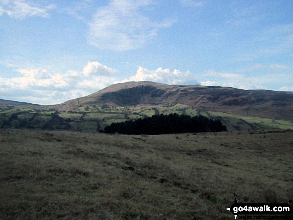
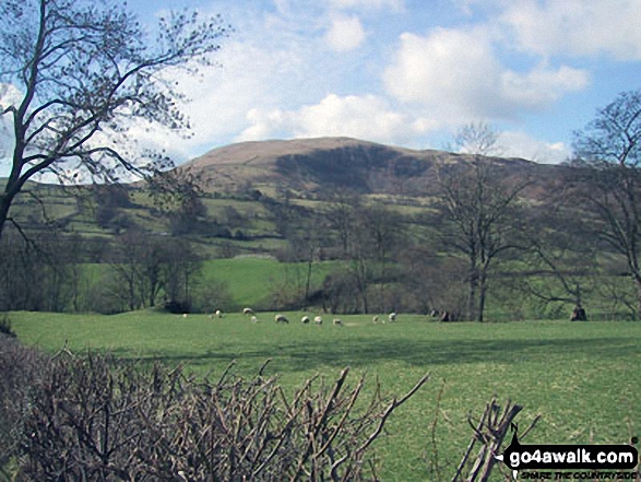
Dentdale with Whernside (left) Calf Top (centre) and Aye Gill Pike (right) from Great Knoutberry Hill (Widdale Fell)
Send us your photographs and pictures on, of, or from Calf Top
If you would like to add your walk photographs and pictures to this page, please send them as email attachments (configured for any computer) along with your name to:
and we shall do our best to publish them.
(Guide Resolution = 300dpi. At least = 660pixels (wide) x 440 pixels (high).)

You can also submit photos via our Facebook Page.
NB. Please indicate where each photo was taken and whether you wish us to credit your photos with a Username or your First Name/Last Name.