
![]()
Gragareth
628m (2060ft)
The Southern Dales Area, The Yorkshire Dales, Lancashire, England
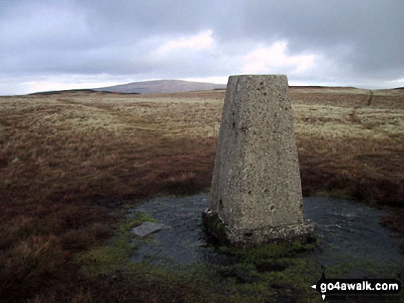
Gragareth is the highest point in the county of Lancashire.
The summit of Gragareth is marked by an Ordnance Survey Trig Point.
Not familiar with this top?
   |
|---|
Vital Statistics:
| Length: | 8.5ml (13.5km) |
|---|---|
| Ascent: | 1,653ft (504m) |
| Time: | 4.75hrs |
| Grade: |  (Moderate) (Moderate) |
Route Summary:
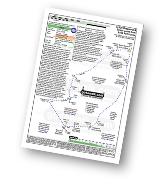
Leck Fell House - The Three Men of Gragareth - Gragareth - Green Hill (Gragareth) - Lancashire County Stone - Great Coum - Crag Hill - Casterton Fell - Ease Gill - Leck Fell House
|
|---|
Vital Statistics:
| Length: | 12.25ml (19.5km) |
|---|---|
| Ascent: | 1,568ft (478m) |
| Time: | 6 hrs |
| Grade: |  (Moderate) (Moderate) |
Route Summary:
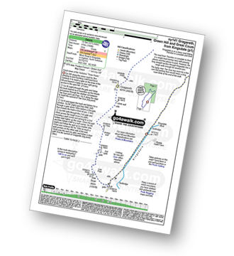
Kingsdale - Tow Scar - Gragareth - Green Hill (Gragareth) - Lancashire County Stone - High Pike - Kingsdale Beck - Kingsdale
|
|---|
Vital Statistics:
| Length: | 16.5ml (26km) |
|---|---|
| Ascent: | 2,447ft (746m) |
| Time: | 8½ hrs |
| Grade: |  (Hard) (Hard) |
Route Summary:
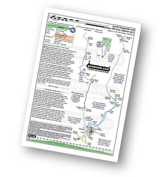
Ingleton - Thornton Hall Farm - Tow Scar - Gragareth - Green Hill (Gragareth) - Lancashire County Stone - High Pike - Kingsdale Beck - Braida Garth Farm - Twistleton Hall Farm - The Ingleton Waterfalls Trail - Beezley Falls - River Doe - Snow Falls - Ingleton
See Gragareth and the surrounding tops on our free-to-access 'Google Style' Peak Bagging Maps:
The Southern Dales Area of The Yorkshire Dales National Park
Less data - quicker to download
The Whole of The Yorkshire Dales National Park
More data - might take a little longer to download
See Gragareth and the surrounding tops on our downloadable Peak Bagging Map in PDF format:

NB: Whether you print off a copy or download it to your phone, this PDF Peak Baggers' Map might prove incredibly useful when your are up there on the tops and you cannot get a phone signal.
You can find Gragareth & all the walks that climb it on these unique free-to-access Interactive Walk Planning Maps:
1:25,000 scale OS Explorer Map (orange/yellow covers):
1:50,000 scale OS Landranger Map (pink/magenta covers):
 Fellow go4awalkers who have already walked, climbed, summited & bagged Gragareth
David Hughes walked up Gragareth on December 22nd, 2020 [from/via/route] Leck farm [with] DD DG Waz
Adrian Howard climbed Gragareth on March 6th, 2017 [from/via/route] Road side parking to South of summit, taking in Tow Scar trig on way.
Stella Nuttall bagged Gragareth on October 17th, 2018 [from/via/route] From Lack House Farm. Ny 129 Gragateth, Great Coum Green Hill & Crag Hill. We didn't see anyone else on this walk until we saw firstly 3 people in orange boiler suits & then 2 men in yellow boiler suits approaching in the distance, quite surreal. They had all been pot holing & were making their way back to the farm. We had lunch by the waterfall in the sun. [with] Stella, Ann, Sally Christine and Kath. [weather] Misty to start with but when this lifted the views were awesome. - Very wet on the top between Gragareth & Great Coum.
Kevin Foster hiked Gragareth on August 16th, 2017 [from/via/route] Yordas cave Kingsdale [with] Henry [weather] Sunny morning turning increasingly cloudy then light rain late in the walk - A fairly straightforward route up, with one very steep pull just after the sheepfold. The red rose county top of Lancashire gave me extensive views towards the west particularly Morecambe Bay & South Lakeland. I was pleasantly surprised by a FaceTime from my 5 year old grandson, wanting to know what I was up to, just as I reached the trig point. Perfect timing. Isn't technology wonderful?
Mark Davidson summited Gragareth on February 2nd, 2004 [with] Mike [weather] Bit of a dull February day but clear on the tops
Darren Mortimer conquered Gragareth on December 20th, 2015 [from/via/route] Leck Farm House [with] Dermot Palmer [weather] Overcast & windy - The very last Yorkshire peak
Caroline Winter scaled Gragareth on October 3rd, 2015 [from/via/route] Yordas woods in Kingdale, summit, Great Coum, High Peak via Green Lane track, road by Long Gill. [with] Solo [weather] Foggy but lifted only to return before peak. Poor visibility 30 metres on higher ground rest of day - Met cavers start & end of day exploring Yordas. I ventured to large entrance in woods but with no torch & by myself- too spooky! I've actually enjoyed caving but alas yearn for the blue skies! Not much blue today, nor views I'd been promised. Trig point easy to spot
Tony Rogerson walked up Gragareth on January 24th, 2010 [from/via/route] From Ireby [weather] Low cloud & mist - Snow under foot & drifts on hills
David Congreave climbed Gragareth on January 20th, 2015 [from/via/route] From Ingleton [with] Jonah [weather] Cold but mainly dry. - Heavy snowfall on the peak made the walk from Gragareth to Green Hill pretty gruelling.
Lynn Symonds bagged Gragareth on June 29th, 2014 [from/via/route] Walk from Leck Farm [with] Nicole [weather] clear sunny
To add (or remove) your name and experiences on this page - Log On and edit your Personal Mountain Bagging Record
. . . [see more walk reports]
More Photographs & Pictures of views from, on or of Gragareth
Send us your photographs and pictures on, of, or from Gragareth
If you would like to add your walk photographs and pictures featuring views from, on or of Gragareth to this page, please send them as email attachments (configured for any computer) along with your name to:
and we shall do our best to publish them.
(Guide Resolution = 300dpi. At least = 660pixels (wide) x 440 pixels (high).)

You can also submit photos via our Facebook Page.
NB. Please indicate where each photo was taken and whether you wish us to credit your photos with a Username or your First Name/Last Name.
Not familiar with this top?


