The Northern Dales Area of The Yorkshire Dales National Park - a fully detailed list of all the Mountains, Peaks, Tops and Hills
The Northern Dales Area of The Yorkshire Dales National Park, Cumbria and North Yorkshire is the area:
- Within the National Park north of the A684 from Sedbergh to Leyburn via Hawes, Bainbridge and Aysgarth
- East of the A683 from Sedbergh to Brough via Kirkby Stephen
If you include the Marilyns, the Bridgets (Hills) and all the Mountains, Tops, Peaks and Hills with a Trig Point on them there are 18 tops to climb, bag & conquer and the highest point is Great Shunner Fell at 716m (2,349ft).
To see these Mountains, Peaks, Tops and Hills displayed in different ways - see the options in the left-hand column and towards the bottom of this page.
![]() Your Personal Bagging Record for The Northern Dales Area of The Yorkshire Dales
Your Personal Bagging Record for The Northern Dales Area of The Yorkshire Dales
LOG ON and RELOAD this page to show which Mountains, Peaks, Tops and Hills you have already climbed, bagged & conquered [. . . more details]
See this list in: Alphabetical Order
| Height Order‡
To reverse the order select the link again.
Mountain, Peak, Top or Hill:
Bagged

![]()
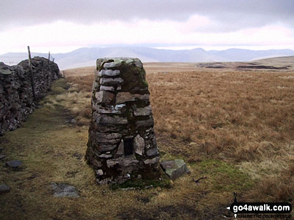
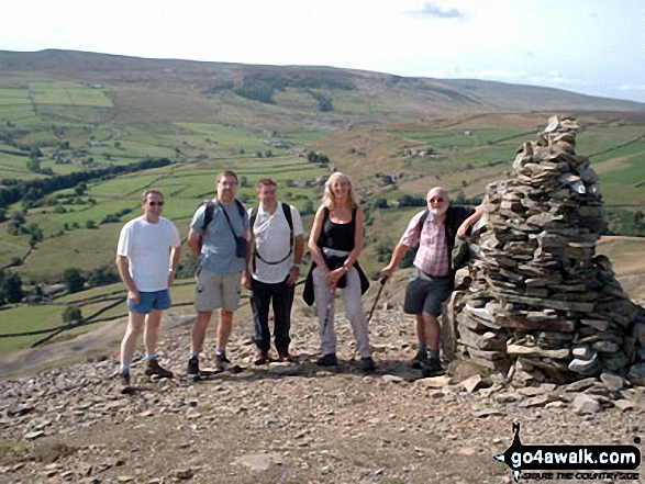
1. Great Shunner Fell
716m (2,349ft)
Great Shunner Fell is on interactive maps:
Great Shunner Fell is on downloadable PDF you can Print or Save to your Phone: |
![]()
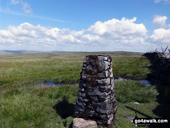
2. Wild Boar Fell
708m (2,323ft)
Wild Boar Fell is on interactive maps:
Wild Boar Fell is on downloadable PDF you can Print or Save to your Phone: |

![]()
3. Baugh Fell (Tarn Rigg Hill)
678m (2,225ft)
Baugh Fell (Tarn Rigg Hill) is on interactive maps:
Baugh Fell (Tarn Rigg Hill) is on downloadable PDF you can Print or Save to your Phone: |

![]()
4. Knoutberry Haw
675m (2,217ft)
Knoutberry Haw is on interactive maps:
Knoutberry Haw is on downloadable PDF you can Print or Save to your Phone: |
![]()
5. Rogan's Seat
672m (2,205ft)
Rogan's Seat is on interactive maps:
Rogan's Seat is on downloadable PDF you can Print or Save to your Phone: |
![]()
6. Water Crag (Arkengarthdale)
668m (2,192ft)
Water Crag (Arkengarthdale) is on interactive maps:
Water Crag (Arkengarthdale) is on downloadable PDF you can Print or Save to your Phone: |
![]()
7. Great Pinseat (Whaw Moor)
583m (1,913ft)
Send it in and we'll publish it here.
Great Pinseat (Whaw Moor) is on interactive maps:
Great Pinseat (Whaw Moor) is on downloadable PDF you can Print or Save to your Phone: |

![]()
8. Black Hill (Melbecks Moor)
569m (1,867ft)
Send it in and we'll publish it here.
Black Hill (Melbecks Moor) is on interactive maps:
Black Hill (Melbecks Moor) is on downloadable PDF you can Print or Save to your Phone: |
![]()
9. Little Fell (Wild Boar Fell)
559m (1,834ft)
Send it in and we'll publish it here.
Little Fell (Wild Boar Fell) is on interactive maps:
Little Fell (Wild Boar Fell) is on downloadable PDF you can Print or Save to your Phone: |
![]()
10. Hoove Faggergill
554m (1,818ft)
Hoove Faggergill is on interactive maps:
Hoove Faggergill is on downloadable PDF you can Print or Save to your Phone: |
![]()
11. The Fleak (Conny Tammy Currack)
551m (1,808ft)
Send it in and we'll publish it here.
The Fleak (Conny Tammy Currack) is on interactive maps:
The Fleak (Conny Tammy Currack) is on downloadable PDF you can Print or Save to your Phone: |
![]()
12. Robert's Seat
549m (1,801ft)
Robert's Seat is on interactive maps:
Robert's Seat is on downloadable PDF you can Print or Save to your Phone: |
![]()
13. Blea Barf
540m (1,772ft)
Blea Barf is on interactive maps:
Blea Barf is on downloadable PDF you can Print or Save to your Phone: |

![]()
14. Peat Moor Hill (Booze Moor)
522m (1,713ft)
Send it in and we'll publish it here.
Peat Moor Hill (Booze Moor) is on interactive maps:
Peat Moor Hill (Booze Moor) is on downloadable PDF you can Print or Save to your Phone: |
![]()
15. Cleasby Hill
511m (1,677ft)
Cleasby Hill is on interactive maps:
Cleasby Hill is on downloadable PDF you can Print or Save to your Phone: |
![]()
16. Kisdon
499m (1,638ft)
Kisdon is on interactive maps:
Kisdon is on downloadable PDF you can Print or Save to your Phone: |
![]()
17. Calver Hill
487m (1,598ft)
Calver Hill is on interactive maps:
Calver Hill is on downloadable PDF you can Print or Save to your Phone: |
![]()
18. Fremington Edge
473m (1,552ft)
Fremington Edge is on interactive maps:
Fremington Edge is on downloadable PDF you can Print or Save to your Phone: |
View these 18 Mountains, Peaks, Tops and Hills:
- On a Downloadable PDF you can Print or Save to your Phone#
- On an Interactive Google Map (loads faster)
- On an Interactive Google Map with a list of tops below it.
(makes it easier to locate a particular top) - On a Detailed List in:
Alphabetical Order | Height Order - On one page with 'yet-to-be-bagged' listed 1st & then 'already-bagged' tops listed 2nd in:
Alphabetical Order | Height Order - On one page with 'already-bagged' tops listed 1st & then 'yet-to-be-bagged' tops listed 2nd in:
Alphabetical Order | Height Order
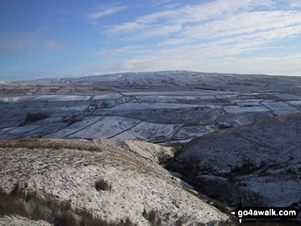
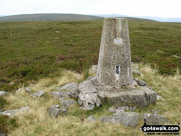
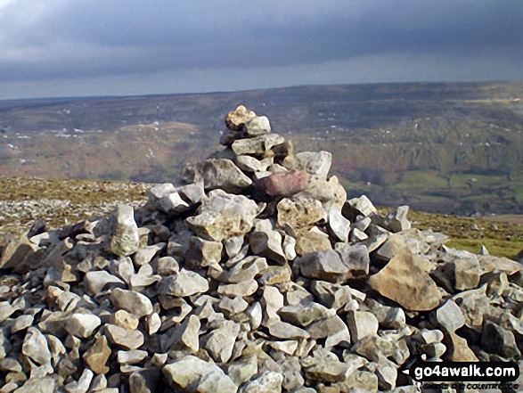
 The summit of Great Shunner Fell in The Northern Dales Area of The Yorkshire Dales
Photo: Paul Harrison
# Whether you print a copy or download it to your phone, this Peak Baggers' Map will prove incredibly useful if you want to know what's what when you are up in the mountains and cannot get a phone signal.
Is there a Mountain, Peak, Top or Hill missing from the above google map or list?
Let us know an we will add it to our database.

To contribute to go4awalk.com or to contact us about anything at all - see Talk To Us.
For help see Help.
go4awalk.com and go4awalk.co.uk are registered trademarks of TMDH Limited.
Copyright © 2000-2025 TMDH Limited. All rights reserved.
Copyright Terms & Conditions Privacy Statement
A - Z Walks Home Log On/Accounts Photo Gallery Walk Ideas and Collections Fell Facts Hill Skills Walking Questions and Answers Your Stories News Competitions Product Reviews/Gear Tests Walking Gear Guides Peaks and Mountains Peak Bagging Find New Walking Friends Camping GPS Waypoints for Walking Contents Walk Search Talk To Us go4awalk.com Help Free Example Walks Newsletter


