![]()
Water Crag (Arkengarthdale)
668m (2192ft)
The Northern Dales Area, The Yorkshire Dales, North Yorkshire, England
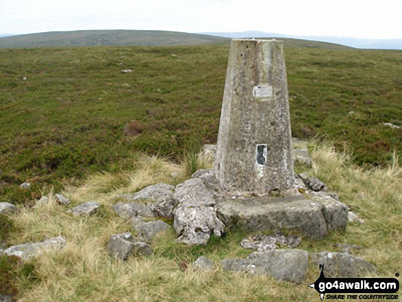
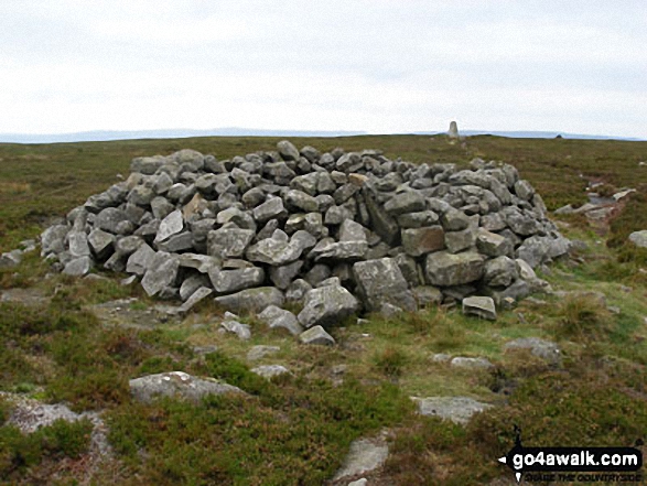
The summit of Water Crag (Arkengarthdale) is marked by an Ordnance Survey Trig Point.
Not familiar with this top?
   |
|---|
Vital Statistics:
| Length: | 11ml (17.5km) |
|---|---|
| Ascent: | 2,681ft (817m) |
| Time: | 6.75hrs |
| Grade: |  (Hard) (Hard) |
Route Summary:
Keld - The Pennine Way - The Herriot Way - The River Swale - Swaledale - Wainwright's Coast to Coast Walk - Kisdon Force - Crackpot Hall - Swinner Gill - Hind Hole Beck - Swinner Gill Lead Mines - East Grain - High Stone Man - Rogan's Seat - Moor Hen Nest - Water Crag (Arkengarthdale) - Blakethwaite Gill - Blakethwaite Meres - Blakethwaite Dams - Gunnerside Gill - Eweleap Scar - Bling Gill - Lownathwaite Mea - High Whim - Swinner Gill - Kisdon Force - Crackpot Hall - Keld
See Water Crag (Arkengarthdale) and the surrounding tops on our free-to-access 'Google Style' Peak Bagging Maps:
The Northern Dales Area of The Yorkshire Dales National Park
Less data - quicker to download
The Whole of The Yorkshire Dales National Park
More data - might take a little longer to download
See Water Crag (Arkengarthdale) and the surrounding tops on our downloadable Peak Bagging Map in PDF format:

NB: Whether you print off a copy or download it to your phone, this PDF Peak Baggers' Map might prove incredibly useful when your are up there on the tops and you cannot get a phone signal.
You can find Water Crag (Arkengarthdale) & all the walks that climb it on these unique free-to-access Interactive Walk Planning Maps:
1:25,000 scale OS Explorer Map (orange/yellow covers):
1:50,000 scale OS Landranger Maps (pink/magenta covers):
 Fellow go4awalkers who have already walked, climbed, summited & bagged Water Crag (Arkengarthdale)
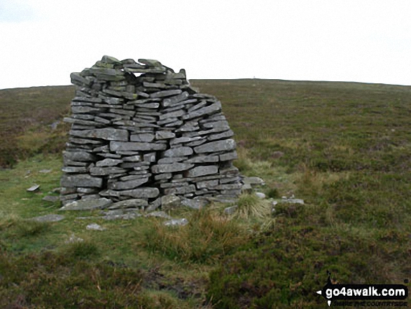
Kevin Foster walked up it on August 27th, 2017 [from/via/route] Rogan's Seat [with] By myself [weather] Perfect conditions; sunny with a cool breeze - The route to Water Crag appeared daunting when viewed from Rogan's Seat, but on the ground was quite easy to follow & relatively dry underfoot. Leaving the fence line I had been following at a corner as it turned left I struck NE towards a wall to find my second abandoned vehicle of the day, an eight wheeled all terrain vehicle looking in very good nick. It had robably been left up here by a game keeper, & quite recently by the condition of it, this walk being largely on grouse shooting estate. I half expected the game keeper to appear from behind the wall & tell me I was trespassing on Lord Peel's land but it was Sunday & there was no one about. With the summit of Water Crag reached, I walked over to the OS trig point & the large well constructed wind shelter to admire the views northwards. I tried to locate the position of the Tan Hill Inn across the vast desolate moorland but without luck. Many miles away I could make out the speeding cars & lorries on the A66 a road I've driven on many times. Now I know that the big fell on my left as I drive over Bowes Moor towards Stainmore Gap is in fact Water Crag. Having 'bagged' Water Crag I knew I had completed the Northern section of the Yorkshire Dales 2000ers but I was still a long way from my car. So, initially ignoring the route description to 'descend southwards over rough & pathless moor', I followed the boundary stones on a reasonable track SE towards Great Punchard Head. After a while though I realised that this would take me too far East & by the time I picked up any tracks South I would reappear about half way down Gunnerside Gill & miss the ruined Blakethwaite Dams which was something I particularly wanted to see. Therefore, I left the track I was on & 'struck South over rough & pathless moor', which was luckily very dry to eventually pick up the head of Blakethwaite Gill & a decent trod leading down. Route finding difficulties over the rest of the walk along the entire length of Gunnerside Gill & the descent into Swaledale at Ivelet was an absolute delight in warm sunshine with many stops along the way to take photos. From Ivelet bridge it was a short stroll through the meadows beside the Swale back To Muker. What a day!
Mark Davidson climbed it on September 25th, 2008 [with] Mike [weather] Bit cloudy but dry
Tony Rogerson bagged it on August 7th, 2016 [from/via/route] Tan Hill William Gill Water Crag William Gill Great Cocker Sleightholme Moor Road Pennine Way Tan Hill [with] Caz Floss [weather] Mostly dry but very windy
Darren Mortimer hiked it on February 7th, 2015 [from/via/route] Keld [with] Dermot Palmer [weather] Clear skies & lots of snow - Walk ny103
Christine Shepherd summited on July 3rd, 2014 [from/via/route] Walked from Keld using walk ny103 [with] On my own [weather] Overcast but stayed dry. - See comments for Rogan's seat. Great to revisit some of the Coast to Coast. Happy memories.
Andrew Joss conquered it on May 3rd, 2014 [from/via/route] Keld [weather] Cloudy but mild - Walk down was fantastic & good views from the top
Ray O'hara scaled it on September 25th, 2013 [from/via/route] NY103 [weather] Fine - Just walked across from Rogan's seat & because the route ahead looked fairly boggy, I decided to back track to Rogan's Seat & return that way.
Gary Powell walked up it during June, 2012 [with] husband
Matthew Thomas has walked, climbed & bagged Water Crag (Arkengarthdale).
To add (or remove) your name and experiences on this page - Log On and edit your Personal Mountain Bagging Record
More Photographs & Pictures of views from, on or of Water Crag (Arkengarthdale)
Send us your photographs and pictures on, of, or from Water Crag (Arkengarthdale)
If you would like to add your walk photographs and pictures to this page, please send them as email attachments (configured for any computer) along with your name to:
and we shall do our best to publish them.
(Guide Resolution = 300dpi. At least = 660pixels (wide) x 440 pixels (high).)

You can also submit photos via our Facebook Page.
NB. Please indicate where each photo was taken and whether you wish us to credit your photos with a Username or your First Name/Last Name.
Not familiar with this top?