The Yorkshire region of England - a fully detailed list of all the Mountains, Peaks, Tops and Hills (Page 2 of 2)
The Yorkshire region of England comprises the traditional counties of East Riding of Yorkshire, North Yorkshire, South Yorkshire and West Yorkshire.
If you include all the Mountains (Hewitts), the Deweys, the Nuttalls, the Marilyns, the Bridgets (Hills) and all the Mountains, Tops, Peaks and Hills with a Trig Point on them there are 117 tops to climb, bag & conquer and the highest point is Whernside at 736m (2,416ft).
To see these Mountains, Peaks, Tops and Hills displayed in different ways - see the options in the left-hand column and towards the bottom of this page.
LOG ON and RELOAD this page to show which Mountains, Peaks, Tops and Hills you have already climbed, bagged & conquered [. . . more details]
Page 2 of 2 Go to page:
1 2 |
See this list in: Alphabetical Order‡
| Height Order
To reverse the order select the link again.
Mountain, Peak, Top or Hill:
Bagged
31. Kilnsey Moor
450m (1,477ft)
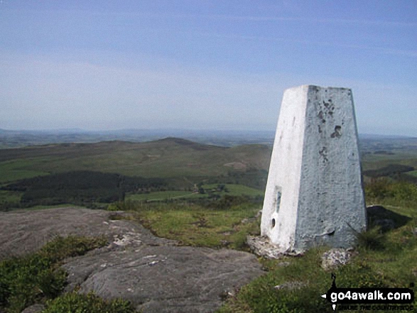
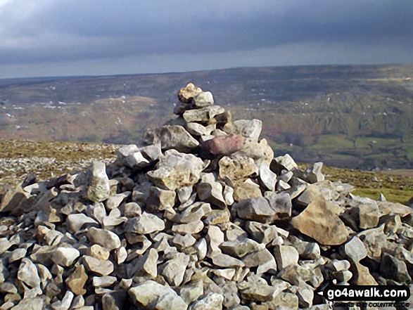
OS Trig Point
We hope to have walks that climb & bag Kilnsey Moor very soon
See the location of Kilnsey Moor and walks up it on a google MapKilnsey Moor is on interactive maps:
OS Explorer (Orange Covers): OL2
OS Landranger (Pink Covers): 98
Kilnsey Moor is on downloadable PDF you can Print or Save to your Phone:
|
32. Ingleborough
724m (2,375ft)
Mountain (83rd in England, 144th in England & Wales)
Nuttall (104th in England, 178th in England & Wales)
Marilyn (26th in England, 540th in GB)
OS Trig Point
To walk, climb & bag Ingleborough use any of these easy-to-follow walks:
See the location of Ingleborough and walks up it on a google MapIngleborough is on interactive maps:
OS Explorer (Orange Covers): OL2
OS Landranger (Pink Covers): 98
Ingleborough is on downloadable PDF you can Print or Save to your Phone:
|
33. Horse Head (Horse Head Moor)
605m (1,985ft)
Bridget
OS Trig Point
To walk, climb & bag Horse Head (Horse Head Moor) use this easy-to-follow walk:
See the location of Horse Head (Horse Head Moor) and walks up it on a google MapHorse Head (Horse Head Moor) is on interactive maps:
OS Explorer (Orange Covers): OL30
OS Landranger (Pink Covers): 98
|
34. Hoove Faggergill
554m (1,818ft)
Dewey (62nd in England, 145th in England & Wales)
Marilyn (62nd in England, 862nd in GB)
OS Trig Point
We hope to have walks that climb & bag Hoove Faggergill very soon
See the location of Hoove Faggergill and walks up it on a google MapHoove Faggergill is on interactive maps:
OS Explorer (Orange Covers): OL30
OS Landranger (Pink Covers): 92
Hoove Faggergill is on downloadable PDF you can Print or Save to your Phone:
|
35. Hollin Hill (Oxenhope Moor)
451m (1,480ft)
Bridget
OS Trig Point
To walk, climb & bag Hollin Hill (Oxenhope Moor) use this easy-to-follow walk:
See the location of Hollin Hill (Oxenhope Moor) and walks up it on a google MapHollin Hill (Oxenhope Moor) is on interactive maps:
OS Explorer (Orange Covers): OL21
OS Landranger (Pink Covers): 104
Hollin Hill (Oxenhope Moor) is on downloadable PDF you can Print or Save to your Phone:
|
36. High Stones (Howden Moor)
548m (1,798ft)
Dewey (74th in England, 173rd in England & Wales)
To walk, climb & bag High Stones (Howden Moor) use either of these easy-to-follow walks:
See the location of High Stones (Howden Moor) and walks up it on a google MapHigh Stones (Howden Moor) is on interactive maps:
OS Explorer (Orange Covers): OL1
OS Landranger (Pink Covers): 110
High Stones (Howden Moor) is on downloadable PDF you can Print or Save to your Phone:
|
37. High Green Field Knott (Cosh Knott)
602m (1,975ft)
Dewey (10th in England, 23rd in England & Wales)
To walk, climb & bag High Green Field Knott (Cosh Knott) use this easy-to-follow walk:
See the location of High Green Field Knott (Cosh Knott) and walks up it on a google MapHigh Green Field Knott (Cosh Knott) is on interactive maps:
OS Explorer (Orange Covers): OL2 and
OL30
OS Landranger (Pink Covers): 98
High Green Field Knott (Cosh Knott) is on downloadable PDF you can Print or Save to your Phone:
|
38. Height of Hazely
553m (1,814ft)
Dewey (65th in England, 152nd in England & Wales)
We hope to have walks that climb & bag Height of Hazely very soon
See the location of Height of Hazely and walks up it on a google MapHeight of Hazely is on interactive maps:
OS Explorer (Orange Covers): OL30
OS Landranger (Pink Covers): 98
Height of Hazely is on downloadable PDF you can Print or Save to your Phone:
|
39. Hartcliff Hill
364m (1,194ft)
Bridget
We hope to have walks that climb & bag Hartcliff Hill very soon
See the location of Hartcliff Hill and walks up it on a google MapHartcliff Hill is on interactive maps:
OS Explorer (Orange Covers): OL1
OS Landranger (Pink Covers): 110
Hartcliff Hill is on downloadable PDF you can Print or Save to your Phone:
|
40. Harland Hill
535m (1,756ft)
Dewey (104th in England, 240th in England & Wales)
We hope to have walks that climb & bag Harland Hill very soon
See the location of Harland Hill and walks up it on a google MapHarland Hill is on interactive maps:
OS Explorer (Orange Covers): OL30
OS Landranger (Pink Covers): 98
Harland Hill is on downloadable PDF you can Print or Save to your Phone:
|
41. Grizedales
553m (1,814ft)
Dewey (64th in England, 151st in England & Wales)
We hope to have walks that climb & bag Grizedales very soon
See the location of Grizedales and walks up it on a google MapGrizedales is on interactive maps:
OS Explorer (Orange Covers): OL2 and
OL41
OS Landranger (Pink Covers): 98
Grizedales is on downloadable PDF you can Print or Save to your Phone:
|
42. Great Wold
164m (538ft)
Bridget
OS Trig Point
We hope to have walks that climb & bag Great Wold very soon
See the location of Great Wold and walks up it on a google MapGreat Wold is on interactive maps:
OS Explorer (Orange Covers): 293
OS Landranger (Pink Covers): 106
|
43. Great Whernside
704m (2,310ft)
Mountain (102nd in England, 168th in England & Wales)
Nuttall (127th in England, 211th in England & Wales)
Marilyn (31st in England, 584th in GB)
OS Trig Point
To walk, climb & bag Great Whernside use either of these easy-to-follow walks:
See the location of Great Whernside and walks up it on a google MapGreat Whernside is on interactive maps:
OS Explorer (Orange Covers): OL30
OS Landranger (Pink Covers): 98
Great Whernside is on downloadable PDF you can Print or Save to your Phone:
|
44. Great Shunner Fell
716m (2,349ft)
Mountain (88th in England, 151st in England & Wales)
Nuttall (111th in England, 190th in England & Wales)
Marilyn (27th in England, 554th in GB)
OS Trig Point
To walk, climb & bag Great Shunner Fell use this easy-to-follow walk:
See the location of Great Shunner Fell and walks up it on a google MapGreat Shunner Fell is on interactive maps:
OS Explorer (Orange Covers): OL30
OS Landranger (Pink Covers): 98
Great Shunner Fell is on downloadable PDF you can Print or Save to your Phone:
|
45. Great Pinseat (Whaw Moor)
583m (1,913ft)
Dewey (26th in England, 64th in England & Wales)
OS Trig Point
We hope to have walks that climb & bag Great Pinseat (Whaw Moor) very soon
See the location of Great Pinseat (Whaw Moor) and walks up it on a google MapGreat Pinseat (Whaw Moor) is on interactive maps:
OS Explorer (Orange Covers): OL30
OS Landranger (Pink Covers): 92
Great Pinseat (Whaw Moor) is on downloadable PDF you can Print or Save to your Phone:
|
46. Great Haw
542m (1,779ft)
Bridget
We hope to have walks that climb & bag Great Haw very soon
See the location of Great Haw and walks up it on a google MapGreat Haw is on interactive maps:
OS Explorer (Orange Covers): OL30
OS Landranger (Pink Covers): 99
Great Haw is on downloadable PDF you can Print or Save to your Phone:
|
47. Gisborough Moor
328m (1,076ft)
Marilyn (119th in England, 1334th in GB)
Gisborough Moor is the highest point in the county of Redcar and Cleveland.
We hope to have walks that climb & bag Gisborough Moor very soon
See the location of Gisborough Moor and walks up it on a google MapGisborough Moor is on interactive maps:
OS Explorer (Orange Covers): OL26
OS Landranger (Pink Covers): 94
A downloadable go4awalk.com PDF Peak Bagging Map featuring Gisborough Moor will be available soon. |
48. Fremington Edge
473m (1,552ft)
Bridget
To walk, climb & bag Fremington Edge use any of these easy-to-follow walks:
See the location of Fremington Edge and walks up it on a google MapFremington Edge is on interactive maps:
OS Explorer (Orange Covers): OL30
OS Landranger (Pink Covers): 92
Fremington Edge is on downloadable PDF you can Print or Save to your Phone:
|
49. Fountains Fell (South Top)
663m (2,176ft)
Nuttall (178th in England, 301st in England & Wales)
To walk, climb & bag Fountains Fell (South Top) use this easy-to-follow walk:
See the location of Fountains Fell (South Top) and walks up it on a google MapFountains Fell (South Top) is on interactive maps:
OS Explorer (Orange Covers): OL2
OS Landranger (Pink Covers): 98
Fountains Fell (South Top) is on downloadable PDF you can Print or Save to your Phone:
|
50. Fountains Fell
668m (2,192ft)
Mountain (129th in England, 220th in England & Wales)
Nuttall (172nd in England, 292nd in England & Wales)
Marilyn (41st in England, 657th in GB)
To walk, climb & bag Fountains Fell use this easy-to-follow walk:
See the location of Fountains Fell and walks up it on a google MapFountains Fell is on interactive maps:
OS Explorer (Orange Covers): OL2
OS Landranger (Pink Covers): 98
Fountains Fell is on downloadable PDF you can Print or Save to your Phone:
|
51. Firth Fell
607m (1,992ft)
Bridget
OS Trig Point
To walk, climb & bag Firth Fell use this easy-to-follow walk:
See the location of Firth Fell and walks up it on a google MapFirth Fell is on interactive maps:
OS Explorer (Orange Covers): OL30
OS Landranger (Pink Covers): 98
|
52. Featherbed Moss (Howden Edge)
545m (1,788ft)
Bridget
To walk, climb & bag Featherbed Moss (Howden Edge) use either of these easy-to-follow walks:
See the location of Featherbed Moss (Howden Edge) and walks up it on a google MapFeatherbed Moss (Howden Edge) is on interactive maps:
OS Explorer (Orange Covers): OL1
OS Landranger (Pink Covers): 110
Featherbed Moss (Howden Edge) is on downloadable PDF you can Print or Save to your Phone:
|
53. Eston Nab (Eston Beacon)
242m (794ft)
Bridget
OS Trig Point
We hope to have walks that climb & bag Eston Nab (Eston Beacon) very soon
See the location of Eston Nab (Eston Beacon) and walks up it on a google MapEston Nab (Eston Beacon) is on interactive maps:
OS Explorer (Orange Covers): OL26
OS Landranger (Pink Covers): 93
|
54. Embsay Crag
371m (1,217ft)
Bridget
To walk, climb & bag Embsay Crag use this easy-to-follow walk:
See the location of Embsay Crag and walks up it on a google MapEmbsay Crag is on interactive maps:
OS Explorer (Orange Covers): OL2
OS Landranger (Pink Covers): 104
Embsay Crag is on downloadable PDF you can Print or Save to your Phone:
|
55. Elslack Moor (Pinhaw Beacon)
388m (1,273ft)
Bridget
OS Trig Point
We hope to have walks that climb & bag Elslack Moor (Pinhaw Beacon) very soon
See the location of Elslack Moor (Pinhaw Beacon) and walks up it on a google MapElslack Moor (Pinhaw Beacon) is on interactive maps:
OS Explorer (Orange Covers): OL21
OS Landranger (Pink Covers): 103
Elslack Moor (Pinhaw Beacon) is on downloadable PDF you can Print or Save to your Phone:
|
56. Earl Crag (Wainman's Pinnacle)
353m (1,159ft)
Bridget
We hope to have walks that climb & bag Earl Crag (Wainman's Pinnacle) very soon
See the location of Earl Crag (Wainman's Pinnacle) and walks up it on a google MapEarl Crag (Wainman's Pinnacle) is on interactive maps:
OS Explorer (Orange Covers): OL21
OS Landranger (Pink Covers): 103
Earl Crag (Wainman's Pinnacle) is on downloadable PDF you can Print or Save to your Phone:
|
57. Drumaldrace (Wether Fell)
614m (2,015ft)
Mountain (174th in England, 303rd in England & Wales)
Nuttall (243rd in England, 423rd in England & Wales)
To walk, climb & bag Drumaldrace (Wether Fell) use this easy-to-follow walk:
See the location of Drumaldrace (Wether Fell) and walks up it on a google MapDrumaldrace (Wether Fell) is on interactive maps:
OS Explorer (Orange Covers): OL2 and
OL30
OS Landranger (Pink Covers): 98
Drumaldrace (Wether Fell) is on downloadable PDF you can Print or Save to your Phone:
|
58. Dog Hill (Rishworth Moor)
435m (1,428ft)
Bridget
OS Trig Point
To walk, climb & bag Dog Hill (Rishworth Moor) use either of these easy-to-follow walks:
See the location of Dog Hill (Rishworth Moor) and walks up it on a google MapDog Hill (Rishworth Moor) is on interactive maps:
OS Explorer (Orange Covers): OL21
OS Landranger (Pink Covers): 110
|
59. Dodd Fell Hill
668m (2,192ft)
Mountain (128th in England, 218th in England & Wales)
Nuttall (171st in England, 289th in England & Wales)
Marilyn (40th in England, 655th in GB)
OS Trig Point
To walk, climb & bag Dodd Fell Hill use this easy-to-follow walk:
See the location of Dodd Fell Hill and walks up it on a google MapDodd Fell Hill is on interactive maps:
OS Explorer (Orange Covers): OL2 and
OL30
OS Landranger (Pink Covers): 98
Dodd Fell Hill is on downloadable PDF you can Print or Save to your Phone:
|
60. Dead Man's Hill
546m (1,792ft)
Dewey (78th in England, 182nd in England & Wales)
We hope to have walks that climb & bag Dead Man's Hill very soon
See the location of Dead Man's Hill and walks up it on a google MapDead Man's Hill is on interactive maps:
OS Explorer (Orange Covers): OL30
OS Landranger (Pink Covers): 98
Dead Man's Hill is on downloadable PDF you can Print or Save to your Phone:
|
61. Darnbrook Fell
624m (2,047ft)
Mountain (164th in England, 285th in England & Wales)
Nuttall (223rd in England, 388th in England & Wales)
OS Trig Point
To walk, climb & bag Darnbrook Fell use this easy-to-follow walk:
See the location of Darnbrook Fell and walks up it on a google MapDarnbrook Fell is on interactive maps:
OS Explorer (Orange Covers): OL30
OS Landranger (Pink Covers): 98
Darnbrook Fell is on downloadable PDF you can Print or Save to your Phone:
|
62. Crookrise Crag Top
415m (1,362ft)
Bridget
OS Trig Point
To walk, climb & bag Crookrise Crag Top use any of these easy-to-follow walks:
See the location of Crookrise Crag Top and walks up it on a google MapCrookrise Crag Top is on interactive maps:
OS Explorer (Orange Covers): OL2
OS Landranger (Pink Covers): 103
Crookrise Crag Top is on downloadable PDF you can Print or Save to your Phone:
|
63. Cringle Moor (Drake Howe)
434m (1,424ft)
Marilyn (91st in England, 1138th in GB)
We hope to have walks that climb & bag Cringle Moor (Drake Howe) very soon
See the location of Cringle Moor (Drake Howe) and walks up it on a google MapCringle Moor (Drake Howe) is on interactive maps:
OS Explorer (Orange Covers): OL26
OS Landranger (Pink Covers): 93
A downloadable go4awalk.com PDF Peak Bagging Map featuring Cringle Moor (Drake Howe) will be available soon. |
64. Cracoe Fell
507m (1,663ft)
Dewey (168th in England, 390th in England & Wales)
Marilyn (76th in England, 977th in GB)
OS Trig Point
To walk, climb & bag Cracoe Fell use this easy-to-follow walk:
See the location of Cracoe Fell and walks up it on a google MapCracoe Fell is on interactive maps:
OS Explorer (Orange Covers): OL2
OS Landranger (Pink Covers): 103
Cracoe Fell is on downloadable PDF you can Print or Save to your Phone:
|
65. Cosh Outside (Cosh Knott)
600m (1,969ft)
Bridget
OS Trig Point
To walk, climb & bag Cosh Outside (Cosh Knott) use this easy-to-follow walk:
See the location of Cosh Outside (Cosh Knott) and walks up it on a google MapCosh Outside (Cosh Knott) is on interactive maps:
OS Explorer (Orange Covers): OL2
OS Landranger (Pink Covers): 98
|
66. Conistone Moor (Great Whernside)
513m (1,683ft)
Bridget
OS Trig Point
We hope to have walks that climb & bag Conistone Moor (Great Whernside) very soon
See the location of Conistone Moor (Great Whernside) and walks up it on a google MapConistone Moor (Great Whernside) is on interactive maps:
OS Explorer (Orange Covers): OL30
OS Landranger (Pink Covers): 98
|
67. Cleasby Hill
511m (1,677ft)
Bridget
We hope to have walks that climb & bag Cleasby Hill very soon
See the location of Cleasby Hill and walks up it on a google MapCleasby Hill is on interactive maps:
OS Explorer (Orange Covers): OL30
OS Landranger (Pink Covers): 92
Cleasby Hill is on downloadable PDF you can Print or Save to your Phone:
|
68. Carncliff Top (Earl Seat)
449m (1,473ft)
Bridget
To walk, climb & bag Carncliff Top (Earl Seat) use this easy-to-follow walk:
See the location of Carncliff Top (Earl Seat) and walks up it on a google MapCarncliff Top (Earl Seat) is on interactive maps:
OS Explorer (Orange Covers): OL2
OS Landranger (Pink Covers): 104
Carncliff Top (Earl Seat) is on downloadable PDF you can Print or Save to your Phone:
|
69. Cam Rakes (Oughtershaw Moss)
501m (1,644ft)
Dewey (178th in England, 417th in England & Wales)
OS Trig Point
We hope to have walks that climb & bag Cam Rakes (Oughtershaw Moss) very soon
See the location of Cam Rakes (Oughtershaw Moss) and walks up it on a google MapCam Rakes (Oughtershaw Moss) is on interactive maps:
OS Explorer (Orange Covers): OL2
OS Landranger (Pink Covers): 98
Cam Rakes (Oughtershaw Moss) is on downloadable PDF you can Print or Save to your Phone:
|
70. Calver Hill
487m (1,598ft)
Bridget
OS Trig Point
To walk, climb & bag Calver Hill use this easy-to-follow walk:
See the location of Calver Hill and walks up it on a google MapCalver Hill is on interactive maps:
OS Explorer (Orange Covers): OL30
OS Landranger (Pink Covers): 92
Calver Hill is on downloadable PDF you can Print or Save to your Phone:
|
71. Burbage Rocks
429m (1,408ft)
Bridget
To walk, climb & bag Burbage Rocks use either of these easy-to-follow walks:
See the location of Burbage Rocks and walks up it on a google MapBurbage Rocks is on interactive maps:
OS Explorer (Orange Covers): OL1
OS Landranger (Pink Covers): 110
Burbage Rocks is on downloadable PDF you can Print or Save to your Phone:
|
72. Buckden Pike
702m (2,303ft)
Mountain (104th in England, 171st in England & Wales)
Nuttall (131st in England, 216th in England & Wales)
Marilyn (32nd in England, 592nd in GB)
OS Trig Point
To walk, climb & bag Buckden Pike use either of these easy-to-follow walks:
See the location of Buckden Pike and walks up it on a google MapBuckden Pike is on interactive maps:
OS Explorer (Orange Covers): OL30
OS Landranger (Pink Covers): 98
Buckden Pike is on downloadable PDF you can Print or Save to your Phone:
|
73. Brown Haw (North Moor)
574m (1,884ft)
Dewey (35th in England, 79th in England & Wales)
We hope to have walks that climb & bag Brown Haw (North Moor) very soon
See the location of Brown Haw (North Moor) and walks up it on a google MapBrown Haw (North Moor) is on interactive maps:
OS Explorer (Orange Covers): OL30
OS Landranger (Pink Covers): 98
Brown Haw (North Moor) is on downloadable PDF you can Print or Save to your Phone:
|
74. Brown Bank Head
412m (1,352ft)
Bridget
We hope to have walks that climb & bag Brown Bank Head very soon
See the location of Brown Bank Head and walks up it on a google MapBrown Bank Head is on interactive maps:
OS Explorer (Orange Covers): OL2
OS Landranger (Pink Covers): 104
Brown Bank Head is on downloadable PDF you can Print or Save to your Phone:
|
75. Brow Moor
266m (873ft)
Bridget
OS Trig Point
We hope to have walks that climb & bag Brow Moor very soon
See the location of Brow Moor and walks up it on a google MapBrow Moor is on interactive maps:
OS Explorer (Orange Covers): OL27
OS Landranger (Pink Covers): 94
|
76. Blea Moor (Crag of Blea Moor)
535m (1,755ft)
Dewey (105th in England, 242nd in England & Wales)
We hope to have walks that climb & bag Blea Moor (Crag of Blea Moor) very soon
See the location of Blea Moor (Crag of Blea Moor) and walks up it on a google MapBlea Moor (Crag of Blea Moor) is on interactive maps:
OS Explorer (Orange Covers): OL2
OS Landranger (Pink Covers): 98
Blea Moor (Crag of Blea Moor) is on downloadable PDF you can Print or Save to your Phone:
|
77. Blea Barf
540m (1,772ft)
Bridget
We hope to have walks that climb & bag Blea Barf very soon
See the location of Blea Barf and walks up it on a google MapBlea Barf is on interactive maps:
OS Explorer (Orange Covers): OL30
OS Landranger (Pink Covers): 98
Blea Barf is on downloadable PDF you can Print or Save to your Phone:
|
78. Blaydike Moss
510m (1,674ft)
Dewey (159th in England, 367th in England & Wales)
We hope to have walks that climb & bag Blaydike Moss very soon
See the location of Blaydike Moss and walks up it on a google MapBlaydike Moss is on interactive maps:
OS Explorer (Orange Covers): OL2 and
OL30
OS Landranger (Pink Covers): 98
Blaydike Moss is on downloadable PDF you can Print or Save to your Phone:
|
79. Blackstone Edge (Oxnop Common)
584m (1,917ft)
Dewey (25th in England, 62nd in England & Wales)
We hope to have walks that climb & bag Blackstone Edge (Oxnop Common) very soon
See the location of Blackstone Edge (Oxnop Common) and walks up it on a google MapBlackstone Edge (Oxnop Common) is on interactive maps:
OS Explorer (Orange Covers): OL30
OS Landranger (Pink Covers): 98
Blackstone Edge (Oxnop Common) is on downloadable PDF you can Print or Save to your Phone:
|
80. Black Hill (Soldier's Lump)
582m (1,910ft)
Dewey (28th in England, 66th in England & Wales)
Marilyn (55th in England, 795th in GB)
OS Trig Point
Black Hill (Soldier's Lump) is the highest point in the county of West Yorkshire.
To walk, climb & bag Black Hill (Soldier's Lump) use this easy-to-follow walk:
See the location of Black Hill (Soldier's Lump) and walks up it on a google MapBlack Hill (Soldier's Lump) is on interactive maps:
OS Explorer (Orange Covers): OL1
OS Landranger (Pink Covers): 110
Black Hill (Soldier's Lump) is on downloadable PDF you can Print or Save to your Phone:
|
81. Black Hill (Melbecks Moor)
569m (1,867ft)
Bridget
We hope to have walks that climb & bag Black Hill (Melbecks Moor) very soon
See the location of Black Hill (Melbecks Moor) and walks up it on a google MapBlack Hill (Melbecks Moor) is on interactive maps:
OS Explorer (Orange Covers): OL30
OS Landranger (Pink Covers): 91 and
92
Black Hill (Melbecks Moor) is on downloadable PDF you can Print or Save to your Phone:
|
82. Black Hambleton
400m (1,312ft)
Bridget
OS Trig Point
We hope to have walks that climb & bag Black Hambleton very soon
See the location of Black Hambleton and walks up it on a google MapBlack Hambleton is on interactive maps:
OS Explorer (Orange Covers): OL26
OS Landranger (Pink Covers): 100
|
83. Bishop Wilton Wold (South Wold)
246m (807ft)
Marilyn (157th in England, 1475th in GB)
OS Trig Point
Bishop Wilton Wold (South Wold) is the highest point in The East Riding of Yorkshire.
We hope to have walks that climb & bag Bishop Wilton Wold (South Wold) very soon
See the location of Bishop Wilton Wold (South Wold) and walks up it on a google MapBishop Wilton Wold (South Wold) is on interactive maps:
OS Explorer (Orange Covers): 294
OS Landranger (Pink Covers): 106
|
84. Birks Fell
610m (2,002ft)
Mountain (177th in England, 312th in England & Wales)
Nuttall (249th in England, 435th in England & Wales)
Marilyn (50th in England, 749th in GB)
To walk, climb & bag Birks Fell use this easy-to-follow walk:
See the location of Birks Fell and walks up it on a google MapBirks Fell is on interactive maps:
OS Explorer (Orange Covers): OL30
OS Landranger (Pink Covers): 98
Birks Fell is on downloadable PDF you can Print or Save to your Phone:
|
85. Beamsley Beacon (Howber Hill)
393m (1,290ft)
Bridget
OS Trig Point
We hope to have walks that climb & bag Beamsley Beacon (Howber Hill) very soon
See the location of Beamsley Beacon (Howber Hill) and walks up it on a google MapBeamsley Beacon (Howber Hill) is on interactive maps:
OS Explorer (Orange Covers): OL2
OS Landranger (Pink Covers): 104
Beamsley Beacon (Howber Hill) is on downloadable PDF you can Print or Save to your Phone:
|
86. Barns Cliff End
229m (751ft)
Bridget
We hope to have walks that climb & bag Barns Cliff End very soon
See the location of Barns Cliff End and walks up it on a google MapBarns Cliff End is on interactive maps:
OS Explorer (Orange Covers): OL27
OS Landranger (Pink Covers): 94 and
101
|
87. Addlebrough
477m (1,565ft)
Bridget
OS Trig Point
To walk, climb & bag Addlebrough use any of these easy-to-follow walks:
See the location of Addlebrough and walks up it on a google MapAddlebrough is on interactive maps:
OS Explorer (Orange Covers): OL30
OS Landranger (Pink Covers): 98
A downloadable go4awalk.com PDF Peak Bagging Map featuring Addlebrough will be available soon. |
Page 2 of 2 Go to page:
1 2 |
View these 117 Mountains, Peaks, Tops and Hills:
Is there a Mountain, Peak, Top or Hill missing from the above google map or list?
Let us know an we will add it to our database.


 Whernside in of The Yorkshire Dales


