
![]()
Firth Fell
607m (1992ft)
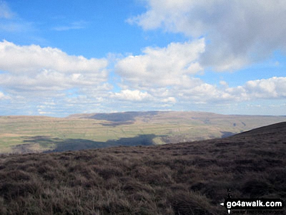
The Southern Dales Area, The Yorkshire Dales, North Yorkshire, England
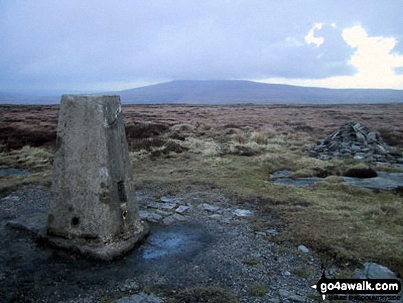
The summit of Firth Fell is marked by an Ordnance Survey Trig Point.
Not familiar with this top?
   |
|---|
Vital Statistics:
| Length: | 12.5ml (20km) |
|---|---|
| Ascent: | 2,099ft (640m) |
| Time: | 6.75hrs |
| Grade: |  (Moderate) (Moderate) |
Route Summary:
Buckden - Rakes Wood - Buckden Rake - Cray Gill - Cray - Crook Gill - Todd's Wood - Scar House - Strans Gill - Strans Wood - Yockenthwaite - Horse Head (Horse Head Moor) - Sugar Loaf (Horse Head Moor) - High Combe Stoop - Birks Fell - Birks Tarn - Firth Fell - Redmire Farm - Buckden
See Firth Fell and the surrounding tops on our free-to-access 'Google Style' Peak Bagging Maps:
The Southern Dales Area of The Yorkshire Dales National Park
Less data - quicker to download
The Whole of The Yorkshire Dales National Park
More data - might take a little longer to download
See Firth Fell and the surrounding tops on our downloadable Peak Bagging Map in PDF format:

NB: Whether you print off a copy or download it to your phone, this PDF Peak Baggers' Map might prove incredibly useful when your are up there on the tops and you cannot get a phone signal.
You can find Firth Fell & all the walks that climb it on these unique free-to-access Interactive Walk Planning Maps:
1:25,000 scale OS Explorer Map (orange/yellow covers):
 Fellow go4awalkers who have already walked, climbed, summited & bagged Firth Fell
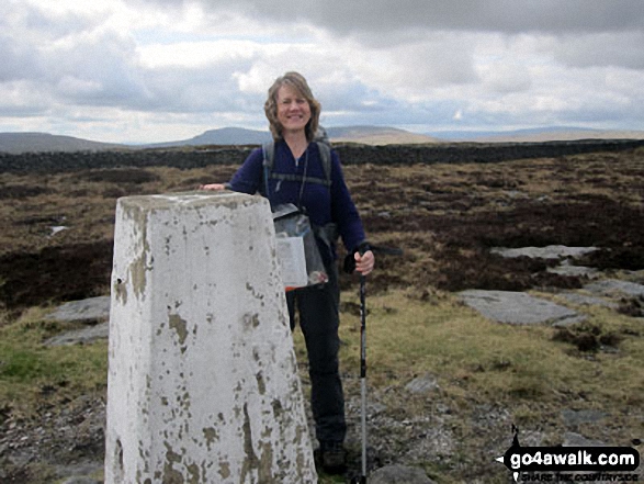
Christine Shepherd walked up Firth Fell on April 11th, 2014 [from/via/route] Walked from Buckden using walk ny153. A lovely walk with great views & a delightful tarn. We even saw a lizard on the way down to Buckden, just to add even more interest to the walk. [with] Jenny [weather] A lovely spring day.
Chris Faulkner climbed Firth Fell on August 23rd, 2015 [from/via/route] From Buckden, Firth Fell & Birks Fell. [with] Michelle Chandler [weather] Perfect. Bright sunshine with a warm wind.
Patrick Rogozinski has walked, climbed & bagged Firth Fell.
To add (or remove) your name and experiences on this page - Log On and edit your Personal Mountain Bagging Record
More Photographs & Pictures of views from, on or of Firth Fell
Send us your photographs and pictures on, of, or from Firth Fell
If you would like to add your walk photographs and pictures featuring views from, on or of Firth Fell to this page, please send them as email attachments (configured for any computer) along with your name to:
and we shall do our best to publish them.
(Guide Resolution = 300dpi. At least = 660pixels (wide) x 440 pixels (high).)

You can also submit photos via our Facebook Page.
NB. Please indicate where each photo was taken and whether you wish us to credit your photos with a Username or your First Name/Last Name.
Not familiar with this top?


