Snowdonia National Park - a fully detailed list of all the Mountains, Peaks, Tops and Hills (Page 1 of 3)
Snowdonia National Park in Clwyd, Conwy, Gwynedd and Powys is the area of Wales within the Snowdonia National Park boundary including the non-National Park 'island' around Blaenau Ffestiniog.
If you count only the Deweys there are 82 tops to climb, bag & conquer and the highest point is Craig Fach at 609m (1,999ft).
To see these Mountains, Peaks, Tops and Hills displayed in different ways - see the options in the left-hand column and towards the bottom of this page.
![]() Your Personal Bagging Record for Snowdonia National Park
Your Personal Bagging Record for Snowdonia National Park
LOG ON and RELOAD this page to show which Mountains, Peaks, Tops and Hills you have already climbed, bagged & conquered [. . . more details]
See this list in: Alphabetical Order
| Height Order‡
To reverse the order select the link again.
Mountain, Peak, Top or Hill:
Bagged

![]()
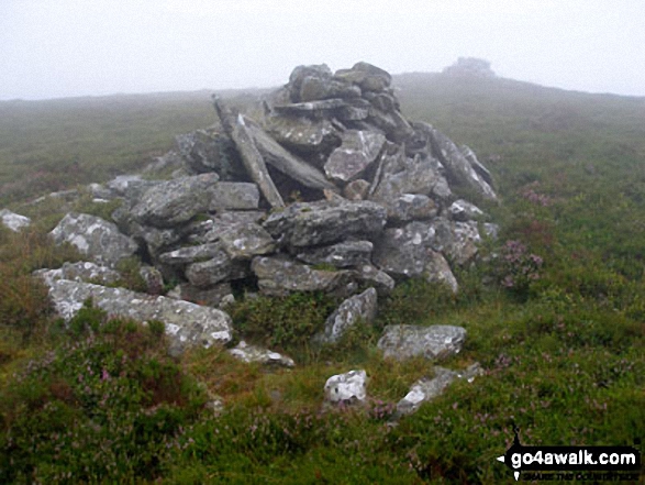
1. Craig Fach
609m (1,999ft)
Craig Fach is on interactive maps:
Craig Fach is on downloadable PDF you can Print or Save to your Phone: |
![]()
2. Moel Meirch
607m (1,992ft)
Moel Meirch is on interactive maps:
Moel Meirch is on downloadable PDF you can Print or Save to your Phone: |
![]()
3. Foel Tyn-y-fron (Moel y Pawl)
606m (1,988ft)
Send it in and we'll publish it here.
Foel Tyn-y-fron (Moel y Pawl) is on interactive maps:
Foel Tyn-y-fron (Moel y Pawl) is on downloadable PDF you can Print or Save to your Phone: |
![]()
4. Craig Portas
605m (1,985ft)
Craig Portas is on interactive maps:
Craig Portas is on downloadable PDF you can Print or Save to your Phone: |
![]()
5. Foel Goch (Snowdon)
605m (1,985ft)
Foel Goch (Snowdon) is on interactive maps:
Foel Goch (Snowdon) is on downloadable PDF you can Print or Save to your Phone: |
![]()
6. Foel Lwyd
603m (1,979ft)
Foel Lwyd is on interactive maps:
Foel Lwyd is on downloadable PDF you can Print or Save to your Phone: |
![]()
7. Moel Llygoed (Cerreg y Big)
598m (1,962ft)
Send it in and we'll publish it here.
Moel Llygoed (Cerreg y Big) is on interactive maps:
Moel Llygoed (Cerreg y Big) is on downloadable PDF you can Print or Save to your Phone: |
![]()
8. Mynydd Braich-goch
597m (1,959ft)
Mynydd Braich-goch is on interactive maps:
Mynydd Braich-goch is on downloadable PDF you can Print or Save to your Phone: |
![]()
9. Craig Ddrwg
596m (1,956ft)
Craig Ddrwg is on interactive maps:
Craig Ddrwg is on downloadable PDF you can Print or Save to your Phone: |
![]()
10. Foel-boeth (Llyn Celyn)
596m (1,956ft)
Foel-boeth (Llyn Celyn) is on interactive maps:
Foel-boeth (Llyn Celyn) is on downloadable PDF you can Print or Save to your Phone: |
![]()
11. Clip (Rhinogs)
594m (1,950ft)
Clip (Rhinogs) is on interactive maps:
Clip (Rhinogs) is on downloadable PDF you can Print or Save to your Phone: |
![]()
12. Cefn Coch (Berwyns)
594m (1,949ft)
Send it in and we'll publish it here.
Cefn Coch (Berwyns) is on interactive maps:
Cefn Coch (Berwyns) is on downloadable PDF you can Print or Save to your Phone: |
![]()
13. Y Ro Wen
594m (1,949ft)
Y Ro Wen is on interactive maps:
Y Ro Wen is on downloadable PDF you can Print or Save to your Phone: |
![]()
14. Carnedd y Cribau
591m (1,940ft)
Carnedd y Cribau is on interactive maps:
Carnedd y Cribau is on downloadable PDF you can Print or Save to your Phone: |
![]()
15. Foel Figenau
590m (1,936ft)
Foel Figenau is on interactive maps:
Foel Figenau is on downloadable PDF you can Print or Save to your Phone: |
![]()
16. Craig y Grut (Llawlech)
589m (1,933ft)
Send it in and we'll publish it here.
Craig y Grut (Llawlech) is on interactive maps:
Craig y Grut (Llawlech) is on downloadable PDF you can Print or Save to your Phone: |
![]()
17. Moelfre (Rhinogs)
589m (1,933ft)
Moelfre (Rhinogs) is on interactive maps:
Moelfre (Rhinogs) is on downloadable PDF you can Print or Save to your Phone: |
![]()
18. Y Gamallt (Llynnau Gamalt)
589m (1,933ft)
Send it in and we'll publish it here.
Y Gamallt (Llynnau Gamalt) is on interactive maps:
Y Gamallt (Llynnau Gamalt) is on downloadable PDF you can Print or Save to your Phone: |
![]()
19. Yr Arddu
589m (1,933ft)
Yr Arddu is on interactive maps:
Yr Arddu is on downloadable PDF you can Print or Save to your Phone: |
![]()
20. Craig Portas (East Top)
587m (1,926ft)
Craig Portas (East Top) is on interactive maps:
Craig Portas (East Top) is on downloadable PDF you can Print or Save to your Phone: |
![]()
21. Foel-fras (Moel Penamnen)
586m (1,923ft)
Send it in and we'll publish it here.
Foel-fras (Moel Penamnen) is on interactive maps:
Foel-fras (Moel Penamnen) is on downloadable PDF you can Print or Save to your Phone: |
![]()
22. Graig Goch (Mynydd Cedris)
586m (1,923ft)
Send it in and we'll publish it here.
Graig Goch (Mynydd Cedris) is on interactive maps:
Graig Goch (Mynydd Cedris) is on downloadable PDF you can Print or Save to your Phone: |
![]()
23. Moel Wnion
580m (1,904ft)
Moel Wnion is on interactive maps:
Moel Wnion is on downloadable PDF you can Print or Save to your Phone: |
![]()
24. Moel Farlwyd
577m (1,894ft)
Moel Farlwyd is on interactive maps:
Moel Farlwyd is on downloadable PDF you can Print or Save to your Phone: |
![]()
25. Moel y Feidiog
577m (1,894ft)
Moel y Feidiog is on interactive maps:
Moel y Feidiog is on downloadable PDF you can Print or Save to your Phone: |
![]()
26. Moel yr Wden (Bwlch y Bi)
573m (1,881ft)
Send it in and we'll publish it here.
Moel yr Wden (Bwlch y Bi) is on interactive maps:
Moel yr Wden (Bwlch y Bi) is on downloadable PDF you can Print or Save to your Phone: |
![]()
27. Craig Wion
566m (1,858ft)
Craig Wion is on interactive maps:
Craig Wion is on downloadable PDF you can Print or Save to your Phone: |
![]()
28. Pen Ochr y Bwlch
564m (1,851ft)
Pen Ochr y Bwlch is on interactive maps:
Pen Ochr y Bwlch is on downloadable PDF you can Print or Save to your Phone: |
![]()
29. Yr Orsedd
559m (1,835ft)
Yr Orsedd is on interactive maps:
Yr Orsedd is on downloadable PDF you can Print or Save to your Phone: |
![]()
30. Gallt Ceinlogau (Bryn Glas)
558m (1,831ft)
Send it in and we'll publish it here.
Gallt Ceinlogau (Bryn Glas) is on interactive maps:
Gallt Ceinlogau (Bryn Glas) is on downloadable PDF you can Print or Save to your Phone: |
View these 82 Mountains, Peaks, Tops and Hills:
- On Ten Downloadable PDFs you can Print or save to your phone covering:
- The Arans #
- The Arenigs #
- The Berwyns #
- The Cadair Idris Area #
- The Carneddau #
- The Glyderau #
- The Moel Hebog #
- The Moelwyns #
- The Snowdon Area # and
- The Rhinogs #
 Snowdon (Yr Wyddfa) in The AransSnowdonia
Photo: Don Williams
- On an Interactive Google Map with a list of tops below it.
(makes it easier to locate a particular top) - On a Detailed List in:
Alphabetical Order | Height Order - On one page with 'yet-to-be-bagged' listed 1st
& then 'already-bagged' tops listed 2nd in:
Alphabetical Order | Height Order - On one page with 'already-bagged' tops listed 1st
& then 'yet-to-be-bagged' tops listed 2nd in:
Alphabetical Order | Height Order
# Whether you print copies or download them to your phone, these Peak Baggers' Maps will prove incredibly useful if you want to know what's what when you are up in the mountains and cannot get a phone signal.
Is there a Mountain, Peak, Top or Hill missing from the above google map or list?
Let us know an we will add it to our database.
To contribute to go4awalk.com or to contact us about anything at all - see Talk To Us.
For help see Help.
go4awalk.com and go4awalk.co.uk are registered trademarks of TMDH Limited.
Copyright © 2000-2026 TMDH Limited. All rights reserved.
Copyright Terms & Conditions Privacy Statement
A - Z Walks Home Log On/Accounts Photo Gallery Walk Ideas and Collections Fell Facts Hill Skills Walking Questions and Answers Your Stories News Competitions Product Reviews/Gear Tests Walking Gear Guides Peaks and Mountains Peak Bagging Find New Walking Friends Camping GPS Waypoints for Walking Contents Walk Search Talk To Us go4awalk.com Help Free Example Walks Newsletter


