
![]()
Craig Portas (East Top)
587m (1926ft)
The Cadair Idris Area, Snowdonia, Gwynedd, Wales
Not familiar with this top?
   |
|---|
Vital Statistics:
| Length: | 9.5mls (15km) |
|---|---|
| Ascent: | 2,777ft (846m) |
| Time: | 6½ hrs |
| Grade: |  (Moderate) (Moderate) |
Route Summary:
Aberllefenni - Bryn Coedwig Field Studies Centre - Cwm Ratgoed - Fynnon-Badarn - Ffridd Newydd - Mynydd Ceiswyn - Waun-oer - Cribin Fawr - Craig Portas - Craig Portas (East Top) - Craig Portas - Mynydd Dolgoed - Dolgoed - Ratgoed Hall - Bryn Coedwig - Aberllefenni
|
|---|
Vital Statistics:
| Length: | 12.5ml (20km) |
|---|---|
| Ascent: | 3,738ft (1,139m) |
| Time: | 8.25hrs |
| Grade: |  (Hard) (Hard) |
Route Summary:
Aberllefenni - Bryn Coedwig Field Studies Centre - Cwm Ratgoed - Fynnon-Badarn - Ffridd Newydd - Mynydd Ceiswyn - Waun-oer - Cribin Fawr - Craig Portas - Craig Portas (East Top) - Maesglase (Craig Rhiw-erch) - Maesglase (Maen Du) - Craig Portas (East Top) - Craig Portas - Mynydd Dolgoed - Dolgoed - Ratgoed Hall - Bryn Coedwig - Aberllefenni
See Craig Portas (East Top) and the surrounding tops on our free-to-access 'Google Style' Peak Bagging Maps:
The Cadair Idris area of Snowdonia National Park
Less data - quicker to download
The Whole of Snowdonia National Park
More data - might take a little longer to download
See Craig Portas (East Top) and the surrounding tops on our downloadable Peak Bagging Map in PDF format:

NB: Whether you print off a copy or download it to your phone, this PDF Peak Baggers' Map might prove incredibly useful when your are up there on the tops and you cannot get a phone signal.
You can find Craig Portas (East Top) & all the walks that climb it on these unique free-to-access Interactive Walk Planning Maps:
1:25,000 scale OS Explorer Map (orange/yellow covers):
1:50,000 scale OS Landranger Map (pink/magenta covers):
 Fellow go4awalkers who have already walked, climbed, summited & bagged Craig Portas (East Top)
Mark Davidson walked up Craig Portas (East Top) on June 30th, 2006 [from/via/route] Walk gw167 Waun-oer, Cribin Fawr & Maesglase from Bryn Coedwig, Aberllefenni [with] Alone [weather] Nice & sunny
To add (or remove) your name and experiences on this page - Log On and edit your Personal Mountain Bagging Record
More Photographs & Pictures of views from, on or of Craig Portas (East Top)
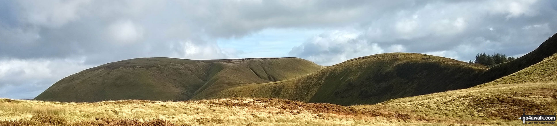
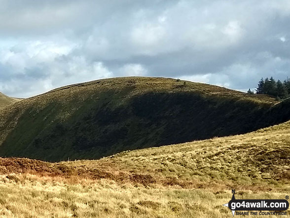
Maesglase (Craig Rhiw-erch) (left), Maesglase (Maen Du) (centre) and Craig Portas (East Top) from the lower slopes of Craig Portas
Send us your photographs and pictures on, of, or from Craig Portas (East Top)
If you would like to add your walk photographs and pictures featuring views from, on or of Craig Portas (East Top) to this page, please send them as email attachments (configured for any computer) along with your name to:
and we shall do our best to publish them.
(Guide Resolution = 300dpi. At least = 660pixels (wide) x 440 pixels (high).)

You can also submit photos via our Facebook Page.
NB. Please indicate where each photo was taken and whether you wish us to credit your photos with a Username or your First Name/Last Name.
Not familiar with this top?


