All the Mountains, Peaks, Tops and Hills in England, England as a detailed list

England is defined as the whole of the country of England which includes the National Parks of Dartmoor, Exmoor, The Lake District, The Peak District, The North York Moors, Northumberland, The South Downs and The Yorkshire Dales, as well as The Chilterns, The Cotswolds, The Forest of Bowland, The North Peninnes, The Shropshire Hills and The South Peninnes.


If you count only the Marilyns there are 174 tops to climb, bag & conquer and the highest point is Scafell Pike at 978m (3,210ft).

Wainwright
214/0
Wainwrights

Hewitt
180/0
English
Mountains

Dewey
180/0
English
Deweys

nuttall
254/0
English
Nuttalls

Wainwright Outlying Fell
116/0
Wainwright
Outlying Fells

marilyn
174/0
English
Marilyns

Bridget
534/0
English
Bridgets

Trig Point
487/0
Trig
Points


To see all Mountains, Peaks, Tops and Hills displayed in different ways - see the options in the left-hand column and towards the bottom of this page.


LOG ON and RELOAD this page to show which Mountains, Peaks, Tops and Hills you have already climbed, bagged & conquered [. . . more]


Page 3 of 6    Go to page: 1 2 3 4 5 6


See this list in: Alphabetical Order | Height Order
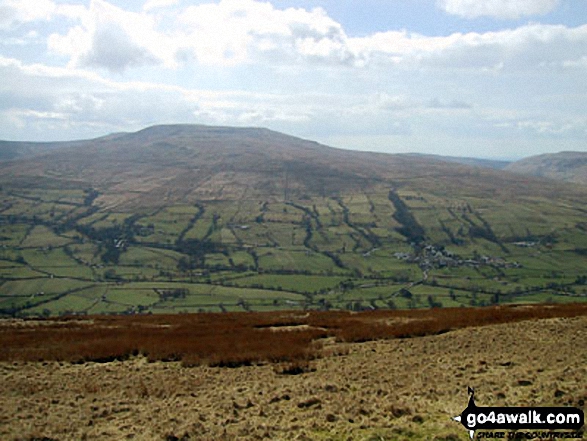
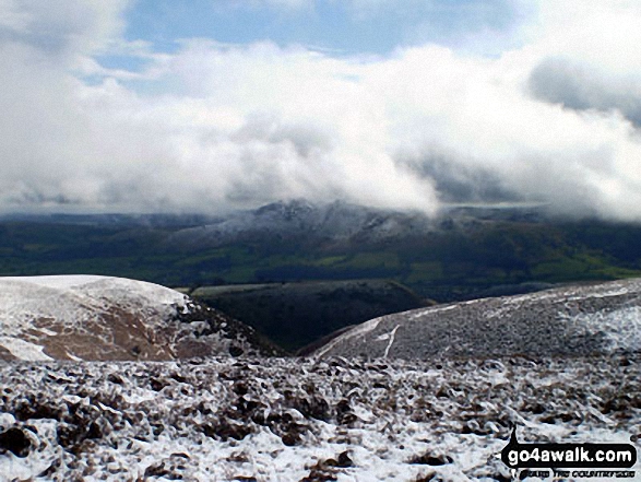
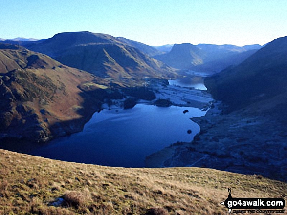
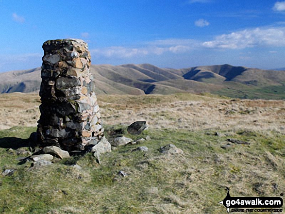
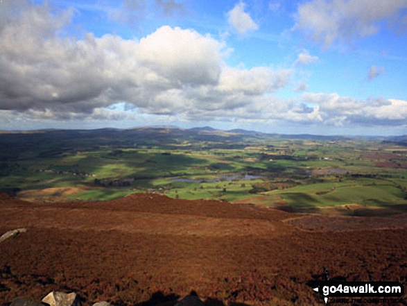
To reverse the order select the link again.


Mountain, Peak, Top or Hill:

Bagged


61. Aye Gill Pike

556m (1,824ft)

  • Dewey (60th in England, 139th in England & Wales)
  • Marilyn (61st in England, 856th in GB)
  • OS Trig Point

  • To walk, climb & bag Aye Gill Pike use either of these easy to follow walks:

    Google Maps Icon
    See the location of Aye Gill Pike and walks up it on a google Map

    Aye Gill Pike is on interactive maps:

  • OS Explorer (Orange Covers): OL2
  • OS Landranger (Pink Covers): 98

  • Aye Gill Pike is on Peak Bagging Map and Hill Tick List:


    62. Hoove Faggergill

    554m (1,818ft)

  • Dewey (62nd in England, 145th in England & Wales)
  • Marilyn (62nd in England, 862nd in GB)
  • OS Trig Point

  • We hope to have walks that climb & bag Hoove Faggergill very soon

    Google Maps Icon
    See the location of Hoove Faggergill and walks up it on a google Map

    Hoove Faggergill is on interactive maps:

  • OS Explorer (Orange Covers): OL30
  • OS Landranger (Pink Covers): 92

  • Hoove Faggergill is on Peak Bagging Map and Hill Tick List:


    63. Lord's Seat (Whinlatter)

    552m (1,812ft)

  • Wainwright (No. 147)
  • Dewey (66th in England, 153rd in England & Wales)
  • Marilyn (63rd in England, 868th in GB)
  • OS Trig Point

  • To walk, climb & bag Lord's Seat (Whinlatter) use any of these easy to follow walks:

    Google Maps Icon
    See the location of Lord's Seat (Whinlatter) and walks up it on a google Map

    Lord's Seat (Whinlatter) is on interactive maps:

  • OS Explorer (Orange Covers): OL4
  • OS Landranger (Pink Covers): 89 and 90

  • Lord's Seat (Whinlatter) is on Peak Bagging Map and Hill Tick List:

    *Version including the walk routes marked on it that you need to follow to Walk all 214 Wainwrights in just 59 walks.


    64. Hard Knott

    549m (1,802ft)

  • Wainwright (No. 151)
  • Dewey (72nd in England, 166th in England & Wales)
  • Marilyn (64th in England, 879th in GB)

  • To walk, climb & bag Hard Knott use either of these easy to follow walks:

    Google Maps Icon
    See the location of Hard Knott and walks up it on a google Map

    Hard Knott is on interactive maps:

  • OS Explorer (Orange Covers): OL6
  • OS Landranger (Pink Covers): 89 and 90

  • Hard Knott is on Peak Bagging Map and Hill Tick List:

    *Version including the walk routes marked on it that you need to follow to Walk all 214 Wainwrights in just 59 walks.


    65. White Hill (Forest of Bowland)

    544m (1,785ft)

  • Dewey (84th in England, 195th in England & Wales)
  • Marilyn (65th in England, 891st in GB)
  • OS Trig Point

  • To walk, climb & bag White Hill (Forest of Bowland) use either of these easy to follow walks:

    Google Maps Icon
    See the location of White Hill (Forest of Bowland) and walks up it on a google Map

    White Hill (Forest of Bowland) is on interactive maps:

  • OS Explorer (Orange Covers): OL41
  • OS Landranger (Pink Covers): 103

  • White Hill (Forest of Bowland) is on Peak Bagging Map and Hill Tick List:


    66. Brown Clee Hill (Abdon Burf)

    540m (1,772ft)

  • Dewey (93rd in England, 212th in England & Wales)
  • Marilyn (66th in England, 895th in GB)
  • OS Trig Point
  • Brown Clee Hill (Abdon Burf) is the highest point in the county of Shropshire


    To walk, climb & bag Brown Clee Hill (Abdon Burf) use this easy to follow walk:

    Google Maps Icon
    See the location of Brown Clee Hill (Abdon Burf) and walks up it on a google Map

    Brown Clee Hill (Abdon Burf) is on interactive maps:

  • OS Explorer (Orange Covers): 217
  • OS Landranger (Pink Covers): 137 and 138

  • Brown Clee Hill (Abdon Burf) is on Peak Bagging Map and Hill Tick List:


    67. Great Mell Fell

    537m (1,762ft)

  • Wainwright (No. 154)
  • Dewey (98th in England, 229th in England & Wales)
  • Marilyn (67th in England, 901st in GB)
  • OS Trig Point

  • To walk, climb & bag Great Mell Fell use either of these easy to follow walks:

    Google Maps Icon
    See the location of Great Mell Fell and walks up it on a google Map

    Great Mell Fell is on interactive maps:

  • OS Explorer (Orange Covers): OL5
  • OS Landranger (Pink Covers): 90

  • Great Mell Fell is on Peak Bagging Map and Hill Tick List:

    *Version including the walk routes marked on it that you need to follow to Walk all 214 Wainwrights in just 59 walks.


    68. Stiperstones (Manstone Rock)

    536m (1,759ft)

  • Dewey (101st in England, 234th in England & Wales)
  • Marilyn (68th in England, 904th in GB)
  • OS Trig Point

  • To walk, climb & bag Stiperstones (Manstone Rock) use either of these easy to follow walks:

    Google Maps Icon
    See the location of Stiperstones (Manstone Rock) and walks up it on a google Map

    Stiperstones (Manstone Rock) is on interactive maps:

  • OS Explorer (Orange Covers): 217
  • OS Landranger (Pink Covers): 137

  • Stiperstones (Manstone Rock) is on Peak Bagging Map and Hill Tick List:


    69. Titterstone Clee Hill

    533m (1,749ft)

  • Dewey (106th in England, 247th in England & Wales)
  • Marilyn (69th in England, 912th in GB)
  • OS Trig Point

  • To walk, climb & bag Titterstone Clee Hill use this easy to follow walk:

    Google Maps Icon
    See the location of Titterstone Clee Hill and walks up it on a google Map

    Titterstone Clee Hill is on interactive maps:

  • OS Explorer (Orange Covers): 217
  • OS Landranger (Pink Covers): 137 and 138

  • Titterstone Clee Hill is on Peak Bagging Map and Hill Tick List:


    70. Fair Snape Fell

    520m (1,706ft)

  • Dewey (138th in England, 317th in England & Wales)
  • Marilyn (70th in England, 937th in GB)

  • To walk, climb & bag Fair Snape Fell use any of these easy to follow walks:

    Google Maps Icon
    See the location of Fair Snape Fell and walks up it on a google Map

    Fair Snape Fell is on interactive maps:

  • OS Explorer (Orange Covers): OL41
  • OS Landranger (Pink Covers): 102

  • Fair Snape Fell is on Peak Bagging Map and Hill Tick List:


    71. Sighty Crag

    520m (1,706ft)

  • Dewey (139th in England, 318th in England & Wales)
  • Marilyn (71st in England, 938th in GB)
  • OS Trig Point

  • We hope to have walks that climb & bag Sighty Crag very soon

    Google Maps Icon
    See the location of Sighty Crag and walks up it on a google Map

    Sighty Crag is on interactive maps:

  • OS Explorer (Orange Covers): OL42
  • OS Landranger (Pink Covers): 80

  • A go4awalk.com Peak Bagging Map and Hill Tick List featuring Sighty Crag will be available soon.


    72. Dunkery Beacon

    519m (1,703ft)

  • Dewey (140th in England, 319th in England & Wales)
  • Marilyn (72nd in England, 940th in GB)
  • OS Trig Point
  • Dunkery Beacon is the highest point in the county of Somerset.


    To walk, climb & bag Dunkery Beacon use either of these easy to follow walks:

    Google Maps Icon
    See the location of Dunkery Beacon and walks up it on a google Map

    Dunkery Beacon is on interactive maps:

  • OS Explorer (Orange Covers): OL9
  • OS Landranger (Pink Covers): 181

  • A go4awalk.com Peak Bagging Map and Hill Tick List featuring Dunkery Beacon will be available soon.


    73. Lad Law (Boulsworth Hill)

    517m (1,697ft)

  • Dewey (143rd in England, 331st in England & Wales)
  • Marilyn (73rd in England, 942nd in GB)
  • OS Trig Point

  • To walk, climb & bag Lad Law (Boulsworth Hill) use this easy to follow walk:

    Google Maps Icon
    See the location of Lad Law (Boulsworth Hill) and walks up it on a google Map

    Lad Law (Boulsworth Hill) is on interactive maps:

  • OS Explorer (Orange Covers): OL21
  • OS Landranger (Pink Covers): 103

  • Lad Law (Boulsworth Hill) is on Peak Bagging Map and Hill Tick List:


    74. Pole Bank (Long Mynd)

    516m (1,693ft)

  • Dewey (149th in England, 341st in England & Wales)
  • Marilyn (74th in England, 948th in GB)
  • OS Trig Point

  • To walk, climb & bag Pole Bank (Long Mynd) use this easy to follow walk:

    Google Maps Icon
    See the location of Pole Bank (Long Mynd) and walks up it on a google Map

    Pole Bank (Long Mynd) is on interactive maps:

  • OS Explorer (Orange Covers): 217
  • OS Landranger (Pink Covers): 137

  • Pole Bank (Long Mynd) is on Peak Bagging Map and Hill Tick List:


    75. Mellbreak

    512m (1,680ft)

  • Wainwright (No. 168)
  • Dewey (156th in England, 358th in England & Wales)
  • Marilyn (75th in England, 962nd in GB)

  • To walk, climb & bag Mellbreak use any of these easy to follow walks:

    Google Maps Icon
    See the location of Mellbreak and walks up it on a google Map

    Mellbreak is on interactive maps:

  • OS Explorer (Orange Covers): OL4
  • OS Landranger (Pink Covers): 89

  • Mellbreak is on Peak Bagging Map and Hill Tick List:

    *Version including the walk routes marked on it that you need to follow to Walk all 214 Wainwrights in just 59 walks.


    76. Cracoe Fell

    507m (1,663ft)

  • Dewey (168th in England, 390th in England & Wales)
  • Marilyn (76th in England, 977th in GB)
  • OS Trig Point

  • To walk, climb & bag Cracoe Fell use this easy to follow walk:

    Google Maps Icon
    See the location of Cracoe Fell and walks up it on a google Map

    Cracoe Fell is on interactive maps:

  • OS Explorer (Orange Covers): OL2
  • OS Landranger (Pink Covers): 103

  • Cracoe Fell is on Peak Bagging Map and Hill Tick List:


    77. Little Mell Fell

    505m (1,657ft)

  • Wainwright (No. 173)
  • Dewey (172nd in England, 398th in England & Wales)
  • Marilyn (77th in England, 980th in GB)
  • OS Trig Point

  • To walk, climb & bag Little Mell Fell use either of these easy to follow walks:

    Google Maps Icon
    See the location of Little Mell Fell and walks up it on a google Map

    Little Mell Fell is on interactive maps:

  • OS Explorer (Orange Covers): OL5
  • OS Landranger (Pink Covers): 90

  • Little Mell Fell is on Peak Bagging Map and Hill Tick List:

    *Version including the walk routes marked on it that you need to follow to Walk all 214 Wainwrights in just 59 walks.


    78. Shillhope Law

    501m (1,644ft)

  • Dewey (176th in England, 415th in England & Wales)
  • Marilyn (78th in England, 985th in GB)
  • OS Trig Point

  • We hope to have walks that climb & bag Shillhope Law very soon

    Google Maps Icon
    See the location of Shillhope Law and walks up it on a google Map

    Shillhope Law is on interactive maps:

  • OS Explorer (Orange Covers): OL16
  • OS Landranger (Pink Covers): 80

  • A go4awalk.com Peak Bagging Map and Hill Tick List featuring Shillhope Law will be available soon.


    79. Kisdon

    499m (1,638ft)

  • Marilyn (79th in England, 986th in GB)

  • To walk, climb & bag Kisdon use this easy to follow walk:

    Google Maps Icon
    See the location of Kisdon and walks up it on a google Map

    Kisdon is on interactive maps:

  • OS Explorer (Orange Covers): OL30
  • OS Landranger (Pink Covers): 98

  • Kisdon is on Peak Bagging Map and Hill Tick List:


    80. Grayrigg Forest

    494m (1,621ft)

  • Marilyn (80th in England, 994th in GB)
  • OS Trig Point

  • To walk, climb & bag Grayrigg Forest use this easy to follow walk:

    Google Maps Icon
    See the location of Grayrigg Forest and walks up it on a google Map

    Grayrigg Forest is on interactive maps:

  • OS Explorer (Orange Covers): OL7
  • OS Landranger (Pink Covers): 97

  • A go4awalk.com Peak Bagging Map and Hill Tick List featuring Grayrigg Forest will be available soon.


    81. Dufton Pike

    481m (1,579ft)

  • Marilyn (81st in England, 1025th in GB)

  • To walk, climb & bag Dufton Pike use either of these easy to follow walks:

    Google Maps Icon
    See the location of Dufton Pike and walks up it on a google Map

    Dufton Pike is on interactive maps:

  • OS Explorer (Orange Covers): OL19
  • OS Landranger (Pink Covers): 91

  • Dufton Pike is on Peak Bagging Map and Hill Tick List:


    82. Hail Storm Hill

    477m (1,566ft)

  • Marilyn (82nd in England, 1035th in GB)

  • To walk, climb & bag Hail Storm Hill use any of these easy to follow walks:

    Google Maps Icon
    See the location of Hail Storm Hill and walks up it on a google Map

    Hail Storm Hill is on interactive maps:

  • OS Explorer (Orange Covers): OL21
  • OS Landranger (Pink Covers): 109

  • Hail Storm Hill is on Peak Bagging Map and Hill Tick List:


    83. Lingmoor Fell

    469m (1,539ft)

  • Wainwright (No. 184)
  • Marilyn (83rd in England, 1052nd in GB)

  • To walk, climb & bag Lingmoor Fell use either of these easy to follow walks:

    Google Maps Icon
    See the location of Lingmoor Fell and walks up it on a google Map

    Lingmoor Fell is on interactive maps:

  • OS Explorer (Orange Covers): OL6 and OL7
  • OS Landranger (Pink Covers): 90

  • Lingmoor Fell is on Peak Bagging Map and Hill Tick List:

    *Version including the walk routes marked on it that you need to follow to Walk all 214 Wainwrights in just 59 walks.


    84. Caer Caradoc Hill

    459m (1,506ft)

  • Marilyn (84th in England, 1083rd in GB)

  • To walk, climb & bag Caer Caradoc Hill use any of these easy to follow walks:

    Google Maps Icon
    See the location of Caer Caradoc Hill and walks up it on a google Map

    Caer Caradoc Hill is on interactive maps:

  • OS Explorer (Orange Covers): 217
  • OS Landranger (Pink Covers): 137 and 138

  • Caer Caradoc Hill is on Peak Bagging Map and Hill Tick List:


    85. Winter Hill (Rivington Moor)

    456m (1,497ft)

  • Marilyn (85th in England, 1093rd in GB)
  • OS Trig Point

  • To walk, climb & bag Winter Hill (Rivington Moor) use either of these easy to follow walks:

    Google Maps Icon
    See the location of Winter Hill (Rivington Moor) and walks up it on a google Map

    Winter Hill (Rivington Moor) is on interactive maps:

  • OS Explorer (Orange Covers): 287
  • OS Landranger (Pink Covers): 109

  • Winter Hill (Rivington Moor) is on Peak Bagging Map and Hill Tick List:


    86. Freeholds Top

    455m (1,493ft)

  • Marilyn (86th in England, 1095th in GB)
  • OS Trig Point

  • We hope to have walks that climb & bag Freeholds Top very soon

    Google Maps Icon
    See the location of Freeholds Top and walks up it on a google Map

    Freeholds Top is on interactive maps:

  • OS Explorer (Orange Covers): OL21
  • OS Landranger (Pink Covers): 103

  • Freeholds Top is on Peak Bagging Map and Hill Tick List:


    87. Urra Moor (Round Hill)

    454m (1,490ft)

  • Marilyn (87th in England, 1097th in GB)
  • OS Trig Point

  • We hope to have walks that climb & bag Urra Moor (Round Hill) very soon

    Google Maps Icon
    See the location of Urra Moor (Round Hill) and walks up it on a google Map

    Urra Moor (Round Hill) is on interactive maps:

  • OS Explorer (Orange Covers): OL26
  • OS Landranger (Pink Covers): 93

  • A go4awalk.com Peak Bagging Map and Hill Tick List featuring Urra Moor (Round Hill) will be available soon.


    88. Heath Mynd

    452m (1,483ft)

  • Marilyn (88th in England, 1100th in GB)
  • OS Trig Point

  • We hope to have walks that climb & bag Heath Mynd very soon

    Google Maps Icon
    See the location of Heath Mynd and walks up it on a google Map

    Heath Mynd is on interactive maps:

  • OS Explorer (Orange Covers): 216
  • OS Landranger (Pink Covers): 137

  • Heath Mynd is on Peak Bagging Map and Hill Tick List:


    89. Binsey

    447m (1,467ft)

  • Wainwright (No. 192)
  • Marilyn (89th in England, 1113th in GB)
  • OS Trig Point

  • To walk, climb & bag Binsey use either of these easy to follow walks:

    Google Maps Icon
    See the location of Binsey and walks up it on a google Map

    Binsey is on interactive maps:

  • OS Explorer (Orange Covers): OL4
  • OS Landranger (Pink Covers): 89 and 90

  • Binsey is on Peak Bagging Map and Hill Tick List:

    *Version including the walk routes marked on it that you need to follow to Walk all 214 Wainwrights in just 59 walks.


    90. Tosson Hill

    440m (1,444ft)

  • Marilyn (90th in England, 1127th in GB)
  • OS Trig Point

  • We hope to have walks that climb & bag Tosson Hill very soon

    Google Maps Icon
    See the location of Tosson Hill and walks up it on a google Map

    Tosson Hill is on interactive maps:

  • OS Explorer (Orange Covers): OL42
  • OS Landranger (Pink Covers): 81

  • A go4awalk.com Peak Bagging Map and Hill Tick List featuring Tosson Hill will be available soon.


    Page 3 of 6    Go to page: 1 2 3 4 5 6


    View all 1233 Mountains, Peaks, Tops and Hills in EnglandNorthumberland:


    Is there a Mountain, Peak, Top or Hill missing from the above google map or list?

    Let us know an we will add it to our database.


    Follow go4awalk.com on Twitter Follow go4awalk.com on Facebook


    Home


    Find new Friends to go walking with

    Walk all 214 Wainwrights in just 59 Walks. Download GPS Waypoints - Great Walks you must not miss!

    Walk The Yorkshire Three Peaks Challenge Walk - All the Latest Route Information, GPS Waypoints and Split Times to keep you on Schedule

    Walk The British Three Peaks Challenge Walk - All the Latest Route Information and GPS Waypoints

    See our pick of The Best Walks in The Lake District - Great Walks you must not miss!

    Walk our pick of the Best Lake District Ridge Walks - Great Walks you must not miss!

    Walk our pick of the Best Lake District Walks to do in the rain - Great Walks you must not miss!

    Walk our pick of The Best Walks in Snowdonia - Great Walks you must not miss!

    Walk our pick of The Best Ridge Walks in Wales - Walks you must not miss!

    Walk our pick of The Best Walks in The Brecon Beacons - Great Walks you must not miss!

    Walk our pick of The Best Walks in The Yorkshire Dales - Walks you must not miss!

    Walk our pick of The Best Walks in The Peak District - Walks you must not miss!

    Walk our pick of The Best Walks in The Forest of Bowland - Walks you must not miss!

    Walk our pick of The Best Walks in Shropshire - Walks you must not miss!

    Walk our pick of The Best Walks in Cheshire - Walks you must not miss!

    Walk our pick of The Best Walks in Lancashire - Walks you must not miss!

    Not sure where to walk next? Try Peak Bagging - Great Walks you must not miss!

    Not sure where to walk next? Walk part of a National Trail - Great Walks you must not miss!

    Walks with Downloadable and Uploadable GPS Waypoint Data

    Walking Kit and Gear Tested by Walkers

    Full Site Search
    Do not miss our pick of the Best Walks in Britain