
![]()
Mellbreak
512m (1680ft)
The Western Fells, The Lake District, Cumbria, England
Tap/mouse over a coloured circle (1-3 easy walks, 4-6 moderate walks, 7-9 hard walks) and click to select.
Not familiar with this top?
   |
|---|
Vital Statistics:
| Length: | 6.5ml (10.5km) |
|---|---|
| Ascent: | 1,877ft (572m) |
| Time: | 4.25hrs |
| Grade: |  (Moderate) (Moderate) |

Route Summary:
Lanthwaite - Scale Hill - Scalehill Bridge - Muncaster House - Loweswater - Low Park - Mellbreak (North Top) - Mellbreak - Black Beck (Mosedale) - Scale Knott - Scale Beck - High Ling Crag - Low Ling Crag - Crummock Water - Lanthwaite
|
|---|
Vital Statistics:
| Length: | 6.25mls (10km) |
|---|---|
| Ascent: | 6ft (770m) |
| Time: | 5 hrs |
| Grade: |  (Moderate) (Moderate) |
Route Summary:
Maggie's Bridge (Loweswater) - Loweswater - Kirkgate Farm - Raven Crag - White Crag - Mellbreak (North Top) - Mellbreak - Mosedale Beck (Loweswater) - Thrang Crags - Hen Comb - Little Dodd (Loweswater Fell) - Mosedale Beck (Loweswater) - Kirkgate Farm - Loweswater - Maggie's Bridge (Loweswater)
|
|---|
Vital Statistics:
| Length: | 9.5ml (15km) |
|---|---|
| Ascent: | 3,666ft (1,117m) |
| Time: | 7.25hrs |
| Grade: |  (Hard) (Hard) |
Route Summary:
Maggie's Bridge (Loweswater) - Loweswater - High Nook Farm - Highnook Beck - Holme Wood - Holme Beck - Burnbank Fell - Sharp Knott - Blake Fell - Fothergill Head - Gavel Fell - Grain Gill - Whiteoak Moss - Hen Comb - Thrang Crags - Mosedale (Loweswater) - Mosedale Beck (Loweswater) - Mellbreak - Mellbreak (North Top) - White Crag - Loweswater Village - Maggie's Bridge (Loweswater)
See Mellbreak and the surrounding tops on our free-to-access 'Google Style' Peak Bagging Maps:
The Western Fells of The Lake District National Park
Less data - quicker to download
The Whole of The Lake District National Park
More data - might take a little longer to download
See Mellbreak and the surrounding tops on our downloadable Peak Bagging Maps in PDF format:

NB: Whether you print off a copy or download it to your phone, these PDF Peak Baggers' Maps might prove incredibly useful when your are up there on the tops and you cannot get a phone signal.
*This version is marked with the walk routes you need to follow to Walk all 214 Wainwrights in just 59 walks.
You can find Mellbreak & all the walks that climb it on these unique free-to-access Interactive Walk Planning Maps:
1:25,000 scale OS Explorer Map (orange/yellow covers):
1:50,000 scale OS Landranger Map (pink/magenta covers):
 Fellow go4awalkers who have already walked, climbed, summited & bagged Mellbreak
Caroline Winter walked up Mellbreak on July 12th, 2025 [from/via/route] Lane by Kirkstile Inn, flank of Mellbreak North top, scale force, crummock lake [with] Solo [weather] Heat wave - Desperately hot, so dipped under scale force falls & then a dip in the lake at Low Ling crags. Bitten by a few horse flies. No parking allowed at the inn at weekends unless booked & all the lanes packed with cars.
Ian Ashton climbed Mellbreak on February 15th, 2025 [with] Ella
Geoff Hand bagged Mellbreak on September 17th, 2024 [from/via/route] Walk C212 Burnbank fell, Blake fell, Gavel fell, Hen Comb & Mellbreak from Loweswater. What a lovely area, although quite wet. Route finding early on was difficult but once on Burnbank it was quite straight forward. Weather was superb, blue sky all day. Loweswater is lovely. [with] Tess, my Jack Russell [weather] Lovely blue sky all day & warm! - Finding the way up Burnbank was difficult as there didn't appear to be any paths, but after that it was plain sailing. Great climb down Mell break!
Christine Shepherd hiked Mellbreak on May 30th, 2010 [from/via/route] Used walk c212 from Maggie's Bridge Climbed Mellbreak again on 25.09.2021. Went up the scramble & loved it. Climbed up the nose again on 24.2.24 [with] On my own [weather] Bight & sunny - This was the last fell of a good days walking. The descent to Loweswater was a bit steep though!
Simon Myerscough summited Mellbreak on November 5th, 2023 [from/via/route] Buttermere NT car park - was meant to start from Lanthwaite car park but couldn't find it. [with] Joanne [weather] Light winds & sunny spells - Steep scramble (loose rocks) to start climb
Richard Fulcher conquered Mellbreak on August 1st, 2022 [from/via/route] Parked near phone box in Loweswater & walked towards Mellbreak, ascending White Crag navigating the scree carefully. We walked from the north peak to the south & then down the other side, walking back alongside Crummock Water. Finished with a pint in the gardens of the hotel in Loweswater. [with] Jen [weather] Fine day with some wind on the tops.
Richard Marchant scaled Mellbreak on November 12th, 2022 [from/via/route] Parked at Maggie's Bridge then walked up through Holme Wood on to Burbank Fell. From here I headed along a broad ridge on to Blake Fell & continued on to Gavel Fell staying high & heading South on the broad ridge. From Gavel I dropped down to Floutern Pass & headed East & then headed North up on to Hen Comb. Retracing my steps back to the pass I carried on Eastward & then picked up a path heading Northward on to Mellbreak & eventually over it & descended steeply in to Loweswater & back by road to the car. [with] On my Own [weather] Misty start to the Day with a slight breeze but brightened up by the afternoon
Paul Macey walked up Mellbreak on July 26th, 2022 [from/via/route] c212 in reverse [with] Luke [weather] Sunny
John Tippins climbed Mellbreak on July 12th, 2022 [from/via/route] From Loweswater [with] Alone [weather] Overcast most of the day & very windy on top, but dry. Sunny late afternoon.
Pete George bagged Mellbreak on August 28th, 2021 [from/via/route] Loweswater [with] Roco [weather] Sunny
To add (or remove) your name and experiences on this page - Log On and edit your Personal Mountain Bagging Record
. . . [see more walk reports]
More Photographs & Pictures of views from, on or of Mellbreak
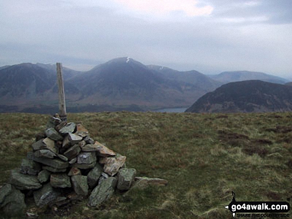
The cairn on the North West end of the Carling Knott ridge with Whiteside (Crummock), Grasmoor, Crummock Water and Mellbreak beyond
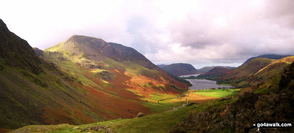
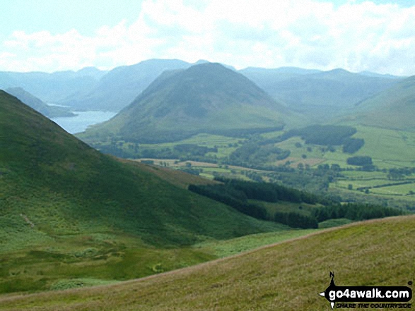
Buttermere Lake - with the lower slopes of High Stile (left), Hen Comb (centre) and Mellbreak (right)
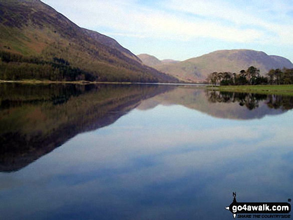
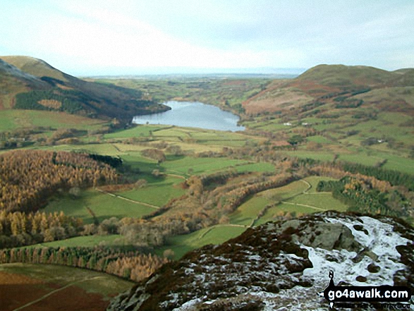
Crummock Water with Rannerdale Knotts (centre left), The High Stile Ridge (High Crag, High Stile and Red Pike (Buttermere) and the lower slopes of Mellbreak (far right) from Lanthwaite Wood
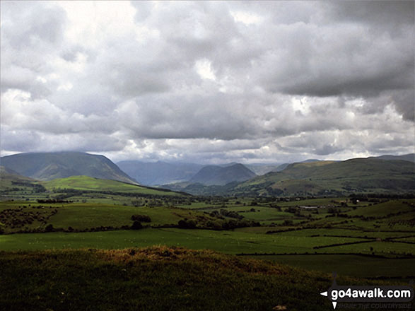
Looking down Lorton Vale from Graystones featuring Whiteside and Grasmoor (left - in mist) and Mellbreak (centre)
The flank of Hay Stacks (Haystacks), High Crag and High Stile (left), Mellbreak, Buttermere and Crummock Water (centre) with Grasmoor and High Snockrigg (right) from Fleetwith Pike
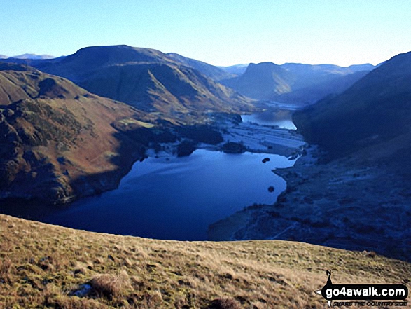
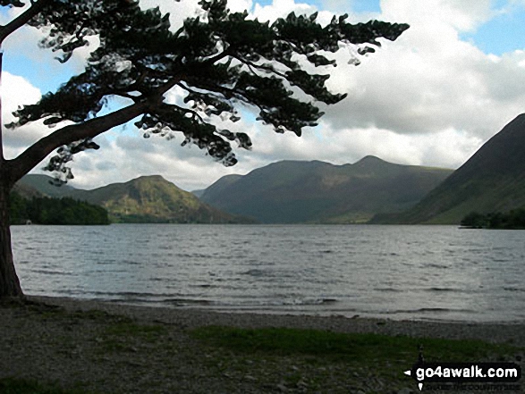
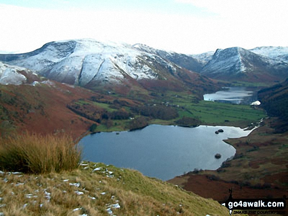
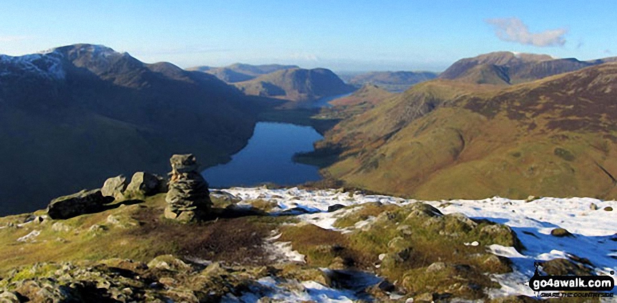
Bleaberry Tarn (bottom left), Mellbreak and Crummock Water from High Stile
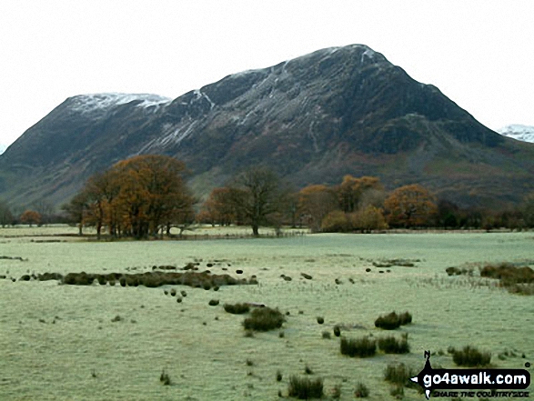
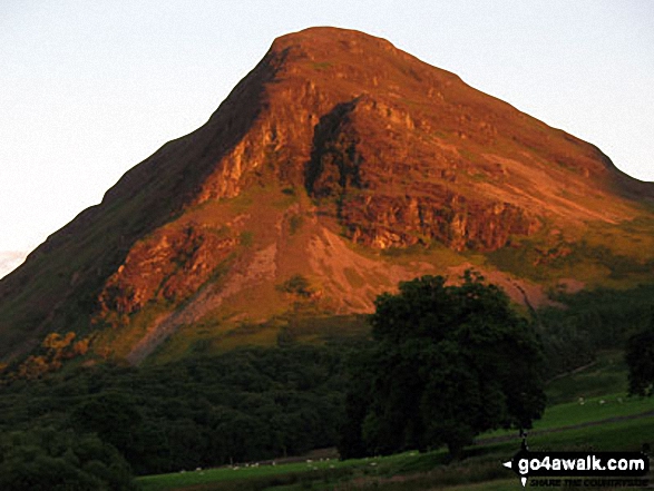
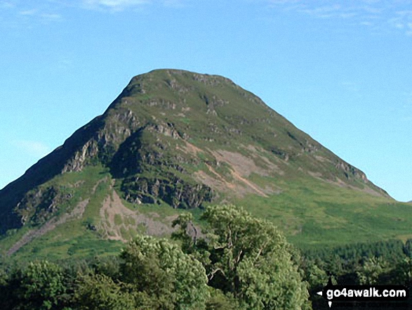
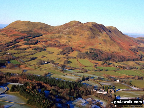
Mellbreak taken in the evening sunlight from the Kirkstile Inn in Loweswater Village
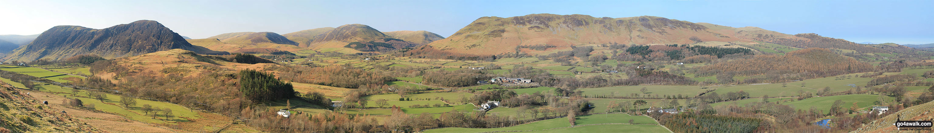
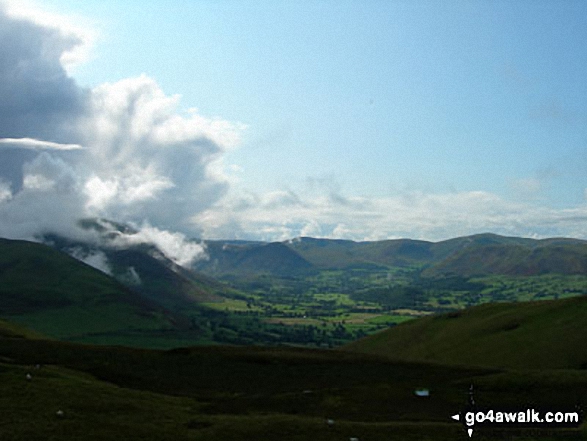
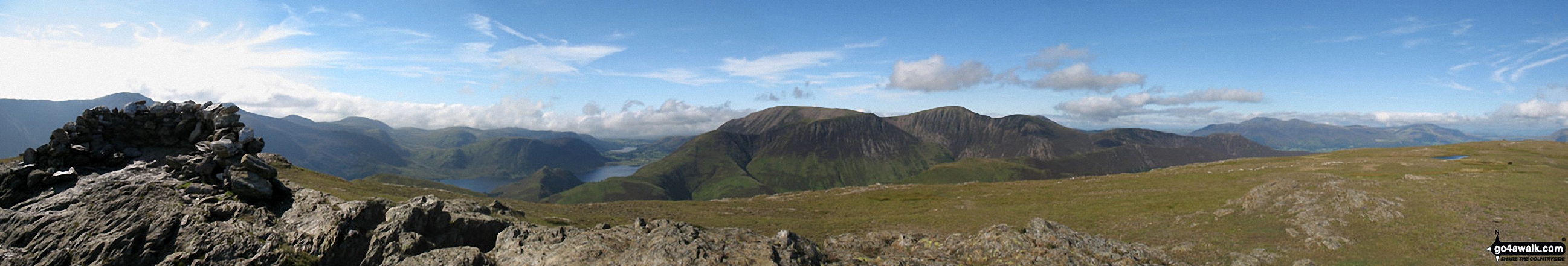
Mellbreak, Mellbreak (North Top), Gavel Fell, Blake Fell, Carling Knott, Burnbank Fell and Loweswater Fell featuring Darling Fell, Low Fell and Fellbarrow from Lanthwaite Green
Whiteside (Crummock) (left), Mellbreak (centre) and Fellbarrow (right) from Setmurthy Common (Watch Hill)
High Stile (left) Buttermere, Mellbreak, Rannerdale Knotts, High Snockrigg, Grasmoor and the shoulder of Robinson (right) from the summit of Fleetwith Pike
The summit shelter, Mellbreak, Rannerdale Knotts, Buttermere, Grasmoor, Whiteless Pike, Wandope, Crag Hill (Eel Crag), Sail and Knott Rigg from the summit of Robinson
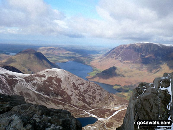
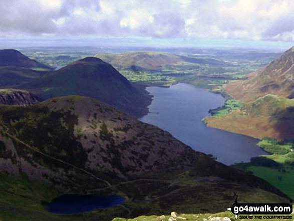
Mellbreak, Crummock Water and Grasmoor with Dodd (Buttermere) and Bleaberry Tarn in the foreground from Red Pike (Buttermere)
. . . see all 52 walk photographs & pictures of views from, on or of Mellbreak
Send us your photographs and pictures on, of, or from Mellbreak
If you would like to add your walk photographs and pictures featuring views from, on or of Mellbreak to this page, please send them as email attachments (configured for any computer) along with your name to:
and we shall do our best to publish them.
(Guide Resolution = 300dpi. At least = 660pixels (wide) x 440 pixels (high).)

You can also submit photos via our Facebook Page.
NB. Please indicate where each photo was taken and whether you wish us to credit your photos with a Username or your First Name/Last Name.
Not familiar with this top?


