England - a fully detailed list of all the Mountains, Peaks, Tops and Hills (Page 1 of 6)
England is defined as the whole of the country of England which includes the National Parks of Dartmoor, Exmoor, The Lake District, The Peak District, The North York Moors, Northumberland, The South Downs and The Yorkshire Dales, as well as The Chilterns, The Cotswolds, The Forest of Bowland, The North Peninnes, The Shropshire Hills and The South Peninnes.
If you count only the Marilyns there are 173 tops to climb, bag & conquer and the highest point is Scafell Pike at 978m (3,210ft).
To see these Mountains, Peaks, Tops and Hills displayed in different ways - see the options in the left-hand column and towards the bottom of this page.
![]() Your Personal Bagging Record for England
Your Personal Bagging Record for England
LOG ON and RELOAD this page to show which Mountains, Peaks, Tops and Hills you have already climbed, bagged & conquered [. . . more details]
See this list in: Alphabetical Order
| Height Order‡
To reverse the order select the link again.
Mountain, Peak, Top or Hill:
Bagged

![]()
1. Arnside Knott
159m (522ft)
Arnside Knott is on interactive maps:
Arnside Knott is on downloadable PDF you can Print or Save to your Phone: |
![]()
2. Acre (Normanby le Wold)
168m (551ft)
Send it in and we'll publish it here.
Acre (Normanby le Wold) is on interactive maps:
A downloadable go4awalk.com PDF Peak Bagging Map featuring Acre (Normanby le Wold) will be available soon. |
![]()
3. Billinge Hill
179m (587ft)
Billinge Hill is on interactive maps:
Billinge Hill is on downloadable PDF you can Print or Save to your Phone: |
![]()
4. Nine Barrow Down (Coringdon)
199m (653ft)
Send it in and we'll publish it here.
Nine Barrow Down (Coringdon) is on interactive maps:
A downloadable go4awalk.com PDF Peak Bagging Map featuring Nine Barrow Down (Coringdon) will be available soon. |
![]()
5. Thurnham Court Estate (Detling Hill)
200m (656ft)
Send it in and we'll publish it here.
Thurnham Court Estate (Detling Hill) is on interactive maps:
|
![]()
6. Hardown Hill
207m (679ft)
Hardown Hill is on interactive maps:
A downloadable go4awalk.com PDF Peak Bagging Map featuring Hardown Hill will be available soon. |
![]()
7. Brighstone Down
214m (702ft)
Brighstone Down is on interactive maps:
|
![]()
8. Wilmington Hill
214m (702ft)
Wilmington Hill is on interactive maps:
A downloadable go4awalk.com PDF Peak Bagging Map featuring Wilmington Hill will be available soon. |
![]()
9. Lord's Seat (Whitbarrow Scar)
215m (706ft)
Lord's Seat (Whitbarrow Scar) is on interactive maps:
A downloadable go4awalk.com PDF Peak Bagging Map featuring Lord's Seat (Whitbarrow Scar) will be available soon. |
![]()
10. Firle Beacon
217m (712ft)
Firle Beacon is on interactive maps:
A downloadable go4awalk.com PDF Peak Bagging Map featuring Firle Beacon will be available soon. |
![]()
11. Muncaster Fell (Hooker Crag)
231m (758ft)
Muncaster Fell (Hooker Crag) is on interactive maps:
A downloadable go4awalk.com PDF Peak Bagging Map featuring Muncaster Fell (Hooker Crag) will be available soon. |
![]()
12. Dundry (Dundry Down)
233m (764ft)
Send it in and we'll publish it here.
Dundry (Dundry Down) is on interactive maps:
|
![]()
13. Chanctonbury Ring (Chanctonbury Hill)
238m (781ft)
Send it in and we'll publish it here.
Chanctonbury Ring (Chanctonbury Hill) is on interactive maps:
A downloadable go4awalk.com PDF Peak Bagging Map featuring Chanctonbury Ring (Chanctonbury Hill) will be available soon. |
![]()
14. St Boniface Down (Wroxall Down)
241m (790ft)
Send it in and we'll publish it here.
St Boniface Down (Wroxall Down) is on interactive maps:
|
![]()
15. Crowborough
242m (794ft)
Crowborough is on interactive maps:
A downloadable go4awalk.com PDF Peak Bagging Map featuring Crowborough will be available soon. |
![]()
16. Swinside (Portinscale)
244m (800ft)
Swinside (Portinscale) is on interactive maps:
Swinside (Portinscale) is on downloadable PDF you can Print or Save to your Phone: *Version including the walk routes marked on it that you need to follow to Walk all 214 Wainwrights in just 59 walks. |
![]()
17. Bishop Wilton Wold (South Wold)
246m (807ft)
Send it in and we'll publish it here.
Bishop Wilton Wold (South Wold) is on interactive maps:
|
![]()
18. Ditchling Beacon
248m (813ft)
Ditchling Beacon is on interactive maps:
A downloadable go4awalk.com PDF Peak Bagging Map featuring Ditchling Beacon will be available soon. |
![]()
19. Carnmenellis
252m (827ft)
Carnmenellis is on interactive maps:
|
![]()
20. Watch Croft (White Downs)
252m (827ft)
Send it in and we'll publish it here.
Watch Croft (White Downs) is on interactive maps:
A downloadable go4awalk.com PDF Peak Bagging Map featuring Watch Croft (White Downs) will be available soon. |
![]()
21. Hegdon Hill (Lower Hegdon)
254m (833ft)
Send it in and we'll publish it here.
Hegdon Hill (Lower Hegdon) is on interactive maps:
|
![]()
22. Setmurthy Common (Watch Hill)
254m (833ft)
Setmurthy Common (Watch Hill) is on interactive maps:
Setmurthy Common (Watch Hill) is on downloadable PDF you can Print or Save to your Phone: *Version including the walk routes marked on it that you need to follow to Walk all 214 Wainwrights in just 59 walks. |
![]()
23. Christ Cross
261m (856ft)
Christ Cross is on interactive maps:
|
![]()
24. Housedon Hill
266m (873ft)
Housedon Hill is on interactive maps:
|
![]()
25. Botley Hill
267m (876ft)
Botley Hill is on interactive maps:
A downloadable go4awalk.com PDF Peak Bagging Map featuring Botley Hill will be available soon. |
![]()
26. Wendover Woods (Haddington Hill)
267m (876ft)
Wendover Woods (Haddington Hill) is on interactive maps:
|
![]()
27. Butser Hill
270m (886ft)
Butser Hill is on interactive maps:
A downloadable go4awalk.com PDF Peak Bagging Map featuring Butser Hill will be available soon. |
![]()
28. Claife Heights (High Blind How)
270m (886ft)
Claife Heights (High Blind How) is on interactive maps:
A downloadable go4awalk.com PDF Peak Bagging Map featuring Claife Heights (High Blind How) will be available soon. |
![]()
29. Seager Hill (Bunker's Hill)
272m (892ft)
Send it in and we'll publish it here.
Seager Hill (Bunker's Hill) is on interactive maps:
|
![]()
30. Hutton Roof Crags
274m (899ft)
Hutton Roof Crags is on interactive maps:
Hutton Roof Crags is on downloadable PDF you can Print or Save to your Phone: |
View these 173 Mountains, Peaks, Tops and Hills:
- On an Interactive Google Map (loads faster)
- On an Interactive Google Map with a list of tops below it.
(makes it easier to locate a particular top) - On a Detailed List in:
Alphabetical Order | Height Order - On one page with 'yet-to-be-bagged' listed 1st & then 'already-bagged' tops listed 2nd in:
Alphabetical Order | Height Order - On one page with 'already-bagged' tops listed 1st & then 'yet-to-be-bagged' tops listed 2nd in:
Alphabetical Order | Height Order
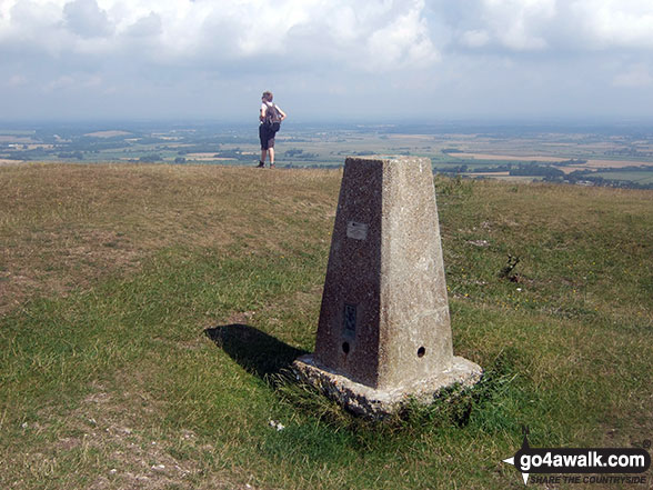
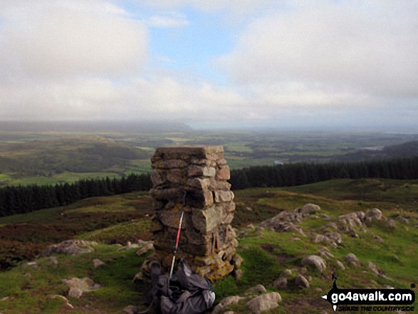
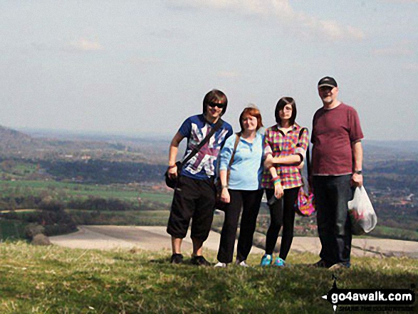
 The view from Scafell Pike in England
Photo: David Cochrane
Is there a Mountain, Peak, Top or Hill missing from the above google map or list?
Let us know an we will add it to our database.
To contribute to go4awalk.com or to contact us about anything at all - see Talk To Us.
For help see Help.
go4awalk.com and go4awalk.co.uk are registered trademarks of TMDH Limited.
Copyright © 2000-2025 TMDH Limited. All rights reserved.
Copyright Terms & Conditions Privacy Statement
A - Z Walks Home Log On/Accounts Photo Gallery Walk Ideas and Collections Fell Facts Hill Skills Walking Questions and Answers Your Stories News Competitions Product Reviews/Gear Tests Walking Gear Guides Peaks and Mountains Peak Bagging Find New Walking Friends Camping GPS Waypoints for Walking Contents Walk Search Talk To Us go4awalk.com Help Free Example Walks Newsletter


