UK Postcode LA23 - The 30 nearest easy-to-follow, circular walk route maps to you
The thirty nearest easy-to-follow, circular walk route maps to you in UK Postcode LA23 in Walk Grade Order
The UK cities, towns and villages in Cumbria, England that have LA23 in their UK Postcode include:
• Bowness-on-Windermere • Troutbeck • Troutbeck Bridge • Windermere •
Not familiar with the area around LA23?
See these 30 nearest walks to UK Postcode LA23 on a google map
   |
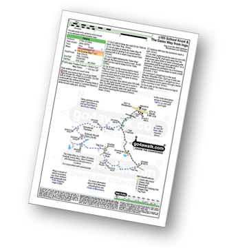
Vital Statistics:
| Length: | 7.5 miles (12 km) |
| Ascent: | 787ft (240m) |
| Time: | 3½ hrs |
| Grade: |  |
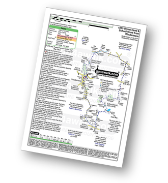
Route Summary:
Windermere - Ellery Woods - Orrest Head - Near Orrest Farm - Mislet Farm - Heaning Farm - Blackmoss Farm - School Knott Plantation - School Knott - The Dales Way - High Cleabarrow Farm - Matson Ground - Heaththwaite Manor - Windermere
|
Vital Statistics:
| Length: | 7.25 miles (11.5 km) |
| Ascent: | 1,247ft (380m) |
| Time: | 3.75hrs |
| Grade: | |
Route Summary:
Windermere - Orrest Head - Moorhowe - Dubbs Road - Garburn Road - Longmire Road - Far Orrest Farm - Orrest Head - Windermere
|
Vital Statistics:
| Length: | 7 miles (11 km) |
| Ascent: | 945ft (288m) |
| Time: | 3½ hrs |
| Grade: | |
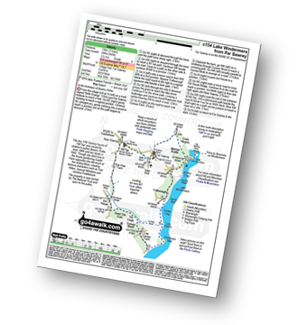
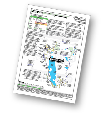
Route Summary:
Far Sawrey - Mitchell Knotts - Fellborough - Lake Windermere Shore - Rawlinson Nab - Low Cunsey Farm - Cunsey Wood - The Forge - Great Ore Gate - Cunsey Beck - Eel House Bridge - Dub How Farm - Near Sawrey - Hill Top (former Home of Beatrix Potter) - Wilfin Beck - Far Sawrey
|
Vital Statistics:
| Length: | 8.5 miles (13.5 km) |
| Ascent: | 1,644ft (501m) |
| Time: | 4.75hrs |
| Grade: |  |
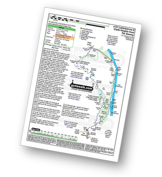
Route Summary:
Far Sawrey - Mitchell Knotts - Low Pate Crag - Claife Heights (High Blind How) - The Heald - High Moss - Belle Grange Beck - Long Height - Latterbarrow - High Wray - Red Nap Car Park - Lake Windermere - Belle Grange Bay - Bark Barn Ferry - Slape Scar - Strawberry Gardens - Far Sawrey
|
Vital Statistics:
| Length: | 6 miles (9.5 km) |
| Ascent: | 531ft (246m) |
| Time: | 2½ hrs |
| Grade: |  |
Route Summary:
Ings - High Fairbank - The Dales Way - Crag House Farm - Outrun Nook - Hag End Farm - School Knott - Schoolknott Plantation - Whasdike Farm - Ings
|
Vital Statistics:
| Length: | 7 miles (11 km) |
| Ascent: | 1,218ft (371m) |
| Time: | 3.75hrs |
| Grade: | |
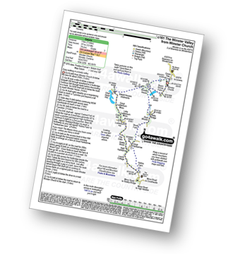
Route Summary:
Winster Church - Winster House - Birkett Houses Allotments - Ghyll Head Reservoir - Great Ludderburn Moss - Little Ludderburn Moss - Ludderburn Hill - The Oaks - Intake Wood - High Hartbarrow - Lound Cottage - Strawberry Bank - Hollins Farm - Great Hartbarrow - Wood Farm - River Winster - Bryan House Farm - Winster Church
|
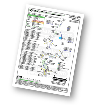
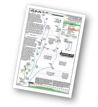
Vital Statistics:
| Length: | 5.5 miles (8.5 km) |
| Ascent: | 1,582ft (482m) |
| Time: | 3.75hrs |
| Grade: | |
Route Summary:
Troutbeck Bridge - Garburn Road - Backstone Barrow - Sour Howes - Sallows - Garburn Pass - Troutbeck - Troutbeck Bridge
|
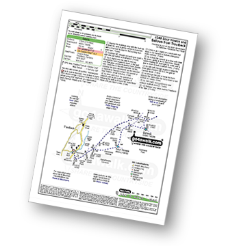
Vital Statistics:
| Length: | 11 miles (17.5 km) |
| Ascent: | 3,410ft (1,039m) |
| Time: | 7½ hrs |
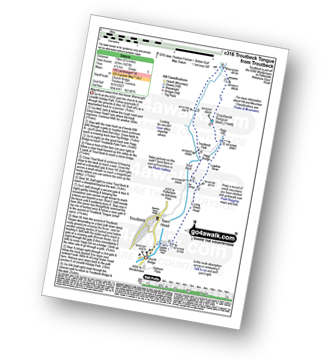
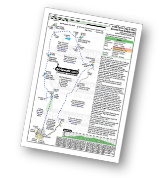
| Grade: |  |
Route Summary:
Troutbeck Bridge - Garburn Road - Backstone Barrow - Sour Howes - Sallows - Garburn Pass - Yoke - Ill Bell - Froswick - Wanfer Crag - Hagg Gill - Trout Beck - Troutbeck Tongue - Lowther Brow - Long Green Head - Limefitt Campsite - Troutbeck - Troutbeck Bridge
|
Vital Statistics:
| Length: | 8.25 miles (13 km) |
| Ascent: | 1,421ft (433m) |
| Time: | 4½ hrs |
| Grade: | |
Route Summary:
Troutbeck Bridge - Troutbeck - Limefitt Holiday Park - Long Green Head - Ing Bridge - Troutbeck Park - Park Fell Head - Trout Beck - Troutbeck Tongue - Hagg Gill - Lowther Brow - Long Green Head - Limefitt Holiday Park - Troutbeck - Troutbeck Bridge
|
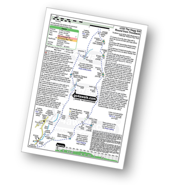
Vital Statistics:
| Length: | 12.25 miles (19.5 km) |
| Ascent: | 4,194ft (1,278m) |
| Time: | 8.75hrs |
| Grade: |  |
Route Summary:
Troutbeck Bridge - Garburn Pass - Yoke - Ill Bell - Froswick - Thornthwaite Crag - Stony Cove Pike (Caudale Moor) - Doup Crag - Trout Beck - Troutbeck Tongue - Hagg Gill - Lowther Brow - Long Green Head - Limefitt Campsite - Troutbeck - Troutbeck Bridge
|
Vital Statistics:
| Length: | 7.25 miles (11.5 km) |
| Ascent: | 896ft (273m) |
| Time: | 3½ hrs |
| Grade: | |
Route Summary:
Hawkshead - Colthouse - Long Height - Holland Band Planation - Wise Een Tarn - Scale Tarn - Moss Eccles Tarn - Stones Lane - Near Sawrey - Hill Top (former Home of Beatrix Potter) - Ees Bridge - Esthwaite Tarn - Howe Farm - Roger Ground - Hawkshead
|
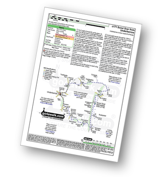
Vital Statistics:
| Length: | 5.5 miles (8.5 km) |
| Ascent: | 974ft (297m) |
| Time: | 3 hrs |
| Grade: | |
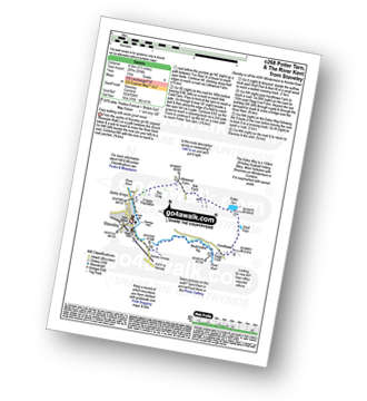
Route Summary:
Staveley - Barley Bridge - Craggy Plantation - Spy Crag - Littlewood Farm - Birk Field Farm - Potter Tarn - Ghyll Pool - Hundhowe - Hagg Foot - The River Kent - The Dales Way - Beckmickle Ing - Staveley
|
Vital Statistics:
| Length: | 11 miles (17.5 km) |
| Ascent: | 3,633ft (1,107m) |
| Time: | 7.75hrs |
| Grade: | |
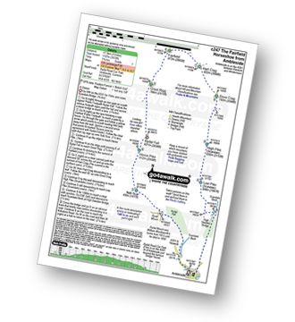
Route Summary:
Ambleside - Rydal - Nab Scar - Heron Pike - Rydal Fell (Heron Pike North Top) - Great Rigg - Fairfield - Rydal Head - Hart Crag - Dove Crag - High Pike (Scandale) - Low Pike (Scandale) - High Sweden Bridge - High Sweden Coppice - Ambleside
|
Vital Statistics:
| Length: | 12.5 miles (20 km) |
| Ascent: | 3,411ft (1,040m) |
| Time: | 8 hrs |
| Grade: | |
Route Summary:
Ambleside - Rydal - Nab Scar - Heron Pike - Rydal Fell (Heron Pike North Top) - Great Rigg - Fairfield - Rydal Head - Hart Crag - Dove Crag - Little Hart Crag - Scandale Pass - Red Screes - Snarker Pike - Ambleside
|
Vital Statistics:
| Length: | 6 miles (9.5 km) |
| Ascent: | 1,401ft (427m) |
| Time: | 3½ hrs |
| Grade: | |
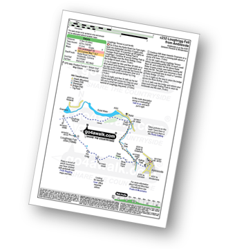
Route Summary:
Ambleside - Rothay Park - Ivy Fell - Loughrigg Fell - Loughrigg Terrace - Rydal Water - Loughrigg Caves - River Rothay - Pelter Bridge - Ambleside
Not familiar with the area around LA23?
See these 30 nearest walks to UK Postcode LA23 on a google map
|
Vital Statistics:
| Length: | 12.25 miles (19.5 km) |
| Ascent: | 3,984ft (1,214m) |
| Time: | 8½ hrs |
| Grade: | |
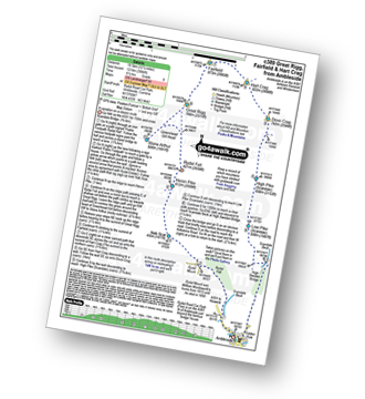
Route Summary:
Ambleside - Rydal - Nab Scar - Heron Pike - Rydal Fell (Heron Pike North Top) - Greenhead Gill Head - Stone Arthur - Great Rigg - Fairfield - Rydal Head - Hart Crag - Dove Crag - High Pike (Scandale) - Low Pike (Scandale) - High Sweden Bridge - High Sweden Coppice - Ambleside
|
Vital Statistics:
| Length: | 9.75 miles (15.5 km) |
| Ascent: | 3,551ft (1,082m) |
| Time: | 7.25hrs |
| Grade: | |
Route Summary:
Ambleside - Snarker Pike - Red Screes - Scandale Pass - Little Hart Crag - Dove Crag - High Pike (Scandale) - Low Pike (Scandale) - High Sweden Bridge - Ambleside
|
Vital Statistics:
| Length: | 10 miles (16 km) |
| Ascent: | 1,496ft (456m) |
| Time: | 5.25hrs |
| Grade: | |
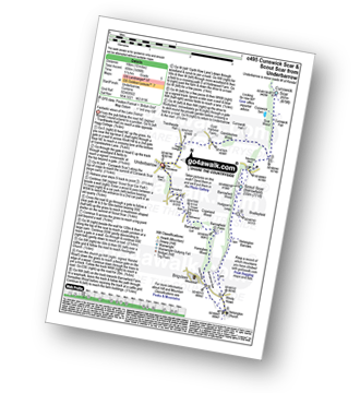
Route Summary:
Underbarrow - Hagg Cottage - Gambleshire Lane - Gambleshire Lane - Cunswick Fell - Cunswick Scar - Scout Scar (Barrowfield) - Hodgeson's Leap - Bradleyfield - Helsington Barrows - Windy Howe - Helsington Church - Honeybee Wood - Barrowfield Farm - Barrowfield Lot - Copeland Wood - Hollinwood - Cooper Tenement - Rockyfield - Underbarrow
|
Vital Statistics:
| Length: | 5.75 miles (9 km) |
| Ascent: | 932ft (284m) |
| Time: | 3 hrs |
| Grade: | |
Route Summary:
Underbarrow - Hagg Cottage - Gambleshire Lane - Gambleshire Lane - Cunswick Fell - Scout Scar (Barrowfield) - Hodgeson's Leap - Bradleyfield - Helsington Barrows - Barrowfield Farm - Barrowfield Lot - Copeland Wood - Hollinwood - Cooper Tenement - Rockyfield - Underbarrow
|
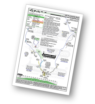
Vital Statistics:
| Length: | 7.5 miles (12 km) |
| Ascent: | 2,519ft (768m) |
| Time: | 5.25hrs |
| Grade: |  |
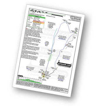
Route Summary:
Ambleside - Snarker Pike - Red Screes - Scandale Pass - High Sweden Bridge - Ambleside
|
Vital Statistics:
| Length: | 8.75 miles (14 km) |
| Ascent: | 558ft (170m) |
| Time: | 3½ hrs |
| Grade: | |
Route Summary:
Ambleside - Scandale Beck - Rydal Park - Rydal Hall - Rydal - Rydal Mount - Rydal Water - Coffin Route - Dove Cottage - Grasmere Village - Silverhowe - The Lea - Grasmere - Red Bank - Rydal Cave - Jobson Close - Rough Intake - Pelter Bridge - Foxghyll - River Rothay - Rothay Park - Ambleside
|
Vital Statistics:
| Length: | 6 miles (9.5 km) |
| Ascent: | 2,192ft (668m) |
| Time: | 5 hrs |
| Grade: | |
Route Summary:
Ambleside - Stockghyll Force - Wansfell Pike - Baystones (Wansfell) - The Hundreds - Nanny Lane - Troutbeck - Robin Lane - High Skelghyll Farm - Skelghyll Wood - Jenkin Crag - Ambleside
|
Vital Statistics:
| Length: | 3.25 miles (5 km) |
| Ascent: | 1,428ft (435m) |
| Time: | 2½ hrs |
| Grade: | |
|
Vital Statistics:
| Length: | 5 miles (8 km) |
| Ascent: | 1,769ft (539m) |
| Time: | 3.75hrs |
| Grade: | |
Route Summary:
Ambleside - Stockghyll Force - Wansfell Pike - Baystones (Wansfell) - Wansfell Pike - Stockghyll Force - Ambleside
|
Vital Statistics:
| Length: | 11.5 miles (18.5 km) |
| Ascent: | 3,378ft (1,030m) |
| Time: | 7½ hrs |
| Grade: | |
Route Summary:
Kentmere - Garburn Pass - Yoke - Ill Bell - Froswick - Thornthwaite Crag - Mardale Ill Bell - Nan Bield Pass - Harter Fell (Mardale) - Kentmere Pike - Brookstones - Kentmere
|
Vital Statistics:
| Length: | 11 miles (17.5 km) |
| Ascent: | 2,310ft (704m) |
| Time: | 6.25hrs |
| Grade: | |
Route Summary:
Grizedale Forest Visitor Centre - Silurian Way - Priest Wood - Ridding Wood - Braithwaite Plantation - Potato Peg Plantation - Grisedale Tarn - The Connob - Low Scar Wood - Beck Side Intake - Great Wood - New South Wales Plantation - Breasty Haw - Lawrence Scar Wood - Dale Park Scar - Blind Lane Wood - Force Knott - Swainsley Hill - Force Beck - Farce Falls - Low Bowkerstead Hob Gill Plantation - Satterthwaite - Scale Green Wood - Scale Green Intake - Carron Crag - Park Plantation - Broad Piece - Grizedale Forest Visitor Centre
|
Vital Statistics:
| Length: | 6 miles (9.5 km) |
| Ascent: | 853ft (260m) |
| Time: | 3 hrs |
| Grade: | |
Route Summary:
Tom Gill - Tom Gill Waterfall - Tarn Hows - Rose Castle Plantation - Torver Intake - The Cumbria Way - Tom Heights - Iron Keld - Low Arnside - The Cumbria Way - Oxen Fell High Cross - Man Crag - Yew Tree Tarn - Harry Guards Wood - Yew Tree Farm - Glen Mary Bridge - Tom Gill
|
Vital Statistics:
| Length: | 5.75 miles (9 km) |
| Ascent: | 909ft (277m) |
| Time: | 3 hrs |
| Grade: | |
Route Summary:
Tom Gill - Tom Gill Waterfall - Tarn Hows - Rose Castle Plantation - Torver Intake - The Cumbria Way - Tom Heights - Arnside Intake - Stone Chair Hill - Griddle How - Oxen Fell High Cross - High Oxenfell Farm - Wythe Howe - Wythebank - Hodge Close Quarry - Bakestone Barrow Wood - Holme Ground - Low Tilberthwaite - Yew Bank - Shepherd's Bridge - Yew Tree Farm - Glen Mary Bridge - Tom Gill
|
Vital Statistics:
| Length: | 8.25 miles (13 km) |
| Ascent: | 1,995ft (608m) |
| Time: | 5 hrs |
| Grade: | |
Route Summary:
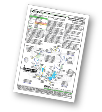
Tom Gill Car Park - Glen Mary Bridge - Yew Tree Farm - Yew Tree Farm - Harry Guards Wood - Uskdale Gap - Holme Fell - Holme Hill Wood - Low Tilberthwaite - Hodge Close Quarry - High Tilberthwaite - Wythebank - High Oxenfell Farm - Low Arnside - Black Fell (Black Crag) - Iron Keld - Tarn Hows - Tom Gill Waterfalls - Tom Gill Car Park.
|
Vital Statistics:
| Length: | 10 miles (16 km) |
| Ascent: | 1,364ft (416m) |
| Time: | 5 hrs |
| Grade: | |
Route Summary:
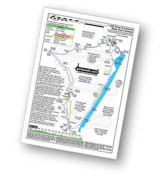
Coniston - Walna Scar Road - Banishead - Torver Beck - Torver - Beckstones - The Cumbria Way - Coniston Water - Coniston Sailing Club - Coniston Hall - Coniston
Not familiar with the area around LA23?
See these 30 nearest walks to UK Postcode LA23 on a google map


