
![]()
Troutbeck Tongue
364m (1195ft)
The Far Eastern Fells, The Lake District, Cumbria, England
Not familiar with this top?
   |
|---|
Vital Statistics:
| Length: | 8.25ml (13km) |
|---|---|
| Ascent: | 1,421ft (433m) |
| Time: | 4½ hrs |
| Grade: |  (Moderate) (Moderate) |
Route Summary:
Troutbeck Bridge - Troutbeck - Limefitt Holiday Park - Long Green Head - Ing Bridge - Troutbeck Park - Park Fell Head - Trout Beck - Troutbeck Tongue - Hagg Gill - Lowther Brow - Long Green Head - Limefitt Holiday Park - Troutbeck - Troutbeck Bridge
|
|---|
Vital Statistics:
| Length: | 11ml (17.5km) |
|---|---|
| Ascent: | 3,410ft (1,039m) |
| Time: | 7½ hrs |
| Grade: |  (Hard) (Hard) |
Route Summary:
Troutbeck Bridge - Garburn Road - Backstone Barrow - Sour Howes - Sallows - Garburn Pass - Yoke - Ill Bell - Froswick - Wanfer Crag - Hagg Gill - Trout Beck - Troutbeck Tongue - Lowther Brow - Long Green Head - Limefitt Campsite - Troutbeck - Troutbeck Bridge
|
|---|
Vital Statistics:
| Length: | 12.25ml (19.5km) |
|---|---|
| Ascent: | 4,194ft (1,278m) |
| Time: | 8.75hrs |
| Grade: |  (Hard) (Hard) |
Route Summary:
Troutbeck Bridge - Garburn Pass - Yoke - Ill Bell - Froswick - Thornthwaite Crag - Stony Cove Pike (Caudale Moor) - Doup Crag - Trout Beck - Troutbeck Tongue - Hagg Gill - Lowther Brow - Long Green Head - Limefitt Campsite - Troutbeck - Troutbeck Bridge
See Troutbeck Tongue and the surrounding tops on our free-to-access 'Google Style' Peak Bagging Maps:
The Far Eastern Fells of The Lake District National Park
Less data - quicker to download
The Whole of The Lake District National Park
More data - might take a little longer to download
See Troutbeck Tongue and the surrounding tops on our downloadable Peak Bagging Maps in PDF format:

NB: Whether you print off a copy or download it to your phone, these PDF Peak Baggers' Maps might prove incredibly useful when your are up there on the tops and you cannot get a phone signal.
*This version is marked with the walk routes you need to follow to Walk all 214 Wainwrights in just 59 walks.
You can find Troutbeck Tongue & all the walks that climb it on these unique free-to-access Interactive Walk Planning Maps:
1:25,000 scale OS Explorer Map (orange/yellow covers):
1:50,000 scale OS Landranger Map (pink/magenta covers):
 Fellow go4awalkers who have already walked, climbed, summited & bagged Troutbeck Tongue
Martin Hartshorne walked up Troutbeck Tongue on January 20th, 2026 [from/via/route] Dubbs road [with] finley [weather] Mostly grey but skies but clear. Windy out of tje valley & cold
Mr M A Blanchard climbed Troutbeck Tongue on December 12th, 2025 [with] The mutts
James Hughes bagged Troutbeck Tongue on September 11th, 2024 [from/via/route] c332 The Hagg Gill Round from Troutbeck [weather] Mixed. Odd shower, warm in valleys, cold on tops. Clear visibility. - Stunning & reasonably straight forward easy to navigate walk. Beautiful vistas. Multiple jet fly-bys. Tongue boggy & tusoucky in places. Mortal Man for post walk pint.
Ian Ashton hiked Troutbeck Tongue on May 3rd, 2024 [with] Steve H - Ì
Paul Roddam summited Troutbeck Tongue on March 17th, 2024 [with] Barber [weather] Cloudy coming into sun
Richard Fulcher conquered Troutbeck Tongue on March 10th, 2024 [from/via/route] We parked beside the church in Troutbeck after having to make a big diversion because of a road closed in Troutbeck! Set off through Limefitt Holiday Park up to the Longmire Road (track) & followed this all the way to below Ill Bell before turning left up a path & then sharp left to follow a path up to the summit. The descent was fairly steep & made more challenging by the rain & wind. We followed the footpaths over Hagg bridge & Ing bridge & then along Ing lane until it reached the A592. We then decided to walk down the A592 to the car as it was closed at the Kirstone Pass & therefore quiet. [with] Jen [weather] Windy, cold with intermittent rain.
Sarah Moore scaled Troutbeck Tongue on February 24th, 2024 [from/via/route] c332 / The Hagg Gill Round from Troutbeck. Loads of parking options & the route was well defined. Only thing to watch for is the path down when on the ridge. Most continuing on from Froswick but I needed to go left - it's clear if you look for it! Nice to go along the path once down at the Gill / stream - the road / track would be easier if there was a hurry. [with] On my own [weather] February frost, but dry although low visibility for most of the walk - particularly once past Sallows until coming down from Froswick. Glad of layers today! - 10 months since I've been in The Lakes - & it was so so good to be back. Not as cold as I expected & the sun made an appearance but visibility was rubbish. Coming down from Froswick was lethal & I went full length twice - but very glad for the poles & nothing that the washing machine can't fix! (Disappointing given how clear it was later in the day & the next day!)
David Higginbottom walked up Troutbeck Tongue on February 9th, 2023 [from/via/route] Route 332 [with] Carolyn [weather] Good
Tim Winn climbed Troutbeck Tongue on December 29th, 2022 [from/via/route] Troutbeck [with] Jane [weather] Rainy
Clare Tait bagged Troutbeck Tongue on May 31st, 2022 [from/via/route] Parked in small lay-by near wooden building & opposite the holiday park. Took lane through Troutbeck Park to the far end of the Tongue for an easier ascent. [with] Charlie [weather] In amidst three named storms, a beautiful day allowed us to bag Binsey & Dodd. A nice brace of fells. - Our no 79 Wainwright. Pleasant walk. Bad patch of bog on lower slopes to watch out for. Return spoiled by heavy rain.
To add (or remove) your name and experiences on this page - Log On and edit your Personal Mountain Bagging Record
. . . [see more walk reports]
More Photographs & Pictures of views from, on or of Troutbeck Tongue
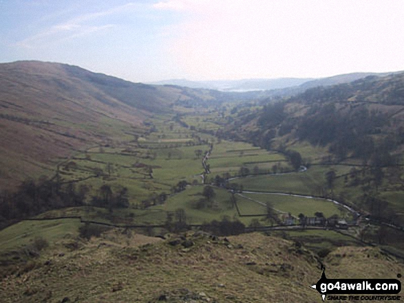
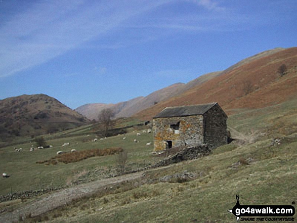
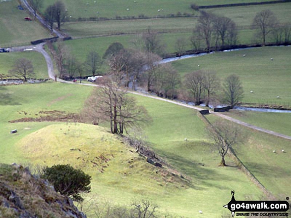
Looking South towards Troutbeck and Windermere from Troutbeck Tongue summit

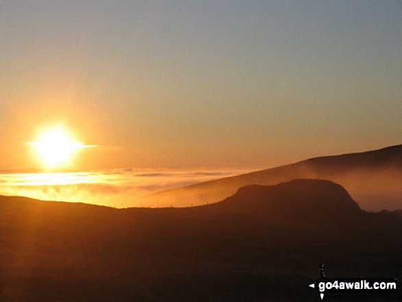
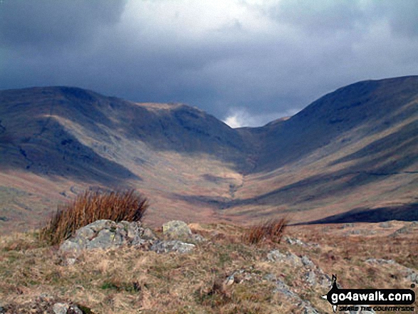
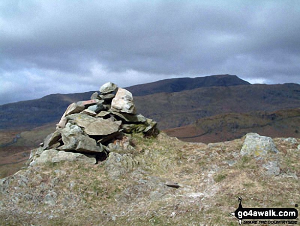
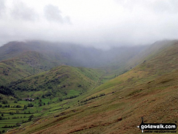
Stony Cove Pike (Caudale Moor) (left), Thresthwaite Mouth and Thornthwaite Crag (right) from the Northern end of Troutbeck Tongue
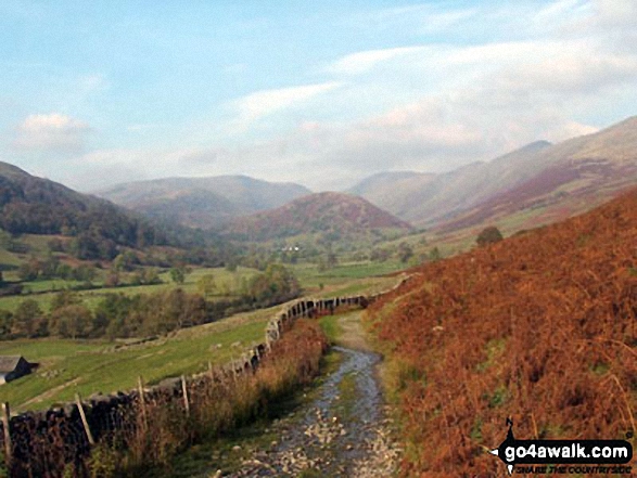
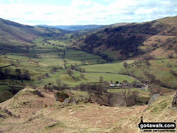
Troutbeck from the path beside Hagg Gill on the East side of Troutbeck Tongue
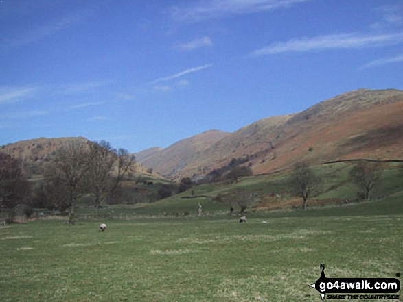
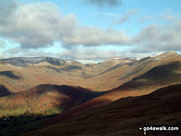
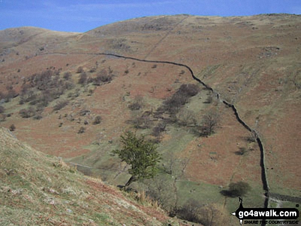
Troutbeck Tongue from Garburn Road with Stony Cove Pike and Thornthwaite Crag beyond covered in cloud
Send us your photographs and pictures on, of, or from Troutbeck Tongue
If you would like to add your walk photographs and pictures featuring views from, on or of Troutbeck Tongue to this page, please send them as email attachments (configured for any computer) along with your name to:
and we shall do our best to publish them.
(Guide Resolution = 300dpi. At least = 660pixels (wide) x 440 pixels (high).)

You can also submit photos via our Facebook Page.
NB. Please indicate where each photo was taken and whether you wish us to credit your photos with a Username or your First Name/Last Name.
Not familiar with this top?


