
![]()
Nab Scar
450m (1477ft)
The Eastern Fells, The Lake District, Cumbria, England

Not familiar with this top?
You can walk/hike to the top of Nab Scar by using any of these 3 easy‑to‑follow route maps:
Walk c247 The Fairfield Horseshoe from Ambleside
A classic lakeland horseshoe walk
   |
|---|
Vital Statistics:
| Length: | 11ml (17.5km) |
|---|---|
| Ascent: | 3,633ft (1,107m) |
| Time: | 7.75hrs |
| Grade: |  (Hard) (Hard) |

Route Summary:
Ambleside - Rydal - Nab Scar - Heron Pike - Rydal Fell (Heron Pike North Top) - Great Rigg - Fairfield - Rydal Head - Hart Crag - Dove Crag - High Pike (Scandale) - Low Pike (Scandale) - High Sweden Bridge - High Sweden Coppice - Ambleside
Walk c389 Great Rigg, Fairfield and Hart Crag from Ambleside
A variation on a classic route
|
|---|
Vital Statistics:
| Length: | 12.25ml (19.5km) |
|---|---|
| Ascent: | 3,984ft (1,214m) |
| Time: | 8½ hrs |
| Grade: |  (Hard) (Hard) |

Route Summary:
Ambleside - Rydal - Nab Scar - Heron Pike - Rydal Fell (Heron Pike North Top) - Greenhead Gill Head - Stone Arthur - Great Rigg - Fairfield - Rydal Head - Hart Crag - Dove Crag - High Pike (Scandale) - Low Pike (Scandale) - High Sweden Bridge - High Sweden Coppice - Ambleside
Walk c230 The Scandale Beck Horizon from Ambleside
Fabulous high level route
|
|---|
Vital Statistics:
| Length: | 12.5ml (20km) |
|---|---|
| Ascent: | 3,411ft (1,040m) |
| Time: | 8 hrs |
| Grade: | (Hard) |

Route Summary:
Ambleside - Rydal - Nab Scar - Heron Pike - Rydal Fell (Heron Pike North Top) - Great Rigg - Fairfield - Rydal Head - Hart Crag - Dove Crag - Little Hart Crag - Scandale Pass - Red Screes - Snarker Pike - Ambleside
See Nab Scar and the surrounding tops on our free-to-access 'Google Style' Peak Bagging Maps:
The Eastern Fells of The Lake District National Park
Less data - quicker to download
The Whole of The Lake District National Park
More data - might take a little longer to download
See Nab Scar and the surrounding tops on our unique, downloadable, PDF Peak Bagging Maps:

NB: Whether you print off a copy or download it to your phone, these PDF Peak Baggers' Maps might prove incredibly useful when your are up there on the tops and you cannot get a phone signal.
*This version is marked with the walk routes you need to follow to Walk all 214 Wainwrights in just 59 walks.
You can find Nab Scar & all the walks that climb it on these unique free-to-access Interactive Walk Planning Maps:
1:25,000 scale OS Explorer Map (orange/yellow covers):
1:50,000 scale OS Landranger Map (pink/magenta covers):
 Fellow go4awalkers who have already walked, climbed, scaled, summited, hiked & bagged Nab Scar
Nick Tippins walked up Nab Scar on July 2nd, 2025 [from/via/route] c247: The Fairfield Horseshoe from Ambleside [with] Fran
Paul Roddam climbed it on September 14th, 2024 [from/via/route] From Ambleside [with] Bri and Barber [weather] Wet
Kate Peacock bagged it on May 18th, 2024 [from/via/route] Helen & Amber walked to this one with me. Anti-clockwise. Great walk. Busy due to events but people were friendly [with] Me & Skye [weather] Sunny with a nice breeze - Sunburnt as the breeze made me think it wasn't as hot
Melfyn Parry hiked Nab Scar on November 21st, 2023 [from/via/route] Followed route C247 - walked out of Ambleside on the A591 & just after Scandale Bridge we crossed the road to follow the lane into the Rydal Hall estate, went passed the cafe & the Hall & then turned right to pass Rydal Mount. Here we veered left to take the stone steps path to the top of Nab Scar, again following a well defined path we were soon on Heron Pike. Continuing along the path with a slight detour to ascend Heron Pike north top. Continuing on to Great Rigg & onwards to Fairfield. We stopped here for lunch & the clouds lifted to give great views over towards Helvellyn & Sunday Crag. After pausing to take some photos we retraced our steps for a few metres before heading left to follow the ridge line to ascend Hart Crag, then Dove Crag & then High Pike. The undulating ridge takes you through some quite boggy areas & on to Low Pike & then down to High Sweden Bridge (a fascinating old bridge). All that was left to do from here was to follow the trail downwards in to Ambleside returning to the village by the Salutation Hotel. [with] DS [weather] Visibility was very good below 800m. By lunchtime the cloud had lifted even more to give clear views of the whole horseshoe. A dry day with sunny intervals, quite cold above 600m but very pleasant below this level. - Doing the walk in a clockwise direction as per C247 is best as the ascent anticlockwise would be much more of a cardio vascular workout.
David Higginbottom summited on February 8th, 2023 [from/via/route] Route 247 [with] Carolyn [weather] Very poor
To add (or remove) your name and experiences on this page - Log On and edit your Personal Mountain Bagging Record
. . . [see more walk reports]
More Photographs & Pictures of views from, on, or of, Nab Scar
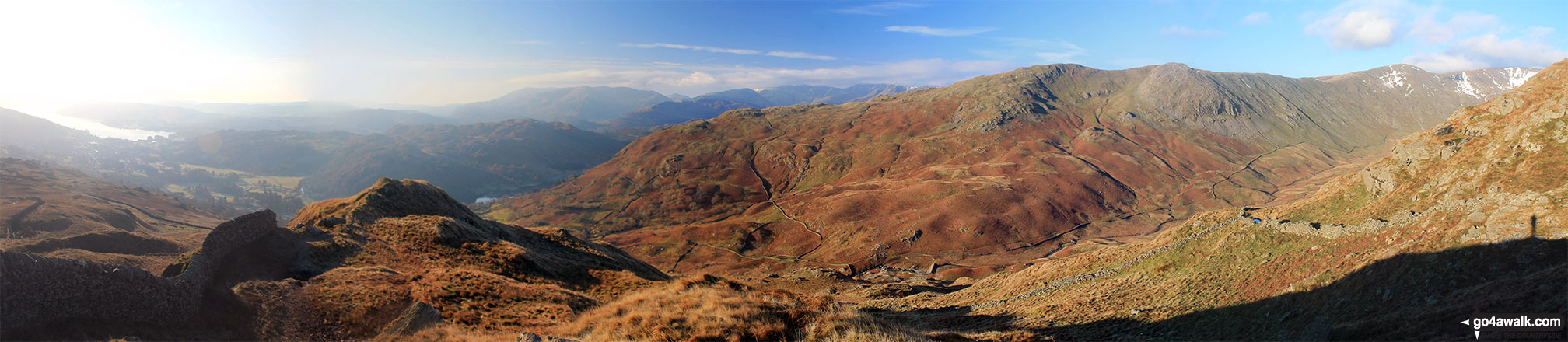
Lake Windermere, Nab Scar, Heron Pike, Heron Pike (North Top) and Great Rigg (far right) from the summit of Low Pike (Scandale)


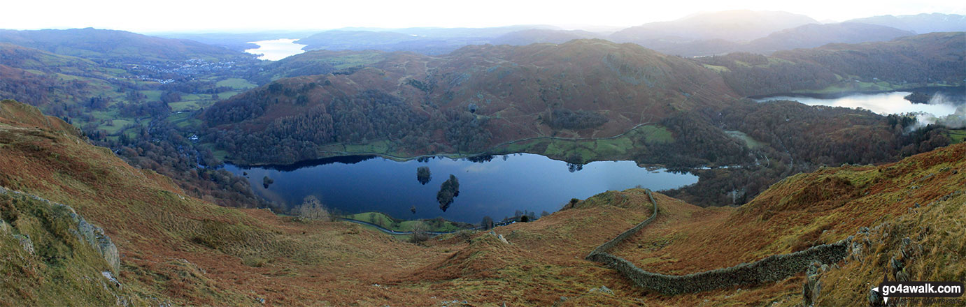
Rydal Water (centre) with Lake Windermere (top left) and Grasmere (right) from Nab Scar on The Fairfield Horeshoe


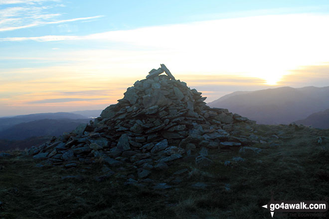
Steve Taylor and Ian Matthews Golledge looking back over Ambleside & Lake Windermere as we ascended Nab scar and on up to Fairfield

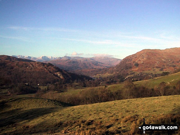
Helm Crag, Seat Sandal, Grisedale Hause, Fairfield, Great Rigg, Stone Arthur, Heron Crag, Nab Scar, Loughrigg and Grasmere above The Pass of Dunmail Raise from the top of High Raven Crag
. . . see all 15 walk photographs & pictures of views from, on, or of, Nab Scar
Send us your photographs and pictures on, of, or from Nab Scar
If you would like to add your walk photographs and pictures to this page, please send them as email attachments (configured for any computer) along with your name to:
and we shall do our best to publish them.
(Guide Resolution = 300dpi. At least = 660pixels (wide) x 440 pixels (high).)

You can also submit photos via our Facebook Page.
NB. Please indicate where each photo was taken and whether you wish us to credit your photos with a Username or your First Name/Last Name.


