
![]()
Snarker Pike
644m (2114ft)
The Eastern Fells, The Lake District, Cumbria, England

Not familiar with this top?
You can walk/hike to the top of Snarker Pike by using any of these 3 easy‑to‑follow route maps:
Walk c102 Red Screes from Ambleside
Quieter alternative to the popular routes from Ambleside
   |
|---|
Vital Statistics:
| Length: | 7.5ml (12km) |
|---|---|
| Ascent: | 2,519ft (768m) |
| Time: | 5.25hrs |
| Grade: |  (Moderate) (Moderate) |
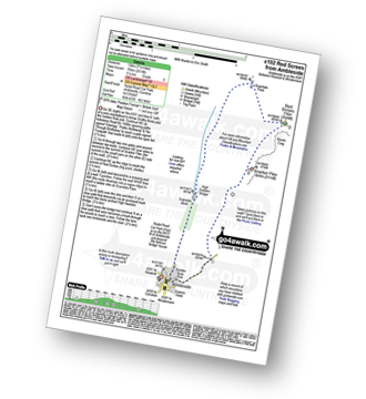
Route Summary:
Ambleside - Snarker Pike - Red Screes - Scandale Pass - High Sweden Bridge - Ambleside
Walk c184 Red Screes and High Pike (Scandale) from Ambleside
Quieter alternative to the popular routes from Ambleside
|
|---|
Vital Statistics:
| Length: | 9.75ml (15.5km) |
|---|---|
| Ascent: | 3,551ft (1,082m) |
| Time: | 7.25hrs |
| Grade: |  (Hard) (Hard) |

Route Summary:
Ambleside - Snarker Pike - Red Screes - Scandale Pass - Little Hart Crag - Dove Crag - High Pike (Scandale) - Low Pike (Scandale) - High Sweden Bridge - Ambleside
Walk c230 The Scandale Beck Horizon from Ambleside
Fabulous high level route
|
|---|
Vital Statistics:
| Length: | 12.5ml (20km) |
|---|---|
| Ascent: | 3,411ft (1,040m) |
| Time: | 8 hrs |
| Grade: |  (Hard) (Hard) |

Route Summary:
Ambleside - Rydal - Nab Scar - Heron Pike - Rydal Fell (Heron Pike North Top) - Great Rigg - Fairfield - Rydal Head - Hart Crag - Dove Crag - Little Hart Crag - Scandale Pass - Red Screes - Snarker Pike - Ambleside
See Snarker Pike and the surrounding tops on our free-to-access 'Google Style' Peak Bagging Maps:
The Eastern Fells of The Lake District National Park
Less data - quicker to download
The Whole of The Lake District National Park
More data - might take a little longer to download
See Snarker Pike and the surrounding tops on our unique, downloadable, PDF Peak Bagging Maps:

NB: Whether you print off a copy or download it to your phone, these PDF Peak Baggers' Maps might prove incredibly useful when your are up there on the tops and you cannot get a phone signal.
*This version is marked with the walk routes you need to follow to Walk all 214 Wainwrights in just 59 walks.
You can find Snarker Pike & all the walks that climb it on these unique free-to-access Interactive Walk Planning Maps:
1:25,000 scale OS Explorer Map (orange/yellow covers):
1:50,000 scale OS Landranger Map (pink/magenta covers):
 Fellow go4awalkers who have already walked, climbed, scaled, summited, hiked & bagged Snarker Pike
John Tippins walked up Snarker Pike on May 28th, 2019 [from/via/route] From Ambleside, walk c184 from go4awalk.com. [with] Afia, Zahra and Farah. [weather] Sunny with clouds, few spots of rain in the afternoon.
Simon Myerscough climbed it on November 8th, 2009 [from/via/route] C184 [with] Joanne [weather] cloudy but clearing at times, very windy
Mark Davidson bagged it on June 25th, 2004 [with] Alone [weather] Beautiful & sunny
Darren Mortimer hiked Snarker Pike on September 24th, 2016 [from/via/route] Ambleside via Fairfield [with] Dermot Palmer [weather] ok ish. Windy & a bit wet at times.
Christine Shepherd summited on September 30th, 2007 [from/via/route] Walked from Ambleside, started on route c102 but extended the walk to do the whole Scandale Beck Horizon.(Walk c230) [with] Miriam [weather] Bright Autumn sunshine
Adrian Roberts and Phyllis Mcgibbon have both walked, climbed & bagged Snarker Pike.
To add (or remove) your name and experiences on this page - Log On and edit your Personal Mountain Bagging Record
More Photographs & Pictures of views from, on, or of, Snarker Pike
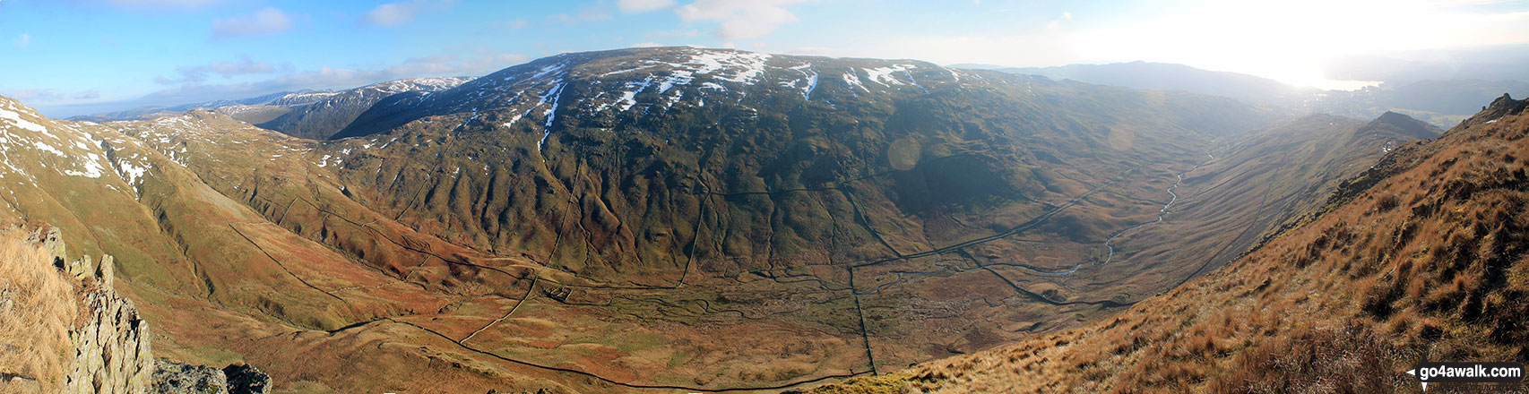
Middle Dodd, Red Screes, Snarker Pike, the Scandale Valley and Lake Windermere from High Pike (Scandale)
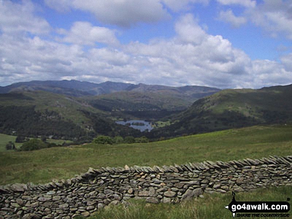


Send us your photographs and pictures on, of, or from Snarker Pike
If you would like to add your walk photographs and pictures to this page, please send them as email attachments (configured for any computer) along with your name to:
and we shall do our best to publish them.
(Guide Resolution = 300dpi. At least = 660pixels (wide) x 440 pixels (high).)

You can also submit photos via our Facebook Page.
NB. Please indicate where each photo was taken and whether you wish us to credit your photos with a Username or your First Name/Last Name.


