
![]()
Stone Arthur
500m (1641ft)
The Eastern Fells, The Lake District, Cumbria, England

Not familiar with this top?
You can walk/hike to the top of Stone Arthur by using any of these 3 easy‑to‑follow route maps:
Walk c216 Stone Arthur, Great Rigg and Heron Pike from Grasmere
Fabulous views of Grasmere - the descent off Heron Pike is down steep grass
   |
|---|
Vital Statistics:
| Length: | 7ml (11km) |
|---|---|
| Ascent: | 2,661ft (811m) |
| Time: | 5.25hrs |
| Grade: |  (Moderate) (Moderate) |

Route Summary:
Grasmere - River Rothay - Grasmere (A591) - Stone Arthur - Great Rigg - Rydal Fell (Heron Pike North Top) - Heron Pike - Butter Crag - Alcock Tarn - Brackenfell - Dove Cottage - Grasmere (A591) - Grasmere
Walk c266 Seat Sandal and Fairfield from Grasmere
Fabulous views - classic Lakeland
|
|---|
Vital Statistics:
| Length: | 7.5ml (12km) |
|---|---|
| Ascent: | 3,116ft (950m) |
| Time: | 6 hrs |
| Grade: | (Moderate) |

Route Summary:
Grasmere - Wainwright's Coast to Coast Walk - Mill Bridge - Little Tongue - Seat Sandal - Grisedale Tarn - Fairfield - Rydal Head - Great Rigg - Stone Arthur - Grasmere
Walk c389 Great Rigg, Fairfield and Hart Crag from Ambleside
A variation on a classic route
|
|---|
Vital Statistics:
| Length: | 12.25ml (19.5km) |
|---|---|
| Ascent: | 3,984ft (1,214m) |
| Time: | 8½ hrs |
| Grade: |  (Hard) (Hard) |

Route Summary:
Ambleside - Rydal - Nab Scar - Heron Pike - Rydal Fell (Heron Pike North Top) - Greenhead Gill Head - Stone Arthur - Great Rigg - Fairfield - Rydal Head - Hart Crag - Dove Crag - High Pike (Scandale) - Low Pike (Scandale) - High Sweden Bridge - High Sweden Coppice - Ambleside
See Stone Arthur and the surrounding tops on our free-to-access 'Google Style' Peak Bagging Maps:
The Eastern Fells of The Lake District National Park
Less data - quicker to download
The Whole of The Lake District National Park
More data - might take a little longer to download
See Stone Arthur and the surrounding tops on our unique, downloadable, PDF Peak Bagging Maps:

NB: Whether you print off a copy or download it to your phone, these PDF Peak Baggers' Maps might prove incredibly useful when your are up there on the tops and you cannot get a phone signal.
*This version is marked with the walk routes you need to follow to Walk all 214 Wainwrights in just 59 walks.
You can find Stone Arthur & all the walks that climb it on these unique free-to-access Interactive Walk Planning Maps:
1:25,000 scale OS Explorer Maps (orange/yellow covers):
1:50,000 scale OS Landranger Map (pink/magenta covers):
 Fellow go4awalkers who have already walked, climbed, scaled, summited, hiked & bagged Stone Arthur
Neil Heywood walked up Stone Arthur on September 9th, 2024 [from/via/route] grassmere [with] logan Heywood
David Higginbottom climbed it on October 8th, 2024 [from/via/route] From Grasmere up & down [with] Carolyn [weather] Misty & very wet
Paul Roddam bagged it on September 14th, 2024 [from/via/route] From Ambleside [with] Bri and Barber [weather] Wet
Tim Winn hiked Stone Arthur on September 14th, 2024 [from/via/route] Grasmere [with] Barry [weather] Wet.
John Ramsbottom summited on August 31st, 2024 [from/via/route] Stone Arthur, Great Rigg, Heron Pike [with] Lola [weather] Changeable, warm at the bottom, windy at the top - Good day with & Lola, went to Watersedge Inn Ambleside, for a quick pint
To add (or remove) your name and experiences on this page - Log On and edit your Personal Mountain Bagging Record
. . . [see more walk reports]
More Photographs & Pictures of views from, on, or of, Stone Arthur


Helm Crag, Seat Sandal, Grisedale Hause, Fairfield, Great Rigg, Stone Arthur, Heron Crag, Nab Scar, Loughrigg and Grasmere above The Pass of Dunmail Raise from the top of High Raven Crag
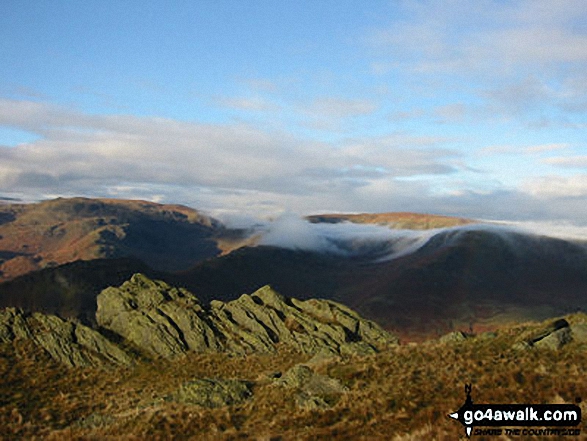


Great Rigg (left). Stone Arthur (centre) and Heron Pike (right) from the top of High Raven Crag

. . . see all 10 walk photographs & pictures of views from, on, or of, Stone Arthur
Send us your photographs and pictures on, of, or from Stone Arthur
If you would like to add your walk photographs and pictures to this page, please send them as email attachments (configured for any computer) along with your name to:
and we shall do our best to publish them.
(Guide Resolution = 300dpi. At least = 660pixels (wide) x 440 pixels (high).)

You can also submit photos via our Facebook Page.
NB. Please indicate where each photo was taken and whether you wish us to credit your photos with a Username or your First Name/Last Name.


