79 easy-to-follow circular walks in North Yorkshire
Seventy-nine easy-to-follow hand-crafted circular walks, routes & maps in North Yorkshire of all grades in Walk Length Order (Shortest to Longest)
See this list of walks, routes & maps in:
Grade Order |
Length Order |
Time Order |
Walk Number or Start Location Order
NB. To reverse (toggle) this order, click Length Order again
   |
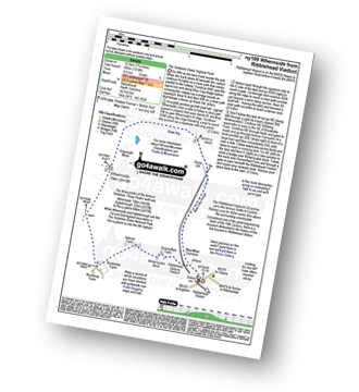
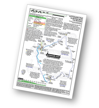
Vital Statistics:
| Length: | 3 miles (4.5 km) |
| Ascent: | 367ft (112m) |
| Time: | 1½ hrs |
| Grade: |  |
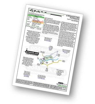
Route Summary:
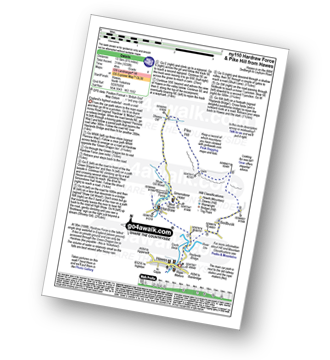
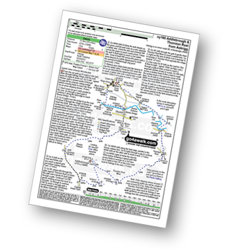
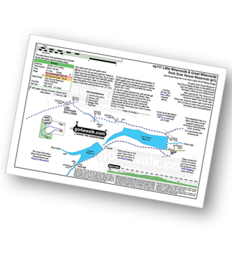
Aysgarth - Aysgarth Falls - High Force - The Herriot Way - Aysgarth Falls - Middle Force - Aysgarth Falls - Low Force - St Josephs Wood - Freeholders' Wood - Aysgarth
|
Vital Statistics:
| Length: | 3.5 miles (5.5 km) |
| Ascent: | 738ft (225m) |
| Time: | 2 hrs |
| Grade: |  |
|
Vital Statistics:
| Length: | 3.75 miles (6 km) |
| Ascent: | 295ft (90m) |
| Time: | 1.75hrs |
| Grade: | |
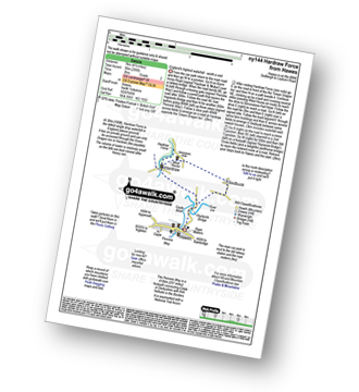
Route Summary:
Hawes - The Pennine Way - The Herriot Way - Haylands Bridge - The River Ure - Hardraw - Hardraw Force - West House - Simonstone Hotel - Sedbusk - Hawes
|
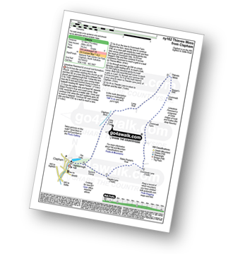
Vital Statistics:
| Length: | 4 miles (6.5 km) |
| Ascent: | 558ft (170m) |
| Time: | 2 hrs |
| Grade: | |
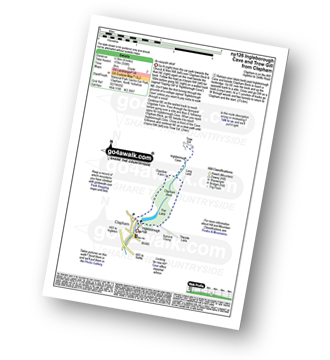
Route Summary:
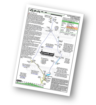
Clapham - Limekiln Plantation - Clapdale Farm - Ingleborough Cave - Trow Gill - Long Lane (Track) - Thwaite Scars - Thwaite Lane (Track) - Clapham
|
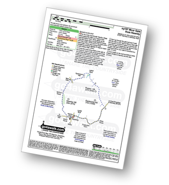
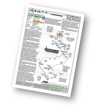
Vital Statistics:
| Length: | 4.5 miles (7 km) |
| Ascent: | 623ft (190m) |
| Time: | 2.25hrs |
| Grade: | |
Route Summary:
Hutton-le-Hole - The Lund - Fairy Call Beck - High Cross Plain - Mary Magdalene Well - Lastingham - St Chad's Well - St Cedd's Well - Ings Beck - Hagg Wood - Spaunton - Grange Farm - Austin Head - Hutton-le-Hole
| |
Vital Statistics:
| Length: | 4.5 miles (7 km) |
| Ascent: | 977ft (298m) |
| Time: | 2.75hrs |
| Grade: | |
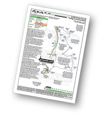
Route Summary:
Settle - Constitution Hill - Attermire - Attermire Scar - Warrendale Knotts - Victoria Cave - Clay Pits Plantation - Blua Crags - Settle
|
Vital Statistics:
| Length: | 4.5 miles (7 km) |
| Ascent: | 870ft (265m) |
| Time: | 2½ hrs |
| Grade: | |
Route Summary:
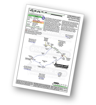
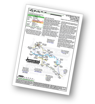
Thornton Rust - Thornton Rust Moor - Addlebrough - Swallow Hole - Worton Scar - Thornton Scar - Thornton Rust
|
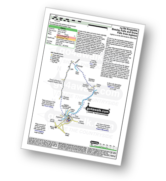
Vital Statistics:
| Length: | 4.75 miles (7.5 km) |
| Ascent: | 984ft (300m) |
| Time: | 3 hrs |
| Grade: | |
Route Summary:
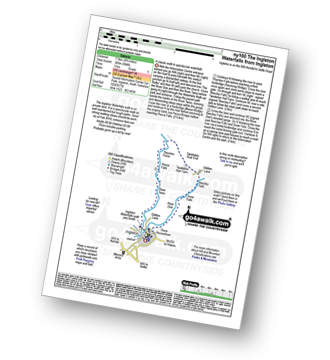
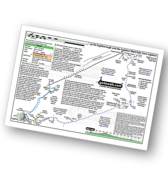
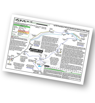
Ingleton - The Ingleton Waterfalls Trail - River Twiss - Swilla Glen - The Money Tree - Helks - Mount - Manor Bridge - Constitution Hill - Pecca Bridge - Pecca Falls - Thornton Force - Raven Ray Bridge - Kingsdale - Twistleton Hall - River Doe - Beezley Falls - Rival Falls - Snow Falls - Ingleton
|
Vital Statistics:
| Length: | 4.75 miles (7.5 km) |
| Ascent: | 571ft (174m) |
| Time: | 2.25hrs |
| Grade: | |
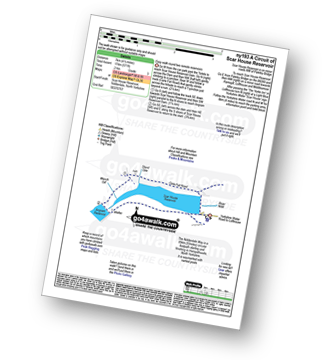
Route Summary:
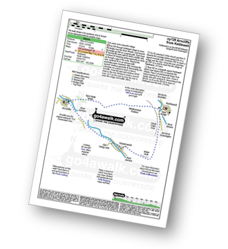
Nidderdale - Scar House Reservoir - River Nidd - Nidderdale - Carle Fell Road (Track) - Stand Sike - Wench Gill - Angram Reservoir - Scar House Reservoir - Nidderdale
|
Vital Statistics:
| Length: | 5 miles (8 km) |
| Ascent: | 689ft (210m) |
| Time: | 2½ hrs |
| Grade: | |
Route Summary:
Hawnby - Hill End House - Moor Gate - Sportsman's Hall - Ladhill Beck - Pepper Hill - Easterside Hill - Wass House - Easterside Farm - Ladhill Beck - Hawnby
|
Vital Statistics:
| Length: | 5 miles (8 km) |
| Ascent: | 961ft (293m) |
| Time: | 3 hrs |
| Grade: | |
Route Summary:
Ingleton - Thornton Hall Farm - Kingsdale - River Dow - The Ingleton Waterfalls Trail Beezley Falls - Rival Falls - Snow Falls - Ingleton
|
Vital Statistics:
| Length: | 5 miles (8 km) |
| Ascent: | 804ft (245m) |
| Time: | 2½ hrs |
| Grade: |  |
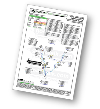
Route Summary:
Malham - The Pennine Way - Gordale Beck - New Laithe - Mantley Field Laithe - Janet's Foss - Gordale Bridge - Gordale Scar - Gordale Bridge - Cawden Flats Barn - Shorkley Hill - Sheriff Hill - Malham Cove - Malham Beck - Malham
|
Vital Statistics:
| Length: | 5 miles (8 km) |
| Ascent: | 502ft (153m) |
| Time: | 2½ hrs |
| Grade: | |
Route Summary:
Askrigg - Askrigg Bottoms - The River Ure - Wensleysdale - Worton Bridge - Worton - Worton Scar - Thornton Scar - Thornton Rust - River Ure - Wensleydale - Nappa Mill Farm - Askrigg
|
Vital Statistics:
| Length: | 5.25 miles (8.5 km) |
| Ascent: | 380ft (116m) |
| Time: | 2.25hrs |
| Grade: | |
Route Summary:
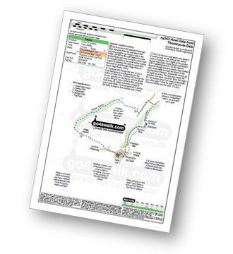
Thornton-le-Dale - Hagg House - Howl Dale Wood - Howl Dale - Orchan Dale - Pexton Moor Plantation - Kirkdale Slack - Ellerburn - Thornton-le-Dale
|
Vital Statistics:
| Length: | 6.25 miles (10 km) |
| Ascent: | 1,640ft (489m) |
| Time: | 4 hrs |
| Grade: |  |
Route Summary:
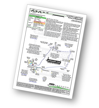
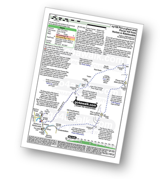
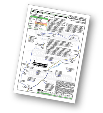
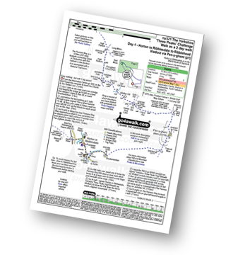
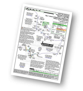
Horton in Ribblesdale - Brackenbottom - Gavel Rigg - The Pennine Way - Pen-y-ghent - Hunt Pot - Hull Pot - Horton in Ribblesdale.
|
Vital Statistics:
| Length: | 6.25 miles (10 km) |
| Ascent: | 1,355ft (413m) |
| Time: | 3.75hrs |
| Grade: | |
Route Summary:
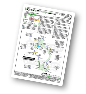
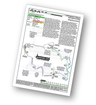
Kilburn White Horse - Hoodhill Feld Plantation - Hood Hill Plantation - Hood Grange - Kennycow - High Cleavers Farm - Gormire Rigg - Gormire Lake - Southwoods Lodge - Garbutt Wood - The Cleveland Way - Whitestone Cliff - White Mare Crag - Great Relief Pot - Cliff Plantation - Sutton Brow - Sutton Bank - Knowlson's Drop - Roulston Scar - Ivy Scar - Kilburn White Horse
|
Vital Statistics:
| Length: | 6.25 miles (10 km) |
| Ascent: | 902ft (275m) |
| Time: | 3.25hrs |
| Grade: | |
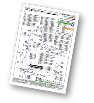
Route Summary:
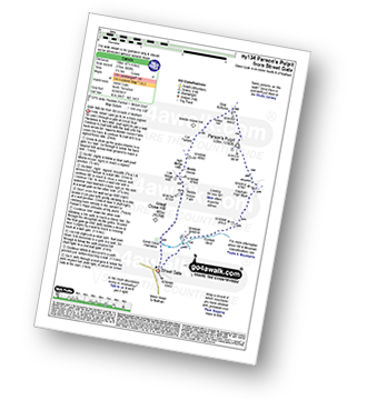
Street Gate - Great Close Plantation - Great Close Scar - Middle House Farm - Low Midge Hills - High Midge Hills - Middle House - Out Pasture - Middle House Hill - Dew Bottoms - Parson's Pulpit - East Great Close - Gordale Beck - Street Gate
|
Vital Statistics:
| Length: | 6.5 miles (10.5 km) |
| Ascent: | 1,476ft (450m) |
| Time: | 3.75hrs |
| Grade: | |
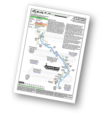
Route Summary:
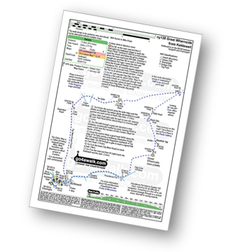
Kettlewell - River Wharfe - New Bridge - Gate Cote Scar - Middlesmoor Pasture - Byre Bank Wood - Arncliffe - River Skirfare - Hawkswick - Knipe Wood - Kettlewell
|
Vital Statistics:
| Length: | 6.5 miles (10.5 km) |
| Ascent: | 647ft (197m) |
| Time: | 3 hrs |
| Grade: | |
Route Summary:
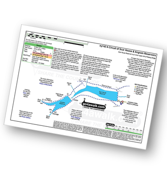
Nidderdale - Scar House Reservoir - River Nidd - Nidderdale - Carle Fell Road (Track) - Stand Sike - Wench Gill - Angram Reservoir - Pudding Hill - West House Pasture - Angram Low Pasture - Stone Beck - Scar House Reservoir - Nidderdale
|
Vital Statistics:
| Length: | 6.5 miles (10.5 km) |
| Ascent: | 932ft (284m) |
| Time: | 3.25hrs |
| Grade: | |
Route Summary:
Low Mill - Horn End Farm - Crow Wood - West Gill Beck - Westside Road (Track) - West Gill Head - Rudland Rigg - Dickon Howe - Monket House Bank (Track) - Monket House - Thorn Wath Bridge - Church Houses - High Mill - River Dove - Ferndale Nature Reserve - Low Mill
|
Vital Statistics:
| Length: | 7 miles (11 km) |
| Ascent: | 1,345ft (410m) |
| Time: | 3.75hrs |
| Grade: | |
Route Summary:
Muker - Kisdon - Hooker Mill Scar - Swallow Hole Farm - Keld - The Herriot Way - The Pennine Way - The River Swale - Wainwright's Coast to Coast Walk - Kisdon Force - East Gill Force - Crackpot Hall - Swinner Gill - Arngill Wood - Swaledale - Ramps Holme Bridge - Muker
|
Vital Statistics:
| Length: | 6.75 miles (11 km) |
| Ascent: | 607ft (185m) |
| Time: | 3.25hrs |
| Grade: | |
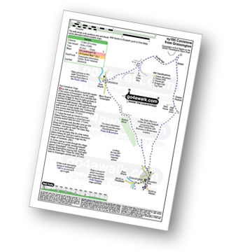
Route Summary:
Grassington - The Dales Way - Bank Lathe - Intake Lathe - Moor Lane - Hebden Beck - Loss Gill Bank - Cockbur Ford - Bolton Haw Side - The Mere - Rocking Stone - Care Scar,Hole Bottom - Scale Haw - Knowles Lathe - Side Lathe - High Green - Hebden - The River Wharfe - The Dales Way - Linton Falls - Grassington
|
Vital Statistics:
| Length: | 7 miles (11 km) |
| Ascent: | 1,674ft (411m) |
| Time: | 4 hrs |
| Grade: | |
Route Summary:
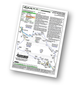
Reeth - Wainwright's Coast to Coast Walk - Arkle Beck - High Fremington - White House Farm - Fremington Edge - Fremington Edge Top - Fell End Lead Mine - Storthwaite Hall - Arkengarthdale - Castle Farm House - Cuckoo Hill - The Herriot Way - Reeth
|
Vital Statistics:
| Length: | 7.25 miles (11.5 km) |
| Ascent: | 991ft (302m) |
| Time: | 3½ hrs |
| Grade: | |
Route Summary:
Buckden - Rakes Wood - Buckden Rake - Cray Gill - Cray - Crook Gill - Todd's Wood - Scar House - Strans Gill - Strans Wood - Yockenthwaite - The Dales Way - Hubberholme - The River Wharfe - Wharfedale - Buckden
|
Vital Statistics:
| Length: | 7.25 miles (11.5 km) |
| Ascent: | 210ft (64m) |
| Time: | 3 hrs |
| Grade: | |
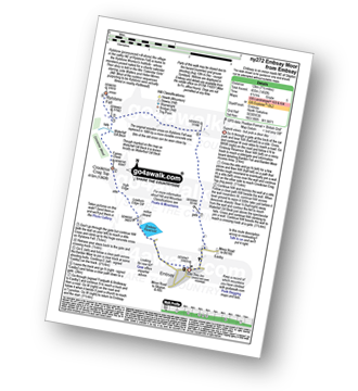
Route Summary:
Wharfedale - Bolton Abbey - The Dales Way - The River Wharfe - Wharfedale - Pickles Beck - Stead Dike - Posforth Gill - Black Sike - Bolton Abbey Aqueduct - Barden Bridge - Bolton Abbey Aqueduct - The Strid - Strid Wood - Cavendish Pavilion - Sand Holme - Bolton Priory - Bolton Abbey - Wharfedale
|
Vital Statistics:
| Length: | 7.5 miles (12 km) |
| Ascent: | 876ft (267m) |
| Time: | 3½ hrs |
| Grade: | |
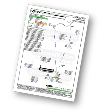
Route Summary:
Grassington - Kimpergill Hill - Downs Pasture - Green Hill Pasture - Seeds Hill - Kelber - Bycliffe Road (Track) - The Dales Way - Old Pasture - Lea Green - Grassington
|
Vital Statistics:
| Length: | 7.5 miles (12 km) |
| Ascent: | 1,296ft (395m) |
| Time: | 4 hrs |
| Grade: | |
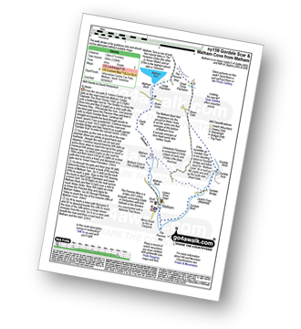
Route Summary:
Malham - The Pennine Way - Gordale Beck - New Laithe - Mantley Field Laithe - Janet's Foss - Gordale Bridge - Gordale Scar - New Close - Seaty Hill - Street Gate - Great Close Scar - Great Close Plantation - Malham Tarn - The Pennine Way - Malham Beck - Water Sinks - Comb Hill - Ing Scar Crag - Watlowes - Malham Cove - Malham
|
Vital Statistics:
| Length: | 7.5 miles (12 km) |
| Ascent: | 1,492ft (455m) |
| Time: | 4½ hrs |
| Grade: | |
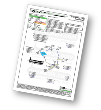
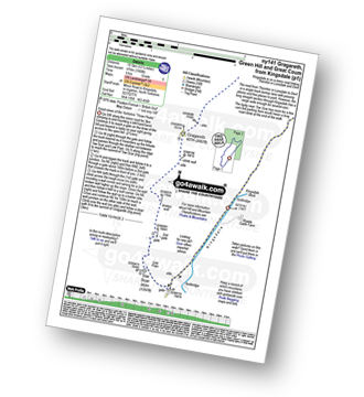
Route Summary:
Embsay - Embsay Reservoir - Embsay Moor - Crookrise Crag Top - Waterfall Gill Beck - Rylstone Fell - Rylstone Cross - Barden Moor - Embsay Moor - Embsay
|
Vital Statistics:
| Length: | 7.75 miles (12.5 km) |
| Ascent: | 1,574ft (480m) |
| Time: | 4½ hrs |
| Grade: | |
Route Summary:
Ribblehead - Blea Moor - Force Gill - Grain Ing - Whernside - Broadrake Farm - Ivescar Farm - Ribblehead
|
Vital Statistics:
| Length: | 7.75 miles (12.5 km) |
| Ascent: | 1,214ft (370m) |
| Time: | 4.25hrs |
| Grade: | |
Route Summary:
Askrigg - Askrigg Bottoms - The River Ure - Wensleysdale - Worton Bridge - Worton - Cubeck - Carpley Green Road - Worton Pasture - Carpley Green Farm - Addlebrough - Swallow Hole - Worton Scar - Worton - Wensleydale - Askrigg Bottoms - Askrigg
|
Vital Statistics:
| Length: | 8.25 miles (13 km) |
| Ascent: | 1,932ft (589m) |
| Time: | 5 hrs |
| Grade: |  |
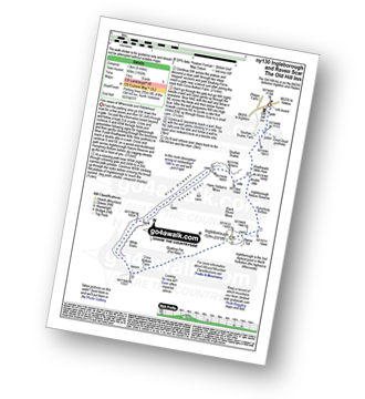
Route Summary:
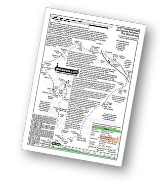
Ribblehead - (The Old Hill Inn) - Chapel-le-Dale - Braithwaite Wife Hole - Ingleborough Nature Reserve - Humphrey Bottom - Ingleborough - Quaking Pot - Crina Bottom Farm - White Scars - High Howeth - Raven Scar - Harry Hallam's Moss - Old Hill Inn - Ribblehead
|
Vital Statistics:
| Length: | 8.25 miles (13 km) |
| Ascent: | 951ft (290m) |
| Time: | 3.75hrs |
| Grade: | |
Route Summary:
Clapham - Ingleborough Hall - Thwaite Lane - Summit Clump - Robin Proctor's Scar - Norber Brow - Nappa Scars - Crummack Lane - Crummack Farm - Crummack Dale - Begger's Stile - Thieves Moss - Sulber Gate - Long Scar - Long Lane (Track). Thwaite Scars - Clapham
|
Vital Statistics:
| Length: | 8.25 miles (13 km) |
| Ascent: | 1,279ft (390m) |
| Time: | 4.25hrs |
| Grade: | |
Route Summary:
Settle - Constitution Hill - Attermire - Attermire Scar - Victoria Cave - Clay Pits Plantation - Upper Winskill - Catrigg Force (waterfall) - Stainforth - Langcliffe - Settle
|
Vital Statistics:
| Length: | 8.5 miles (13.5 km) |
| Ascent: | 1,030ft (314m) |
| Time: | 4 hrs |
| Grade: | |
Route Summary:
Hawes - The Pennine Way - The Herriot Way - Haylands Bridge - The River Ure - Hardraw - Hardraw Force - Shaw Gill Wood - Simonstone Hotel - High Shaw - Shivery Gill - Pike Hill - Abbotside Common - Low Clint - High Pasture Gate - Shutt Lane - Sedbusk - Hawes
|
Vital Statistics:
| Length: | 8.5 miles (13.5 km) |
| Ascent: | 2,178ft (664m) |
| Time: | 5 hrs |
| Grade: | |
Route Summary:
Clapham - Limekiln Plantation - Clapdale Farm - Ingleborough Cave - Trow Gill - Hernal Moss - Gaping Gill - Seat Haw - Little Ingleborough - Ingleborough - Little Ingleborough - Newby Moss - Cote Haw - Newby Cote - Clapham
|
Vital Statistics:
| Length: | 8.5 miles (13.5 km) |
| Ascent: | 1,653ft (504m) |
| Time: | 4.75hrs |
| Grade: | |
Route Summary:
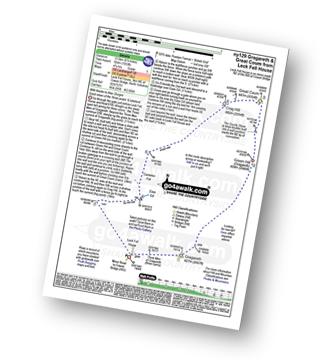
Leck Fell House - The Three Men of Gragareth - Gragareth - Green Hill (Gragareth) - Lancashire County Stone - Great Coum - Crag Hill - Casterton Fell - Ease Gill - Leck Fell House
|
Vital Statistics:
| Length: | 8.5 miles (13.5 km) |
| Ascent: | 1,802ft (549m) |
| Time: | 4.75hrs |
| Grade: | |
Route Summary:
Buckden - Buckden Beck - Buckden Lead Mine - Buckden Pike - Fox Memorial - Starbotton Fell - Tor Mere Top - Cam Head - Starbotton Cam Road - Starbotton - The Dales Way - River Wharfe - Wharfedale - Buckden
|
Vital Statistics:
| Length: | 8.5 miles (13.5 km) |
| Ascent: | 1,158ft (353m) |
| Time: | 4.25hrs |
| Grade: | |
Route Summary:
Grassington - Kimpergill Hill - Downs Pasture - Green Hill Pasture - Seeds Hill - Kelber - Bycliffe Road (Track) - The Dales Way - Bull Scar - Davy Dimple - Conistone - Little Lathe - Dib Dale - Bastow Wood - The Dales Way - Grassington
|
Vital Statistics:
| Length: | 8.5 miles (13.5 km) |
| Ascent: | 1,089ft (332m) |
| Time: | 4 hrs |
| Grade: | |
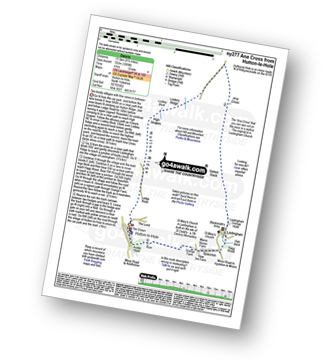
Route Summary:
Hutton-le-Hole - Lodge Road - Wheat Lund - Hutton Ridge - High Snapes - Loskey Beck - Loskey Ridge - Ana Cross - Spaunton Moor - Spring Heads Turn - Barker Slack - Lastingham Ridge - Lastingham - St Chad's Well - St Cedd's Well - Ings beck - Hagg Wood - Spaunton - Grange Farm - Austin Head - Hutton-le-Hole
|
Vital Statistics:
| Length: | 8.75 miles (14 km) |
| Ascent: | 1,162ft (354m) |
| Time: | 4½ hrs |
| Grade: | |
Route Summary:
Street Gate - Great Close Plantation - Great Close Scar - Middle House Farm - Low Midge Hills - High Midge Hills - Middle House - Out Pasture - Middle House Hill - Dew Bottoms - Parson's Pulpit - Lee Gate High Mark - Rabbit Rock - Proctor High Mark - Tommy High Pasture - Mastiles Lane - Street Gate
|
Vital Statistics:
| Length: | 8.75 miles (14 km) |
| Ascent: | 1,870ft (570m) |
| Time: | 5 hrs |
| Grade: | |
Route Summary:
Reeth - Arkle Beck - High Fremington - White House Farm - Fremington Edge - Fremington Edge Top - Fell End Lead Mine - Storthwaite Hall - Arkengarthdale - Langthwaite - Arken Town - Calver Hill - Riddings Farm - Skelgate Lane - Wainwright's Coast to Coast Walk - The Herriot Way - Reeth
|
Vital Statistics:
| Length: | 8.75 miles (14 km) |
| Ascent: | 1,398ft (426m) |
| Time: | 4½ hrs |
| Grade: | |
Route Summary:
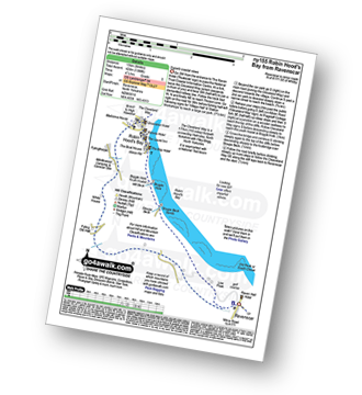
Robin Hood's Bay - The Cleveland Way - Cowfield Hill - Boggle Hole - Stoupe Beck - Stoupe Bank Farm - Stoupebrow Cottage Farm - Ravenscar - Dismantled Railway - Stoupe Brow Farm - Home Farm - Brownside Farm - Howdale Wood - Alison Head Wood - Fyling Old Hall Farm - White House - Fylingthorpe - Robin Hood's Bay
|
Vital Statistics:
| Length: | 8.75 miles (14 km) |
| Ascent: | 1,827ft (557m) |
| Time: | 5 hrs |
| Grade: | |
Route Summary:
Horton In Ribblesdale - Brackenbottom - Gavel Rigg - The Pennine Way - Pen-y-ghent - Plover Hill - Foxup Moor - Swarth Gill Gate - Black Banks - Turpen - Horton Moor - Hull Pot - The Pennine Way - Horton Scar Lane - Horton In Ribblesdale
|
Vital Statistics:
| Length: | 8.75 miles (14 km) |
| Ascent: | 590ft (180m) |
| Time: | 3.75hrs |
| Grade: | |
Route Summary:
Hutton-le-Hole - The Lund - Fairy Call Beck - High Cross Plain - Mary Magdalene Well - Lastingham - St Chad's Well - St Cedd's Well - Ings beck - Hagg Wood - Lower Askew - Birk Head - Scarth Wood - Tenterhill End - Appleton Mill Farm - The Tabular Hills Walk - Hamley Lane - Appleton-le-Moors - South Ings Lane (Track) - Ings Balk (Track) - Lingmoor Lane (Track) - Spring Wood - Bottom Fields Lane - Austin Head - Hutton-le-Hole
|
Vital Statistics:
| Length: | 8.75 miles (14 km) |
| Ascent: | 1,772ft (540m) |
| Time: | 5 hrs |
| Grade: | |
Route Summary:
Ribblehead - (Railway Station) - Blea Moor Common - Blue Clay Ridge - Force Gill - Grain Ing - Greenset Moss - Whernside - Broadrake Farm - Bruntscar Farm - Philpin Farm - Scar Close - Ellerbeck Pasture - Ribblehead
|
Vital Statistics:
| Length: | 9 miles (14.5 km) |
| Ascent: | 1,766ft (538m) |
| Time: | 5 hrs |
| Grade: | |
Route Summary:
Buckden - Rakes Wood - Cow Close - Buckden Pike - Fox Memorial - Starbotton Fell - Tor Mere Top - Cam Head - Starbotton Cam Road - Starbotton - The Dales Way - River Wharfe - Wharfedale - Buckden
|
Vital Statistics:
| Length: | 9 miles (14.5 km) |
| Ascent: | 1,805ft (550m) |
| Time: | 5.25hrs |
| Grade: | |
Route Summary:
Wharfedale - Barden Bridge - The River Wharfe - Wharfedale - The Dales Way - The Strid. Strid Wood - Waterfall Cottage - Posforth Gill - Valley of Desolation - Laund Pasture Plantation - Smithyman Nook - Carncliff Top (Earl Seat) - Nanny Crag - Truckle Crags - Simon's Seat (Wharfedale) - Dalehead Farm - Eastwood Head - Howgill Lodge - The Dales Way - The River Wharfe - Barden Bridge - Wharfedale
|
Vital Statistics:
| Length: | 9 miles (14.5 km) |
| Ascent: | 1,674ft (510m) |
| Time: | 5 hrs |
| Grade: | |
Route Summary:
Reeth - Wainwright's Coast to Coast Walk - Arkle Beck - High Fremington - White House Farm - Fremington Edge - Fremington Edge Top - Fell End Lead Mine - Storthwaite Hall - Arkengarthdale - Langthwaite - Castle Farm House - Cuckoo Hill - The Herriot Way - Reeth
|
Vital Statistics:
| Length: | 9 miles (14.5 km) |
| Ascent: | 1,644ft (501m) |
| Time: | 5 hrs |
| Grade: | |
Route Summary:
Ribblehead - (Railway Station - After Train Journey From Horton in Ribblesdale) - B6255 - Old Hill Inn - Chapel-le-Dale - Braithwaite Wife Hole - Ingleborough - Pen-y-ghent Cafe - Horton in Ribblesdale.
|
Vital Statistics:
| Length: | 9.5 miles (15 km) |
| Ascent: | 2,250ft (686m) |
| Time: | 5½ hrs |
| Grade: | |
Route Summary:
Ingleton - Ingleton Information Centre - Richmond House - Fell Lane - Crina Bottom Farm - Quaking Pot - Ingleborough - Little Ingleborough - Newby Moss - Newby Cote - Bleak Bank - Duck Dub - Holly Platt - Slatenber - Jenkin Bridge - Ingleton
|
Vital Statistics:
| Length: | 9.5 miles (15 km) |
| Ascent: | 2,362ft (720m) |
| Time: | 5.75hrs |
| Grade: | |
Route Summary:
Ingleton - Ingleton Tourist Information Centre - Fell Lane - Crina Bottom Farm - Quaking Pot - Ingleborough - Humphrey Bottom - Ingleborough Nature Reserve - Raven Scar - High Howeth - Harry Hallam's Moss - White Scars - Ingleton
|
Vital Statistics:
| Length: | 9.5 miles (15 km) |
| Ascent: | 1,906ft (581m) |
| Time: | 5½ hrs |
| Grade: | |
Route Summary:
Buckden - Rakes Wood - Buckden Rake - Cray Gill - Cray - Crook Gill - Todd's Wood - Scar House - Strans Gill - Strans Wood - Yockenthwaite Moor - Yockenthwaite - The Dales Way - Hubberholme - The River Wharfe - Wharfedale - Buckden
|
Vital Statistics:
| Length: | 9.75 miles (15.5 km) |
| Ascent: | 1,388ft (423m) |
| Time: | 5 hrs |
| Grade: | |
Route Summary:
Askrigg - Askrigg Bottoms - The River Ure - Wensleysdale - Worton Bridge - Worton - Cubeck - Carpley Green Road - Worton Pasture - Carpley Green Farm - Addlebrough - Thornton Rust Moor - Thornton Rust - River Ure - Wensleydale - Nappa Mill Farm - Askrigg
|
Vital Statistics:
| Length: | 10 miles (16 km) |
| Ascent: | 1,663ft (506m) |
| Time: | 5 hrs |
| Grade: | |
Route Summary:
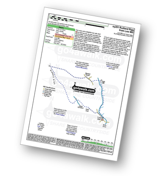
Dale Head - The Pennine Way - Gavel Rigg - Pen-y-ghent - Plover Hill - Foxup Moor - Foxup Road - Low Bergh - Littondale - Pen-y-ghent Gill - Dale Head
|
Vital Statistics:
| Length: | 10 miles (16 km) |
| Ascent: | 1,771ft (540m) |
| Time: | 5½ hrs |
| Grade: | |
Route Summary:
Kettlewell - Dowber Gill Beck - Providence Pot - Hag Dyke (hostel) - Great Whernside - Black Hole Dike - Nidd Head - Little Hunters Sleet - Tor Dyke - Starbotton Road - Top Mere Road - Kettlewell
|
Vital Statistics:
| Length: | 10 miles (16 km) |
| Ascent: | 2,244ft (684m) |
| Time: | 5.75hrs |
| Grade: | |
Route Summary:
Ingleton - Fell Lane - Crina Bottom Farm - Quaking Pot - Ingleborough - Humphrey Bottom - Ingleborough Nature Reserve - Braithwaite Wife Hole - Souther Scales Farm - Chapel-le-Dale - Twistleton Scars - Oddies Lane - The Ingleton Waterfalls Trail - Beezley Falls - Snow Falls - Ingleton
|
Vital Statistics:
| Length: | 10.25 miles (16.5 km) |
| Ascent: | 2,136ft (651m) |
| Time: | 6 hrs |
| Grade: | |
Route Summary:
Horton in Ribblesdale - Pen-y-ghent Cafe - Brackenbottom - Gavel Rigg - The Pennine Way - Pen-y-ghent - Hunt Pot - Hull Pot - Whitber Hill - God's Bridge - Brow Gill Beck - Nether Lodge - River Ribble - Lodge Hall (or Ingman Lodge) - Ribblehead - Ribblehead Railway Station - Train Journey - Horton in Ribblesdale Railway Station - Horton in Ribblesdale.
|
Vital Statistics:
| Length: | 10.75 miles (17 km) |
| Ascent: | 2,022ft (616m) |
| Time: | 6 hrs |
| Grade: | |
Route Summary:
Nidderdale - Scar House Reservoir - The Nidderdale Way - In Moor Lane - Rain Stang - Middlesmoor - How Stean Beck - How Stean Gorge - River Nidd - Lofthouse - Thorpe Lane - Thorp Farm - Dry Wrath Ford - Limley Farm - Thwaite House - Bracken Ridge - Summerstone Lodge - The Edge - Nidd Cottage - New Houses Edge Farm - Turnacar - Thornet Barn - Twizling Gill - Woo Gill - Carl Fell Road (Track) - River Nidd - Scar House Reservoir - Nidderdale
|
Vital Statistics:
| Length: | 10.5 miles (17 km) |
| Ascent: | 1,566ft (477m) |
| Time: | 5½ hrs |
| Grade: | |
Route Summary:
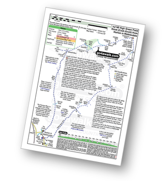
Horton In Ribblesdale - The Pennine Way - Sell Gill Holes - Sell Gill Beck - Red Moss Pot - Birkwith Moor - Birkwith Common - Green Haw Moor - Cosh Knott Well - Cosh Outside (Cosh Knott) - High Green Field Knott (Cosh Knott) - Cosh Beck Head - Lante Shop Caves - Cosh Water Gap - Black Banks - Turpen Horton Moor - Hull Pot Beck - Hull Pot - Hunt Pot - Horton Scar Lane - Horton In Ribblesdale
|
Vital Statistics:
| Length: | 11 miles (17.5 km) |
| Ascent: | 1,181ft (360m) |
| Time: | 5.25hrs |
| Grade: | |
Route Summary:
Yarnbury - Grassington Lead Mines - Duke's New Road (Track) - Hebden Beck - Cupola Corner - Deep Cut - Grassington Moor - Rather Standard Side - Sleet Moor - Rather Standard End - Henstone Band - Meugher Dike - Meugher Drive - Meugher - Friar Hood - Sandy Gate - Sandy Gate Pike Shelter - Mossdale - Mossdale Shooting Lodge - Mossdale Beck - Mossdale Scar - Bycliffe Road (Track) - Bycliffe - Kelber - Seeds Hill - Green Hill Pasture - Back Pasture - Downs Pasture - High Barn (ruin) - New Pasture Edge - Yarnbury
|
Vital Statistics:
| Length: | 11 miles (17.5 km) |
| Ascent: | 2,681ft (817m) |
| Time: | 6.75hrs |
| Grade: |  |
Route Summary:
Keld - The Pennine Way - The Herriot Way - The River Swale - Swaledale - Wainwright's Coast to Coast Walk - Kisdon Force - Crackpot Hall - Swinner Gill - Hind Hole Beck - Swinner Gill Lead Mines - East Grain - High Stone Man - Rogan's Seat - Moor Hen Nest - Water Crag (Arkengarthdale) - Blakethwaite Gill - Blakethwaite Meres - Blakethwaite Dams - Gunnerside Gill - Eweleap Scar - Bling Gill - Lownathwaite Mea - High Whim - Swinner Gill - Kisdon Force - Crackpot Hall - Keld
|
Vital Statistics:
| Length: | 11.25 miles (18 km) |
| Ascent: | 2,091ft (637m) |
| Time: | 6.25hrs |
| Grade: | |
Route Summary:
Keld - The Pennine Way - The Herriot Way - Kisdon Force - Black Moor - Stonesdale Moor - The Tan Hill Inn - Tan Gill - Stonesdale Beck - Thomas Gill - Robert's Seat - Pryclose Gutter - Ravenseat - Wainwright's Coast to Coast Walk - Whitsundale Beck - How Edge Scars - Oven Mouth - Cotterby Scar - East Stonesdale Farm - The River Swale - Keld
|
Vital Statistics:
| Length: | 11.5 miles (18.5 km) |
| Ascent: | 1,017ft (310m) |
| Time: | 5.25hrs |
| Grade: | |
Route Summary:
Grassington - The Dales Way - Lea Green - Old Pasture - Bycliffe Road (Track) - Kelber Gate - Kelber - Seeds Hill - Green Hill Pasture - Downs Pasture - New Pasture Edge - Yarnbury - Hebden Beck - Loss Gill Bank - Cockbur Ford - Bolton Haw Side - The Mere - Rocking Stone - Care Scar,Hole Bottom - Scale Haw - Knowles Lathe - Side Lathe - High Green - Hebden - The River Wharfe - The Dales Way - Linton Falls - Grassington
|
Vital Statistics:
| Length: | 11.5 miles (18.5 km) |
| Ascent: | 1,913ft (583m) |
| Time: | 6.25hrs |
| Grade: | |
Route Summary:
Nidderdale - Scar House Reservoir - Nidderdale - River Nidd - Carle Fell Road - Wench Gill - Little Whernside - Nidd Head - Black Dike Hole - Blackfell Top - Great Whernside - Stone Beck - Angram Reservoir - Scar House Reservoir - Nidderdale
|
Vital Statistics:
| Length: | 11.5 miles (18.5 km) |
| Ascent: | 1,961ft (598m) |
| Time: | 6.25hrs |
| Grade: | |
Route Summary:
Dale Head - The Pennine Way - Fountains Fell - Fountains Fell (South Top) - Fountains Fell Tarn - Darnbrook Fell - Wilson's Pasture - River Skirfare - Nether Hesleden Farm - Pen-y-ghent Gill - Dale Head
|
Vital Statistics:
| Length: | 11.5 miles (18.5 km) |
| Ascent: | 2,227ft (679m) |
| Time: | 6½ hrs |
| Grade: | |
Route Summary:
Ribblehead - (The Old Hill Inn) - Ingleborough Nature Reserve - Humphrey Bottom - Ingleborough - Simon Fell - Park Fell (Ribblehead) - New Close Farm - Ribblehead - Gunnerfleet Farm - Ivescar Farm - Broadrake Farm - Ellerbeck Farm - Jingle Pot - Chaple-le-Dale - The Old Hill Inn - Ribblehead
|
Vital Statistics:
| Length: | 12 miles (19 km) |
| Ascent: | 1,956ft (596m) |
| Time: | 6.25hrs |
| Grade: | |
Route Summary:
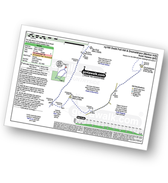
Hawes - The Pennine Way - The Herriot Way - Gayle - Gaudy Lane - Rottonstone Hill - Ten End Peat Ground - West Cam Road - Dodd Fell Hill - North Gate - West Duerley Pasture - Cam High Road - Howgate Head - Drumaldrace (Wether Fell) - Wether Fell - Gayle - Hawes
|
Vital Statistics:
| Length: | 12 miles (19 km) |
| Ascent: | 2,099ft (640m) |
| Time: | 6½ hrs |
| Grade: | |
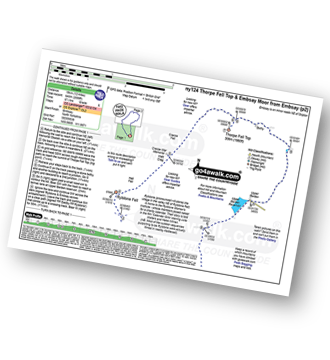
Route Summary:
Embsay - Embsay Reservoir - Embsay Moor - Crookrise Crag Top - Waterfall Gill Beck - Rylstone Fell - Rylstone Cross - Watt Crag - Cracoe Fell - Cracoe War Memorial Cross Obelisk - Thorpe Fell Top - Upper Barden Reservoir - Embsay
|
Vital Statistics:
| Length: | 12.25 miles (19.5 km) |
| Ascent: | 1,568ft (478m) |
| Time: | 6 hrs |
| Grade: | |
Route Summary:
Kingsdale - Tow Scar - Gragareth - Green Hill (Gragareth) - Lancashire County Stone - High Pike - Kingsdale Beck - Kingsdale
|
Vital Statistics:
| Length: | 12.5 miles (20 km) |
| Ascent: | 2,099ft (640m) |
| Time: | 6.75hrs |
| Grade: | |
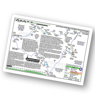
Route Summary:
Buckden - Rakes Wood - Buckden Rake - Cray Gill - Cray - Crook Gill - Todd's Wood - Scar House - Strans Gill - Strans Wood - Yockenthwaite - Horse Head (Horse Head Moor) - Sugar Loaf (Horse Head Moor) - High Combe Stoop - Birks Fell - Birks Tarn - Firth Fell - Redmire Farm - Buckden
|
Vital Statistics:
| Length: | 12.75 miles (20.5 km) |
| Ascent: | 1,935ft (590m) |
| Time: | 6½ hrs |
| Grade: | |
Route Summary:
Reeth - River Swale - Harkerside Place Farm - Harker Mires - The Herriot Way - Low Harker Hill - High Harker Hill - Blue Hill - Beldow Hill - Green Hill Ends - Whitaside Moor - ashpot Gutters - Apedale Road (Track) Apedale - Dent's House - Greets Hill - How Hill - Grinton Lodge - The Herriot Way - Grinton - Arkle Beck - Reeth
|
Vital Statistics:
| Length: | 12.75 miles (20.5 km) |
| Ascent: | 1,056ft (322m) |
| Time: | 5.75hrs |
| Grade: | |
Route Summary:
Hutton-le-Hole - Lodge Road - Wheat Lund - Hutton Ridge - High Snapes - Loskey Beck - Loskey Ridge - Ana Cross - Spaunton Moor - Spring Heads Turn - Barker Slack - Lastingham Ridge - Lastingham - St Chad's Well - St Cedd's Well - Ings beck - Hagg Wood - Lower Askew - Birk Head - Scarth Wood - Tenterhill End - Appleton Mill Farm - The Tabular Hills Walk - Hamley Lane - Appleton-le-Moors - South Ings Lane (Track) - Ings Balk (Track) - Lingmoor Lane (Track) - Spring Wood - Bottom Fields Lane - Austin Head - Hutton-le-Hole
|
Vital Statistics:
| Length: | 13.75 miles (22 km) |
| Ascent: | 2,330ft (710m) |
| Time: | 7.25hrs |
| Grade: | |
Route Summary:
Hawes - The Pennine Way - The Herriot Way - Haylands Bridge - The River Ure - Hardraw - Hardraw Force - Hearne Coal Road - Hollin Hill - Bluebell Hill - Blea Pot Plain - Hearn Top - Bleak Haw - Hearne Head - Great Shunner Fell - Little Shunner Fell - Pickersett Mea - Fossdale Moss - Grimy Gutter - Lovely Seat - Coal Gill Hags - Abbotside Common - High Clint - High Pasture Gate - Shutt Lane - Sedbusk - Hawes
|
Vital Statistics:
| Length: | 13.75 miles (22 km) |
| Ascent: | 2,660ft (811m) |
| Time: | 7½ hrs |
| Grade: | |
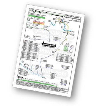
Route Summary:
Embsay - Embsay Reservoir - Embsay Moor - Crookrise Crag Top - Waterfall Gill Beck - Rylstone Fell - Rylstone Cross - Rylstone - Hetton - Flasby - Rough Haw - Sharp Haw - Embsay
|
Vital Statistics:
| Length: | 14 miles (22.5 km) |
| Ascent: | 2,562ft (781m) |
| Time: | 7½ hrs |
| Grade: | |
Route Summary:
Settle - Constitution Hill - Attermire Scar - Victoria Cave - Stickdale Farm - Malham - Malham Cove - Limestone Pavement - Watlowes - Langscar Gate - Outside - Gorbeck - Jubilee Cave - Clay Pits Plantation - Settle
|
Vital Statistics:
| Length: | 14 miles (22.5 km) |
| Ascent: | 3,207ft (977m) |
| Time: | 8½ hrs |
| Grade: |  |
Route Summary:
Horton in Ribblesdale - Railway Station - Train Journey - Ribblehead Railway Station - Ribblehead - Blea Moor - Whernside - Broadrake Farm - Ribblehead - Blea Moor - Whernside - Broadrake Farm - Chapel-le-Dale - Braithwaite Wife Hole - Ingleborough - Pen-y-ghent Cafe - Horton in Ribblesdale.
|
Vital Statistics:
| Length: | 16.5 miles (26 km) |
| Ascent: | 2,447ft (746m) |
| Time: | 8½ hrs |
| Grade: | |
Route Summary:
Ingleton - Thornton Hall Farm - Tow Scar - Gragareth - Green Hill (Gragareth) - Lancashire County Stone - High Pike - Kingsdale Beck - Braida Garth Farm - Twistleton Hall Farm - The Ingleton Waterfalls Trail - Beezley Falls - River Doe - Snow Falls - Ingleton
|
Vital Statistics:
| Length: | 24 miles (38.5 km) |
| Ascent: | 5,297ft (1,614m) |
| Time: | 14 hrs |
| Grade: |  |
Route Summary:
Horton in Ribblesdale - Pen-y-ghent Cafe - Brackenbottom - Gavel Rigg - The Pennine Way - Pen-y-ghent - Hunt Pot - Hull Pot - Whitber Hill - God's Bridge - Brow Gill Beck - Nether Lodge - River Ribble - Lodge Hall (or Ingman Lodge) - Ribblehead - Blea Moor - Whernside - Broadrake Farm - Chapel-le-Dale - Braithwaite Wife Hole - Ingleborough - Pen-y-ghent Cafe - Horton in Ribblesdale.
See this list of walks, routes & maps in:
Grade Order |
Length Order |
Time Order |
Walk Number or Start Location Order
NB. To reverse (toggle) this order, click Length Order again

To contribute to go4awalk.com or to contact us about anything at all - see Talk To Us.
For help see Help.
go4awalk.com and go4awalk.co.uk are registered trademarks of TMDH Limited.
Copyright © 2000-2025 TMDH Limited. All rights reserved.
Copyright Terms & Conditions Privacy Statement
A - Z Walks Home Log On/Accounts Photo Gallery Walk Ideas and Collections Fell Facts Hill Skills Walking Questions and Answers Your Stories News Competitions Product Reviews/Gear Tests Walking Gear Guides Peaks and Mountains Peak Bagging Find New Walking Friends Camping GPS Waypoints for Walking Contents Walk Search Talk To Us go4awalk.com Help Free Example Walks Newsletter


