68 easy-to-follow circular walks in Staffordshire
Sixty-eight easy-to-follow hand-crafted circular walks, routes & maps in Staffordshire of all grades in Walk Grade Order
See this list of walks, routes & maps in:
Grade Order | Length Order | Time Order | Walk Number or Start Location Order
NB. To reverse (toggle) this order, click Grade Order again
   |
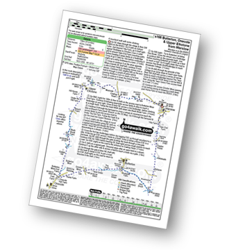
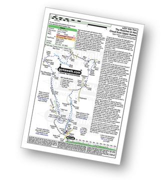
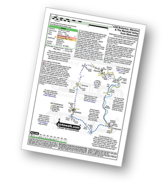
Vital Statistics:
| Length: | 7 miles (11 km) |
| Ascent: | 1,076ft (328m) |
| Time: | 3½ hrs |
| Grade: |  |
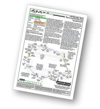
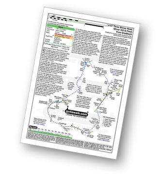
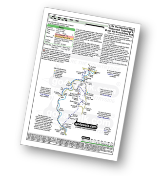
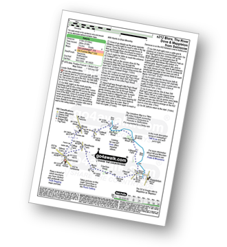
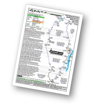
Route Summary:
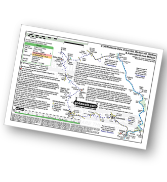
Leek - Mount Road - Holly House - Beely Barn - Morridge - Moor Top - Morridge Side - Egg Well - Roost Hill - Ashenhurst Mill - Lowe Hill - Leek
|
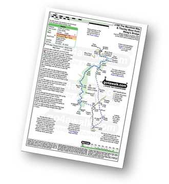
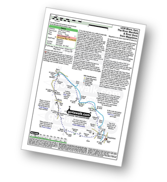
Vital Statistics:
| Length: | 8.25 miles (13 km) |
| Ascent: | 1,588ft (484m) |
| Time: | 4½ hrs |
| Grade: |  |
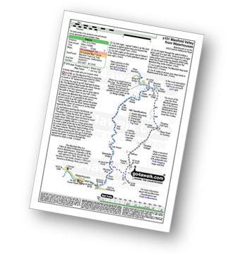
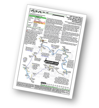
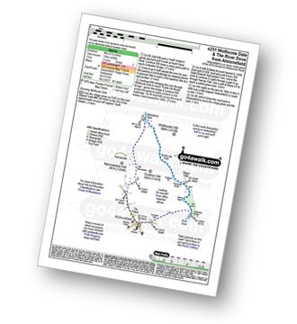
Route Summary:
Waterhouses - The Manifold Way - The River Hamps - Sparrowlee Bridge - Lee House - Hell Hole - Old Soles Wood - Soles Coppice - The River Manifold - Weag's Bridge - Beeston Tor Farm - Throwley Hall Farm - Throwley Cottage - Farwall Farm - The Manifold Way - Waterhouses
|
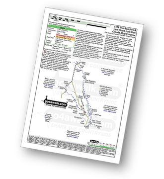
Vital Statistics:
| Length: | 5 miles (8 km) |
| Ascent: | 640ft (195m) |
| Time: | 2½ hrs |
| Grade: |  |
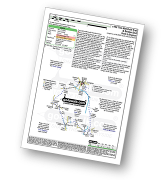
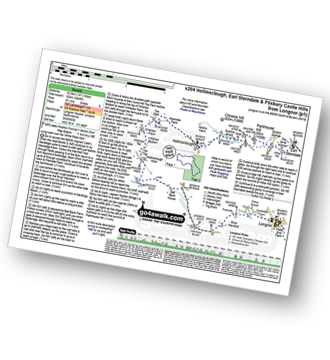
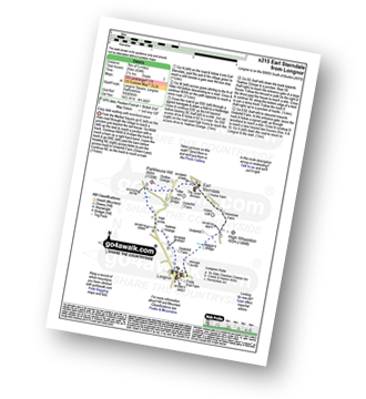
Route Summary:
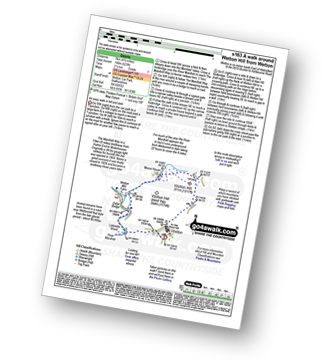
Longnor - The Manifold Trail - River Manifold - Lower Boothfold Farm - Ludburn Farm - Bridge End - The Ferns Farm - Heath House - Longnor
|
Vital Statistics:
| Length: | 8.75 miles (14 km) |
| Ascent: | 1,848ft (563m) |
| Time: | 5 hrs |
| Grade: |  |
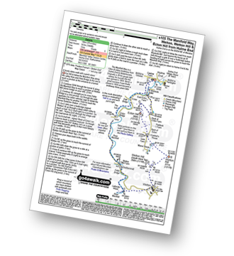
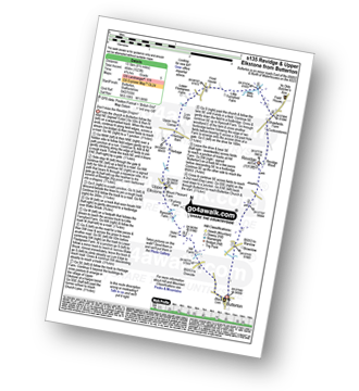
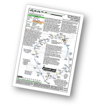
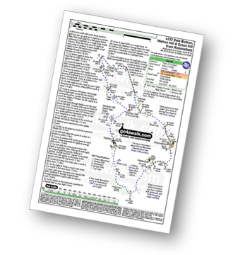
Route Summary:
Hulme End - Manifold Valley Visitors Centre - The Manifold Way - Dale Bridge - The Lee - Tunnel - River Manifold - Wetton Mill Farm - Wettonmill - Dafar Bridge - Ladyside Wood - Wetton - Wetton Hill (South West Top) - Wetton Hill - Cantrell's House - Ecton Hill - Westside Mill - The Manifold Way - Hulme End
|
Vital Statistics:
| Length: | 8.25 miles (13 km) |
| Ascent: | 1,464ft (446m) |
| Time: | 4½ hrs |
| Grade: | |
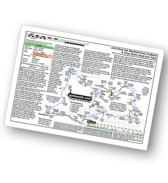
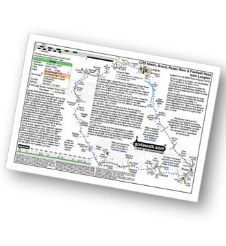
Route Summary:
Gradbach - The Dane Valley Way - River Dane - Dane View House - Three Shires Head - Panniers Pool - Knotbury Farm - Wolf Edge - Oliver Hill - Flash - Lower House Farm - Flash Brook Farm - Ann Roach Rocks - Gib Torr Rocks - Moss Top - Cloughhead - Gradbach
|
Vital Statistics:
| Length: | 7.75 miles (12.5 km) |
| Ascent: | 1,139ft (347m) |
| Time: | 4 hrs |
| Grade: | |
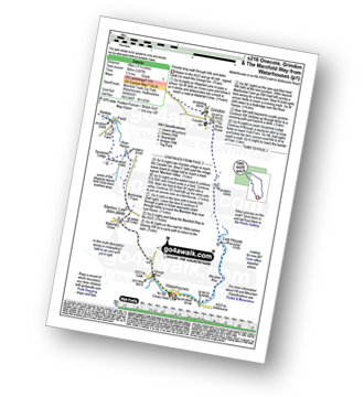
Route Summary:
Onecote - Hamps Way - Onecote Grange - The River Hamps - Mixon Mines - Black Brook Farm - Breech Farm - Under The Hill Farm - Upper Elkstone - Ryecroft Farm - Hole Farm - Hill Farm - Butterton - The Twist - Grindon Moor (Grindon Moor) - Home Farm - Onecote
|
Vital Statistics:
| Length: | 9.75 miles (15.5 km) |
| Ascent: | 2,146ft (654m) |
| Time: | 5.75hrs |
| Grade: | |
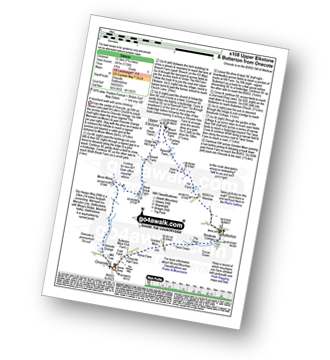
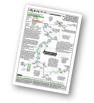
Route Summary:
Ilam - Ilam Country Park - River Manifold - Castern Hall - Castern Wood Nature Reserve - Wetton Low - Wetton - Alstonefield - Milldale - Achas Bank - Raven's Tor - Hall Dale - Dove Dale Wood - Air Cottage - Ilam Tops - Ilamtops Farm - Ilam
|
Vital Statistics:
| Length: | 4.75 miles (7.5 km) |
| Ascent: | 742ft (226m) |
| Time: | 2½ hrs |
| Grade: | |
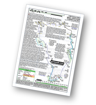
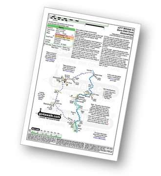
Route Summary:
Ipstones - Booth's Hall Farm - Cherryeye Bridge - Caldon Canal - The Staffordshire Way - Podmores Bridge - Booth's Wood - Consall New Lock - Crowgutter Wood - Churnet Valley Railway - Consall Forge - River Churnet - Devil's Staircase - Belmont Hall - Noonsun Common - Ipstones
|
Vital Statistics:
| Length: | 8.25 miles (13 km) |
| Ascent: | 689ft (210m) |
| Time: | 3.75hrs |
| Grade: | |
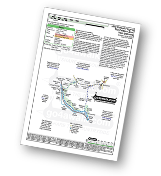
Route Summary:
Milldale - Dove Dale - Viator's Bridge - River Dove - Dove Holes - Upper Taylor's Wood - Pickering Tor,Raynard's Cave - Natural Arch - Sharplow Dale - Jacob's Ladder (Dove Dale) - Lover's Leap - Twelve Apostles - Dove Dale Castle - Thorpe Cloud - Ilam - Ilam Country Park - St Bartram's Bridge - River Manifold - Battle Stone Cross - Ilam Wood - River Lodge - Castern Hall - Castern Farm - Stanshope - Milldale
|
Vital Statistics:
| Length: | 3.75 miles (6 km) |
| Ascent: | 289ft (88m) |
| Time: | 1.75hrs |
| Grade: |  |
Route Summary:
Hulme End - Manifold Valley Visitors Centre - Lowend - Low End Farm - Buttsend - Brund - The Manifold Way - The River Manifold - Brund Mill - Holme House - Hulme End
|
Vital Statistics:
| Length: | 4 miles (6.5 km) |
| Ascent: | 942ft (287m) |
| Time: | 2½ hrs |
| Grade: | |
Route Summary:
Flash - Oliver Hill - Knotbury Farm - Panniers Pool - Three Shires Head - The Dane Valley Way - River Dane - Wicken Walls Farm - Axe Edge Green Farm - Flash
|
Vital Statistics:
| Length: | 7.25 miles (11.5 km) |
| Ascent: | 1,302ft (397m) |
| Time: | 4 hrs |
| Grade: | |
Route Summary:
Milldale - River Dove - Alstonefield - Wetton - Wetton Low - Castern Wood Nature Reserve - Damgate Farm - Hall Dale - Dove Dale - Achas Bank - Milldale
|
Vital Statistics:
| Length: | 6 miles (9.5 km) |
| Ascent: | 1,034ft (315m) |
| Time: | 3.25hrs |
| Grade: | |
Route Summary:
Hulme End - Manifold Valley Visitors Centre - The Manifold Way - Dale Bridge - The Lee - Tunnel - River Manifold - Wetton Mill Farm - Wettonmill - Dale Farm - Sugarloaf (Wetton) - Broad Ecton Farm - Ecton Hill - Westside Mill - The Manifold Way - Hulme End
|
Vital Statistics:
| Length: | 8.5 miles (13.5 km) |
| Ascent: | 1,523ft (464m) |
| Time: | 4.75hrs |
| Grade: | |
Route Summary:
Butterton - Revidge - Cuckoostones - Reaps Moor - Blake Brook - Little Fernyfold Farm - Herbage Barn - Lum Edge - Upper Elkstone - Ryecroft Farm - Hole Farm - Hill Farm - Butterton
|
Vital Statistics:
| Length: | 4.75 miles (7.5 km) |
| Ascent: | 659ft (201m) |
| Time: | 2½ hrs |
| Grade: | |
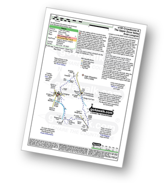
Route Summary:
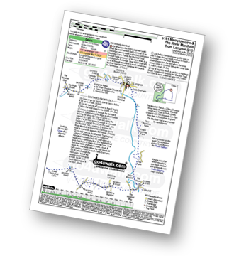
Longnor - Beggar's Bridge - River Dove - Crowdecote (Crowdicote) - Bridge End Farm - Under Wwhitle Farm - Over Boothlow Farm - The Manifold Trail - River Manifold - Longnor.
|
Vital Statistics:
| Length: | 5 miles (8 km) |
| Ascent: | 991ft (302m) |
| Time: | 2.75hrs |
| Grade: | |
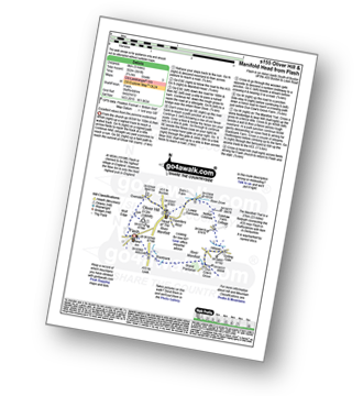
Route Summary:
Flash - Oliver Hill - Oxensitch - River Manifold Head - River Dove - Nether Colshaw Farm - Golling Gate Farm - Dun Cow's Grove Farm - The Manifold Trail - Blackbank Farm - Flash
|
Vital Statistics:
| Length: | 11.5 miles (18.5 km) |
| Ascent: | 1,572ft (479m) |
| Time: | 5.75hrs |
| Grade: | |
Route Summary:
Milldale - Mill Dale - River Dove - Coldeaton Bridge - Gipsy Bank - Peasland Rocks - Wolfscote Dale - Frank-i-the=Ricks Bridge - Beresford Dale - Barracks Farm - Harecops - Acton Moor - Back of Ecton - Ecton Hill - Cantrell's House - Wetton Hill - Wetton Hill (West Top) - Wetton - Alstonefield - Milldale
|
Vital Statistics:
| Length: | 4 miles (6.5 km) |
| Ascent: | 830ft (253m) |
| Time: | 2.25hrs |
| Grade: | |
Route Summary:
Froghall Wharf - Moseymoor Wood - Whieldon's Wood - Cloughead Wood - Blackbank Brook - Foxt - Newfields Gallery - Shirley Hollow - Oldridge Pinnacle - Harston Wood - Oldridge - Froghall Wharf
|
Vital Statistics:
| Length: | 6 miles (9.5 km) |
| Ascent: | 1,234ft (376m) |
| Time: | 3½ hrs |
| Grade: | |
Route Summary:
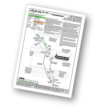
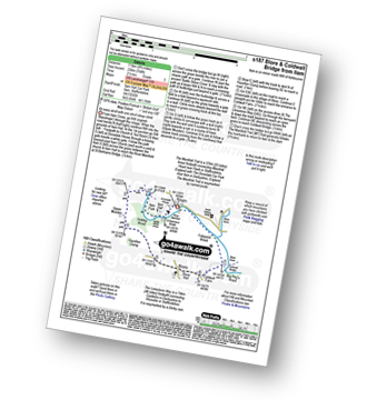
Five Clouds - Upper Hulme - Rockhall - The Roaches - Roach End - Back Forest - Lud's Church - Rock Chasm - Forest Wood - Roach End - Spring Cottage - Five Clouds - Upper Hulme
|
Vital Statistics:
| Length: | 4.5 miles (7 km) |
| Ascent: | 623ft (190m) |
| Time: | 2.25hrs |
| Grade: | |
Route Summary:
Wetton - River Manifold - Wettonmill - The Manifold Way - Thor's Cave - Manor House - Wetton
|
Vital Statistics:
| Length: | 4.5 miles (7 km) |
| Ascent: | 295ft (90m) |
| Time: | 2 hrs |
| Grade: | |
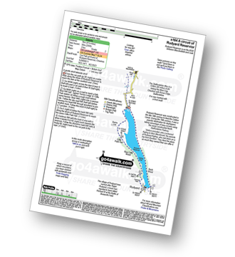
Route Summary:
Rudyard Reservoir - The Staffordshire Way - Rudyard - Rea Cliffe Wood - Cliffe Park Hall - Rudyard Reservoir
|
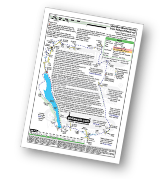
Vital Statistics:
| Length: | 9.5 miles (15 km) |
| Ascent: | 1,483ft (452m) |
| Time: | 5 hrs |
| Grade: | |
Route Summary:
Warslow - Villa Farm - Clayton House - Wallacre - Hoo Brook - Butterton - The Twist - Grindon Moor (Grindon Moor) - Onecote - Butterton Moor End Farm - Butterton Moor - Golden Hill - Black Brook Farm - Breech Farm - Underhill Farm - Upper Elkstone - Moorside - Cowhay Head - Warslow
|
Vital Statistics:
| Length: | 6.5 miles (10.5 km) |
| Ascent: | 689ft (210m) |
| Time: | 3.25hrs |
| Grade: | |
Route Summary:
Weag's Bridge - River Manifold - The Manifold Way - River Hamps - Lee House Farm - Farwell Farm - Calton - Slade House - Throwley Moor - Soles Hollow - The Manifold Way - River Manifold - Weag's Bridge
|
Vital Statistics:
| Length: | 4.75 miles (7.5 km) |
| Ascent: | 1,182ft (360m) |
| Time: | 3 hrs |
| Grade: | |
Route Summary:
Five Clouds - Pheasants Clough Farm - Roach Grange - Roach End - Bearstone Rock - The Roaches - Doxey Pool - Rockhall - Hen Cloud - Rockhall - Five Clouds
|
Vital Statistics:
| Length: | 6.75 miles (11 km) |
| Ascent: | 623ft (190m) |
| Time: | 3.25hrs |
| Grade: | |
Route Summary:
Milldale - Dove Dale - Viator's Bridge - River Dove - Dove Holes - Upper Taylor's Wood - Pickering Tor,Raynard's Cave - Natural Arch - Sharplow Dale - Jacob's Ladder (Dove Dale) - Lover's Leap - Twelve Apostles - Dove Dale Castle - Thorpe Cloud - Ilam - Ilamtops Farm - Ilam Tops - Ilam Rock - Hall Dale - Raven's Tor - Achas Bank - Milldale
|
Vital Statistics:
| Length: | 11.5 miles (18.5 km) |
| Ascent: | 1,487ft (453m) |
| Time: | 2.75hrs |
| Grade: | |
Route Summary:
Longnor - The Manifold Trail - Gauledge Farm - Fawside Farm - The River Manifold - Hardings Booth - Shining Ford - Holly Grove Farm - Newtown - Lady Edge - Round Knowl - Noon Sun Farm - Blake Mere (Merryton Low) - Blake Brook - Lower Fleetgreen Farm - Little Fernyford Farm - The Manifold Trail - Brund Mill - Pool Farm - Lower Boothlow Farm - Over Boothlow Farm - Folds End Farm - Longnor
|
Vital Statistics:
| Length: | 7 miles (11 km) |
| Ascent: | 1,090ft (332m) |
| Time: | 3.75hrs |
| Grade: | |
Route Summary:
Longnor - The Manifold Trail - Gauledge Farm - Fawside Farm - The River Manifold - Hardings Booth - Hollinsclough Moor - Hollinsclough - Swallow Brook - Earl Sterndale - Abbotside Farm - Green Lane - Beaggar's Bridge - Longnor
|
Vital Statistics:
| Length: | 4.75 miles (7.5 km) |
| Ascent: | 754ft (230m) |
| Time: | 2½ hrs |
| Grade: | |
Route Summary:
Ilam - Ilam Country Park - River Manifold - Lower Dove Dale - Upper Musden - Hazelton Clump - Blore - Coldwall Farm - The Limestone Way - Coldwall Bridge - The Manifold Trail - River Dove - Fishpond Wood - River Manifold - Ilam
|
Vital Statistics:
| Length: | 4.75 miles (7.5 km) |
| Ascent: | 909ft (277m) |
| Time: | 3 hrs |
| Grade: | |
Route Summary:
Grindon - Weag's Bridge - The Manifold Way - Thor's Cave - Wettonmill - Hoo Brook - Grindon
|
Vital Statistics:
| Length: | 11.5 miles (18.5 km) |
| Ascent: | 1,897ft (578m) |
| Time: | 6.25hrs |
| Grade: | |
Route Summary:
Gradbach - Bradley Howel - Little Hillend - Ann Roach Farm - Adder's Green - Morridge Top - Penthills Farm - Smallshaw Farm - High Ash - Bradshaw Farm - Bottom Hocker - Oakenclough Hall - Oakenclough Brook - Boarsgrove Farm - Middle Hills - Morridge - Royal Cottage - Blackbank Farm - Goldsitch Farm - Black Brook - Cloughhead - Gradbach
|
Vital Statistics:
| Length: | 6 miles (9.5 km) |
| Ascent: | 860ft (262m) |
| Time: | 3 hrs |
| Grade: | |
Route Summary:
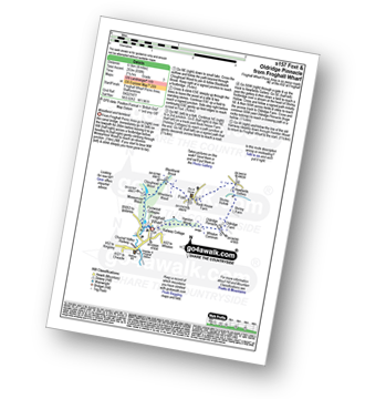
Froghall Wharf - Moseymoor Wood - Ipstones - New House Wood - Booth's Farm - Booth's Hall Farm - Glenwood House - Crowgutter Wood - Caldon Canal - The Staffordshire Way - Consall Forge - Churnet Valley Railway - Consall New Lock - Booth's Wood - Podmores Bridge - Cherryeye Bridge - Ruelow Wood - Froghall - Froghall Wharf
|
Vital Statistics:
| Length: | 4.5 miles (7 km) |
| Ascent: | 538ft (164m) |
| Time: | 2.25hrs |
| Grade: | |
Route Summary:
Longnor - The Manifold Trail - Moss Carr Farm - Hollinsclough - Swallow Brook - Yewtree Grange - Under The Hill - Longnor
|
Vital Statistics:
| Length: | 8.75 miles (14 km) |
| Ascent: | 1,690ft (515m) |
| Time: | 5 hrs |
| Grade: | |
Route Summary:
Butterton - Grindon Moor (Grindon Moor) - Ford - Ryebrook Farm - Grindon - Weag's Bridge - The Manifold Way - The River Manifold - Thor's Cave - Ladyside Wood - Dafar Bridge - Wettonmill - Hoo Brook - Butterton
|
Vital Statistics:
| Length: | 14.5 miles (23.5 km) |
| Ascent: | 3,049ft (929m) |
| Time: | 8½ hrs |
| Grade: | |
Route Summary:
Longnor - The Manifold Trail - Gauledge Farm - Fawside Farm - The River Manifold - Hardings Booth - Ball Bank Farm - The River Manifold - Heathylee House - Hollinsclough Moor - Wilshaw Bottom - Wilshaw Farm - Moorside Farm - Hollinsclough - Hollins Farm - Swallow Brook - Parkhouse Hill - Hitter Hill - Earl Sterndale - Abbots Grove - Wheeldon Trees - High Wheeldon - Crowdecote - Bridge End Farm - Pilsbury Castle Hills - Pilsbury - Sheen Lane Farm - Ridge End Farm - The Manifold Trail - Lower Boothlow Farm - Folds End Farm - Longnor
|
Vital Statistics:
| Length: | 7.5 miles (12 km) |
| Ascent: | 811ft (247m) |
| Time: | 3½ hrs |
| Grade: | |
Route Summary:
Longnor - The Manifold Trail - River Manifold - Lower Boothfold Farm - Ludburn Farm - Reaps Moor - Blake Brook - Boosley Grange - Bank House Farm - Shining Ford Farm - Hardings Booth Farm - Fawside Farm - Gualedge Farm - Longnor
|
Vital Statistics:
| Length: | 10 miles (16 km) |
| Ascent: | 1,953ft (595m) |
| Time: | 5.75hrs |
| Grade: | |
Route Summary:
Flash - Oliver Hill - Oxensitch - River Manifold Head - River Dove - Nether Colshaw Farm - Golling Gate Farm - Dun Cow's Grove Farm - The Manifold Trail - Blackbank Farm - Wilson Knowl Farm - Lower House Farm - Culvert Farm - Tollbridge Cottage - Gradbach - The Dane Valley Way - Dane View House - River Dane - Three Shires Head - Panniers Pool - Knotbury Farm - Wolf Edge - Flash
|
Vital Statistics:
| Length: | 6 miles (9.5 km) |
| Ascent: | 918ft (280m) |
| Time: | 3.25hrs |
| Grade: | |
Route Summary:
Swinscoe - Hillend Farm - Feenie Lee - Blore - The Limestone Way - Coldwall Bridge - River Dove - Big Peg's Wood - Little Peg's Wood - Littlepark Farm - Mappleton (aka Mapleton) - Okeover Hall - Okeover Park - Cowclose Wood - Martin Hill - Woodhouse Farm - Swinscoe
|
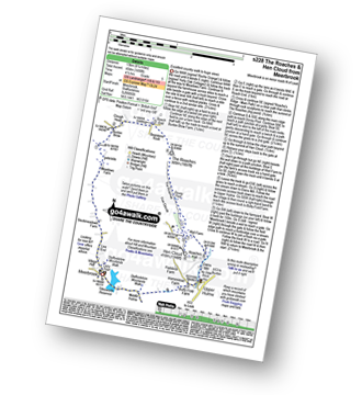
Vital Statistics:
| Length: | 4.5 miles (7 km) |
| Ascent: | 834ft (254m) |
| Time: | 2½ hrs |
| Grade: | |
Route Summary:
Longnor - River Dove - Beggar's Bridge - High Wheeldon - Abbotside Farm - Earl Sterndale - Hitter Hill - Parkhouse Hill - High Acres - Yewtree Grange - Underhill Farm - Longnor
|
Vital Statistics:
| Length: | 11.5 miles (18 km) |
| Ascent: | 1,267ft (386m) |
| Time: | 5½ hrs |
| Grade: | |
Route Summary:
Waterhouses - Waterfall Cross - Martins Low - River Hamps - Ford - Onecote - Grindonmoor Gate - Grindon Moor (Grindon Moor) - Grindon - Lee House - The Manifold Way - Waterhouses
|
Vital Statistics:
| Length: | 5.5 miles (9 km) |
| Ascent: | 1,615ft (492m) |
| Time: | 3.75hrs |
| Grade: | |
Route Summary:
Alstonefield - Alstonefield Youth Hostel - Overdale - Gipsy Bank - Wolfescote Dale - Coldeaton Bridge - Mill Dale - Milldale - Dove Dale - Achas Bank - Ilam Rock - Dovedale - Hall Dale - Stanshope - Dale Bottome - Alstonefield.
|
Vital Statistics:
| Length: | 9 miles (14.5 km) |
| Ascent: | 1,795ft (547m) |
| Time: | 5 hrs |
| Grade: | |
Route Summary:
Upper Hulme - Dains Mill - Blue Hills - Black Brook Nature Reserve - Gib Torr Rocks - Moss Top - Moss End Farm - Black Brook - Roach End - The Roaches - Rockhall - Hen Cloud - Roaches Hall - Upper Hulme
|
Vital Statistics:
| Length: | 6.5 miles (10.5 km) |
| Ascent: | 745ft (227m) |
| Time: | 3.25hrs |
| Grade: | |
Route Summary:
Mappleton (aka Mapleton) - Okeover Bridge - Okeover Hall - Okeover Park - Cowclose Wood - Martin Hill Farm - Woodhouses Farm - Blore - Blore Pastures - Ilam - River Manifold - The Manifold Trail - Fishpond Wood - River Dove - Coldwall Bridge - Big Peg's Wood - Little Peg's Wood - Littlepark Farm - Okeover Bridge - Mappleton (aka Mapleton)
|
Vital Statistics:
| Length: | 8.25 miles (13 km) |
| Ascent: | 1,490ft (454m) |
| Time: | 4½ hrs |
| Grade: | |
Route Summary:
Meerbrook - Lea End - Stockmeadows Farm - Meadows Farm - Buxton Brow Farm - Clough Head - Roach End - Bearstone Rock - The Roaches - Doxey Pool - Rockhall - Hen Cloud - Rockhall - Well Farm - Dains Mill - Upper Hulme - Butty Fold Farm - Tittesworth Reservoir - Meerbrook
|
Vital Statistics:
| Length: | 10.25 miles (16.5 km) |
| Ascent: | 1,969ft (600m) |
| Time: | 2.75hrs |
| Grade: | |
Route Summary:
Ilam - The Manifold Trail - Ilam Country Park - River Manifold - Rushley - Slade House - Throwley Moor - Lee House Farm - Manifold Valley - River Hamps - Saucefield Farm - Grindon - Weag's Bridge - Beeston Tor Farm - The Manifold Trail - Throwley Hall Farm - Rushley - Ilam Country Park - Ilam
|
Vital Statistics:
| Length: | 5.5 miles (9 km) |
| Ascent: | 426ft (130m) |
| Time: | 2½ hrs |
| Grade: | |
Route Summary:
Alstonefield - Overdale - Coldeaton Bridge - River Dove - Coldeaton Bridge - Iron Tors - Gipsy Bank - Drabber Tor - Caves - Peasland Tor - Wolfscote Dale - Beresford Dale - Narrow Dale - The Rakes - Alstonefield
|
Vital Statistics:
| Length: | 9.25 miles (15 km) |
| Ascent: | 1,769ft (539m) |
| Time: | 5.25hrs |
| Grade: | |
Route Summary:
Alstonefield - Dale Bottom - Hopedale - Castern Wood Nature Reserve - Wetton Low - Wetton - Wetton Hill (West Top) - Wetton Hill - Ecton Hill - Acton Moor - Gateham Grange - Gateham Farm - Steep Low - Alstonefield
|
Vital Statistics:
| Length: | 11 miles (17.5 km) |
| Ascent: | 1,342ft (409m) |
| Time: | 5.25hrs |
| Grade: | |
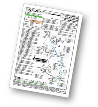
Route Summary:
Longnor - River Manifold - The Manifold Trail - Over Boothlow Farm - Lower Boothlow Farm - Hill End Farm - Sheen Hill - Slate House Farm - Sheen - Brund - River Manifold - Brund Mill - New Road Farm - Field House Farm - Reaps Moor - Black Brook - Smedley Sytch - Boosley Grange - Fawfield Head - Bank House - Shining Ford - The Manifold Trail - Hardings Booth - Fawside Farm - Gauledge Farm,Longnor.
|
Vital Statistics:
| Length: | 15 miles (24 km) |
| Ascent: | 2,028ft (618m) |
| Time: | 8 hrs |
| Grade: |  |
Route Summary:
Weag's Bridge - River Manifold - Beeston Tor Farm - River Hamps - Soles Coppice - Old Soles Wood - Hell Hole - Lee House - Farwell Farm - Calton - Carlton Green - Rushley Wood - Musden Wood - Rushley - Ilam Country Park - Ilam - River Dove - Dovedale Castle - Dove Dale - The River Dove - Stepping Stones - Lover's Leap - Tissington Spires - Shaplow Dale,Natural Arch - Raynard's Cave - Upper Taylor's Wood - Dove Holes - Viator's Bridge - Milldale - Alstonefield - Wetton - Thor's Cave - Weag's Bridge
|
Vital Statistics:
| Length: | 10.25 miles (16.5 km) |
| Ascent: | 1,486ft (453m) |
| Time: | 5.25hrs |
| Grade: | |
Route Summary:
Ilam - The Manifold Trail - Ilam Country Park - River Manifold - Castern Hall - Castern Wood Nature Reserve - Weag's Bridge - The Manifold Way - The River Hamps - Manifold Valley - Lee House Farm - Throwley Moor - Slade House - Rushley - Ilam Country Park - Ilam
|
Vital Statistics:
| Length: | 10.5 miles (17 km) |
| Ascent: | 1,847ft (563m) |
| Time: | 5.75hrs |
| Grade: | |
Route Summary:
Grindon - Weag's Bridge - The Manifold Way - The River Manifold - Thor's Cave - Dafar Bridge - Wettonmill - Ecton Bridge - Dale Bridge - Ecton - Hulme End - Hollow Farm - Warslow Hall - Upper Brownhill Farm - Warslow - Villa Farm - Clayton House - Wallacre - Hoo Brook - Ladyside Farm - Grindon
|
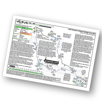
Vital Statistics:
| Length: | 6.75 miles (11 km) |
| Ascent: | 722ft (220m) |
| Time: | 3 hrs |
| Grade: | |
Route Summary:
Alstonefield - Milldale - Mill Dale - Lode Mill Bridge - River Dove - Coldeaton Bridge - Iron Tors - Gipsy Bank - Drabber Tor - Caves - Peasland Tor - Wolfscote Dale - Frank-i-th-Rocks Bridge - Beresford Dale - Narrow Dale - The Rakes - Alstonefield
|
Vital Statistics:
| Length: | 7 miles (11 km) |
| Ascent: | 1,395ft (425m) |
| Time: | 4 hrs |
| Grade: | |
Route Summary:
Hollinsclough - The New Farm - The Manifold Trail - Hardings Booth - Shining Ford - Holly Grove Farm - Oakenclough Brook - Oakenclough Hall Farm - Blackstone Edge - Bradshaw Farm - High Ash Farm - The River Manifold - Heathylee House - Hollinsclough Moor - Wilshaw Bottom - Wilshaw Farm - Moorside Farm - Hollinsclough
|
Vital Statistics:
| Length: | 7 miles (10.5 km) |
| Ascent: | 787ft (240m) |
| Time: | 3.25hrs |
| Grade: | |
Route Summary:
Wettonmill - Hoo Brook - Butterton - Warslow - Dale Bridge - Ecton - The Manifold Way - The River Manifold - Manifold Valley - Wettonmill
|
Vital Statistics:
| Length: | 10 miles (16 km) |
| Ascent: | 1,404ft (428m) |
| Time: | 5 hrs |
| Grade: | |
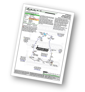
Route Summary:
Rudyard Reservoir - The Staffordshire Way - Ryecroft Gate - Rushton Spencer - Heaton Lodge Farm - Weathercock Farm - Gun End House - Gun (Staffordshire) - Fould Farm - Fould Villa - Poolend - Willgate Farm - Rudyard - Black Wood - Rudyard Reservoir
|
Vital Statistics:
| Length: | 3 miles (5 km) |
| Ascent: | 1,040ft (317m) |
| Time: | 2.25hrs |
| Grade: | |
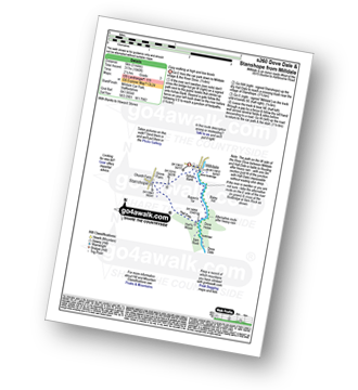
Route Summary:
Milldale - Achas Bank - Dove Dale - The River Dove - Raven's Tor - Hall Dale - Ilam Rock - Hurt's Wood - Stanshope - Church Farm - Milldale
|
Vital Statistics:
| Length: | 9.5 miles (15 km) |
| Ascent: | 1,641ft (500m) |
| Time: | 5 hrs |
| Grade: | |
Route Summary:
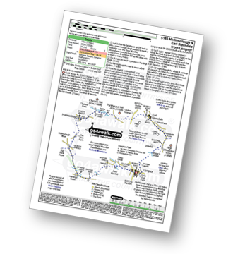
Butterton - Hoo Brook - The Twist - Grindon Moor - Onecote - Waterhouse - Old Mixon Hey Farm - Manor Farm - Hill House - Under The Hill Farm - Upper Elkstone - Ryecroft Farm - Hole Farm - Hill Farm - Butterton
|
Vital Statistics:
| Length: | 6.25 miles (10 km) |
| Ascent: | 623ft (190m) |
| Time: | 3 hrs |
| Grade: | |
Route Summary:
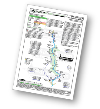
Dove Dale - The River Dove - Stepping Stones - Lover's Leap - Tissington Spires - Shaplow Dale,Natural Arch - Raynard's Cave - Upper Taylor's Wood - Dove Holes - Viator's Bridge - Milldale - Achas Bank - Hall Dale - Hurt's Wood - Ilam Rock - Jacob's Ladder (Dove Dale) - Dove Dale Wood - Dovedale Castle - Dove Dale
|
Vital Statistics:
| Length: | 6.5 miles (10.5 km) |
| Ascent: | 738ft (225m) |
| Time: | 3.25hrs |
| Grade: | |
Route Summary:
Cheddleton - Basford Bridge - Monk's Wood - Basfordbridge Farm - Felt House Farm - Consall - Consall Forge - River Churnet - Churnet Valley Railway - Caldon Canal - The Staffordshire Way - Consall Wood - Cheddleton
|
Vital Statistics:
| Length: | 11.5 miles (18.5 km) |
| Ascent: | 2,274ft (693m) |
| Time: | 6½ hrs |
| Grade: | |
Route Summary:
Gradbach - The Dane Valley Way - Gradbach Youth Hostel - Black Brook - Forest Wood - Roach End - The Roaches - Doxey Pool - Rockhall - Hen Cloud - Well Farm - Dains Mill - Upper Hulme - Butty Fold Farm - Staffordshire Moorlands Walk - Tittesworth Reservoir - Meerbrook - Stockmeadows Farm - Meadows Farm - Buxton Brow - Clough Head - Back Forest - Lud's Church - Rock Chasm - Black Brook - Gradbach Youth Hostel - The Dane Valley Way - Gradbach
|
Vital Statistics:
| Length: | 3.75 miles (6 km) |
| Ascent: | 775ft (236m) |
| Time: | 2.25hrs |
| Grade: | |
Route Summary:
Five Clouds - Upper Hulme - Rockhall - Doxey Pool - The Roaches - Roach End - Spring Cottage - Five Clouds - Upper Hulme
|
Vital Statistics:
| Length: | 3.25 miles (5 km) |
| Ascent: | 778ft (237m) |
| Time: | 2 hrs |
| Grade: | |
Route Summary:
Roach End - Back Forest - Forest Wood - Lud's Church - Roach End - The Roaches - Roach End
|
Vital Statistics:
| Length: | 5 miles (8 km) |
| Ascent: | 1,306ft (398m) |
| Time: | 3.25hrs |
| Grade: | |
Route Summary:
Gradbach - The Dane Valley Way - Gradbach Youth Hostel - The River Dane - Black Brook - Forest Wood - Lud's Church - Back Forest - Roach End - The Roaches - Roach End - Forest Wood - Black Brook - The River Dane - Gradbach Youth Hostel - The Dane Valley Way - Gradbach
|
Vital Statistics:
| Length: | 4 miles (6.5 km) |
| Ascent: | 1,306ft (398m) |
| Time: | 2½ hrs |
| Grade: | |
Route Summary:
Gradbach - The Dane Valley Way - Gradbach Youth Hostel - The River Dane - Black Brook - Forest Wood - Lud's Church - Back Forest - Roach End - Forest Wood - Black Brook - The River Dane - Gradbach Youth Hostel - The Dane Valley Way - Gradbach
|
Vital Statistics:
| Length: | 5.5 miles (8.5 km) |
| Ascent: | 896ft (273m) |
| Time: | 3 hrs |
| Grade: | |
Route Summary:
Rushton Spencer - Oulton - Woodhouse Green - Wood Common Farm - Avona - The Staffordshire Way - The Gritstone Trail - The Cloud (Bosley Cloud) - Bosley Cloud - Avona - The Dane Valley Way - Raven's Clough - Ravensclough Brook - Rushton Spencer
|
Vital Statistics:
| Length: | 9 miles (14.5 km) |
| Ascent: | 1,178ft (359m) |
| Time: | 4½ hrs |
| Grade: | |
Route Summary:
Abbey Green - Abbey Wood - Hillswood - North Hillswood Farm - Tittesworth Reservoir - Meerbrook - Lea End - Stockmeadows Farm - Meadows Farm - Turner's Pool - Old Hag Farm - Gun (Staffordshire) - Fould Farm - Abbey Green
|
Vital Statistics:
| Length: | 6 miles (9.5 km) |
| Ascent: | 715ft (218m) |
| Time: | 3 hrs |
| Grade: | |
Route Summary:
Meerbrook - Lea End - Stockmeadows Farm - Meadows Farm - Turner's Pool - Old Hag Farm - Gun (Staffordshire) - Meerbrook
|
Vital Statistics:
| Length: | 6 miles (9.5 km) |
| Ascent: | 1,237ft (377m) |
| Time: | 3½ hrs |
| Grade: | |
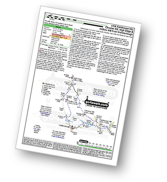
Route Summary:
Hollinsclough - Swallow Brook - Parkhouse Hill - Chrome Hill - Stoop Farm - High Edge - Booth Farm - Hollins Hill - Hollinsclough
|
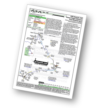
Vital Statistics:
| Length: | 9.75 miles (15.5 km) |
| Ascent: | 1,910ft (582m) |
| Time: | 5½ hrs |
| Grade: | |
Route Summary:
Alstonefield - Milldale - Mill Dale - Lode Mill Bridge - River Dove - Coldeaton Bridge - Iron Tors - Gipsy Bank - Drabber Tor - Caves - Peasland Tor - Wolfscote Dale - Frank-i-th-Rocks Bridge - Wolfscote Grange - Wolfscote Hill - Beresford Dale - Narrowdale Hill - Narrow Dale - Gratton Hill - The Rakes - Alstonefield
See this list of walks, routes & maps in:
Grade Order | Length Order | Time Order | Walk Number or Start Location Order
NB. To reverse (toggle) this order, click Grade Order again


