The Arenigs area of Snowdonia National Park - a fully detailed list of all the Mountains, Peaks, Tops and Hills
The Arenigs area of Snowdonia National Park in Conwy and Gwynedd is the area enclosed by:
- The A5 from Betws-y-coed to Druid to the North
- The A494 from Druid to Dolgellau to the South East
- The A470 from Dolgellau to Llan Ffestiniog to the West
- The B4391, B4407 & B4406 from Llan Ffestiniog to the A5 south of Betws-y-coed to the North West
If you count only the Deweys there are 31 tops to climb, bag & conquer and the highest point is Foel-boeth (Llyn Celyn) at 596m (1,956ft).
To see these Mountains, Peaks, Tops and Hills displayed in different ways - see the options in the left-hand column and towards the bottom of this page.
![]() Your Personal Bagging Record for The Arenigs area of Snowdonia
Your Personal Bagging Record for The Arenigs area of Snowdonia
LOG ON and RELOAD this page to show which Mountains, Peaks, Tops and Hills you have already climbed, bagged & conquered [. . . more details]
See this list in: Alphabetical Order‡
| Height Order
To reverse the order select the link again.
Mountain, Peak, Top or Hill:
Bagged

![]()
1. Rhobell-y-big
504m (1,654ft)
Rhobell-y-big is on interactive maps:
Rhobell-y-big is on downloadable PDF you can Print or Save to your Phone: |
![]()
2. Rhobell Ganol
521m (1,710ft)
Rhobell Ganol is on interactive maps:
Rhobell Ganol is on downloadable PDF you can Print or Save to your Phone: |
![]()
3. Pen y Bwlch Gwyn
502m (1,647ft)
Pen y Bwlch Gwyn is on interactive maps:
Pen y Bwlch Gwyn is on downloadable PDF you can Print or Save to your Phone: |
![]()
4. Pen y Bedw (East Top)
528m (1,732ft)
Send it in and we'll publish it here.
Pen y Bedw (East Top) is on interactive maps:
Pen y Bedw (East Top) is on downloadable PDF you can Print or Save to your Phone: |
![]()
5. Orddu
555m (1,821ft)
Orddu is on interactive maps:
Orddu is on downloadable PDF you can Print or Save to your Phone: |
![]()
6. Mynydd Nodol
539m (1,769ft)
Mynydd Nodol is on interactive maps:
Mynydd Nodol is on downloadable PDF you can Print or Save to your Phone: |
![]()
7. Mynydd Bryn-llech
545m (1,789ft)
Mynydd Bryn-llech is on interactive maps:
Mynydd Bryn-llech is on downloadable PDF you can Print or Save to your Phone: |
![]()
8. Moel yr Wden (Bwlch y Bi)
573m (1,881ft)
Send it in and we'll publish it here.
Moel yr Wden (Bwlch y Bi) is on interactive maps:
Moel yr Wden (Bwlch y Bi) is on downloadable PDF you can Print or Save to your Phone: |
![]()
9. Moel Ymenyn
550m (1,805ft)
Moel Ymenyn is on interactive maps:
Moel Ymenyn is on downloadable PDF you can Print or Save to your Phone: |
![]()
10. Moel y Gydros
521m (1,710ft)
Moel y Gydros is on interactive maps:
Moel y Gydros is on downloadable PDF you can Print or Save to your Phone: |
![]()
11. Moel y Feidiog
577m (1,894ft)
Moel y Feidiog is on interactive maps:
Moel y Feidiog is on downloadable PDF you can Print or Save to your Phone: |
![]()
12. Moel Oernant
503m (1,651ft)
Moel Oernant is on interactive maps:
Moel Oernant is on downloadable PDF you can Print or Save to your Phone: |
![]()
13. Moel Emoel
549m (1,801ft)
Moel Emoel is on interactive maps:
Moel Emoel is on downloadable PDF you can Print or Save to your Phone: |
![]()
14. Moel Cae'r-defaid
531m (1,742ft)
Moel Cae'r-defaid is on interactive maps:
Moel Cae'r-defaid is on downloadable PDF you can Print or Save to your Phone: |
![]()
15. Graig Wen (Arenigs)
556m (1,825ft)
Send it in and we'll publish it here.
Graig Wen (Arenigs) is on interactive maps:
Graig Wen (Arenigs) is on downloadable PDF you can Print or Save to your Phone: |
![]()
16. Graig Ddu (Arenigs)
537m (1,762ft)
Send it in and we'll publish it here.
Graig Ddu (Arenigs) is on interactive maps:
Graig Ddu (Arenigs) is on downloadable PDF you can Print or Save to your Phone: |
![]()
17. Garnedd Fawr
569m (1,867ft)
Garnedd Fawr is on interactive maps:
Garnedd Fawr is on downloadable PDF you can Print or Save to your Phone: |
![]()
18. Garn Prys
533m (1,749ft)
Garn Prys is on interactive maps:
Garn Prys is on downloadable PDF you can Print or Save to your Phone: |
![]()
19. Foel-boeth (Llyn Celyn)
596m (1,956ft)
Foel-boeth (Llyn Celyn) is on interactive maps:
Foel-boeth (Llyn Celyn) is on downloadable PDF you can Print or Save to your Phone: |
![]()
20. Foel Ystrodur Fawr
518m (1,700ft)
Foel Ystrodur Fawr is on interactive maps:
Foel Ystrodur Fawr is on downloadable PDF you can Print or Save to your Phone: |
![]()
21. Foel Fawr (Mynydd Maentwrog)
528m (1,733ft)
Send it in and we'll publish it here.
Foel Fawr (Mynydd Maentwrog) is on interactive maps:
Foel Fawr (Mynydd Maentwrog) is on downloadable PDF you can Print or Save to your Phone: |
![]()
22. Foel Boeth (Talcen Llwyd)
509m (1,671ft)
Send it in and we'll publish it here.
Foel Boeth (Talcen Llwyd) is on interactive maps:
Foel Boeth (Talcen Llwyd) is on downloadable PDF you can Print or Save to your Phone: |
![]()
23. Foel Boeth (Ffridd Trawsgoed)
541m (1,776ft)
Send it in and we'll publish it here.
Foel Boeth (Ffridd Trawsgoed) is on interactive maps:
Foel Boeth (Ffridd Trawsgoed) is on downloadable PDF you can Print or Save to your Phone: |
![]()
24. Ffridd yr Allt-lwyd
500m (1,641ft)
Send it in and we'll publish it here.
Ffridd yr Allt-lwyd is on interactive maps:
Ffridd yr Allt-lwyd is on downloadable PDF you can Print or Save to your Phone: |
![]()
25. Ffridd Wen (Bryn-pig)
523m (1,716ft)
Send it in and we'll publish it here.
Ffridd Wen (Bryn-pig) is on interactive maps:
Ffridd Wen (Bryn-pig) is on downloadable PDF you can Print or Save to your Phone: |
![]()
26. Craig yr Hafod
523m (1,716ft)
Craig yr Hafod is on interactive maps:
Craig yr Hafod is on downloadable PDF you can Print or Save to your Phone: |
![]()
27. Craig y Benglog
526m (1,726ft)
Craig y Benglog is on interactive maps:
Craig y Benglog is on downloadable PDF you can Print or Save to your Phone: |
![]()
28. Craig Dolfudr (North Top) (Pennant-Lliw)
519m (1,703ft)
Send it in and we'll publish it here.
Craig Dolfudr (North Top) (Pennant-Lliw) is on interactive maps:
Craig Dolfudr (North Top) (Pennant-Lliw) is on downloadable PDF you can Print or Save to your Phone: |
![]()
29. Craig Dolfudr
518m (1,700ft)
Craig Dolfudr is on interactive maps:
Craig Dolfudr is on downloadable PDF you can Print or Save to your Phone: |
![]()
30. Carnedd Iago
538m (1,766ft)
Carnedd Iago is on interactive maps:
Carnedd Iago is on downloadable PDF you can Print or Save to your Phone: |
![]()
31. Bryn-mawr
511m (1,677ft)
Bryn-mawr is on interactive maps:
Bryn-mawr is on downloadable PDF you can Print or Save to your Phone: |
View these 31 Mountains, Peaks, Tops and Hills:
- On a Downloadable PDF you can Print or Save to your Phone#
- On an Interactive Google Map (loads faster)
- On an Interactive Google Map with a list of tops below it.
(makes it easier to locate a particular top) - On a Detailed List in:
Alphabetical Order | Height Order - On one page with 'yet-to-be-bagged' listed 1st & then 'already-bagged' tops listed 2nd in:
Alphabetical Order | Height Order - On one page with 'already-bagged' tops listed 1st & then 'yet-to-be-bagged' tops listed 2nd in:
Alphabetical Order | Height Order
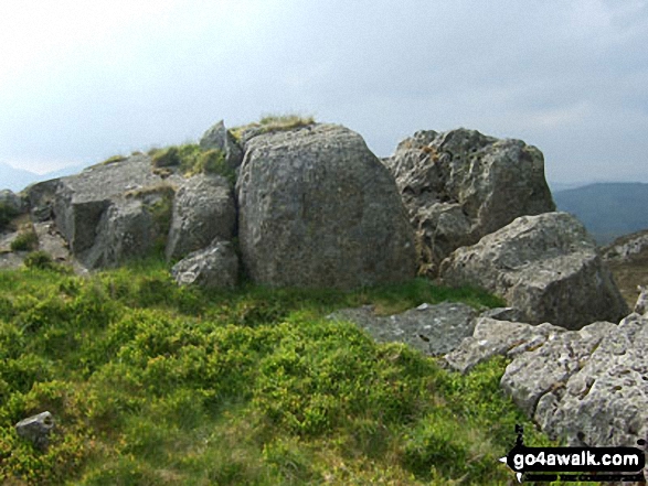
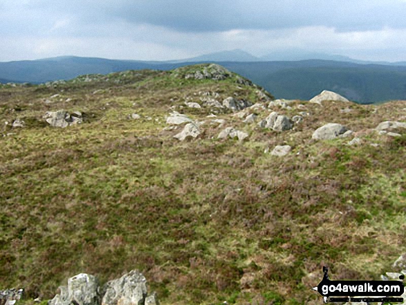
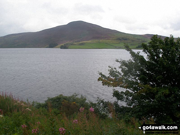
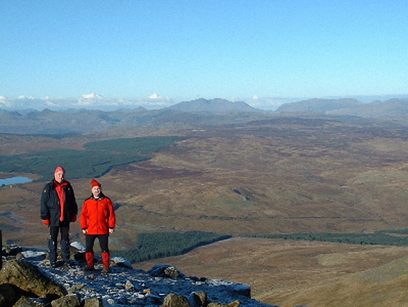 The summit of Arenig Fawr (Moel Yr Eglwys), the highest point in The Arenigs area of Snowdonia
Photo: John Roberts
# Whether you print a copy or download it to your phone, this Peak Baggers' Map will prove incredibly useful if you want to know what's what when you are up in the mountains and cannot get a phone signal.
Is there a Mountain, Peak, Top or Hill missing from the above google map or list?
Let us know an we will add it to our database.

To contribute to go4awalk.com or to contact us about anything at all - see Talk To Us.
For help see Help.
go4awalk.com and go4awalk.co.uk are registered trademarks of TMDH Limited.
Copyright © 2000-2025 TMDH Limited. All rights reserved.
Copyright Terms & Conditions Privacy Statement
A - Z Walks Home Log On/Accounts Photo Gallery Walk Ideas and Collections Fell Facts Hill Skills Walking Questions and Answers Your Stories News Competitions Product Reviews/Gear Tests Walking Gear Guides Peaks and Mountains Peak Bagging Find New Walking Friends Camping GPS Waypoints for Walking Contents Walk Search Talk To Us go4awalk.com Help Free Example Walks Newsletter


