Dewey Icon

Pen y Bwlch Gwyn
502m (1647ft)


The Arenigs Area, Gwynedd, Wales

*Pen y Bwlch Gwyn is actually just outside of The National Park Boundary


Record Pen y Bwlch Gwyn as Bagged, Climbed & Conquered

Welsh Dewey Icon

Welsh Dewey
233rd in Wales,
409th in England & Wales

Walk Pen y Bwlch Gwyn walking UK Mountains in The Arenigs Area Snowdonia National Park*<br> Gwynedd, Wales

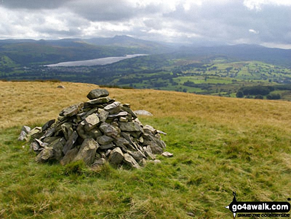
Pen y Bwlch Gwyn Summit

Photo: Graham Lister


Not familiar with this top?

How is Pen y Bwlch Gwyn classified?

Download 1 easy-to-follow, circular walk that climbs Pen y Bwlch Gwyn

See the location of Pen y Bwlch Gwyn and the walk on an interactive Google Map

See the location of Pen y Bwlch Gwyn on an interactive Google Bagging Map

Read walk reports from hikers who have already bagged Pen y Bwlch Gwyn

View more photographs & pictures of views from, on or of Pen y Bwlch Gwyn


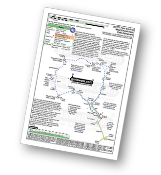
You can walk to the top of Pen y Bwlch Gwyn by using this easy‑to‑follow route map:
Walking Boot Print Icon

Walk gw177 Foel Goch (Arenigs) and Moel Emoel from Cefn-ddwysarn

Good views of the Arenig Mountains

Walk GPS Icon
Walk GPX Icon
Walk PDF Icon

Vital Statistics:

Length: 7.5ml (12km)
Ascent:1,963ft (598m)
Time:4.75hrs
Grade:Walk Grade 5 Icon (Moderate)

See Pen y Bwlch Gwyn and the surrounding tops on our free-to-access 'Google Style' Peak Bagging Map:

Find Google Maps Peak Bagging Map Icon

The Arenigs of Snowdonia National Park


See Pen y Bwlch Gwyn and the surrounding tops on our downloadable Peak Bagging Map in PDF format:

Find PDF Peak Bagging Map Icon

The Arenigs area of Snowdonia National Park

NB: Whether you print off a copy or download it to your phone, this PDF Peak Baggers' Map might prove incredibly useful when your are up there on the tops and you cannot get a phone signal.


You can find Pen y Bwlch Gwyn & all the walks that climb it on these unique free-to-access Interactive Walk Planning Maps:


1:25,000 scale OS Explorer Map (orange/yellow covers):

OS Explorer OL18 Harlech, Porthmadog & Bala/Y Bala


1:50,000 scale OS Landranger Map (pink/magenta covers):

OS Landranger 125 Bala & Lake Vyrnwy, Berwyn


Other walkers who hiked, climbed, bagged and summited Pen y Bwlch Gwyn Fellow go4awalkers who have already walked, climbed, summited & bagged Pen y Bwlch Gwyn

Mark Davidson walked up on August 18th, 2008 [with] Mike [weather] Wet & rainy but cleared up later in the afternoon

To add (or remove) your name and experiences on this page - Log On and edit your Personal Mountain Bagging Record


More Photographs & Pictures of views from, on or of Pen y Bwlch Gwyn

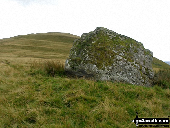
The huge rock on the lower slopes of Pen y Bwlch Gwyn

The huge rock on the lower slopes of Pen y Bwlch Gwyn

Photo: Graham Lister (6)

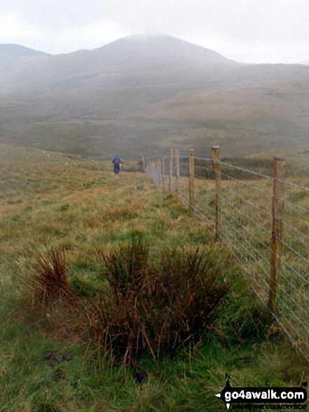
Pen y Bwlch Gwyn from Garnedd Fawr

Pen y Bwlch Gwyn from Garnedd Fawr

Photo: Graham Lister (5)


Send us your photographs and pictures on, of, or from Pen y Bwlch Gwyn

If you would like to add your walk photographs and pictures featuring views from, on or of Pen y Bwlch Gwyn to this page, please send them as email attachments (configured for any computer) along with your name to:


and we shall do our best to publish them.

(Guide Resolution = 300dpi. At least = 660pixels (wide) x 440 pixels (high).)

Send us your photographs and pictures on, of, or from Pen y Bwlch Gwyn via Facebook

You can also submit photos via our Facebook Page.

NB. Please indicate where each photo was taken.


Not familiar with this top?

How is Pen y Bwlch Gwyn classified?

Download 1 easy-to-follow, circular walk that climbs Pen y Bwlch Gwyn

See the location of Pen y Bwlch Gwyn and the walk on an interactive Google Map

See the location of Pen y Bwlch Gwyn on an interactive Google Bagging Map

Read walk reports from hikers who have already bagged Pen y Bwlch Gwyn

View more photographs & pictures of views from, on or of Pen y Bwlch Gwyn


Follow go4awalk.com on Twitter Follow go4awalk.com on Facebook


Home


Find new Friends to go walking with

Walk all 214 Wainwrights in just 59 Walks. Download GPS Waypoints - Great Walks you must not miss!

Walk The Yorkshire Three Peaks Challenge Walk - All the Latest Route Information, GPS Waypoints and Split Times to keep you on Schedule

Walk The British Three Peaks Challenge Walk - All the Latest Route Information and GPS Waypoints

See our pick of The Best Walks in The Lake District - Great Walks you must not miss!

Walk our pick of the Best Lake District Ridge Walks - Great Walks you must not miss!

Walk our pick of the Best Lake District Walks to do in the rain - Great Walks you must not miss!

Walk our pick of The Best Walks in Snowdonia - Great Walks you must not miss!

Walk our pick of The Best Ridge Walks in Wales - Walks you must not miss!

Walk our pick of The Best Walks in The Brecon Beacons - Great Walks you must not miss!

Walk our pick of The Best Walks in The Yorkshire Dales - Walks you must not miss!

Walk our pick of The Best Walks in The Peak District - Walks you must not miss!

Walk our pick of The Best Walks in The Forest of Bowland - Walks you must not miss!

Walk our pick of The Best Walks in Shropshire - Walks you must not miss!

Walk our pick of The Best Walks in Cheshire - Walks you must not miss!

Walk our pick of The Best Walks in Lancashire - Walks you must not miss!

Not sure where to walk next? Try Peak Bagging - Great Walks you must not miss!

Not sure where to walk next? Walk part of a National Trail - Great Walks you must not miss!

Walks with Downloadable and Uploadable GPS Waypoint Data

Walking Kit and Gear Tested by Walkers

Full Site Search