All the Mountains, Peaks, Tops and Hills in The Far Eastern Marches area of The Lake District, Cumbria, England as a detailed list (Page 1 of 1)
The Far Eastern Marches area of The Lake District National Park, Cumbria is the area enclosed by:
- An imaginary line from Ambleside through Troutbeck, Kentmere and Sadgill to the Eastern tip of Haweswater Reservoir and then Pooley Bridge to the West
- The A592 to Penrith to the North
- The M6 South & then the A684 to Kendal to the East
- The A591 from Kendal to Ambleside to the South
If you count only the Wainwright Outlying Fells there are 33 tops to climb, bag & conquer and the highest point is Great Yarlside at 585m (1,920ft).
To see these Mountains, Peaks, Tops and Hills displayed in different ways - see the options in the left-hand column and towards the bottom of this page.
![]() Your Personal Bagging Record for The Far Eastern Marches area of The Lake District
Your Personal Bagging Record for The Far Eastern Marches area of The Lake District
When logged on, you can mark each Mountain, Peak, Top or Hill as 'bagged' by either:
- if you opt to display the tops in this area using a google map, click or tap on its symbol on the map below. This will open a text window. Click or tap on the 'Record [mountain name] as Bagged, Climbed & Conquered' link towards the bottom of the text window, or
- if you opt to display the tops in this area as a list, click or tap on the red 'not yet' symbol to the right of the name of each 'top'
Either method will open a new page where you can complete all your details such as:
- when you bagged the Mountain, Peak, Top or Hill;
- which route you took
- who you went with
- what the weather was like
- any other comment that will remind you of the day
Once you have completed your details and click or tap the submit button, you will automatically return to this page and the top you bagged will show with a green tick.
NB. None of the above fields are 'mandatory' - you can leave them blank if you wish.
NNB. You also have the option whether to display your peak bagging exploits to other users of this site or keep them private so only you can see them when you are logged on.
Furthermore, since you can also access your Personal Mountain & Hill Bagging Record via go4awalk Mobile you can quickly & easily record, edit and view your achievements - whether you are at home/work on your desktop computer or in the pub/at the top of a mountain with your Mobile Phone. (You can even download your Personal Mountain & Hill Bagging Record as a .csv file for importing into and saving with spreadsheet software like Excel or NeoOffice!)
This facility costs one credit to initially access your personal bagging record. Once accessed, all other interactions, such as recording other Mountains, Peaks, Tops and Hills as 'bagged' or altering an existing bagging record, are free.
Click REGISTER to register and purchase credits.
LOG ON and RELOAD this page to show which Mountains, Peaks, Tops and Hills you have already climbed, bagged & conquered. [ . . . remove this text]
See this list in: Alphabetical Order
| Height Order‡
To reverse the order select the link again.
Mountain, Peak, Top or Hill:
Bagged

![]()
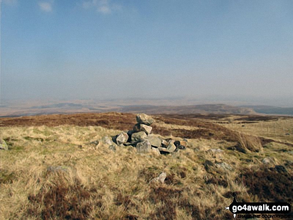
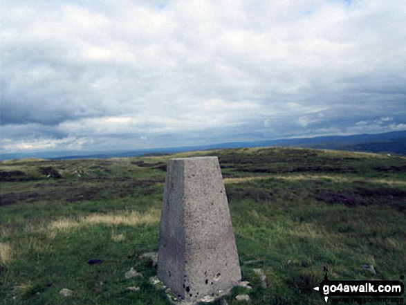
1. Great Yarlside
585m (1,920ft)
Great Yarlside is on interactive maps:
A downloadable go4awalk.com PDF Peak Bagging Map featuring Great Yarlside will be available soon. |
![]()
2. Great Saddle Crag
565m (1,854ft)
Great Saddle Crag is on interactive maps:
A downloadable go4awalk.com PDF Peak Bagging Map featuring Great Saddle Crag will be available soon. |
![]()
3. Wasdale Pike
565m (1,854ft)
Wasdale Pike is on interactive maps:
A downloadable go4awalk.com PDF Peak Bagging Map featuring Wasdale Pike will be available soon. |
![]()
4. Ancrow Brow (Swinklebank Crag)
555m (1,822ft)
Ancrow Brow (Swinklebank Crag) is on interactive maps:
A downloadable go4awalk.com PDF Peak Bagging Map featuring Ancrow Brow (Swinklebank Crag) will be available soon. |
![]()
5. Ancrow Brow (North East Top)
541m (1,775ft)
Ancrow Brow (North East Top) is on interactive maps:
A downloadable go4awalk.com PDF Peak Bagging Map featuring Ancrow Brow (North East Top) will be available soon. |
![]()
6. High Wether Howe
531m (1,743ft)
High Wether Howe is on interactive maps:
A downloadable go4awalk.com PDF Peak Bagging Map featuring High Wether Howe will be available soon. |
![]()
7. White Howe (Bannisdale)
530m (1,739ft)
White Howe (Bannisdale) is on interactive maps:
A downloadable go4awalk.com PDF Peak Bagging Map featuring White Howe (Bannisdale) will be available soon. |
![]()
8. The Forest (Bannisdale)
528m (1,732ft)
The Forest (Bannisdale) is on interactive maps:
A downloadable go4awalk.com PDF Peak Bagging Map featuring The Forest (Bannisdale) will be available soon. |
![]()
9. Lord's Seat (Crookdale)
524m (1,720ft)
Lord's Seat (Crookdale) is on interactive maps:
A downloadable go4awalk.com PDF Peak Bagging Map featuring Lord's Seat (Crookdale) will be available soon. |
![]()
10. Little Yarlside
516m (1,694ft)
Little Yarlside is on interactive maps:
A downloadable go4awalk.com PDF Peak Bagging Map featuring Little Yarlside will be available soon. |
![]()
11. Seat Robert
515m (1,690ft)
Seat Robert is on interactive maps:
A downloadable go4awalk.com PDF Peak Bagging Map featuring Seat Robert will be available soon. |
![]()
12. Capplebarrow
512m (1,680ft)
Capplebarrow is on interactive maps:
A downloadable go4awalk.com PDF Peak Bagging Map featuring Capplebarrow will be available soon. |
![]()
13. Fewling Stones
510m (1,674ft)
Fewling Stones is on interactive maps:
A downloadable go4awalk.com PDF Peak Bagging Map featuring Fewling Stones will be available soon. |
![]()
14. Sleddale Pike
505m (1,657ft)
Sleddale Pike is on interactive maps:
A downloadable go4awalk.com PDF Peak Bagging Map featuring Sleddale Pike will be available soon. |
![]()
15. Ulthwaite Rigg
500m (1,641ft)
Ulthwaite Rigg is on interactive maps:
A downloadable go4awalk.com PDF Peak Bagging Map featuring Ulthwaite Rigg will be available soon. |
![]()
16. High House Bank
495m (1,625ft)
High House Bank is on interactive maps:
A downloadable go4awalk.com PDF Peak Bagging Map featuring High House Bank will be available soon. |

![]()
17. Long Crag (Bannisdale Fell)
493m (1,618ft)
Long Crag (Bannisdale Fell) is on interactive maps:
A downloadable go4awalk.com PDF Peak Bagging Map featuring Long Crag (Bannisdale Fell) will be available soon. |
![]()
18. Robin Hood (Crookdale)
493m (1,618ft)
Robin Hood (Crookdale) is on interactive maps:
A downloadable go4awalk.com PDF Peak Bagging Map featuring Robin Hood (Crookdale) will be available soon. |
![]()
19. Whatshaw Common
485m (1,592ft)
Whatshaw Common is on interactive maps:
A downloadable go4awalk.com PDF Peak Bagging Map featuring Whatshaw Common will be available soon. |
![]()
20. Great Ladstones
439m (1,441ft)
Great Ladstones is on interactive maps:
A downloadable go4awalk.com PDF Peak Bagging Map featuring Great Ladstones will be available soon. |
![]()
21. Brunt Knott (Potter Fell)
427m (1,401ft)
Brunt Knott (Potter Fell) is on interactive maps:
A downloadable go4awalk.com PDF Peak Bagging Map featuring Brunt Knott (Potter Fell) will be available soon. |
![]()
22. Harper Hills
420m (1,378ft)
Harper Hills is on interactive maps:
A downloadable go4awalk.com PDF Peak Bagging Map featuring Harper Hills will be available soon. |
![]()
23. Hugh's Laithes Pike
415m (1,362ft)
Hugh's Laithes Pike is on interactive maps:
Hugh's Laithes Pike is on downloadable PDF you can Print or Save to your Phone: *Version including the walk routes marked on it that you need to follow to Walk all 214 Wainwrights in just 59 walks. |
![]()
24. Todd Fell
401m (1,316ft)
Todd Fell is on interactive maps:
A downloadable go4awalk.com PDF Peak Bagging Map featuring Todd Fell will be available soon. |
![]()
25. Langhowe Pike
400m (1,313ft)
Langhowe Pike is on interactive maps:
A downloadable go4awalk.com PDF Peak Bagging Map featuring Langhowe Pike will be available soon. |
![]()
26. Whiteside Pike
397m (1,303ft)
Whiteside Pike is on interactive maps:
A downloadable go4awalk.com PDF Peak Bagging Map featuring Whiteside Pike will be available soon. |
![]()
27. Hugh's Laithes Pike (North East Top)
395m (1,296ft)
Hugh's Laithes Pike (North East Top) is on interactive maps:
A downloadable go4awalk.com PDF Peak Bagging Map featuring Hugh's Laithes Pike (North East Top) will be available soon. |
![]()
28. Heughscar Hill
375m (1,231ft)
Heughscar Hill is on interactive maps:
A downloadable go4awalk.com PDF Peak Bagging Map featuring Heughscar Hill will be available soon. |
![]()
29. Lamb Pasture
367m (1,204ft)
Lamb Pasture is on interactive maps:
A downloadable go4awalk.com PDF Peak Bagging Map featuring Lamb Pasture will be available soon. |
![]()
30. Knipescar Common
342m (1,122ft)
Knipescar Common is on interactive maps:
A downloadable go4awalk.com PDF Peak Bagging Map featuring Knipescar Common will be available soon. |
![]()
31. Scalebarrow Knott
338m (1,109ft)
Scalebarrow Knott is on interactive maps:
A downloadable go4awalk.com PDF Peak Bagging Map featuring Scalebarrow Knott will be available soon. |
![]()
32. High Knott (Williamson's Monument)
275m (902ft)
High Knott (Williamson's Monument) is on interactive maps:
A downloadable go4awalk.com PDF Peak Bagging Map featuring High Knott (Williamson's Monument) will be available soon. |
![]()
33. Orrest Head
238m (781ft)
Orrest Head is on interactive maps:
A downloadable go4awalk.com PDF Peak Bagging Map featuring Orrest Head will be available soon. |
View these 33 Mountains, Peaks, Tops and Hills:
- On an Interactive Google Map (loads faster)
- On an Interactive Google Map with a list of tops below it.
(makes it easier to locate a particular top) - On a Detailed List in:
Alphabetical Order | Height Order - On one page with 'yet-to-be-bagged' listed 1st & then 'already-bagged' tops listed 2nd in:
Alphabetical Order | Height Order - On one page with 'already-bagged' tops listed 1st & then 'yet-to-be-bagged' tops listed 2nd in:
Alphabetical Order | Height Order
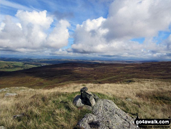
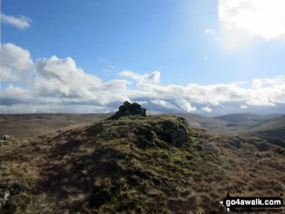
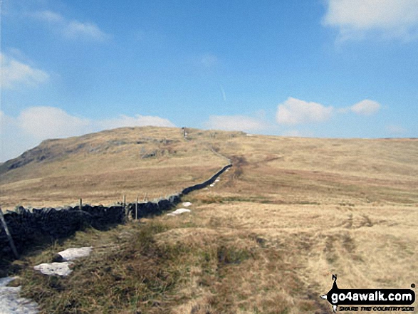
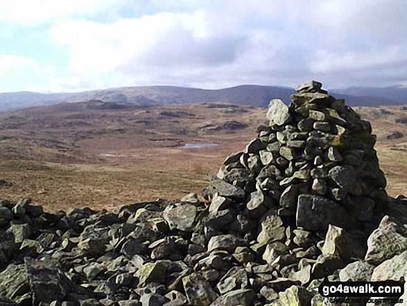
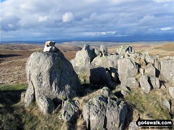
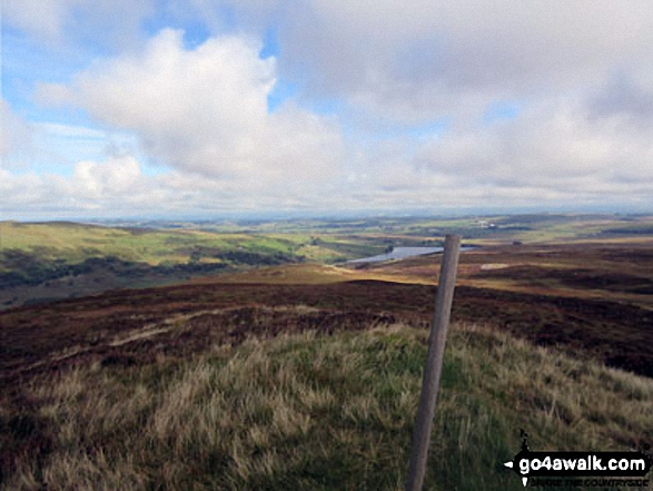
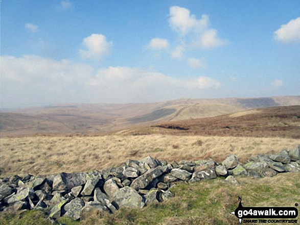
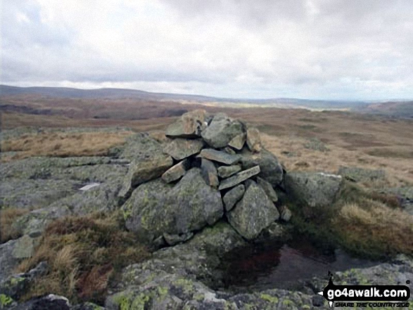
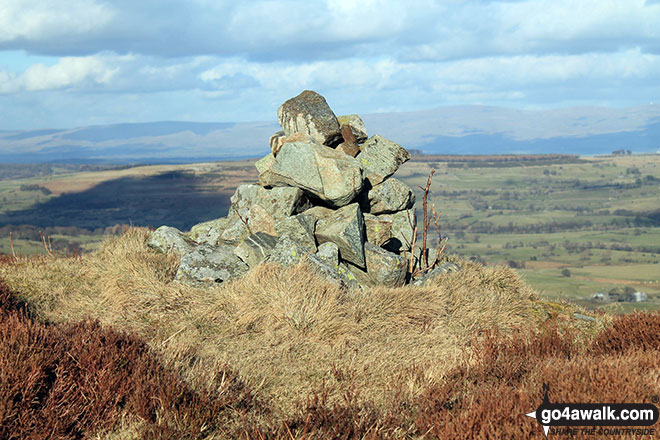
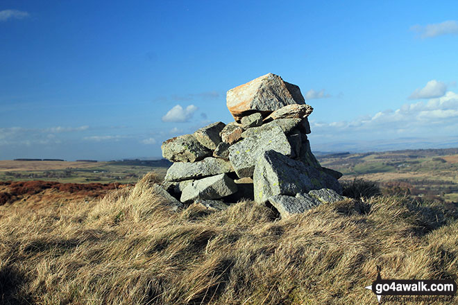
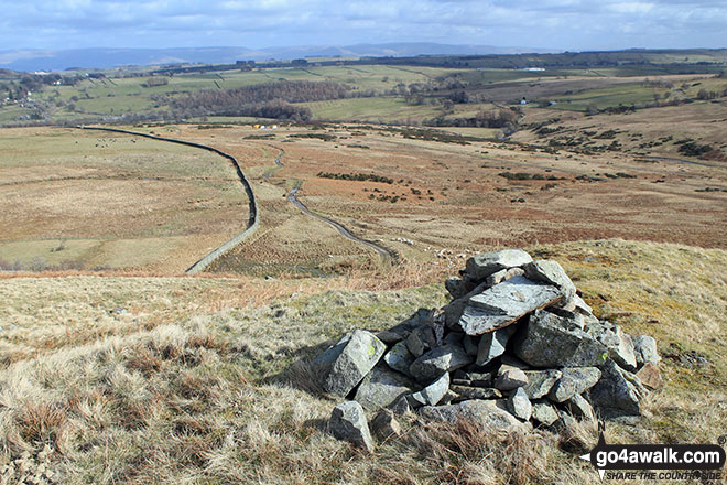
 The summit of Great Yarlside in The Far Eastern Marches area of The Lake District
Photo: Paul Gibson
Is there a Mountain, Peak, Top or Hill missing from the above google map or list?
Let us know an we will add it to our database.
To contribute to go4awalk.com or to contact us about anything at all - see Talk To Us.
For help see Help.
go4awalk.com and go4awalk.co.uk are registered trademarks of TMDH Limited.
Copyright © 2000-2025 TMDH Limited. All rights reserved.
Copyright Terms & Conditions Privacy Statement
A - Z Walks Home Log On/Accounts Photo Gallery Walk Ideas and Collections Fell Facts Hill Skills Walking Questions and Answers Your Stories News Competitions Product Reviews/Gear Tests Walking Gear Guides Peaks and Mountains Peak Bagging Find New Walking Friends Camping GPS Waypoints for Walking Contents Walk Search Talk To Us go4awalk.com Help Free Example Walks Newsletter


