All The Mountains, Peaks, Tops and Hills in Scottish Region : as a detailed list

The Cairngorms National Park is located in North East Scotland covering parts of Aberdeenshire, Moray, Highland, Angus and Perth and Kinross.

If you count only the Munros there are 51 tops to climb, bag & conquer and the highest point is Ben Macdui (Beinn MacDuibh) at 1,309m (4,296ft).

munro
51/0
Munros

corbett
26/0
Corbetts

graham
12/0
Grahams

donald
0/0
Donalds

murdo
86/0
Murdos

marilyn
78/0
Scottish
Marilyns

Bridget
8/0
Scottish
Bridgets

Trig Point
35/0
Trig
Points


To see all Mountains, Peaks, Tops and Hills displayed in different ways - see the options in the left-hand column and towards the bottom of this page.


LOG ON and RELOAD this page to show which Mountains, Peaks, Tops and Hills you have already climbed, bagged & conquered [. . . more]


Page 1 of 2    Go to page: 1 2


See this list in: Alphabetical Order | Height Order
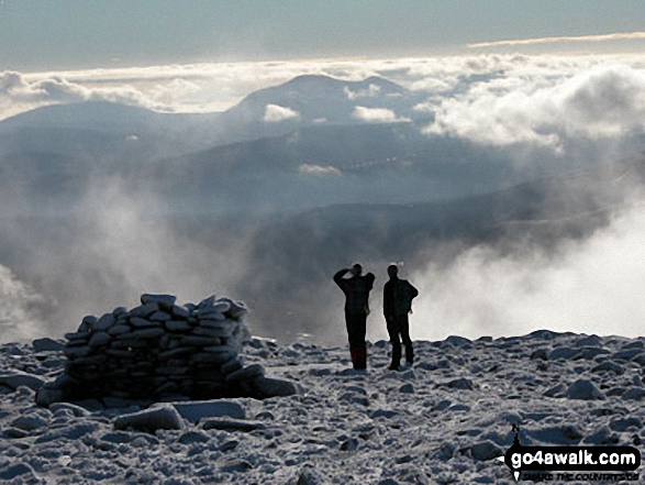
To reverse the order select the link again.


Mountain, Peak, Top or Hill:

Bagged


1. Ben Macdui (Beinn MacDuibh)

1,309m (4,296ft)

  • Munro (No. 2)
  • Murdo (2nd)
  • Marilyn (2nd in Scotland, 2nd in GB)
  • OS Trig Point

  • We hope to have walks that climb & bag Ben Macdui (Beinn MacDuibh) very soon

    Google Maps Icon
    See the location of Ben Macdui (Beinn MacDuibh) and walks up it on a google Map

    Ben Macdui (Beinn MacDuibh) is on interactive maps:

  • OS Explorer (Orange Covers): OL57
  • OS Landranger (Pink Covers): 36 and 43

  • A go4awalk.com Peak Bagging Map and Hill Tick List featuring Ben Macdui (Beinn MacDuibh) will be available soon.


    2. Braeriach (Braigh Riabhach)

    1,296m (4,253ft)

  • Munro (No. 3)
  • Murdo (3rd)
  • Marilyn (3rd in Scotland, 3rd in GB)

  • We hope to have walks that climb & bag Braeriach (Braigh Riabhach) very soon

    Google Maps Icon
    See the location of Braeriach (Braigh Riabhach) and walks up it on a google Map

    Braeriach (Braigh Riabhach) is on interactive maps:

  • OS Explorer (Orange Covers): OL57
  • OS Landranger (Pink Covers): 36 and 43

  • A go4awalk.com Peak Bagging Map and Hill Tick List featuring Braeriach (Braigh Riabhach) will be available soon.


    3. Cairn Toul (Carn an t-Sabhail)

    1,291m (4,237ft)

  • Munro (No. 4)
  • Murdo (4th)
  • Marilyn (4th in Scotland, 4th in GB)

  • To walk, climb & bag Cairn Toul (Carn an t-Sabhail) use this easy to follow walk:

    Google Maps Icon
    See the location of Cairn Toul (Carn an t-Sabhail) and walks up it on a google Map

    Cairn Toul (Carn an t-Sabhail) is on interactive maps:

  • OS Explorer (Orange Covers): OL57
  • OS Landranger (Pink Covers): 36 and 43

  • A go4awalk.com Peak Bagging Map and Hill Tick List featuring Cairn Toul (Carn an t-Sabhail) will be available soon.


    4. Sgor an Lochain Uaine (The Angel's Peak)

    1,258m (4,129ft)

  • Munro (No. 5)
  • Murdo (6th)

  • To walk, climb & bag Sgor an Lochain Uaine (The Angel's Peak) use this easy to follow walk:

    Google Maps Icon
    See the location of Sgor an Lochain Uaine (The Angel's Peak) and walks up it on a google Map

    Sgor an Lochain Uaine (The Angel's Peak) is on interactive maps:

  • OS Explorer (Orange Covers): OL57
  • OS Landranger (Pink Covers): 36

  • A go4awalk.com Peak Bagging Map and Hill Tick List featuring Sgor an Lochain Uaine (The Angel's Peak) will be available soon.


    5. Cairn Gorm (Cairngorms)

    1,244m (4,082ft)

  • Munro (No. 6)
  • Murdo (7th)

  • To walk, climb & bag Cairn Gorm (Cairngorms) use either of these easy to follow walks:

    Google Maps Icon
    See the location of Cairn Gorm (Cairngorms) and walks up it on a google Map

    Cairn Gorm (Cairngorms) is on interactive maps:

  • OS Explorer (Orange Covers): OL57
  • OS Landranger (Pink Covers): 36

  • A go4awalk.com Peak Bagging Map and Hill Tick List featuring Cairn Gorm (Cairngorms) will be available soon.


    6. Beinn a' Bhuird (North Top)

    1,197m (3,929ft)

  • Munro (No. 11)
  • Murdo (15th)
  • Marilyn (8th in Scotland, 8th in GB)

  • We hope to have walks that climb & bag Beinn a' Bhuird (North Top) very soon

    Google Maps Icon
    See the location of Beinn a' Bhuird (North Top) and walks up it on a google Map

    Beinn a' Bhuird (North Top) is on interactive maps:

  • OS Explorer (Orange Covers): OL58
  • OS Landranger (Pink Covers): 36

  • A go4awalk.com Peak Bagging Map and Hill Tick List featuring Beinn a' Bhuird (North Top) will be available soon.


    7. Beinn Mheadhoin (Cairngorms)

    1,182m (3,879ft)

  • Munro (No. 13)
  • Murdo (18th)
  • Marilyn (10th in Scotland, 10th in GB)

  • We hope to have walks that climb & bag Beinn Mheadhoin (Cairngorms) very soon

    Google Maps Icon
    See the location of Beinn Mheadhoin (Cairngorms) and walks up it on a google Map

    Beinn Mheadhoin (Cairngorms) is on interactive maps:

  • OS Explorer (Orange Covers): OL57
  • OS Landranger (Pink Covers): 36

  • A go4awalk.com Peak Bagging Map and Hill Tick List featuring Beinn Mheadhoin (Cairngorms) will be available soon.


    8. Ben Avon (Leabaidh an Daimh Bhuidhe)

    1,171m (3,843ft)

  • Munro (No. 17)
  • Murdo (25th)
  • Marilyn (13th in Scotland, 13th in GB)

  • We hope to have walks that climb & bag Ben Avon (Leabaidh an Daimh Bhuidhe) very soon

    Google Maps Icon
    See the location of Ben Avon (Leabaidh an Daimh Bhuidhe) and walks up it on a google Map

    Ben Avon (Leabaidh an Daimh Bhuidhe) is on interactive maps:

  • OS Explorer (Orange Covers): OL58
  • OS Landranger (Pink Covers): 36

  • A go4awalk.com Peak Bagging Map and Hill Tick List featuring Ben Avon (Leabaidh an Daimh Bhuidhe) will be available soon.


    9. Beinn Bhrotain

    1,157m (3,797ft)

  • Munro (No. 19)
  • Murdo (27th)
  • Marilyn (15th in Scotland, 15th in GB)
  • OS Trig Point

  • To walk, climb & bag Beinn Bhrotain use this easy to follow walk:

    Google Maps Icon
    See the location of Beinn Bhrotain and walks up it on a google Map

    Beinn Bhrotain is on interactive maps:

  • OS Explorer (Orange Covers): OL57
  • OS Landranger (Pink Covers): 43

  • A go4awalk.com Peak Bagging Map and Hill Tick List featuring Beinn Bhrotain will be available soon.


    10. Derry Cairngorm

    1,155m (3,791ft)

  • Munro (No. 21)
  • Murdo (29th)

  • We hope to have walks that climb & bag Derry Cairngorm very soon

    Google Maps Icon
    See the location of Derry Cairngorm and walks up it on a google Map

    Derry Cairngorm is on interactive maps:

  • OS Explorer (Orange Covers): OL57
  • OS Landranger (Pink Covers): 36 and 43

  • A go4awalk.com Peak Bagging Map and Hill Tick List featuring Derry Cairngorm will be available soon.


    11. Lochnagar (Cac Carn Beag)

    1,155m (3,791ft)

  • Munro (No. 20)
  • Murdo (28th)
  • Marilyn (16th in Scotland, 16th in GB)
  • OS Trig Point

  • We hope to have walks that climb & bag Lochnagar (Cac Carn Beag) very soon

    Google Maps Icon
    See the location of Lochnagar (Cac Carn Beag) and walks up it on a google Map

    Lochnagar (Cac Carn Beag) is on interactive maps:

  • OS Explorer (Orange Covers): OL53
  • OS Landranger (Pink Covers): 44

  • A go4awalk.com Peak Bagging Map and Hill Tick List featuring Lochnagar (Cac Carn Beag) will be available soon.


    12. Beinn a' Ghlo (Carn nan Gabhar)

    1,121m (3,679ft)

  • Munro (No. 33)
  • Murdo (45th)
  • Marilyn (28th in Scotland, 28th in GB)
  • OS Trig Point

  • We hope to have walks that climb & bag Beinn a' Ghlo (Carn nan Gabhar) very soon

    Google Maps Icon
    See the location of Beinn a' Ghlo (Carn nan Gabhar) and walks up it on a google Map

    Beinn a' Ghlo (Carn nan Gabhar) is on interactive maps:

  • OS Explorer (Orange Covers): OL51
  • OS Landranger (Pink Covers): 43

  • A go4awalk.com Peak Bagging Map and Hill Tick List featuring Beinn a' Ghlo (Carn nan Gabhar) will be available soon.


    13. Sgor Gaoith

    1,118m (3,669ft)

  • Munro (No. 35)
  • Murdo (47th)
  • Marilyn (30th in Scotland, 30th in GB)

  • We hope to have walks that climb & bag Sgor Gaoith very soon

    Google Maps Icon
    See the location of Sgor Gaoith and walks up it on a google Map

    Sgor Gaoith is on interactive maps:

  • OS Explorer (Orange Covers): OL57
  • OS Landranger (Pink Covers): 36 and 43

  • A go4awalk.com Peak Bagging Map and Hill Tick List featuring Sgor Gaoith will be available soon.


    14. Monadh Mor

    1,113m (3,653ft)

  • Munro (No. 40)
  • Murdo (53rd)

  • To walk, climb & bag Monadh Mor use this easy to follow walk:

    Google Maps Icon
    See the location of Monadh Mor and walks up it on a google Map

    Monadh Mor is on interactive maps:

  • OS Explorer (Orange Covers): OL57
  • OS Landranger (Pink Covers): 36

  • A go4awalk.com Peak Bagging Map and Hill Tick List featuring Monadh Mor will be available soon.


    15. Carn a' Choire Boidheach

    1,110m (3,643ft)

  • Munro (No. 43)
  • Murdo (57th)

  • We hope to have walks that climb & bag Carn a' Choire Boidheach very soon

    Google Maps Icon
    See the location of Carn a' Choire Boidheach and walks up it on a google Map

    Carn a' Choire Boidheach is on interactive maps:

  • OS Explorer (Orange Covers): OL53
  • OS Landranger (Pink Covers): 44

  • A go4awalk.com Peak Bagging Map and Hill Tick List featuring Carn a' Choire Boidheach will be available soon.


    16. Bynack More

    1,090m (3,577ft)

  • Munro (No. 54)
  • Murdo (74th)
  • Marilyn (40th in Scotland, 40th in GB)

  • To walk, climb & bag Bynack More use this easy to follow walk:

    Google Maps Icon
    See the location of Bynack More and walks up it on a google Map

    Bynack More is on interactive maps:

  • OS Explorer (Orange Covers): OL57 and OL58
  • OS Landranger (Pink Covers): 36

  • A go4awalk.com Peak Bagging Map and Hill Tick List featuring Bynack More will be available soon.


    17. Beinn a' Chaorainn (Cairngorms)

    1,083m (3,554ft)

  • Munro (No. 58)
  • Murdo (78th)
  • Marilyn (44th in Scotland, 45th in GB)

  • We hope to have walks that climb & bag Beinn a' Chaorainn (Cairngorms) very soon

    Google Maps Icon
    See the location of Beinn a' Chaorainn (Cairngorms) and walks up it on a google Map

    Beinn a' Chaorainn (Cairngorms) is on interactive maps:

  • OS Explorer (Orange Covers): OL57 and OL58
  • OS Landranger (Pink Covers): 36

  • A go4awalk.com Peak Bagging Map and Hill Tick List featuring Beinn a' Chaorainn (Cairngorms) will be available soon.


    18. Braigh Coire Chruinn-bhalgain

    1,070m (3,512ft)

  • Munro (No. 66)
  • Murdo (91st)
  • Marilyn (51st in Scotland, 52nd in GB)

  • We hope to have walks that climb & bag Braigh Coire Chruinn-bhalgain very soon

    Google Maps Icon
    See the location of Braigh Coire Chruinn-bhalgain and walks up it on a google Map

    Braigh Coire Chruinn-bhalgain is on interactive maps:

  • OS Explorer (Orange Covers): OL51
  • OS Landranger (Pink Covers): 43

  • A go4awalk.com Peak Bagging Map and Hill Tick List featuring Braigh Coire Chruinn-bhalgain will be available soon.


    19. Glas Maol

    1,068m (3,505ft)

  • Munro (No. 69)
  • Murdo (94th)
  • Marilyn (54th in Scotland, 55th in GB)
  • OS Trig Point

  • We hope to have walks that climb & bag Glas Maol very soon

    Google Maps Icon
    See the location of Glas Maol and walks up it on a google Map

    Glas Maol is on interactive maps:

  • OS Explorer (Orange Covers): OL52
  • OS Landranger (Pink Covers): 43

  • A go4awalk.com Peak Bagging Map and Hill Tick List featuring Glas Maol will be available soon.


    20. Cairn of Claise

    1,064m (3,492ft)

  • Munro (No. 71)
  • Murdo (97th)

  • We hope to have walks that climb & bag Cairn of Claise very soon

    Google Maps Icon
    See the location of Cairn of Claise and walks up it on a google Map

    Cairn of Claise is on interactive maps:

  • OS Explorer (Orange Covers): OL52 and OL53
  • OS Landranger (Pink Covers): 43

  • A go4awalk.com Peak Bagging Map and Hill Tick List featuring Cairn of Claise will be available soon.


    21. Glas Tulaichean

    1,051m (3,449ft)

  • Munro (No. 79)
  • Murdo (108th)
  • Marilyn (60th in Scotland, 62nd in GB)
  • OS Trig Point

  • We hope to have walks that climb & bag Glas Tulaichean very soon

    Google Maps Icon
    See the location of Glas Tulaichean and walks up it on a google Map

    Glas Tulaichean is on interactive maps:

  • OS Explorer (Orange Covers): OL52
  • OS Landranger (Pink Covers): 43

  • A go4awalk.com Peak Bagging Map and Hill Tick List featuring Glas Tulaichean will be available soon.


    22. Carn an t-Sagairt Mor

    1,047m (3,436ft)

  • Munro (No. 84)
  • Murdo (114th)

  • We hope to have walks that climb & bag Carn an t-Sagairt Mor very soon

    Google Maps Icon
    See the location of Carn an t-Sagairt Mor and walks up it on a google Map

    Carn an t-Sagairt Mor is on interactive maps:

  • OS Explorer (Orange Covers): OL53
  • OS Landranger (Pink Covers): 44

  • A go4awalk.com Peak Bagging Map and Hill Tick List featuring Carn an t-Sagairt Mor will be available soon.


    23. Beinn Iutharn Mhor

    1,045m (3,430ft)

  • Munro (No. 88)
  • Murdo (120th)
  • Marilyn (67th in Scotland, 69th in GB)

  • We hope to have walks that climb & bag Beinn Iutharn Mhor very soon

    Google Maps Icon
    See the location of Beinn Iutharn Mhor and walks up it on a google Map

    Beinn Iutharn Mhor is on interactive maps:

  • OS Explorer (Orange Covers): OL52
  • OS Landranger (Pink Covers): 43

  • A go4awalk.com Peak Bagging Map and Hill Tick List featuring Beinn Iutharn Mhor will be available soon.


    24. Carn a' Mhaim

    1,037m (3,403ft)

  • Munro (No. 95)
  • Murdo (132nd)
  • Marilyn (74th in Scotland, 76th in GB)

  • We hope to have walks that climb & bag Carn a' Mhaim very soon

    Google Maps Icon
    See the location of Carn a' Mhaim and walks up it on a google Map

    Carn a' Mhaim is on interactive maps:

  • OS Explorer (Orange Covers): OL57
  • OS Landranger (Pink Covers): 36 and 43

  • A go4awalk.com Peak Bagging Map and Hill Tick List featuring Carn a' Mhaim will be available soon.


    25. Carn an Righ

    1,029m (3,377ft)

  • Munro (No. 103)
  • Murdo (142nd)
  • Marilyn (81st in Scotland, 83rd in GB)

  • We hope to have walks that climb & bag Carn an Righ very soon

    Google Maps Icon
    See the location of Carn an Righ and walks up it on a google Map

    Carn an Righ is on interactive maps:

  • OS Explorer (Orange Covers): OL52
  • OS Landranger (Pink Covers): 43

  • A go4awalk.com Peak Bagging Map and Hill Tick List featuring Carn an Righ will be available soon.


    26. Carn an Tuirc

    1,019m (3,344ft)

  • Munro (No. 113)
  • Murdo (157th)

  • We hope to have walks that climb & bag Carn an Tuirc very soon

    Google Maps Icon
    See the location of Carn an Tuirc and walks up it on a google Map

    Carn an Tuirc is on interactive maps:

  • OS Explorer (Orange Covers): OL52 and OL53
  • OS Landranger (Pink Covers): 43

  • A go4awalk.com Peak Bagging Map and Hill Tick List featuring Carn an Tuirc will be available soon.


    27. Mullach Clach a' Bhlair

    1,019m (3,344ft)

  • Munro (No. 114)
  • Murdo (158th)

  • We hope to have walks that climb & bag Mullach Clach a' Bhlair very soon

    Google Maps Icon
    See the location of Mullach Clach a' Bhlair and walks up it on a google Map

    Mullach Clach a' Bhlair is on interactive maps:

  • OS Explorer (Orange Covers): OL57
  • OS Landranger (Pink Covers): 35 and 36

  • A go4awalk.com Peak Bagging Map and Hill Tick List featuring Mullach Clach a' Bhlair will be available soon.


    28. Cairn Bannoch

    1,012m (3,321ft)

  • Munro (No. 117)
  • Murdo (164th)

  • We hope to have walks that climb & bag Cairn Bannoch very soon

    Google Maps Icon
    See the location of Cairn Bannoch and walks up it on a google Map

    Cairn Bannoch is on interactive maps:

  • OS Explorer (Orange Covers): OL53
  • OS Landranger (Pink Covers): 44

  • A go4awalk.com Peak Bagging Map and Hill Tick List featuring Cairn Bannoch will be available soon.


    29. Beinn Dearg (The Tarf and Tilt Hills)

    1,008m (3,308ft)

  • Munro (No. 124)
  • Murdo (174th)
  • Marilyn (100th in Scotland, 102nd in GB)
  • OS Trig Point

  • We hope to have walks that climb & bag Beinn Dearg (The Tarf and Tilt Hills) very soon

    Google Maps Icon
    See the location of Beinn Dearg (The Tarf and Tilt Hills) and walks up it on a google Map

    Beinn Dearg (The Tarf and Tilt Hills) is on interactive maps:

  • OS Explorer (Orange Covers): OL51
  • OS Landranger (Pink Covers): 43

  • A go4awalk.com Peak Bagging Map and Hill Tick List featuring Beinn Dearg (The Tarf and Tilt Hills) will be available soon.


    30. An Sgarsoch

    1,006m (3,302ft)

  • Munro (No. 126)
  • Murdo (178th)
  • Marilyn (101st in Scotland, 103rd in GB)

  • We hope to have walks that climb & bag An Sgarsoch very soon

    Google Maps Icon
    See the location of An Sgarsoch and walks up it on a google Map

    An Sgarsoch is on interactive maps:

  • OS Explorer (Orange Covers): OL51
  • OS Landranger (Pink Covers): 43

  • A go4awalk.com Peak Bagging Map and Hill Tick List featuring An Sgarsoch will be available soon.


    Page 1 of 2    Go to page: 1 2


    View all 144 Mountains, Peaks, Tops and Hills in Scottish Region : The West Mounth - Blair Atholl to Braemar and Blairgowrie:


    Is there a Mountain, Peak, Top or Hill missing from the above google map or list?

    Let us know an we will add it to our database.


    Follow go4awalk.com on Twitter Follow go4awalk.com on Facebook


    Home


    Find new Friends to go walking with

    Walk all 214 Wainwrights in just 59 Walks. Download GPS Waypoints - Great Walks you must not miss!

    Walk The Yorkshire Three Peaks Challenge Walk - All the Latest Route Information, GPS Waypoints and Split Times to keep you on Schedule

    Walk The British Three Peaks Challenge Walk - All the Latest Route Information and GPS Waypoints

    See our pick of The Best Walks in The Lake District - Great Walks you must not miss!

    Walk our pick of the Best Lake District Ridge Walks - Great Walks you must not miss!

    Walk our pick of the Best Lake District Walks to do in the rain - Great Walks you must not miss!

    Walk our pick of The Best Walks in Snowdonia - Great Walks you must not miss!

    Walk our pick of The Best Ridge Walks in Wales - Walks you must not miss!

    Walk our pick of The Best Walks in The Brecon Beacons - Great Walks you must not miss!

    Walk our pick of The Best Walks in The Yorkshire Dales - Walks you must not miss!

    Walk our pick of The Best Walks in The Peak District - Walks you must not miss!

    Walk our pick of The Best Walks in The Forest of Bowland - Walks you must not miss!

    Walk our pick of The Best Walks in Shropshire - Walks you must not miss!

    Walk our pick of The Best Walks in Cheshire - Walks you must not miss!

    Walk our pick of The Best Walks in Lancashire - Walks you must not miss!

    Not sure where to walk next? Try Peak Bagging - Great Walks you must not miss!

    Not sure where to walk next? Walk part of a National Trail - Great Walks you must not miss!

    Walks with Downloadable and Uploadable GPS Waypoint Data

    Walking Kit and Gear Tested by Walkers

    Full Site Search
    Do not miss our pick of the Best Walks in Britain