
![]()
Cairn Toul (Carn an t-Sabhail)
1291m (4237ft)
The Western Cairngorms, The Cairngorm Mountains, The Cairngorms, Aberdeenshire, Scotland
Cairn Toul (Carn an t-Sabhail) means 'Hill of the Barn' .

Not familiar with this top?
You can walk/hike to the top of Cairn Toul (Carn an t-Sabhail) by using this easy‑to‑follow route map:
Walk ad104 The Devil's Point and Cairn Toul from Corrour Bothy, Lairig Ghru
Unsurpassed views, but access is tricky
   |
|---|
Vital Statistics:
| Length: | 11.5ml (18.5km) |
|---|---|
| Ascent: | 4,260ft (1,298m) |
| Time: | 8½ hrs |
| Grade: |  (Hard) (Hard) |

Route Summary:
Corrour Bothy - Lairig Ghru - Allt a' Coire Odhar - Coire Odhar - The Devil's Point - Stob Coire an t-Saighdeir (Cairn Toul) - Cairn Toul (Carn an t-Sabhail) - Coire An an t-Sabhail - Sgor An Lochain Uaine (The Angel's Peak) - Garbh Core Mor - Carn na Criche (Braeriach) - Clais Luinneag - Loch Nan Stuirteng - Allt Clais an t-Sabhail - Allt a' Core Cath Nam Fionn - Glen Geusachan - Geusachan Burn - River Dee - Corrour Bothy - Lairig Ghru.
See Cairn Toul (Carn an t-Sabhail) and the surrounding tops on our free-to-access 'Google Style' Peak Bagging Maps:
The Western Cairngorms area of Scottish Region 8: The Cairngorm Mountains
Less data - quicker to download
Scottish Region 8: The Cairngorm Mountains
Less data - quicker to download
A go4awalk.com downloadable Peak Bagging Map in PDF format featuring Cairn Toul (Carn an t-Sabhail) should be available soon.
Free-to-access Interactive Walk Planning Maps:
1:25,000 scale OS Explorer Map (orange/yellow covers):
1:50,000 scale OS Landranger Maps (pink/magenta covers):
An Interactive Walk Planning Map for OS Landranger 43 Braemar & Blair Atholl is not currently available
 Fellow go4awalkers who have already walked, climbed, scaled, summited, hiked & bagged Cairn Toul (Carn an t-Sabhail)
Christine Shepherd walked up Cairn Toul (Carn an t-Sabhail) on May 29th, 2005 [from/via/route] Walked from Cairn Gorm [with] Graeme, Adam, Miriam, James and Chris [weather] Sleet & snow - It was on this peak that our party split. Three of us opted out of risking Angel peak (Sgor an Lochain Uaine) because we were afraid of corries on the ridge.
Mark Davidson climbed it on June 17th, 2005 [with] MK [weather] Clear on the tops - Wild camped in Lairig Ghru near the bothy for 2 nights after backpacking in from Linn of Dee. Apart from MK's pissy fit over a camera, this was a fantastic day in the high mountains.
Roderick Devall, Paul Booth, Simon Duerden, Ian Simpson, Trevor Williams, Tom Mcewan and Matthew Thomas have all walked, climbed & bagged Cairn Toul (Carn an t-Sabhail).
To add (or remove) your name and experiences on this page - Log On and edit your Personal Mountain Bagging Record
More Photographs & Pictures of views from, on, or of, Cairn Toul (Carn an t-Sabhail)
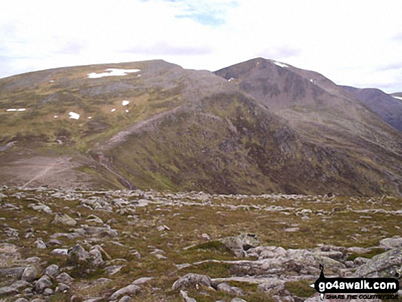
Stob Coire an t-Saighdeir (with Cairn Toul (Carn an t-Sabhail)) beyond) from The Devil's Point

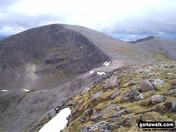
Cairn Toul (Carn an t-Sabhail) and Sgor an Lochain Uaine (The Angel's Peak) from Braeriach (Carn na Criche)

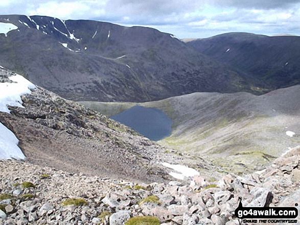
Cairn Toul (Carn an t-Sabhail) from Sgor an Lochain Uaine (The Angel's Peak)

Sgor an Lochain Uaine (The Angel's Peak) from Cairn Toul (Carn an t-Sabhail)
The Falls on Dee, Braeriach (Braigh Riabhach) from Sgor an Lochain Uaine (The Angel's Peak)
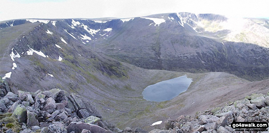
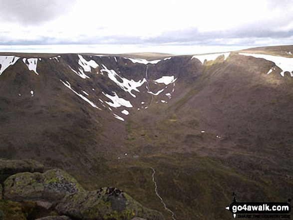
*Sgor an Lochain Uaine (The Angel's Peak), Lochain Uaine and Braeriach (Braigh Riabhach) from Cairn Toul (Carn an t-Sabhail)

*Carn a' Mhaim, Lairig Ghru, The Devil's Point and Stob Coire an t-Saighdeir from Cairn Toul (Carn an t-Sabhail)
Send us your photographs and pictures on, of, or from Cairn Toul (Carn an t-Sabhail)
If you would like to add your walk photographs and pictures to this page, please send them as email attachments (configured for any computer) along with your name to:
and we shall do our best to publish them.
(Guide Resolution = 300dpi. At least = 660pixels (wide) x 440 pixels (high).)

You can also submit photos via our Facebook Page.
NB. Please indicate where each photo was taken and whether you wish us to credit your photos with a Username or your First Name/Last Name.


