
![]()
Beinn Bhrotain
1157m (3797ft)
The Western Cairngorms, The Cairngorm Mountains, The Cairngorms, Aberdeenshire, Scotland
The summit of Beinn Bhrotain is marked by an Ordnance Survey Trig Point.
Not familiar with this top?
   |
|---|
Vital Statistics:
| Length: | 12.75ml (20.5km) |
|---|---|
| Ascent: | 3,243ft (988m) |
| Time: | 8 hrs |
| Grade: |  (Hard) (Hard) |
Route Summary:
Corrour Bothy - Lairig Ghru - River Dee - Glen Dee - Coachan Roibidh - Coire Coachan Roibidh - Beinn Bhrotain (East Top) - Coire an t-Sneachda - Beinn Bhrotain - Core Cath Nam Fionn - Leac Ghorm - Monadh Mor - Allt Luineas - Loch Nan Stuirteng - Allt Clais an t-Sabhail - Allt A`Coire Cath Nam Fionn - Glen Geusachan - Geusachan Burn - River Dee - Corrour Bothy - Lairig Ghru.
See Beinn Bhrotain and the surrounding tops on our free-to-access 'Google Style' Peak Bagging Maps:
The Western Cairngorms area of Scottish Region 8: The Cairngorm Mountains
Less data - quicker to download
Scottish Region 8: The Cairngorm Mountains
Less data - quicker to download
A go4awalk.com downloadable Peak Bagging Map in PDF format featuring Beinn Bhrotain should be available soon.
Free-to-access Interactive Walk Planning Maps:
1:25,000 scale OS Explorer Map (orange/yellow covers):
1:50,000 scale OS Landranger Map (pink/magenta covers):
An Interactive Walk Planning Map for OS Landranger 43 Braemar & Blair Atholl is not currently available
 Fellow go4awalkers who have already walked, climbed, summited & bagged Beinn Bhrotain
Mark Davidson walked up Beinn Bhrotain on June 16th, 2005 [with] MK [weather] Bit Misty on the Top
Simon Duerden and Trevor Williams have both walked, climbed & bagged Beinn Bhrotain.
To add (or remove) your name and experiences on this page - Log On and edit your Personal Mountain Bagging Record
More Photographs & Pictures of views from, on or of Beinn Bhrotain
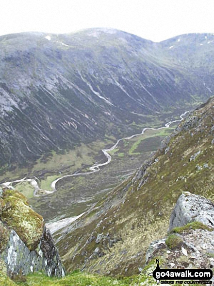
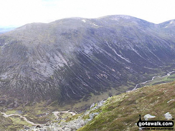
Beinn Bhrotain (left) and Monadh Mor (right) above Glen Geusachan from The Devil's Point
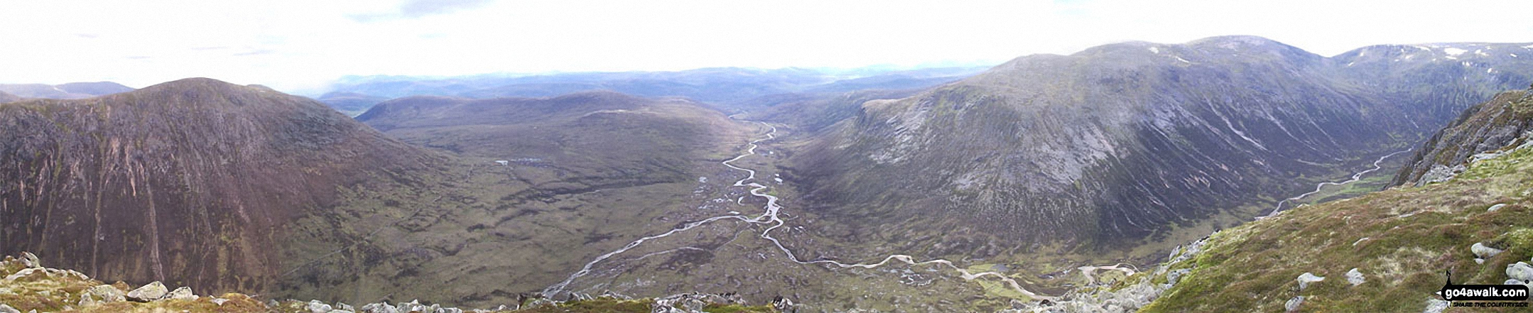
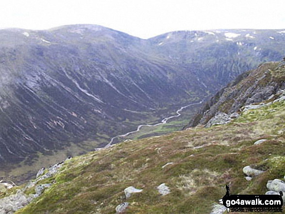
*Carn a' Mhaim, Glen Dee, Beinn Bhrotain, Monadh Mor and Glen Geusachan from The Devil's Point
Send us your photographs and pictures on, of, or from Beinn Bhrotain
If you would like to add your walk photographs and pictures featuring views from, on or of Beinn Bhrotain to this page, please send them as email attachments (configured for any computer) along with your name to:
and we shall do our best to publish them.
(Guide Resolution = 300dpi. At least = 660pixels (wide) x 440 pixels (high).)

You can also submit photos via our Facebook Page.
NB. Please indicate where each photo was taken and whether you wish us to credit your photos with a Username or your First Name/Last Name.
Not familiar with this top?


