Wales - a fully detailed list of all the Mountains, Peaks, Tops and Hills (Page 1 of 7)
Wales is defined as the whole of the principality of Wales which includes the National Parks of Snowdonia,
Bannau Brycheiniog (The Brecon Beacons) and The Pembrokeshire Coast as well as Mynyddoedd Cambria (The Cambrian Mountains), Radnor Forest, Anglesey, The Llynn Peninsula, The Preseli Mountains and The Gower Peninsula.
If you count only the Nuttalls there are 188 tops to climb, bag & conquer and the highest point is Snowdon (Yr Wyddfa) at 1,085m (3,561ft).
To see these Mountains, Peaks, Tops and Hills displayed in different ways - see the options in the left-hand column and towards the bottom of this page.
LOG ON and RELOAD this page to show which Mountains, Peaks, Tops and Hills you have already climbed, bagged & conquered [. . . more details]
Page 1 of 7 Go to page:
1 2 3 4 5 6 7 |
See this list in: Alphabetical Order‡
| Height Order
To reverse the order select the link again.
Mountain, Peak, Top or Hill:
Bagged
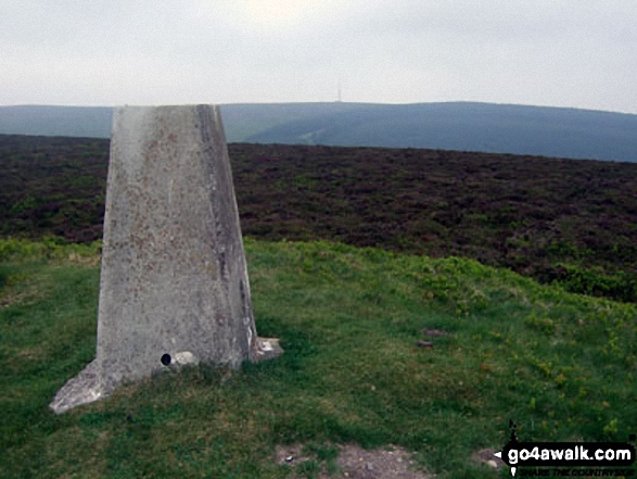
1. Allt Lwyd
654m (2,146ft)
Nuttall (137th in Wales, 324th in England & Wales)
To walk, climb & bag Allt Lwyd use any of these easy-to-follow walks:
See the location of Allt Lwyd and walks up it on a google MapAllt Lwyd is on interactive maps:
OS Explorer (Orange Covers): OL12
OS Landranger (Pink Covers): 160
Allt Lwyd is on downloadable PDF you can Print or Save to your Phone:
|
2. Allt-fawr (Moelwyns)
698m (2,291ft)
Mountain (68th in Wales, 175th in England & Wales)
Nuttall (88th in Wales, 223rd in England & Wales)
Marilyn (34th in Wales, 599th in GB)
To walk, climb & bag Allt-fawr (Moelwyns) use this easy-to-follow walk:
See the location of Allt-fawr (Moelwyns) and walks up it on a google MapAllt-fawr (Moelwyns) is on interactive maps:
OS Explorer (Orange Covers): OL17
OS Landranger (Pink Covers): 115
Allt-fawr (Moelwyns) is on downloadable PDF you can Print or Save to your Phone:
|
3. Aran Benllyn
885m (2,905ft)
Mountain (20th in Wales, 32nd in England & Wales)
Nuttall (22nd in Wales, 37th in England & Wales)
To walk, climb & bag Aran Benllyn use either of these easy-to-follow walks:
See the location of Aran Benllyn and walks up it on a google MapAran Benllyn is on interactive maps:
OS Explorer (Orange Covers): OL23
OS Landranger (Pink Covers): 124
Aran Benllyn is on downloadable PDF you can Print or Save to your Phone:
|
4. Aran Fawddwy
905m (2,970ft)
Mountain (16th in Wales, 23rd in England & Wales)
Nuttall (17th in Wales, 26th in England & Wales)
Marilyn (7th in Wales, 228th in GB)
OS Trig Point
To walk, climb & bag Aran Fawddwy use either of these easy-to-follow walks:
See the location of Aran Fawddwy and walks up it on a google MapAran Fawddwy is on interactive maps:
OS Explorer (Orange Covers): OL23
OS Landranger (Pink Covers): 124
Aran Fawddwy is on downloadable PDF you can Print or Save to your Phone:
|
5. Arenig Fach
689m (2,261ft)
Mountain (73rd in Wales, 184th in England & Wales)
Nuttall (95th in Wales, 239th in England & Wales)
Marilyn (36th in Wales, 613th in GB)
OS Trig Point
To walk, climb & bag Arenig Fach use this easy-to-follow walk:
See the location of Arenig Fach and walks up it on a google MapArenig Fach is on interactive maps:
OS Explorer (Orange Covers): OL18
OS Landranger (Pink Covers): 124 and
125
Arenig Fach is on downloadable PDF you can Print or Save to your Phone:
|
6. Arenig Fawr (Moel Yr Eglwys)
854m (2,802ft)
Mountain (24th in Wales, 46th in England & Wales)
Nuttall (27th in Wales, 53rd in England & Wales)
Marilyn (12th in Wales, 311th in GB)
OS Trig Point
To walk, climb & bag Arenig Fawr (Moel Yr Eglwys) use any of these easy-to-follow walks:
See the location of Arenig Fawr (Moel Yr Eglwys) and walks up it on a google MapArenig Fawr (Moel Yr Eglwys) is on interactive maps:
OS Explorer (Orange Covers): OL18
OS Landranger (Pink Covers): 124 and
125
Arenig Fawr (Moel Yr Eglwys) is on downloadable PDF you can Print or Save to your Phone:
|
7. Arenig Fawr (South Ridge Top)
712m (2,337ft)
Nuttall (81st in Wales, 197th in England & Wales)
To walk, climb & bag Arenig Fawr (South Ridge Top) use either of these easy-to-follow walks:
See the location of Arenig Fawr (South Ridge Top) and walks up it on a google MapArenig Fawr (South Ridge Top) is on interactive maps:
OS Explorer (Orange Covers): OL18 and
OL23
OS Landranger (Pink Covers): 124 and
125
Arenig Fawr (South Ridge Top) is on downloadable PDF you can Print or Save to your Phone:
|
8. Arenig Fawr (South Top)
836m (2,744ft)
Nuttall (29th in Wales, 64th in England & Wales)
To walk, climb & bag Arenig Fawr (South Top) use either of these easy-to-follow walks:
See the location of Arenig Fawr (South Top) and walks up it on a google MapArenig Fawr (South Top) is on interactive maps:
OS Explorer (Orange Covers): OL18
OS Landranger (Pink Covers): 124 and
125
Arenig Fawr (South Top) is on downloadable PDF you can Print or Save to your Phone:
|
9. Bache Hill
610m (2,002ft)
Mountain (133rd in Wales, 311th in England & Wales)
Nuttall (185th in Wales, 434th in England & Wales)
OS Trig Point
To walk, climb & bag Bache Hill use this easy-to-follow walk:
See the location of Bache Hill and walks up it on a google MapBache Hill is on interactive maps:
OS Explorer (Orange Covers): 201
OS Landranger (Pink Covers): 148
A downloadable go4awalk.com PDF Peak Bagging Map featuring Bache Hill will be available soon. |
10. Bera Bach
807m (2,649ft)
Nuttall (41st in Wales, 84th in England & Wales)
To walk, climb & bag Bera Bach use either of these easy-to-follow walks:
See the location of Bera Bach and walks up it on a google MapBera Bach is on interactive maps:
OS Explorer (Orange Covers): OL17
OS Landranger (Pink Covers): 115
Bera Bach is on downloadable PDF you can Print or Save to your Phone:
|
11. Bera Mawr
794m (2,605ft)
Nuttall (48th in Wales, 102nd in England & Wales)
Bera Mawr was demoted as a Welsh Mountain (Hewitt) in 2017 but still retains its status as a Welsh 'Nuttall'
To walk, climb & bag Bera Mawr use either of these easy-to-follow walks:
See the location of Bera Mawr and walks up it on a google MapBera Mawr is on interactive maps:
OS Explorer (Orange Covers): OL17
OS Landranger (Pink Covers): 115
Bera Mawr is on downloadable PDF you can Print or Save to your Phone:
|
12. Black Mixen
650m (2,133ft)
Mountain (103rd in Wales, 248th in England & Wales)
Nuttall (140th in Wales, 332nd in England & Wales)
OS Trig Point
To walk, climb & bag Black Mixen use this easy-to-follow walk:
See the location of Black Mixen and walks up it on a google MapBlack Mixen is on interactive maps:
OS Explorer (Orange Covers): 200
OS Landranger (Pink Covers): 148
A downloadable go4awalk.com PDF Peak Bagging Map featuring Black Mixen will be available soon. |
13. Black Mountain
703m (2,307ft)
Mountain (66th in Wales, 169th in England & Wales)
Nuttall (85th in Wales, 212th in England & Wales)
Marilyn (33rd in Wales, 587th in GB)
Black Mountain straddles the border between England and Wales. Although the actual summit of Black Mountain is in the welsh county of Powys by a couple of metres, the upper NW slope of Black Mountain is the highest point in the english county of Herefordshire.
To walk, climb & bag Black Mountain use either of these easy-to-follow walks:
See the location of Black Mountain and walks up it on a google MapBlack Mountain is on interactive maps:
OS Explorer (Orange Covers): OL13
OS Landranger (Pink Covers): 161
Black Mountain is on downloadable PDF you can Print or Save to your Phone:
|
14. Cadair Berwyn
832m (2,730ft)
Mountain (27th in Wales, 58th in England & Wales)
Nuttall (31st in Wales, 67th in England & Wales)
Marilyn (13th in Wales, 341st in GB)
Cadair Berwyn is the highest point in the county of Denbighshire.
To walk, climb & bag Cadair Berwyn use this easy-to-follow walk:
See the location of Cadair Berwyn and walks up it on a google MapCadair Berwyn is on interactive maps:
OS Explorer (Orange Covers): 255
OS Landranger (Pink Covers): 125
Cadair Berwyn is on downloadable PDF you can Print or Save to your Phone:
|
15. Cadair Berwyn (North Top)
827m (2,714ft)
Nuttall (33rd in Wales, 71st in England & Wales)
OS Trig Point
To walk, climb & bag Cadair Berwyn (North Top) use this easy-to-follow walk:
See the location of Cadair Berwyn (North Top) and walks up it on a google MapCadair Berwyn (North Top) is on interactive maps:
OS Explorer (Orange Covers): 255
OS Landranger (Pink Covers): 125
Cadair Berwyn (North Top) is on downloadable PDF you can Print or Save to your Phone:
|
16. Cadair Bronwen
783m (2,570ft)
Mountain (39th in Wales, 92nd in England & Wales)
Nuttall (50th in Wales, 112th in England & Wales)
To walk, climb & bag Cadair Bronwen use any of these easy-to-follow walks:
See the location of Cadair Bronwen and walks up it on a google MapCadair Bronwen is on interactive maps:
OS Explorer (Orange Covers): 255
OS Landranger (Pink Covers): 125
Cadair Bronwen is on downloadable PDF you can Print or Save to your Phone:
|
17. Cadair Idris (Penygadair)
892m (2,929ft)
Mountain (18th in Wales, 27th in England & Wales)
Nuttall (20th in Wales, 32nd in England & Wales)
Marilyn (9th in Wales, 247th in GB)
OS Trig Point
To walk, climb & bag Cadair Idris (Penygadair) use any of these easy-to-follow walks:
See the location of Cadair Idris (Penygadair) and walks up it on a google MapCadair Idris (Penygadair) is on interactive maps:
OS Explorer (Orange Covers): OL23
OS Landranger (Pink Covers): 124
Cadair Idris (Penygadair) is on downloadable PDF you can Print or Save to your Phone:
|
18. Carnedd Dafydd
1,040m (3,413ft)
Mountain (4th in Wales, 4th in England & Wales)
Nuttall (4th in Wales, 4th in England & Wales)
OS Trig Point
To walk, climb & bag Carnedd Dafydd use either of these easy-to-follow walks:
See the location of Carnedd Dafydd and walks up it on a google MapCarnedd Dafydd is on interactive maps:
OS Explorer (Orange Covers): OL17
OS Landranger (Pink Covers): 115
Carnedd Dafydd is on downloadable PDF you can Print or Save to your Phone:
|
19. Carnedd Gwenllian (Carnedd Uchaf)
926m (3,039ft)
Mountain (12th in Wales, 18th in England & Wales)
Nuttall (13th in Wales, 20th in England & Wales)
Carnedd Gwenllian was formerly known as Carnedd Uchaf (in 2009) and as Garnedd Uchaf prior to that.
We hope to have walks that climb & bag Carnedd Gwenllian (Carnedd Uchaf) very soon
See the location of Carnedd Gwenllian (Carnedd Uchaf) and walks up it on a google MapCarnedd Gwenllian (Carnedd Uchaf) is on interactive maps:
OS Explorer (Orange Covers): OL17
OS Landranger (Pink Covers): 115
Carnedd Gwenllian (Carnedd Uchaf) is on downloadable PDF you can Print or Save to your Phone:
|
20. Carnedd Llechwedd-llyfn
643m (2,110ft)
Nuttall (146th in Wales, 342nd in England & Wales)
We hope to have walks that climb & bag Carnedd Llechwedd-llyfn very soon
See the location of Carnedd Llechwedd-llyfn and walks up it on a google MapCarnedd Llechwedd-llyfn is on interactive maps:
OS Explorer (Orange Covers): OL18
OS Landranger (Pink Covers): 124 and
125
Carnedd Llechwedd-llyfn is on downloadable PDF you can Print or Save to your Phone:
|
21. Carnedd Llewelyn
1,064m (3,492ft)
Mountain (3rd in Wales, 3rd in England & Wales)
Nuttall (3rd in Wales, 3rd in England & Wales)
Marilyn (2nd in Wales, 57th in GB)
Carnedd Llewelyn is the highest point in the county of Conwy.
To walk, climb & bag Carnedd Llewelyn use any of these easy-to-follow walks:
See the location of Carnedd Llewelyn and walks up it on a google MapCarnedd Llewelyn is on interactive maps:
OS Explorer (Orange Covers): OL17
OS Landranger (Pink Covers): 115
Carnedd Llewelyn is on downloadable PDF you can Print or Save to your Phone:
|
22. Carnedd Moel Siabod
872m (2,861ft)
Mountain (21st in Wales, 36th in England & Wales)
Nuttall (23rd in Wales, 41st in England & Wales)
Marilyn (11th in Wales, 281st in GB)
OS Trig Point
To walk, climb & bag Carnedd Moel Siabod use any of these easy-to-follow walks:
See the location of Carnedd Moel Siabod and walks up it on a google MapCarnedd Moel Siabod is on interactive maps:
OS Explorer (Orange Covers): OL17
OS Landranger (Pink Covers): 115
Carnedd Moel Siabod is on downloadable PDF you can Print or Save to your Phone:
|
23. Carnedd y Filiast (Arenigs)
669m (2,195ft)
Mountain (89th in Wales, 217th in England & Wales)
Nuttall (117th in Wales, 287th in England & Wales)
Marilyn (41st in Wales, 652nd in GB)
OS Trig Point
We hope to have walks that climb & bag Carnedd y Filiast (Arenigs) very soon
See the location of Carnedd y Filiast (Arenigs) and walks up it on a google MapCarnedd y Filiast (Arenigs) is on interactive maps:
OS Explorer (Orange Covers): OL18
OS Landranger (Pink Covers): 124 and
125
Carnedd y Filiast (Arenigs) is on downloadable PDF you can Print or Save to your Phone:
|
24. Carnedd y Filiast (Glyderau)
822m (2,698ft)
Mountain (30th in Wales, 64th in England & Wales)
Nuttall (36th in Wales, 75th in England & Wales)
To walk, climb & bag Carnedd y Filiast (Glyderau) use this easy-to-follow walk:
See the location of Carnedd y Filiast (Glyderau) and walks up it on a google MapCarnedd y Filiast (Glyderau) is on interactive maps:
OS Explorer (Orange Covers): OL17
OS Landranger (Pink Covers): 115
Carnedd y Filiast (Glyderau) is on downloadable PDF you can Print or Save to your Phone:
|
25. Carnedd y Filiast (Glyderau) (North Top)
721m (2,366ft)
Nuttall (75th in Wales, 181st in England & Wales)
To walk, climb & bag Carnedd y Filiast (Glyderau) (North Top) use this easy-to-follow walk:
See the location of Carnedd y Filiast (Glyderau) (North Top) and walks up it on a google MapCarnedd y Filiast (Glyderau) (North Top) is on interactive maps:
OS Explorer (Orange Covers): OL17
OS Landranger (Pink Covers): 115
Carnedd y Filiast (Glyderau) (North Top) is on downloadable PDF you can Print or Save to your Phone:
|
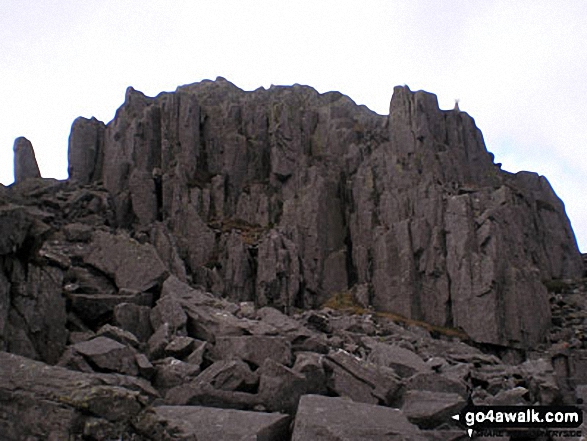
26. Castell y Gwynt (Glyder Fach)
972m (3,190ft)
Nuttall (9th in Wales, 10th in England & Wales)
To walk, climb & bag Castell y Gwynt (Glyder Fach) use any of these easy-to-follow walks:
See the location of Castell y Gwynt (Glyder Fach) and walks up it on a google MapCastell y Gwynt (Glyder Fach) is on interactive maps:
OS Explorer (Orange Covers): OL17
OS Landranger (Pink Covers): 117
Castell y Gwynt (Glyder Fach) is on downloadable PDF you can Print or Save to your Phone:
|
27. Cefn Gwyntog
614m (2,015ft)
Nuttall (179th in Wales, 422nd in England & Wales)
To walk, climb & bag Cefn Gwyntog use either of these easy-to-follow walks:
See the location of Cefn Gwyntog and walks up it on a google MapCefn Gwyntog is on interactive maps:
OS Explorer (Orange Covers): OL23 and
239
OS Landranger (Pink Covers): 125
Cefn Gwyntog is on downloadable PDF you can Print or Save to your Phone:
|
28. Cefn yr Ystrad
617m (2,025ft)
Mountain (126th in Wales, 297th in England & Wales)
Nuttall (175th in Wales, 413th in England & Wales)
Marilyn (51st in Wales, 738th in GB)
OS Trig Point
To walk, climb & bag Cefn yr Ystrad use this easy-to-follow walk:
See the location of Cefn yr Ystrad and walks up it on a google MapCefn yr Ystrad is on interactive maps:
OS Explorer (Orange Covers): OL12
OS Landranger (Pink Covers): 160
Cefn yr Ystrad is on downloadable PDF you can Print or Save to your Phone:
|
29. Chwarel y Fan
679m (2,228ft)
Mountain (86th in Wales, 214th in England & Wales)
Nuttall (107th in Wales, 260th in England & Wales)
Chwarel y Fan is the highest point in the county of Monmouthshire.
To walk, climb & bag Chwarel y Fan use either of these easy-to-follow walks:
See the location of Chwarel y Fan and walks up it on a google MapChwarel y Fan is on interactive maps:
OS Explorer (Orange Covers): OL13
OS Landranger (Pink Covers): 161
Chwarel y Fan is on downloadable PDF you can Print or Save to your Phone:
|
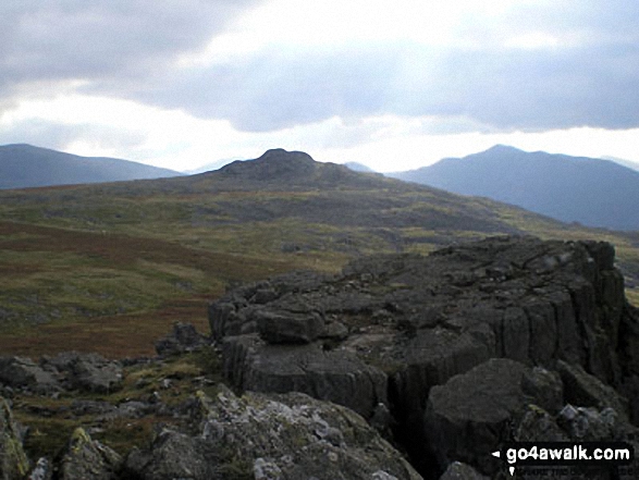
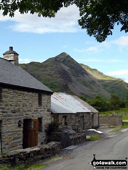
30. Cnicht
689m (2,260ft)
Mountain (74th in Wales, 185th in England & Wales)
Nuttall (96th in Wales, 241st in England & Wales)
Cnicht is often referred to as the Welsh Matterhorn. When viewed from the village of Croesor and the south-west, Cnicht appears to be a perfect pyramid shaped mountain that resembles the Matterhorn on the border between Italy and Switzerland.
To walk, climb & bag Cnicht use any of these easy-to-follow walks:
See the location of Cnicht and walks up it on a google MapCnicht is on interactive maps:
OS Explorer (Orange Covers): OL17
OS Landranger (Pink Covers): 115
Cnicht is on downloadable PDF you can Print or Save to your Phone:
|
Page 1 of 7 Go to page:
1 2 3 4 5 6 7 |
View these 188 Mountains, Peaks, Tops and Hills:
Is there a Mountain, Peak, Top or Hill missing from the above google map or list?
Let us know an we will add it to our database.

 Snowdon (Yr Wyddfa) in The MoelwynsWales


