
![]()
Allt-fawr (Moelwyns)
698m (2291ft)
The Moelwyns, Snowdonia, Conwy/Gwynedd, Wales
Allt-fawr (Moelwyns) means 'High Hill' in Welsh.
The summit of Allt-fawr (Moelwyns) is marked by a rocky outcrop.

Not familiar with this top?
You can walk/hike to the top of Allt-fawr (Moelwyns) by using this easy‑to‑follow route map:
Walk cw115 Allt-fawr, Moel Druman and Ysgafell Wen from Crimea Pass (Bwlch y Gorddinan)
Superb views in glorious solitude
   |
|---|
Vital Statistics:
| Length: | 6.5mls (10.5km) |
|---|---|
| Ascent: | 2,422ft (738m) |
| Time: | 5 hrs |
| Grade: |  (Moderate) (Moderate) |
Route Summary:
Crimea Pass (Bwlch y Gorddinan) - Iwerddon (Allt-fawr) - Allt-fawr (Moelwyns) - Llyn Conglog - Moel Druman - Llyn Coch - Llyn Terfyn - Ysgafell Wen - Ysgafell Wen (North Top) - Llynnau'r Cwn - Ysgafell Wen (Far North Top) - Afon Lledr - Moel Fleiddiau - Moel Lledr - Moel Dyrnogydd - Crimea Pass (Bwlch y Gorddinan)
See Allt-fawr (Moelwyns) and the surrounding tops on our free-to-access 'Google Style' Peak Bagging Maps:
The Moelwyns area of Snowdonia National Park
Less data - quicker to download
The Whole of Snowdonia National Park
More data - might take a little longer to download
See Allt-fawr (Moelwyns) and the surrounding tops on our unique, downloadable, PDF Peak Bagging Map:

NB: Whether you print off a copy or download it to your phone, this PDF Peak Baggers' Map might prove incredibly useful when your are up there on the tops and you cannot get a phone signal.
You can find Allt-fawr (Moelwyns) & all the walks that climb it on these unique free-to-access Interactive Walk Planning Maps:
1:25,000 scale OS Explorer Map (orange/yellow covers):
1:50,000 scale OS Landranger Map (pink/magenta covers):
 Fellow go4awalkers who have already walked, climbed, scaled, summited, hiked & bagged Allt-fawr (Moelwyns)
Daniel Moran walked up Allt-fawr (Moelwyns) on February 18th, 2024 [from/via/route] Carri car park wild walk go for a walk [with] Chel and frankie [weather] Sunny with wind chill - Tough walk, wild walk done 4 summits great views seen a stoat twice
Donovan Suddell climbed it on February 21st, 2023 [from/via/route] Cefn Dddwysarn [with] wife [weather] very very wete - very soggy underfoot & very wet throughout
Mark Davidson bagged it on July 13th, 2011 [from/via/route] Walk cw115 Allt-fawr, Moel Druman & Ysgafell Wen from Crimea Pass (Bwlch y Gorddinan) [with] Alone [weather] Rather cloudy - Quite a lot of walking across rough grass on this one
Christina Lander hiked Allt-fawr (Moelwyns) on July 9th, 2022 [from/via/route] Tanygrisiau - Llyn Cwmorthin - Allt-fawr - Moel Druman - Rhosydd Quarry - down the incline back to Tanygrisiau [with] Dick [weather] Sunny & very warm - Sunny afternoon walk on the way to our holiday cottage in Dolwyddelan, tracks a bit sketchy on the initial ascent to Allt-fawr
Melfyn Parry summited on December 22nd, 2021 [from/via/route] CW115 from Crimea pass [with] DS [weather] Good in the morning, got very wet in the afternoon
To add (or remove) your name and experiences on this page - Log On and edit your Personal Mountain Bagging Record
. . . [see more walk reports]
More Photographs & Pictures of views from, on, or of, Allt-fawr (Moelwyns)
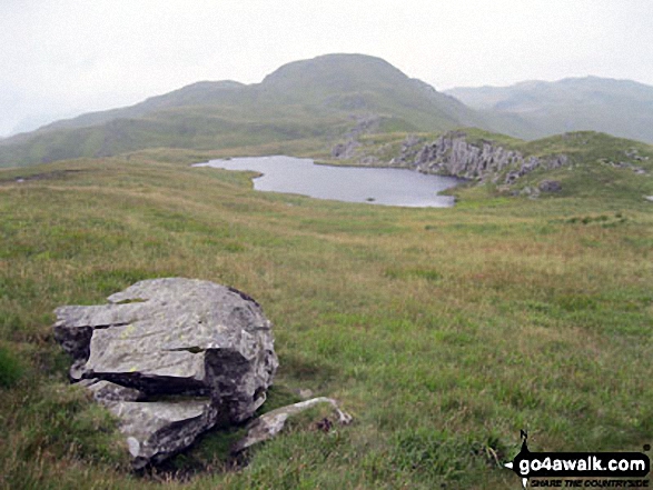
Allt-fawr (Moelwyns) and Iwerddon (Allt-fawr) from Crimea Pass (Bwlch y Gorddinan)

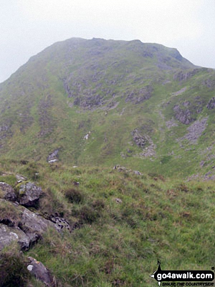
Sheep safely grazing on Allt-fawr (Moelwyns) with Moel Penamnen and Manod Mawr across the valley in the distance

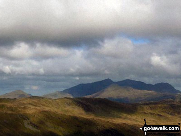
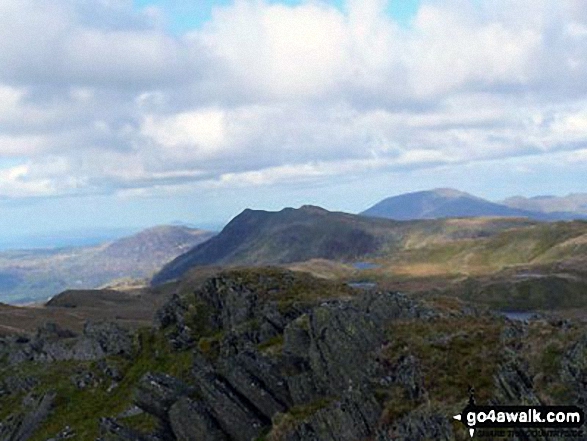
The Snowdon Massif - Yr Aran (far left in sunlight), Snowdon (Yr Wyddfa), Y Lliwedd (in sunlight), Garnedd Ugain (Crib y Ddysgl) and Crib Goch - from Allt-fawr (Moelwyns)
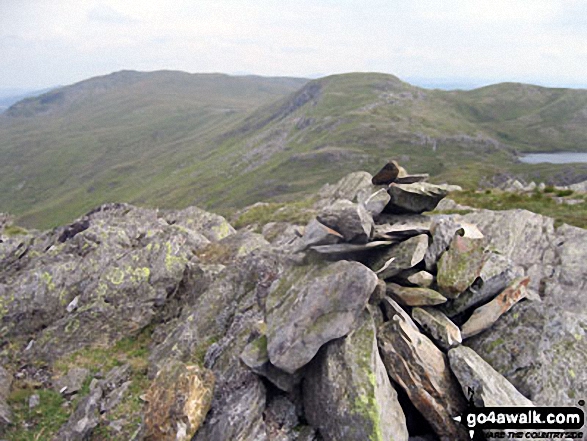

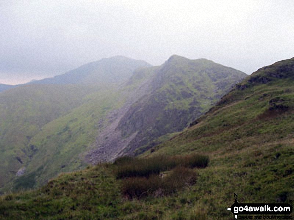
The shoulder of Moelwyn Mawr (left) and Cnicht above Llyn Conlog from Allt-fawr (Moelwyns)

. . . see all 11 walk photographs & pictures of views from, on, or of, Allt-fawr (Moelwyns)
Send us your photographs and pictures on, of, or from Allt-fawr (Moelwyns)
If you would like to add your walk photographs and pictures to this page, please send them as email attachments (configured for any computer) along with your name to:
and we shall do our best to publish them.
(Guide Resolution = 300dpi. At least = 660pixels (wide) x 440 pixels (high).)

You can also submit photos via our Facebook Page.
NB. Please indicate where each photo was taken and whether you wish us to credit your photos with a Username or your First Name/Last Name.


