![]()
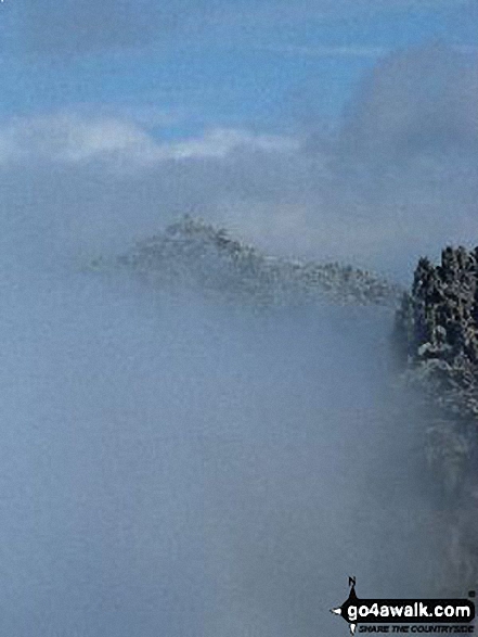
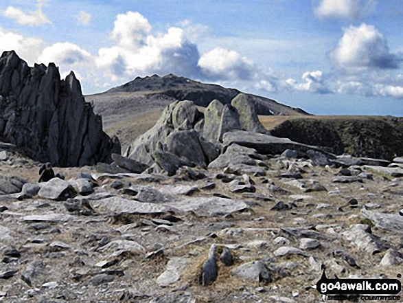
Castell y Gwynt (Glyder Fach)
972m (3190ft)
The Glyders (or Glyderau), Snowdonia, Gwynedd, Wales
Castell y Gwynt (Glyder Fach) means 'Castle of the Wind' in Welsh.
Not familiar with this top?
   |
|---|
Vital Statistics:
| Length: | 5.5ml (9km) |
|---|---|
| Ascent: | 2,854ft (870m) |
| Time: | 5 hrs |
| Grade: |  (Moderate) (Moderate) |
Route Summary:
Llyn Ogwen - Ogwen Cottage - Llyn Bochlwyd - Bwlch Tryfan - Bristly Ridge - The Cantilever Stone - Glyder Fach - Castell y Gwynt (Glyder Fach) - Bwlch y Ddwy-Glyder - Glyder Fawr - Llyn y Cwm - Twll Du (Devil's Kitchen) - Llyn Idwal - Ogwen Cottage - Pont Pen-y-benglog - Llyn Ogwen
|
|---|
Vital Statistics:
| Length: | 7ml (11km) |
|---|---|
| Ascent: | 3,308ft (1,008m) |
| Time: | 6 hrs |
| Grade: | (Moderate) |
Route Summary:
Llyn Ogwen - Ogwen Cottage - 'Tin Pan Alley' - Llyn Glyd - Y Garn (Glyderau) - Llyn y Cwm - Glyder Fawr - Bwlch y Ddwy-Glyder - Castell y Gwynt (Glyder Fach) - Glyder Fach - The Cantilever Stone - Bristly Ridge - Bwlch Tryfan - Llyn Bochlwyd - Ogwen Cottage - Pont Pen-y-benglog - Llyn Ogwen
|
|---|
Vital Statistics:
| Length: | 12.5ml (18.5km) |
|---|---|
| Ascent: | 5,327ft (1,624m) |
| Time: | 9½ hrs |
| Grade: |  (Hard) (Hard) |
Route Summary:
Pen-y-Gwryd Hotel - Llyn Caseg-fraith - Bwlch Tryfan - Tryfan - (Adam and Eve) - Bwlch Tryfan - Glyder Fach - The Cantilever Stone - Castell y Gwynt (Glyder Fach) - Bwlch y Ddwy-Glyder - Glyder Fawr - Y Garn (Glyderau) - Bwlch y Cywion - Foel-goch - Bwlch y Brecan - Bwlch y Marchlyn - Elidir Fawr - Afon Dudodyn - Nant Peris
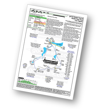
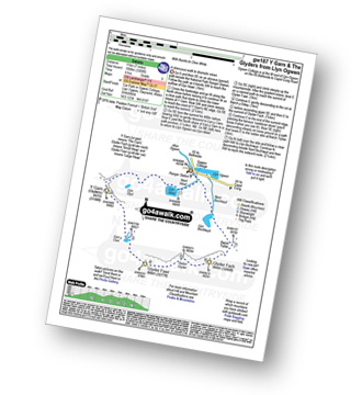
See Castell y Gwynt (Glyder Fach) and the surrounding tops on our free-to-access 'Google Style' Peak Bagging Maps:
The Glyders (or Glyderau) of Snowdonia National Park
Less data - quicker to download
The Whole of Snowdonia National Park
More data - might take a little longer to download
See Castell y Gwynt (Glyder Fach) and the surrounding tops on our downloadable Peak Bagging Map in PDF format:

NB: Whether you print off a copy or download it to your phone, this PDF Peak Baggers' Map might prove incredibly useful when your are up there on the tops and you cannot get a phone signal.
You can find Castell y Gwynt (Glyder Fach) & all the walks that climb it on these unique free-to-access Interactive Walk Planning Maps:
1:25,000 scale OS Explorer Map (orange/yellow covers):
1:50,000 scale OS Landranger Map (pink/magenta covers):
 Fellow go4awalkers who have already walked, climbed, summited & bagged Castell y Gwynt (Glyder Fach)
Melfyn Parry walked up it on March 5th, 2023 [from/via/route] Started walk from free car park on the Conwy side of Pen y Gwryd Hotel, walked past the hotel & veered off the A498 to take the path which runs alongside the A4086 to Pen Y Pass. From here we crossed the road to join a path running behind the YH, this is also known as the red spot route. The path gradually ascends to the summit of Glyder Fawr , from here we continued on to Glyder Fach & then on to Castell y Gwynt. This was the first time I had been in the area when the wind was gentle enough to allow an ascent of Castell y Gwent. From here we continued passed the cantilever to join the Miner's Path which returned us to the A4086 & a short walk back to the car. [with] PRC [weather] Sunny spells & quite warm at times
Adrian Haywood climbed it on April 9th, 2022 [from/via/route] Devil's kitchen [with] Mike, Celia and Darryl [weather] mixed
Mark Smith bagged it on July 9th, 2021 [weather] cloud on summit
Angela Moroney hiked it during 2017 - 2017 3PEAKS
Hugh Strickland summited on September 1st, 2018 [from/via/route] big circuit from Capel Curig
Kevin Williams conquered it on April 21st, 2010 [from/via/route] Start from Llyn Ogwen car park via Devil's kitchen [with] Solo [weather] Sunny, with some snow
Paul Redman scaled it on July 6th, 2014 [from/via/route] Tryfan [with] myself [weather] Windy & Wet
Chris Newham walked up it on November 7th, 2015 [from/via/route] gw115 [with] Craig [weather] Heavey rain all day
Christina Lander climbed it on June 7th, 2015 [from/via/route] Llyn Ogwen - Llyn Idwal - Y Garn - Llyn y Cwn - Glyder Fawr - Glyder Fach - Bwlch Tryfan - Tryfan - Bwlch Tryfan - Llyn Bochlwyd - Llyn Ogwen [with] Dick [weather] Perfect sunny day
Robert Taylor-Marriott bagged it on February 28th, 2010 [from/via/route] Route 7: Glyder Fach & Castell y Glyder via Wetton Gully (GFWG) [with] Vince Wetton and Robert Taylor-Marriott. [weather] Sunny & snow.
To add (or remove) your name and experiences on this page - Log On and edit your Personal Mountain Bagging Record
. . . [see more walk reports]
More Photographs & Pictures of views from, on or of Castell y Gwynt (Glyder Fach)
Send us your photographs and pictures on, of, or from Castell y Gwynt (Glyder Fach)
If you would like to add your walk photographs and pictures to this page, please send them as email attachments (configured for any computer) along with your name to:
and we shall do our best to publish them.
(Guide Resolution = 300dpi. At least = 660pixels (wide) x 440 pixels (high).)

You can also submit photos via our Facebook Page.
NB. Please indicate where each photo was taken and whether you wish us to credit your photos with a Username or your First Name/Last Name.
Not familiar with this top?