The North West region of England - a fully detailed list of all the Mountains, Peaks, Tops and Hills (Page 4 of 16)
The North West region of England comprises the traditional counties of Cheshire, Cumbria, Greater Manchester, Lancashire and Mersyside and includes The Lake District National Park, The Forest of Bowland, parts of The Yorkshire Dales National Park and parts of the Peak District National Park.
If you include all the Mountains (Hewitts), the Deweys, the Nuttalls, the Marilyns, the Bridgets (Hills) and all the Mountains, Tops, Peaks and Hills with a Trig Point on them there are 464 tops to climb, bag & conquer and the highest point is Scafell Pike at 978m (3,210ft).
To see these Mountains, Peaks, Tops and Hills displayed in different ways - see the options in the left-hand column and towards the bottom of this page.
![]() Your Personal Bagging Record for North West of
Your Personal Bagging Record for North West of
LOG ON and RELOAD this page to show which Mountains, Peaks, Tops and Hills you have already climbed, bagged & conquered [. . . more details]
See this list in: Alphabetical Order
| Height Order‡
To reverse the order select the link again.
Mountain, Peak, Top or Hill:
Bagged

![]()
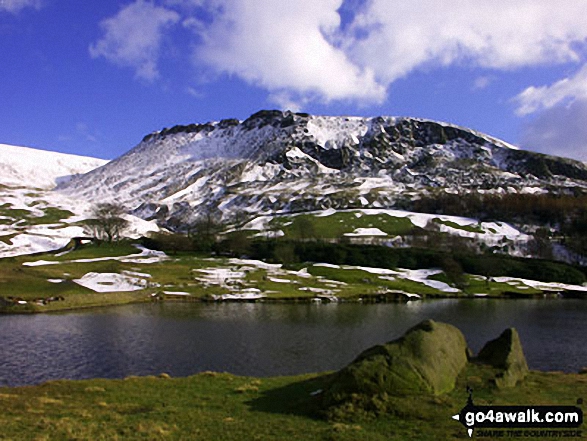
91. Fellbarrow
416m (1,365ft)
Fellbarrow is on interactive maps:
Fellbarrow is on downloadable PDF you can Print or Save to your Phone: *Version including the walk routes marked on it that you need to follow to Walk all 214 Wainwrights in just 59 walks. |

![]()
92. Bull Hill (Holcombe Moor)
418m (1,371ft)
Bull Hill (Holcombe Moor) is on interactive maps:
Bull Hill (Holcombe Moor) is on downloadable PDF you can Print or Save to your Phone: |

![]()
93. Low Fell
423m (1,388ft)
Low Fell is on interactive maps:
Low Fell is on downloadable PDF you can Print or Save to your Phone: *Version including the walk routes marked on it that you need to follow to Walk all 214 Wainwrights in just 59 walks. |
![]()
94. Brunt Knott (Potter Fell)
427m (1,401ft)
Brunt Knott (Potter Fell) is on interactive maps:
A downloadable go4awalk.com PDF Peak Bagging Map featuring Brunt Knott (Potter Fell) will be available soon. |
![]()
95. Hazelhurst Fell (Bleasdale Moors)
429m (1,407ft)
Send it in and we'll publish it here.
Hazelhurst Fell (Bleasdale Moors) is on interactive maps:
Hazelhurst Fell (Bleasdale Moors) is on downloadable PDF you can Print or Save to your Phone: |

![]()
96. Knott (Sedbergh)
429m (1,408ft)
Knott (Sedbergh) is on interactive maps:
Knott (Sedbergh) is on downloadable PDF you can Print or Save to your Phone: |
![]()
97. Crutchenber Fell (Bowland Knotts)
430m (1,411ft)
Crutchenber Fell (Bowland Knotts) is on interactive maps:
Crutchenber Fell (Bowland Knotts) is on downloadable PDF you can Print or Save to your Phone: |
![]()
98. Burn Fell (Forest of Bowland)
431m (1,415ft)
Send it in and we'll publish it here.
Burn Fell (Forest of Bowland) is on interactive maps:
Burn Fell (Forest of Bowland) is on downloadable PDF you can Print or Save to your Phone: |
![]()
99. Parlick
432m (1,418ft)
Parlick is on interactive maps:
Parlick is on downloadable PDF you can Print or Save to your Phone: |
![]()
100. Rough Hill (Shore Moor)
434m (1,424ft)
Rough Hill (Shore Moor) is on interactive maps:
Rough Hill (Shore Moor) is on downloadable PDF you can Print or Save to your Phone: |
![]()
101. Barbon Low Fell
438m (1,437ft)
Barbon Low Fell is on interactive maps:
|
![]()
102. Little Wolf Stones (Keighley Moor)
443m (1,453ft)
Send it in and we'll publish it here.
Little Wolf Stones (Keighley Moor) is on interactive maps:
Little Wolf Stones (Keighley Moor) is on downloadable PDF you can Print or Save to your Phone: |

![]()
103. Binsey
447m (1,467ft)
Binsey is on interactive maps:
Binsey is on downloadable PDF you can Print or Save to your Phone: *Version including the walk routes marked on it that you need to follow to Walk all 214 Wainwrights in just 59 walks. |
![]()
104. Knock Murton (Murton Fell)
447m (1,467ft)
Send it in and we'll publish it here.
Knock Murton (Murton Fell) is on interactive maps:
Knock Murton (Murton Fell) is on downloadable PDF you can Print or Save to your Phone: *Version including the walk routes marked on it that you need to follow to Walk all 214 Wainwrights in just 59 walks. |
![]()
105. Thieveley Pike
449m (1,473ft)
Thieveley Pike is on interactive maps:
Thieveley Pike is on downloadable PDF you can Print or Save to your Phone: |
![]()
106. Great Dove Stone Rocks
450m (1,477ft)
Great Dove Stone Rocks is on interactive maps:
Great Dove Stone Rocks is on downloadable PDF you can Print or Save to your Phone: |
![]()
107. Standedge (Close Moor)
451m (1,480ft)
Send it in and we'll publish it here.
Standedge (Close Moor) is on interactive maps:
Standedge (Close Moor) is on downloadable PDF you can Print or Save to your Phone: |
![]()
108. Ashway Rocks
452m (1,483ft)
Ashway Rocks is on interactive maps:
Ashway Rocks is on downloadable PDF you can Print or Save to your Phone: |
![]()
109. Dick Hill
453m (1,487ft)
Dick Hill is on interactive maps:
Dick Hill is on downloadable PDF you can Print or Save to your Phone: |
![]()
110. Dodd (Whiteside)
454m (1,490ft)
Dodd (Whiteside) is on interactive maps:
Dodd (Whiteside) is on downloadable PDF you can Print or Save to your Phone: *Version including the walk routes marked on it that you need to follow to Walk all 214 Wainwrights in just 59 walks. |
![]()
111. Freeholds Top
455m (1,493ft)
Freeholds Top is on interactive maps:
Freeholds Top is on downloadable PDF you can Print or Save to your Phone: |
![]()
112. Winter Hill (Rivington Moor)
456m (1,497ft)
Winter Hill (Rivington Moor) is on interactive maps:
Winter Hill (Rivington Moor) is on downloadable PDF you can Print or Save to your Phone: |
![]()
113. Crook (Howgills)
461m (1,513ft)
Crook (Howgills) is on interactive maps:
Crook (Howgills) is on downloadable PDF you can Print or Save to your Phone: |
![]()
114. Hannah Moor
463m (1,519ft)
Hannah Moor is on interactive maps:
|
![]()
115. Winterscleugh
464m (1,522ft)
Winterscleugh is on interactive maps:
A downloadable go4awalk.com PDF Peak Bagging Map featuring Winterscleugh will be available soon. |
![]()
116. Knott (Ravenstonedale)
465m (1,526ft)
Send it in and we'll publish it here.
Knott (Ravenstonedale) is on interactive maps:
Knott (Ravenstonedale) is on downloadable PDF you can Print or Save to your Phone: |
![]()
117. Alphin Pike
469m (1,539ft)
Alphin Pike is on interactive maps:
Alphin Pike is on downloadable PDF you can Print or Save to your Phone: |
![]()
118. Ashstead Fell
469m (1,539ft)
Ashstead Fell is on interactive maps:
A downloadable go4awalk.com PDF Peak Bagging Map featuring Ashstead Fell will be available soon. |
![]()
119. Baxton Fell
469m (1,539ft)
Baxton Fell is on interactive maps:
Baxton Fell is on downloadable PDF you can Print or Save to your Phone: |
![]()
120. Lingmoor Fell
469m (1,539ft)
Lingmoor Fell is on interactive maps:
Lingmoor Fell is on downloadable PDF you can Print or Save to your Phone: *Version including the walk routes marked on it that you need to follow to Walk all 214 Wainwrights in just 59 walks. |
View these 464 Mountains, Peaks, Tops and Hills:
- On an Interactive Google Map with a list of tops below it.
(makes it easier to locate a particular top) - On a Detailed List in:
Alphabetical Order | Height Order - On one page with 'yet-to-be-bagged' listed 1st
& then 'already-bagged' tops listed 2nd in:
Alphabetical Order | Height Order - On one page with 'already-bagged' tops listed 1st
& then 'yet-to-be-bagged' tops listed 2nd in:
Alphabetical Order | Height Order
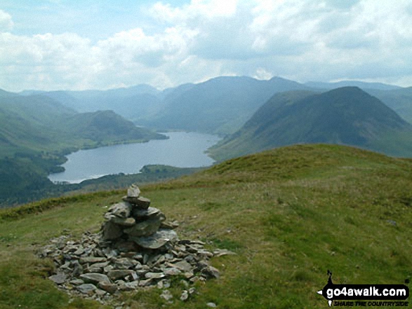
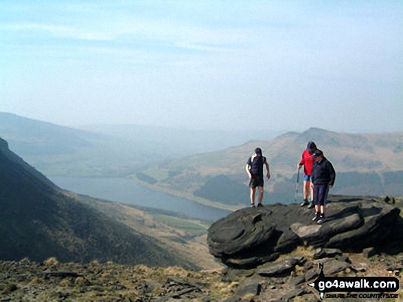
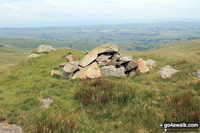
 The view from Scafell Pike in The Southern Fells area of The Lake District
Photo: David Cochrane
Is there a Mountain, Peak, Top or Hill missing from the above google map or list?
Let us know an we will add it to our database.

To contribute to go4awalk.com or to contact us about anything at all - see Talk To Us.
For help see Help.
go4awalk.com and go4awalk.co.uk are registered trademarks of TMDH Limited.
Copyright © 2000-2026 TMDH Limited. All rights reserved.
Copyright Terms & Conditions Privacy Statement
A - Z Walks Home Log On/Accounts Photo Gallery Walk Ideas and Collections Fell Facts Hill Skills Walking Questions and Answers Your Stories News Competitions Product Reviews/Gear Tests Walking Gear Guides Peaks and Mountains Peak Bagging Find New Walking Friends Camping GPS Waypoints for Walking Contents Walk Search Talk To Us go4awalk.com Help Free Example Walks Newsletter


