
![]()
Parlick
432m (1418ft)
The South Pennines and The Forest of Bowland, Lancashire, England
Not familiar with this top?
   |
|---|
Vital Statistics:
| Length: | 6ml (9.5km) |
|---|---|
| Ascent: | 1,279ft (390m) |
| Time: | 3½ hrs |
| Grade: |  (Moderate) (Moderate) |
Route Summary:
Fell Foot (nr Chipping) - Parlick - Blindhurst Fell - Wolf Fell - Paddy's Pole (Fair Snape Fell) - Fair Snape Fell - Saddle Fell - Ward's End - Saddle End Farm - Wolfen Hall - Fell Foot (nr Chipping)
|
|---|
Vital Statistics:
| Length: | 7.75ml (12.5km) |
|---|---|
| Ascent: | 1,538ft (469m) |
| Time: | 4½ hrs |
| Grade: |  (Moderate) (Moderate) |
Route Summary:
Fell Foot (nr Chipping) - Parlick - Blindhurst Fell - Wolf Fell - Paddy's Pole (Fair Snape Fell) - Fair Snape Fell - Holme House Fell - Fiendsdale Head - Holme House Farm - Higher Snape Farm - Fell Foot (nr Chipping)
See Parlick and the surrounding tops on our free-to-access 'Google Style' Peak Bagging Map:
The Forest of Bowland and The South Pennines
Less data - quicker to download
See Parlick and the surrounding tops on our downloadable Peak Bagging Map in PDF format:

NB: Whether you print off a copy or download it to your phone, this PDF Peak Baggers' Map might prove incredibly useful when your are up there on the tops and you cannot get a phone signal.
Free-to-access Interactive Walk Planning Maps:
1:50,000 scale OS Landranger Map (pink/magenta covers):
An Interactive Walk Planning Map for OS Landranger 102 Preston & Blackpool, Lytham St Anne’s is not currently available
 Fellow go4awalkers who have already walked, climbed, summited & bagged Parlick
Adrian Howard walked up Parlick on July 12th, 2010 [from/via/route] From Fell foot. [with] Just me [weather] Very warm & overcast
Patrick Rogozinski has walked, climbed & bagged Parlick.
To add (or remove) your name and experiences on this page - Log On and edit your Personal Mountain Bagging Record
More Photographs & Pictures of views from, on or of Parlick
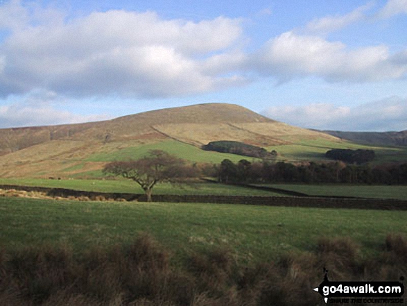
Chipping with Parlick and Paddy's Pole (Fair Snape Fell) beyond from Jeffrey Hill
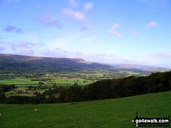
Parlick and Paddy's Pole (Fair Snape Fell) from Longridge Fell (Spire Hill)
Send us your photographs and pictures on, of, or from Parlick
If you would like to add your walk photographs and pictures featuring views from, on or of Parlick to this page, please send them as email attachments (configured for any computer) along with your name to:
and we shall do our best to publish them.
(Guide Resolution = 300dpi. At least = 660pixels (wide) x 440 pixels (high).)

You can also submit photos via our Facebook Page.
NB. Please indicate where each photo was taken and whether you wish us to credit your photos with a Username or your First Name/Last Name.
Not familiar with this top?


