
![]()
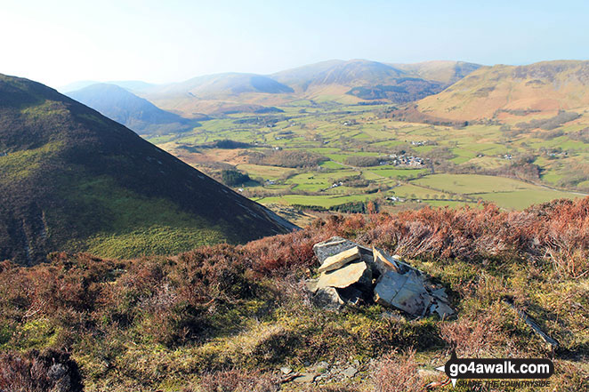
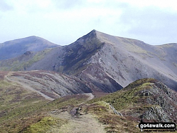
Dodd (Whiteside)
454m (1490ft)
The North Western Fells, The Lake District, Cumbria, England
Not familiar with this top?
You can walk/hike to the top of Dodd (Whiteside) by using this easy‑to‑follow route map:
Walk c209 Hopegill Head from Hopebeck
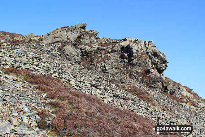
Easy scramble up an exposed ridge
   |
|---|
Vital Statistics:
| Length: | 7.25ml (11.5km) |
|---|---|
| Ascent: | 3,180ft (969m) |
| Time: | 5.75hrs |
| Grade: |  (Moderate) (Moderate) |

Route Summary:
Hopebeck - Hope Beck - Swinside (Whinlatter) - Hope Gill - Ladyside Pike - Hopegill Head - Hobcarton Crag - Grisedale Pike - Hopegill Head - Gasgale Crags - Whiteside (Crummock) - Whiteside (Crummock) (West Top) - Dodd (Whiteside) - Hopebeck
See Dodd (Whiteside) and the surrounding tops on our free-to-access 'Google Style' Peak Bagging Maps:
The North Western Fells of The Lake District National Park
Less data - quicker to download
The Whole of The Lake District National Park
More data - might take a little longer to download
See Dodd (Whiteside) and the surrounding tops on our unique, downloadable, PDF Peak Bagging Maps:

NB: Whether you print off a copy or download it to your phone, these PDF Peak Baggers' Maps might prove incredibly useful when your are up there on the tops and you cannot get a phone signal.
*This version is marked with the walk routes you need to follow to Walk all 214 Wainwrights in just 59 walks.
You can find Dodd (Whiteside) & all the walks that climb it on these unique free-to-access Interactive Walk Planning Maps:
1:25,000 scale OS Explorer Map (orange/yellow covers):
1:50,000 scale OS Landranger Maps (pink/magenta covers):
 Fellow go4awalkers who have already walked, climbed, scaled, summited, hiked & bagged Dodd (Whiteside)
Adrian Howard walked up Dodd (Whiteside) on July 29th, 2024 [from/via/route] Parked near High Swinside Farm - Swinside - Ladyside Pike - Hopegill Head - Sand Hill - Whiteside (East & West tops) - Dodd - Hope Beck - Car.
Mark Davidson climbed it on March 12th, 2014 [with] Alone [weather] Gloriously sunny
Louise Sandwith has walked, climbed & bagged Dodd (Whiteside).
To add (or remove) your name and experiences on this page - Log On and edit your Personal Mountain Bagging Record
More Photographs & Pictures of views from, on, or of, Dodd (Whiteside)


Send us your photographs and pictures on, of, or from Dodd (Whiteside)
If you would like to add your walk photographs and pictures to this page, please send them as email attachments (configured for any computer) along with your name to:
and we shall do our best to publish them.
(Guide Resolution = 300dpi. At least = 660pixels (wide) x 440 pixels (high).)

You can also submit photos via our Facebook Page.
NB. Please indicate where each photo was taken and whether you wish us to credit your photos with a Username or your First Name/Last Name.


