The West Midlands region of England - a fully detailed list of all the Mountains, Peaks, Tops and Hills (Page 2 of 3)
The West Midlands region of England comprises the traditional counties of Herefordshire, Shropshire, Staffordshire, Warwickshire, West Midlands, Worcestershire and parts of the Peak District National Park.
If you include all the Mountains (Hewitts), the Deweys, the Nuttalls, the Marilyns, the Bridgets (Hills) and all the Mountains, Tops, Peaks and Hills with a Trig Point on them there are 176 tops to climb, bag & conquer and the highest point is Black Hill (Craswall) at 641m (2,103ft).
To see these Mountains, Peaks, Tops and Hills displayed in different ways - see the options in the left-hand column and towards the bottom of this page.
LOG ON and RELOAD this page to show which Mountains, Peaks, Tops and Hills you have already climbed, bagged & conquered [. . . more details]
Page 2 of 3 Go to page:
1 2 3 |
See this list in: Alphabetical Order‡
| Height Order
To reverse the order select the link again.
Mountain, Peak, Top or Hill:
Bagged
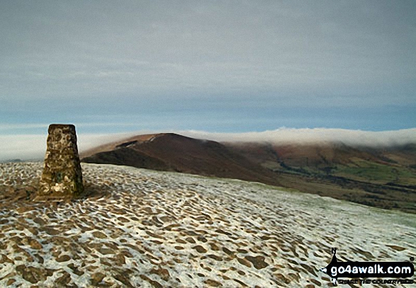
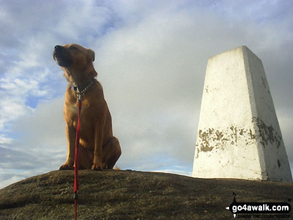
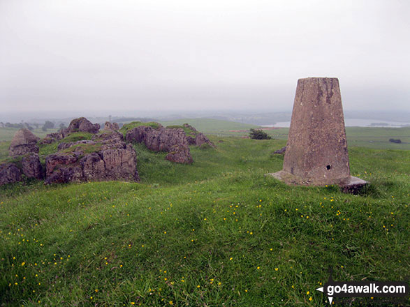
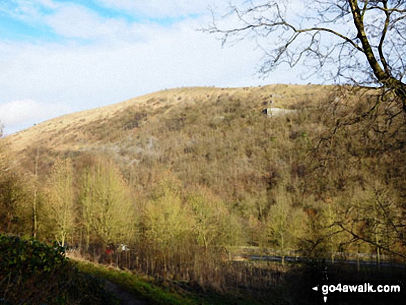
31. Mam Tor
517m (1,696ft)
Dewey (145th in England, 334th in England & Wales)
OS Trig Point
To walk, climb & bag Mam Tor use any of these easy-to-follow walks:
See the location of Mam Tor and walks up it on a google MapMam Tor is on interactive maps:
OS Explorer (Orange Covers): OL1
OS Landranger (Pink Covers): 110
Mam Tor is on downloadable PDF you can Print or Save to your Phone:
|
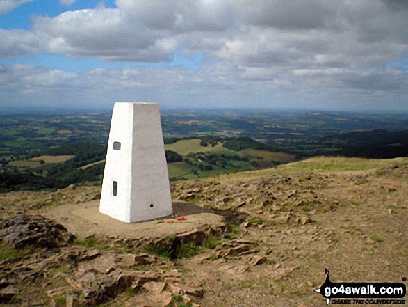
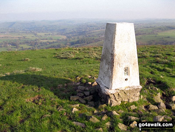
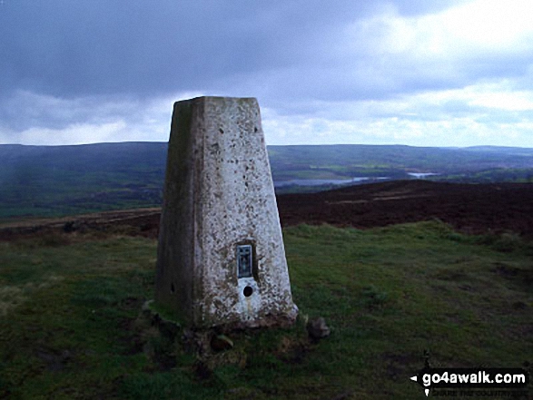
32. Malvern (Worcestershire Beacon)
425m (1,395ft)
Marilyn (93rd in England, 1152nd in GB)
OS Trig Point
Malvern (Worcestershire Beacon) is the highest point in the county of Worcestershire.
To walk, climb & bag Malvern (Worcestershire Beacon) use this easy-to-follow walk:
See the location of Malvern (Worcestershire Beacon) and walks up it on a google MapMalvern (Worcestershire Beacon) is on interactive maps:
OS Explorer (Orange Covers): 190
OS Landranger (Pink Covers): 150
A downloadable go4awalk.com PDF Peak Bagging Map featuring Malvern (Worcestershire Beacon) will be available soon. |
33. Lynchgate (Edgton Hill)
297m (974ft)
Bridget
We hope to have walks that climb & bag Lynchgate (Edgton Hill) very soon
See the location of Lynchgate (Edgton Hill) and walks up it on a google MapLynchgate (Edgton Hill) is on interactive maps:
OS Explorer (Orange Covers): 203 and
216
OS Landranger (Pink Covers): 137
Lynchgate (Edgton Hill) is on downloadable PDF you can Print or Save to your Phone:
|
34. Lordshill
364m (1,194ft)
Bridget
We hope to have walks that climb & bag Lordshill very soon
See the location of Lordshill and walks up it on a google MapLordshill is on interactive maps:
OS Explorer (Orange Covers): 216
OS Landranger (Pink Covers): 126
Lordshill is on downloadable PDF you can Print or Save to your Phone:
|
35. Lord's Seat (Rushup Edge)
546m (1,791ft)
Dewey (80th in England, 184th in England & Wales)
To walk, climb & bag Lord's Seat (Rushup Edge) use any of these easy-to-follow walks:
See the location of Lord's Seat (Rushup Edge) and walks up it on a google MapLord's Seat (Rushup Edge) is on interactive maps:
OS Explorer (Orange Covers): OL1
OS Landranger (Pink Covers): 110
Lord's Seat (Rushup Edge) is on downloadable PDF you can Print or Save to your Phone:
|
36. Longstone Moor
395m (1,296ft)
Bridget
To walk, climb & bag Longstone Moor use either of these easy-to-follow walks:
See the location of Longstone Moor and walks up it on a google MapLongstone Moor is on interactive maps:
OS Explorer (Orange Covers): OL24
OS Landranger (Pink Covers): 119
Longstone Moor is on downloadable PDF you can Print or Save to your Phone:
|
37. Lodge Hill (Causeway Wood)
304m (997ft)
Bridget
OS Trig Point
We hope to have walks that climb & bag Lodge Hill (Causeway Wood) very soon
See the location of Lodge Hill (Causeway Wood) and walks up it on a google MapLodge Hill (Causeway Wood) is on interactive maps:
OS Explorer (Orange Covers): 241
OS Landranger (Pink Covers): 137
Lodge Hill (Causeway Wood) is on downloadable PDF you can Print or Save to your Phone:
|
38. Llanfair Hill
432m (1,417ft)
Bridget
We hope to have walks that climb & bag Llanfair Hill very soon
See the location of Llanfair Hill and walks up it on a google MapLlanfair Hill is on interactive maps:
OS Explorer (Orange Covers): 201
OS Landranger (Pink Covers): 137
Llanfair Hill is on downloadable PDF you can Print or Save to your Phone:
|
39. Little London (Middlehope Hill)
324m (1,063ft)
Bridget
OS Trig Point
We hope to have walks that climb & bag Little London (Middlehope Hill) very soon
See the location of Little London (Middlehope Hill) and walks up it on a google MapLittle London (Middlehope Hill) is on interactive maps:
OS Explorer (Orange Covers): 241
OS Landranger (Pink Covers): 137
Little London (Middlehope Hill) is on downloadable PDF you can Print or Save to your Phone:
|
40. Little Doward
221m (725ft)
Bridget
OS Trig Point
We hope to have walks that climb & bag Little Doward very soon
See the location of Little Doward and walks up it on a google MapLittle Doward is on interactive maps:
OS Explorer (Orange Covers): OL14
OS Landranger (Pink Covers): 162
|
41. Lilywood (Wenlock Edge)
287m (941ft)
Bridget
We hope to have walks that climb & bag Lilywood (Wenlock Edge) very soon
See the location of Lilywood (Wenlock Edge) and walks up it on a google MapLilywood (Wenlock Edge) is on interactive maps:
OS Explorer (Orange Covers): 241
OS Landranger (Pink Covers): 137
Lilywood (Wenlock Edge) is on downloadable PDF you can Print or Save to your Phone:
|
42. Knolls
456m (1,496ft)
Bridget
OS Trig Point
We hope to have walks that climb & bag Knolls very soon
See the location of Knolls and walks up it on a google MapKnolls is on interactive maps:
OS Explorer (Orange Covers): 241
OS Landranger (Pink Covers): 137
Knolls is on downloadable PDF you can Print or Save to your Phone:
|
43. Knoll Hill
287m (941ft)
Bridget
We hope to have walks that climb & bag Knoll Hill very soon
See the location of Knoll Hill and walks up it on a google MapKnoll Hill is on interactive maps:
OS Explorer (Orange Covers): 201
OS Landranger (Pink Covers): 137 and
148 and
149
|
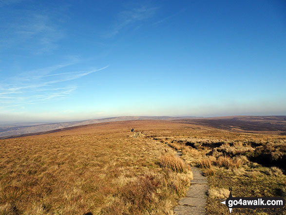
44. Kinder Low (Kinder Scout)
633m (2,078ft)
Bridget
OS Trig Point
To walk, climb & bag Kinder Low (Kinder Scout) use any of these easy-to-follow walks:
See the location of Kinder Low (Kinder Scout) and walks up it on a google MapKinder Low (Kinder Scout) is on interactive maps:
OS Explorer (Orange Covers): OL1
OS Landranger (Pink Covers): 110
Kinder Low (Kinder Scout) is on downloadable PDF you can Print or Save to your Phone:
|
45. Kenslow Knoll
337m (1,106ft)
Bridget
To walk, climb & bag Kenslow Knoll use either of these easy-to-follow walks:
See the location of Kenslow Knoll and walks up it on a google MapKenslow Knoll is on interactive maps:
OS Explorer (Orange Covers): OL24
OS Landranger (Pink Covers): 119
Kenslow Knoll is on downloadable PDF you can Print or Save to your Phone:
|
46. Ilmington Down
261m (856ft)
Bridget
OS Trig Point
Ilmington Down is the highest point in the county of Warwickshire.
We hope to have walks that climb & bag Ilmington Down very soon
See the location of Ilmington Down and walks up it on a google MapIlmington Down is on interactive maps:
OS Explorer (Orange Covers): 205
OS Landranger (Pink Covers): 151
|
47. Huglith Hill
328m (1,076ft)
Bridget
We hope to have walks that climb & bag Huglith Hill very soon
See the location of Huglith Hill and walks up it on a google MapHuglith Hill is on interactive maps:
OS Explorer (Orange Covers): 241
OS Landranger (Pink Covers): 126
Huglith Hill is on downloadable PDF you can Print or Save to your Phone:
|
48. Hopton Titterhill
397m (1,302ft)
Bridget
We hope to have walks that climb & bag Hopton Titterhill very soon
See the location of Hopton Titterhill and walks up it on a google MapHopton Titterhill is on interactive maps:
OS Explorer (Orange Covers): 201
OS Landranger (Pink Covers): 137
Hopton Titterhill is on downloadable PDF you can Print or Save to your Phone:
|
49. Hopesay Hill
284m (932ft)
Bridget
We hope to have walks that climb & bag Hopesay Hill very soon
See the location of Hopesay Hill and walks up it on a google MapHopesay Hill is on interactive maps:
OS Explorer (Orange Covers): 217
OS Landranger (Pink Covers): 137
Hopesay Hill is on downloadable PDF you can Print or Save to your Phone:
|
50. Hope Bowdler Hill
426m (1,398ft)
Bridget
We hope to have walks that climb & bag Hope Bowdler Hill very soon
See the location of Hope Bowdler Hill and walks up it on a google MapHope Bowdler Hill is on interactive maps:
OS Explorer (Orange Covers): 217
OS Landranger (Pink Covers): 137 and
138
Hope Bowdler Hill is on downloadable PDF you can Print or Save to your Phone:
|
51. Hollins Hill
451m (1,480ft)
Bridget
To walk, climb & bag Hollins Hill use this easy-to-follow walk:
See the location of Hollins Hill and walks up it on a google MapHollins Hill is on interactive maps:
OS Explorer (Orange Covers): OL1
OS Landranger (Pink Covers): 119
Hollins Hill is on downloadable PDF you can Print or Save to your Phone:
|
52. Hitter Hill
362m (1,188ft)
Bridget
To walk, climb & bag Hitter Hill use any of these easy-to-follow walks:
See the location of Hitter Hill and walks up it on a google MapHitter Hill is on interactive maps:
OS Explorer (Orange Covers): OL24
OS Landranger (Pink Covers): 119
Hitter Hill is on downloadable PDF you can Print or Save to your Phone:
|
53. Hill House
425m (1,395ft)
Bridget
OS Trig Point
To walk, climb & bag Hill House use this easy-to-follow walk:
See the location of Hill House and walks up it on a google MapHill House is on interactive maps:
OS Explorer (Orange Covers): OL24
OS Landranger (Pink Covers): 119
Hill House is on downloadable PDF you can Print or Save to your Phone:
|
54. Hill End (Cardington)
294m (964ft)
Bridget
We hope to have walks that climb & bag Hill End (Cardington) very soon
See the location of Hill End (Cardington) and walks up it on a google MapHill End (Cardington) is on interactive maps:
OS Explorer (Orange Covers): 241
OS Landranger (Pink Covers): 137
Hill End (Cardington) is on downloadable PDF you can Print or Save to your Phone:
|
55. Higher Shelf Stones
622m (2,041ft)
Nuttall (229th in England, 398th in England & Wales)
OS Trig Point
To walk, climb & bag Higher Shelf Stones use any of these easy-to-follow walks:
See the location of Higher Shelf Stones and walks up it on a google MapHigher Shelf Stones is on interactive maps:
OS Explorer (Orange Covers): OL1
OS Landranger (Pink Covers): 110
Higher Shelf Stones is on downloadable PDF you can Print or Save to your Phone:
|
56. High Vinnalls
375m (1,230ft)
Marilyn (103rd in England, 1258th in GB)
We hope to have walks that climb & bag High Vinnalls very soon
See the location of High Vinnalls and walks up it on a google MapHigh Vinnalls is on interactive maps:
OS Explorer (Orange Covers): 203
OS Landranger (Pink Covers): 137 and
138 and
148
|
57. High Bent (Biddulph Moor)
336m (1,102ft)
Bridget
OS Trig Point
We hope to have walks that climb & bag High Bent (Biddulph Moor) very soon
See the location of High Bent (Biddulph Moor) and walks up it on a google MapHigh Bent (Biddulph Moor) is on interactive maps:
OS Explorer (Orange Covers): OL24
OS Landranger (Pink Covers): 118
High Bent (Biddulph Moor) is on downloadable PDF you can Print or Save to your Phone:
|
58. Higger Tor
434m (1,424ft)
Bridget
To walk, climb & bag Higger Tor use either of these easy-to-follow walks:
See the location of Higger Tor and walks up it on a google MapHigger Tor is on interactive maps:
OS Explorer (Orange Covers): OL1
OS Landranger (Pink Covers): 110
Higger Tor is on downloadable PDF you can Print or Save to your Phone:
|
59. Hergest Ridge
426m (1,398ft)
Marilyn (92nd in England, 1151st in GB)
OS Trig Point
We hope to have walks that climb & bag Hergest Ridge very soon
See the location of Hergest Ridge and walks up it on a google MapHergest Ridge is on interactive maps:
OS Explorer (Orange Covers): 201
OS Landranger (Pink Covers): 148
|
60. Herefordshire Beacon
338m (1,109ft)
Bridget
We hope to have walks that climb & bag Herefordshire Beacon very soon
See the location of Herefordshire Beacon and walks up it on a google MapHerefordshire Beacon is on interactive maps:
OS Explorer (Orange Covers): 190
OS Landranger (Pink Covers): 150
|
61. Helmeth Hill
344m (1,129ft)
Bridget
We hope to have walks that climb & bag Helmeth Hill very soon
See the location of Helmeth Hill and walks up it on a google MapHelmeth Hill is on interactive maps:
OS Explorer (Orange Covers): 241
OS Landranger (Pink Covers): 137
Helmeth Hill is on downloadable PDF you can Print or Save to your Phone:
|
62. Hegdon Hill (Lower Hegdon)
254m (833ft)
Marilyn (152nd in England, 1458th in GB)
OS Trig Point
We hope to have walks that climb & bag Hegdon Hill (Lower Hegdon) very soon
See the location of Hegdon Hill (Lower Hegdon) and walks up it on a google MapHegdon Hill (Lower Hegdon) is on interactive maps:
OS Explorer (Orange Covers): 202
OS Landranger (Pink Covers): 149
|
63. Heath Mynd
452m (1,483ft)
Marilyn (88th in England, 1100th in GB)
OS Trig Point
We hope to have walks that climb & bag Heath Mynd very soon
See the location of Heath Mynd and walks up it on a google MapHeath Mynd is on interactive maps:
OS Explorer (Orange Covers): 216
OS Landranger (Pink Covers): 137
Heath Mynd is on downloadable PDF you can Print or Save to your Phone:
|
64. Hazler Hill
347m (1,138ft)
Bridget
OS Trig Point
We hope to have walks that climb & bag Hazler Hill very soon
See the location of Hazler Hill and walks up it on a google MapHazler Hill is on interactive maps:
OS Explorer (Orange Covers): 241
OS Landranger (Pink Covers): 137
Hazler Hill is on downloadable PDF you can Print or Save to your Phone:
|
65. Hawkstone Hill
208m (682ft)
Bridget
We hope to have walks that climb & bag Hawkstone Hill very soon
See the location of Hawkstone Hill and walks up it on a google MapHawkstone Hill is on interactive maps:
OS Explorer (Orange Covers): 241
OS Landranger (Pink Covers): 126
|
66. Haven Hill
276m (905ft)
Bridget
We hope to have walks that climb & bag Haven Hill very soon
See the location of Haven Hill and walks up it on a google MapHaven Hill is on interactive maps:
OS Explorer (Orange Covers): OL24
OS Landranger (Pink Covers): 119
Haven Hill is on downloadable PDF you can Print or Save to your Phone:
|
67. Harboro' Rocks
379m (1,243ft)
Bridget
OS Trig Point
To walk, climb & bag Harboro' Rocks use this easy-to-follow walk:
See the location of Harboro' Rocks and walks up it on a google MapHarboro' Rocks is on interactive maps:
OS Explorer (Orange Covers): OL24
OS Landranger (Pink Covers): 119
Harboro' Rocks is on downloadable PDF you can Print or Save to your Phone:
|
68. Gun (Staffordshire)
385m (1,264ft)
Marilyn (102nd in England, 1232nd in GB)
OS Trig Point
To walk, climb & bag Gun (Staffordshire) use any of these easy-to-follow walks:
See the location of Gun (Staffordshire) and walks up it on a google MapGun (Staffordshire) is on interactive maps:
OS Explorer (Orange Covers): OL24
OS Landranger (Pink Covers): 118
Gun (Staffordshire) is on downloadable PDF you can Print or Save to your Phone:
|
69. Grinshill Hill
192m (630ft)
Bridget
OS Trig Point
We hope to have walks that climb & bag Grinshill Hill very soon
See the location of Grinshill Hill and walks up it on a google MapGrinshill Hill is on interactive maps:
OS Explorer (Orange Covers): 241
OS Landranger (Pink Covers): 126
|
70. Grindon Moor (Grindon Moor)
377m (1,237ft)
Bridget
OS Trig Point
To walk, climb & bag Grindon Moor (Grindon Moor) use any of these easy-to-follow walks:
See the location of Grindon Moor (Grindon Moor) and walks up it on a google MapGrindon Moor (Grindon Moor) is on interactive maps:
OS Explorer (Orange Covers): OL24
OS Landranger (Pink Covers): 119
Grindon Moor (Grindon Moor) is on downloadable PDF you can Print or Save to your Phone:
|
71. Grindle
459m (1,506ft)
Bridget
We hope to have walks that climb & bag Grindle very soon
See the location of Grindle and walks up it on a google MapGrindle is on interactive maps:
OS Explorer (Orange Covers): 241
OS Landranger (Pink Covers): 137
Grindle is on downloadable PDF you can Print or Save to your Phone:
|
72. Grendon Green (Batchley Farm)
252m (827ft)
OS Trig Point
We hope to have walks that climb & bag Grendon Green (Batchley Farm) very soon
See the location of Grendon Green (Batchley Farm) and walks up it on a google MapGrendon Green (Batchley Farm) is on interactive maps:
OS Explorer (Orange Covers): 202
OS Landranger (Pink Covers): 149
|
73. Gratton Hill
363m (1,191ft)
Bridget
To walk, climb & bag Gratton Hill use this easy-to-follow walk:
See the location of Gratton Hill and walks up it on a google MapGratton Hill is on interactive maps:
OS Explorer (Orange Covers): OL24
OS Landranger (Pink Covers): 119
Gratton Hill is on downloadable PDF you can Print or Save to your Phone:
|
74. Graig Hill
371m (1,217ft)
Bridget
We hope to have walks that climb & bag Graig Hill very soon
See the location of Graig Hill and walks up it on a google MapGraig Hill is on interactive maps:
OS Explorer (Orange Covers): 216
OS Landranger (Pink Covers): 137
|
75. Gatley Hill
338m (1,109ft)
Bridget
We hope to have walks that climb & bag Gatley Hill very soon
See the location of Gatley Hill and walks up it on a google MapGatley Hill is on interactive maps:
OS Explorer (Orange Covers): 203
OS Landranger (Pink Covers): 137 and
148
|
76. Garway Hill
366m (1,201ft)
Marilyn (104th in England, 1275th in GB)
OS Trig Point
We hope to have walks that climb & bag Garway Hill very soon
See the location of Garway Hill and walks up it on a google MapGarway Hill is on interactive maps:
OS Explorer (Orange Covers): 189
OS Landranger (Pink Covers): 161
|
77. Garnons Hill
238m (781ft)
Bridget
We hope to have walks that climb & bag Garnons Hill very soon
See the location of Garnons Hill and walks up it on a google MapGarnons Hill is on interactive maps:
OS Explorer (Orange Covers): 202
OS Landranger (Pink Covers): 148 and
149 and
161
|
78. Fin Cop
327m (1,073ft)
Bridget
To walk, climb & bag Fin Cop use this easy-to-follow walk:
See the location of Fin Cop and walks up it on a google MapFin Cop is on interactive maps:
OS Explorer (Orange Covers): OL24
OS Landranger (Pink Covers): 119
Fin Cop is on downloadable PDF you can Print or Save to your Phone:
|
79. Featherbed Top (Featherbed Moss)
544m (1,785ft)
Dewey (85th in England, 196th in England & Wales)
To walk, climb & bag Featherbed Top (Featherbed Moss) use either of these easy-to-follow walks:
See the location of Featherbed Top (Featherbed Moss) and walks up it on a google MapFeatherbed Top (Featherbed Moss) is on interactive maps:
OS Explorer (Orange Covers): OL1
OS Landranger (Pink Covers): 110
Featherbed Top (Featherbed Moss) is on downloadable PDF you can Print or Save to your Phone:
|
80. Featherbed Moss (Chew Reservoir)
541m (1,775ft)
Bridget
OS Trig Point
To walk, climb & bag Featherbed Moss (Chew Reservoir) use this easy-to-follow walk:
See the location of Featherbed Moss (Chew Reservoir) and walks up it on a google MapFeatherbed Moss (Chew Reservoir) is on interactive maps:
OS Explorer (Orange Covers): OL1
OS Landranger (Pink Covers): 110
|
81. Eldon Hill (Perryfoot)
470m (1,542ft)
Bridget
To walk, climb & bag Eldon Hill (Perryfoot) use this easy-to-follow walk:
See the location of Eldon Hill (Perryfoot) and walks up it on a google MapEldon Hill (Perryfoot) is on interactive maps:
OS Explorer (Orange Covers): OL24
OS Landranger (Pink Covers): 119
Eldon Hill (Perryfoot) is on downloadable PDF you can Print or Save to your Phone:
|
82. Ecton Hill
369m (1,211ft)
Bridget
OS Trig Point
To walk, climb & bag Ecton Hill use any of these easy-to-follow walks:
See the location of Ecton Hill and walks up it on a google MapEcton Hill is on interactive maps:
OS Explorer (Orange Covers): OL1
OS Landranger (Pink Covers): 119
Ecton Hill is on downloadable PDF you can Print or Save to your Phone:
|
83. Eccles Pike
370m (1,214ft)
Bridget
We hope to have walks that climb & bag Eccles Pike very soon
See the location of Eccles Pike and walks up it on a google MapEccles Pike is on interactive maps:
OS Explorer (Orange Covers): OL1
OS Landranger (Pink Covers): 110
Eccles Pike is on downloadable PDF you can Print or Save to your Phone:
|
84. Earl's Hill
320m (1,050ft)
Bridget
OS Trig Point
We hope to have walks that climb & bag Earl's Hill very soon
See the location of Earl's Hill and walks up it on a google MapEarl's Hill is on interactive maps:
OS Explorer (Orange Covers): 241
OS Landranger (Pink Covers): 126
Earl's Hill is on downloadable PDF you can Print or Save to your Phone:
|
85. Dowke Hill
416m (1,365ft)
Bridget
We hope to have walks that climb & bag Dowke Hill very soon
See the location of Dowke Hill and walks up it on a google MapDowke Hill is on interactive maps:
OS Explorer (Orange Covers): 201
OS Landranger (Pink Covers): 137
Dowke Hill is on downloadable PDF you can Print or Save to your Phone:
|
86. Diddlebury Common
317m (1,040ft)
Bridget
We hope to have walks that climb & bag Diddlebury Common very soon
See the location of Diddlebury Common and walks up it on a google MapDiddlebury Common is on interactive maps:
OS Explorer (Orange Covers): 217
OS Landranger (Pink Covers): 137 and
138
|
87. Dead Edge End
499m (1,637ft)
Bridget
OS Trig Point
To walk, climb & bag Dead Edge End use either of these easy-to-follow walks:
See the location of Dead Edge End and walks up it on a google MapDead Edge End is on interactive maps:
OS Explorer (Orange Covers): OL1
OS Landranger (Pink Covers): 110
Dead Edge End is on downloadable PDF you can Print or Save to your Phone:
|
88. Cwm-sanaham Hill
409m (1,342ft)
Bridget
OS Trig Point
We hope to have walks that climb & bag Cwm-sanaham Hill very soon
See the location of Cwm-sanaham Hill and walks up it on a google MapCwm-sanaham Hill is on interactive maps:
OS Explorer (Orange Covers): 201
OS Landranger (Pink Covers): 137
Cwm-sanaham Hill is on downloadable PDF you can Print or Save to your Phone:
|
89. Croft Ambrey
306m (1,004ft)
Bridget
We hope to have walks that climb & bag Croft Ambrey very soon
See the location of Croft Ambrey and walks up it on a google MapCroft Ambrey is on interactive maps:
OS Explorer (Orange Covers): 201 and
203
OS Landranger (Pink Covers): 137
|
90. Credenhill
221m (725ft)
Bridget
We hope to have walks that climb & bag Credenhill very soon
See the location of Credenhill and walks up it on a google MapCredenhill is on interactive maps:
OS Explorer (Orange Covers): 202
OS Landranger (Pink Covers): 148 and
149 and
161
|
Page 2 of 3 Go to page:
1 2 3 |
View these 176 Mountains, Peaks, Tops and Hills:
Is there a Mountain, Peak, Top or Hill missing from the above google map or list?
Let us know an we will add it to our database.


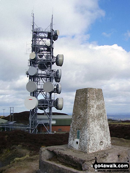 The summit of Brown Clee Hill (Abdon Burf) in


