![]()
Dead Edge End
499m (1637ft)
The Dark Peak Area, The Peak District, Derbyshire, England
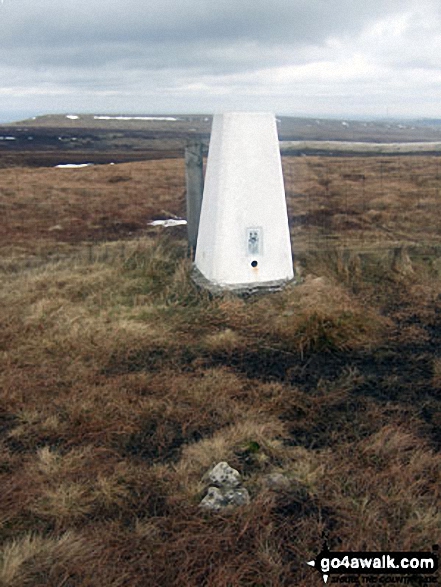
The summit of Dead Edge End is marked by an Ordnance Survey Trig Point.
Not familiar with this top?
   |
|---|
Vital Statistics:
| Length: | 7.25mls (11.5km) |
|---|---|
| Ascent: | 896ft (273m) |
| Time: | 3.75hrs |
| Grade: |  (Moderate) (Moderate) |
Route Summary:
Winscar Reservoir - Dunford Bridge - The Barnsley Boundary Walk - Little Moor - The Trans Pennine Trail - The Longdendale Trail - Windle Edge - Bagshaw Ridge - Gallows Moss - Salter's Brook Moss - Long Side (Woodhead) - Hawthorn Clough - Woodhead Railway Tunnel Air Shaft - Upper Head Dike - Dead Edge End - Upper Dead Edge - Grains Moss - Little Grains Clough - Winscar Reservoir - Dunford Bridge.
|
|---|
Vital Statistics:
| Length: | 12mls (19km) |
|---|---|
| Ascent: | 1,365ft (416m) |
| Time: | 5.75hrs |
| Grade: |  (Moderate) (Moderate) |
Route Summary:
Winscar Reservoir - Dunford Bridge - The Barnsley Boundary Walk - Little Moor - The Trans Pennine Trail - The Longdendale Trail - Windle Edge - Bagshaw Ridge - Gallows Moss - Salter's Brook Moss - Long Side - Hawthorn Clough - Woodhead Railway Tunnel Air Shaft - Upper Head Dike - Dead Edge End - Upper Dead Edge - Grains Moss - Withins Edge - Britland Edge Hill - Bleakmires Moss - Twizle Head Moss - Lad Clough Knoll - Ramsden Clough - Snailsden - Upper Snailsden Moss - Harden Clugh - Harden Reservoir - Winscar Reservoir - Dunford Bridge.
See Dead Edge End and the surrounding tops on our free-to-access 'Google Style' Peak Bagging Maps:
The Dark Peak Area of The Peak District National Park
Less data - quicker to download
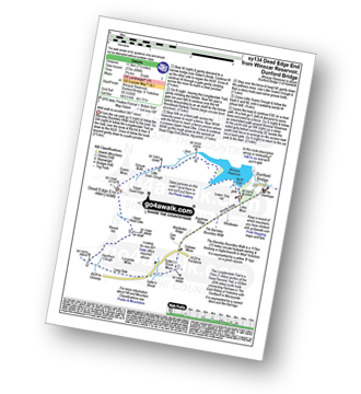
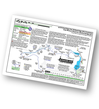
See Dead Edge End and the surrounding tops on our downloadable Peak Bagging Map in PDF format:

NB: Whether you print off a copy or download it to your phone, this PDF Peak Baggers' Map might prove incredibly useful when your are up there on the tops and you cannot get a phone signal.
You can find Dead Edge End & all the walks that climb it on these unique free-to-access Interactive Walk Planning Maps:
1:25,000 scale OS Explorer Map (orange/yellow covers):
1:50,000 scale OS Landranger Map (pink/magenta covers):
 Fellow go4awalkers who have already walked, climbed, summited & bagged Dead Edge End
Andrew Flynn walked up it on August 4th, 2020 [from/via/route] sy125 Dead Edge End, Britland Edge Hill & Snailsden from Winscar Reservoir [weather] Wet & Windy
Margaret Richards climbed it on May 30th, 2013 [from/via/route] Dead Edge End from Winscar Reservoir, Dunford Bridge (sy134, 9miles grade 5 wild walk) [with] Don
Andrew Joss bagged it on July 26th, 2014 [from/via/route] Winscar Reservoir [with] Barbara, Pippa & Mick [weather] Very Sunny - Nice views going towards Snailsden
Nicola Parkinson hiked it on December 29th, 2013 [from/via/route] sy134 from Winscar Reservoir [with] Stu [weather] Windy but bright & clear - Number of times I fell down: 1
Wendy Sockett and Mark Davidson have both walked, climbed & bagged Dead Edge End.
To add (or remove) your name and experiences on this page - Log On and edit your Personal Mountain Bagging Record
Send us your photographs and pictures on, of, or from Dead Edge End
If you would like to add your walk photographs and pictures to this page, please send them as email attachments (configured for any computer) along with your name to:
and we shall do our best to publish them.
(Guide Resolution = 300dpi. At least = 660pixels (wide) x 440 pixels (high).)

You can also submit photos via our Facebook Page.
NB. Please indicate where each photo was taken and whether you wish us to credit your photos with a Username or your First Name/Last Name.
Not familiar with this top?