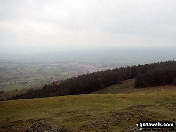
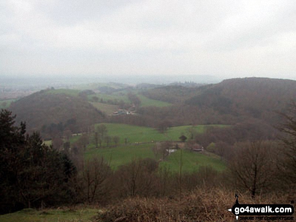
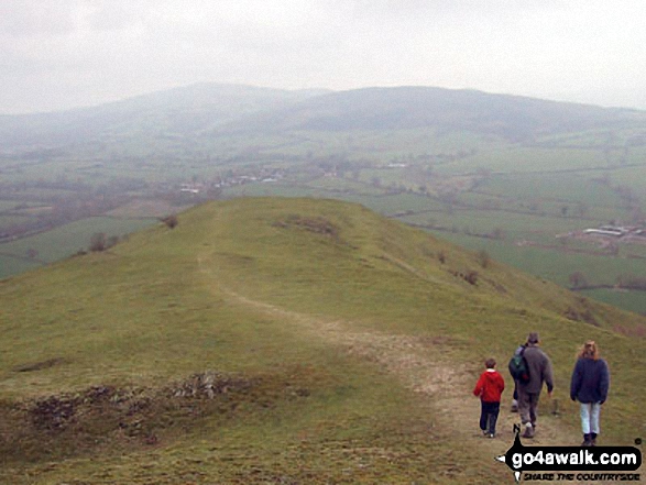
Bridget & OS Trig Point Icon

Earl's Hill
320m (1050ft)


The Shropshire Hills Area of Outstanding Natural Beauty, Shropshire, England

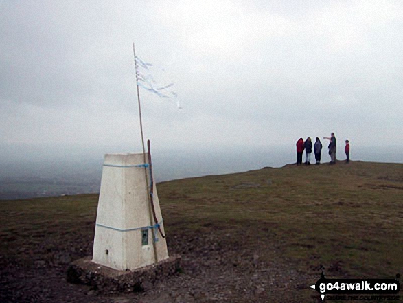
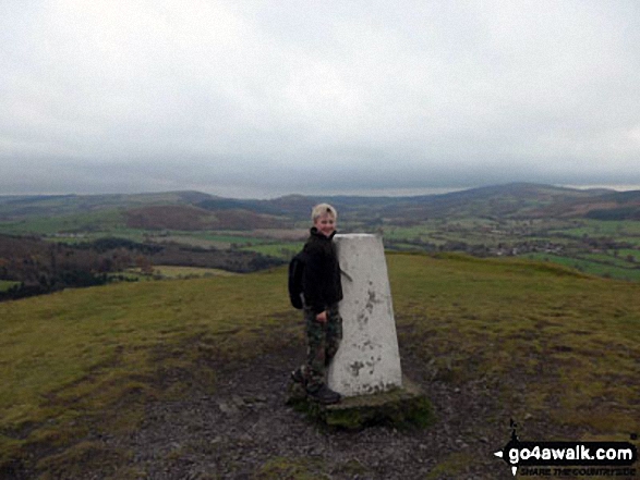
The summit of Earl's Hill is marked by an Ordnance Survey Trig Point.


Record Earl's Hill as Bagged, Climbed & Conquered

English Trig Point Icon


English Trig Point (Pillar)

Walk Earl's Hill walking UK Mountains in The Shropshire Hills Area of Outstanding Natural Beauty  Shropshire, England

Earl's Hill Summit

Photo: Dale Kelly


Not familiar with this top?

How is Earl's Hill classified?

See the location of Earl's Hill on an interactive Google Map

See the location of Earl's Hill on an interactive Google Bagging Map

Read walk reports from hikers who have already bagged Earl's Hill

View more photographs & pictures of views from, on or of Earl's Hill


We will be adding easy-to-follow route maps up Earl's Hill very soon.

See Earl's Hill and the surrounding tops on our free-to-access 'Google Style' Peak Bagging Map:

Find Google Maps Peak Bagging Map Icon

The Shropshire Hills


See Earl's Hill and the surrounding tops on our downloadable Peak Bagging Map in PDF format:

Find PDF Peak Bagging Map Icon

-The Shropshire Hills

NB: Whether you print off a copy or download it to your phone, this PDF Peak Baggers' Map might prove incredibly useful when your are up there on the tops and you cannot get a phone signal.


You can find Earl's Hill & all the walks that climb it on these unique free-to-access Interactive Walk Planning Maps:


1:25,000 scale OS Explorer Map (orange/yellow covers):

OS Explorer 241 Shrewsbury


1:50,000 scale OS Landranger Map (pink/magenta covers):

OS Landranger 126 Shrewsbury & Oswestry


Other walkers who hiked, climbed, bagged and summited Earl's Hill Fellow go4awalkers who have already walked, climbed, summited & bagged Earl's Hill

Stephen Reader walked up on August 1st, 1977 [from/via/route] Pontesford [with] Family

Samantha Kimber climbed it on October 6th, 2013 [from/via/route] Forestry Commission car park in Pontesford [with] The Clarkes (Andy, Claire, Poppy & Violet), some of the Easthopes (Rebecca, Sophie & Oliver), hubby and kids (aged 5, 4 and almost 2yrs) [weather] Sunny, warm & breezy - A lovely walk, kids managed fine (although the toddler did have to ride on Daddy's shoulders a lot of the way) & hubby's Berghaus boots finally gave up the ghost (both soles fell off with no warning!) after 15 years of use!

Roderick Devall has walked, climbed & bagged Earl's Hill.

To add (or remove) your name and experiences on this page - Log On and edit your Personal Mountain Bagging Record


More Photographs & Pictures of views from, on or of Earl's Hill

Pontesbury Hill from Earl's Hill

Pontesbury Hill from Earl's Hill

Photo: Dale Kelly (2)

On the Earl's Hill summit ridge

On the Earl's Hill summit ridge

Photo: Dale Kelly (5)

Oaks wood from Earl's Hill

Oaks wood from Earl's Hill

Photo: Dale Kelly (6)

My son Harry on the top of Earl's Hill near Pontesbury

My son Harry on the top of Earl's Hill near Pontesbury

Photo: Andrew Finch (2)

The Shropshire Hills from Earl's Hill

The Shropshire Hills from Earl's Hill

Photo: Dale Kelly (7)

Shropshire from Earl's Hill

Shropshire from Earl's Hill

Photo: Dale Kelly (4)


Send us your photographs and pictures on, of, or from Earl's Hill

If you would like to add your walk photographs and pictures featuring views from, on or of Earl's Hill to this page, please send them as email attachments (configured for any computer) along with your name to:


and we shall do our best to publish them.

(Guide Resolution = 300dpi. At least = 660pixels (wide) x 440 pixels (high).)

Send us your photographs and pictures on, of, or from Earl's Hill via Facebook

You can also submit photos via our Facebook Page.

NB. Please indicate where each photo was taken.


Not familiar with this top?

How is Earl's Hill classified?

See the location of Earl's Hill on an interactive Google Map

See the location of Earl's Hill on an interactive Google Bagging Map

Read walk reports from hikers who have already bagged Earl's Hill

View more photographs & pictures of views from, on or of Earl's Hill


Do not miss our pick of the Best Walks in Britain


Follow go4awalk.com on Twitter Follow go4awalk.com on Facebook


Home


Find new Friends to go walking with

Walk all 214 Wainwrights in just 59 Walks. Download GPS Waypoints - Great Walks you must not miss!

Walk The Yorkshire Three Peaks Challenge Walk - All the Latest Route Information, GPS Waypoints and Split Times to keep you on Schedule

Walk The British Three Peaks Challenge Walk - All the Latest Route Information and GPS Waypoints

See our pick of The Best Walks in The Lake District - Great Walks you must not miss!

Walk our pick of the Best Lake District Ridge Walks - Great Walks you must not miss!

Walk our pick of the Best Lake District Walks to do in the rain - Great Walks you must not miss!

Walk our pick of The Best Walks in Snowdonia - Great Walks you must not miss!

Walk our pick of The Best Ridge Walks in Wales - Walks you must not miss!

Walk our pick of The Best Walks in The Brecon Beacons - Great Walks you must not miss!

Walk our pick of The Best Walks in The Yorkshire Dales - Walks you must not miss!

Walk our pick of The Best Walks in The Peak District - Walks you must not miss!

Walk our pick of The Best Walks in The Forest of Bowland - Walks you must not miss!

Walk our pick of The Best Walks in Shropshire - Walks you must not miss!

Walk our pick of The Best Walks in Cheshire - Walks you must not miss!

Walk our pick of The Best Walks in Lancashire - Walks you must not miss!

Not sure where to walk next? Try Peak Bagging - Great Walks you must not miss!

Not sure where to walk next? Walk part of a National Trail - Great Walks you must not miss!

Walks with Downloadable and Uploadable GPS Waypoint Data

Walking Kit and Gear Tested by Walkers

Full Site Search
Do not miss our pick of the Best Walks in Britain