5 easy to follow walk route maps of all grades that include part of The Monarch's Way
Five easy-to-follow walk route maps of all grades that include part of The Monarch's Way in Walk Grade Order
The Monarch's Way is a 984km (615 miles) linear footpath connecting Worcester in Worcestershire, England with Shoreham in East Sussex, England.
The Monarch's Way is waymarked by named posts with a crown in an oak tree motif. It follows the escape route of Charles II after the Battle of Worcester in 1651.
Tap/mouse over a coloured circle (1-3 easy walks, 4-6 moderate walks, 7-9 hard walks) and click to select.
You can use these checkboxes to show only the grades of walk you are interested in:-
See this list of walks, routes & maps in:
Grade Order |
Length Order |
Time Order |
Walk Number or Start Location Order
NB. To reverse (toggle) this order, click Grade Order again
Scroll down the list of walks below & click on each walk title (in blue) to locate it on the map above.
   |
Vital Statistics:
| Length: | 9 miles (14.5 km) |
| Ascent: | 754ft (230m) |
| Time: | 4 hrs |
| Grade: |  |
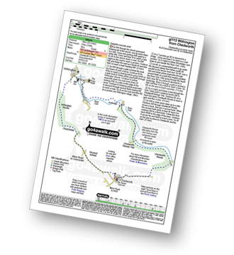
Route Summary:
Chedworth - Woodlands Farm - Postcombe - Withington Woods - Withington - River Coln - Woodbridge - Cassey Compton - Turpin's Green - Hutnage - Chedworth Roman Villa - The Monarch's Way - The Macmillan Way - Yanworth Mill - Chedworth Woods - Chedworth
|
Vital Statistics:
| Length: | 5.75 miles (9 km) |
| Ascent: | 571ft (174m) |
| Time: | 2.75hrs |
| Grade: |  |
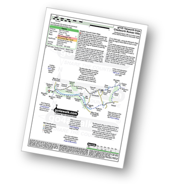
Route Summary:
Chedworth Roman Villa - The Macmillan Way - River Coln - Yanworth Common - Yanworth Wood - Streetfold - Yanworth - Dean Grove - Sheep Wash - Oxpens Farm - The Monarch's Way - Stowell Grove - Budford's Grove - Yanworth Mill - River Coln - Chedworth Woods - Chedworth Roman Villa
|
Vital Statistics:
| Length: | 6 miles (9.5 km) |
| Ascent: | 508ft (155m) |
| Time: | 2½ hrs |
| Grade: | |
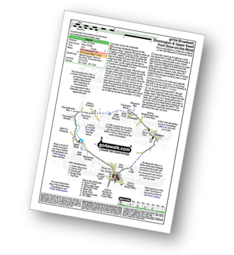
Route Summary:
Stow-on-the-Wold - The Monarch's Way - Broadwell - Donnington - Battle of Stow Memorial - The Gloucestershire Way - Upper Swell - Stow-on-the-Wold
|
Vital Statistics:
| Length: | 3.75 miles (6 km) |
| Ascent: | 689ft (210m) |
| Time: | 2.25hrs |
| Grade: | |
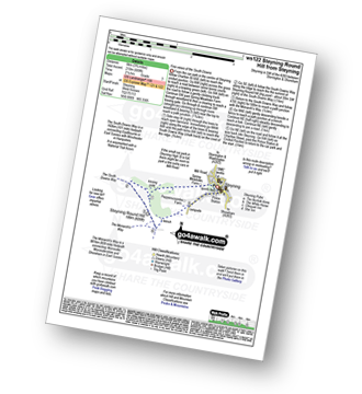
Route Summary:
Steyning - Spring Meadows Farm - The South Downs Way - Steyning Round Hill - The Monarch's Way - Pepperscoombe Farm - Steyning
|
Vital Statistics:
| Length: | 9 miles (14.5 km) |
| Ascent: | 853ft (260m) |
| Time: | 4.25hrs |
| Grade: | |
Route Summary:
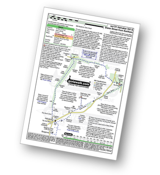
Eartham Woods - The Monarch's Way - Selhurst Park Farm - Red Copse - Chisledown - Eastdean Hill - Pillygreen Lodges - Halnaker Gallop - Open Winkins - Ladys Winkins - Little Copse - Little Halnaker - Halnaker - Boxgrove Priory - Boxgrove Commoon - Warehead Farm - Halnaker Hill - Stane Street (Roman Road) - Bushy Copse - Eartham Woods
See this list of walks, routes & maps in:
Grade Order |
Length Order |
Time Order |
Walk Number or Start Location Order
NB. To reverse (toggle) this order, click Grade Order again


