12 easy to follow walk route maps of all grades that include part of The Dane Valley Way
The Dane Valley Way is a 66km (41 miles) linear footpath connecting Buxton in Derbyshire, with Middlewich in Cheshire, England.
The Dane Valley Way is waymarked by the letters DVW.
Not familiar with The Dane Valley Way?
See these 12 walks that include part of The Dane Valley Way on an interactive Google Map
See this list of walks, routes & maps in:
Grade Order | Length Order | Time Order | Walk Number or Start Location Order
NB. To reverse (toggle) this order, click Grade Order again
   |
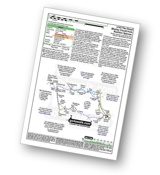
Vital Statistics:
| Length: | 9 miles (14.5 km) |
| Ascent: | 1,208ft (368m) |
| Time: | 4½ hrs |
| Grade: |  |
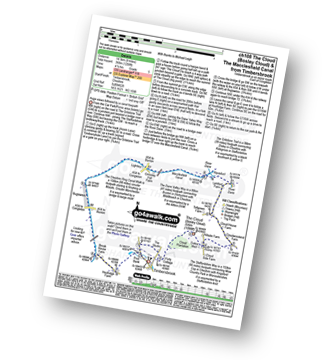
Route Summary:
Timbersbrook - The Gritstone Trail - Pool Bank - The Staffordshire Way - Folly Cottage - Cloud Plantation - The Cloud (Bosley Cloud) - Avona - The Dane Valley Way - River Dane - The Macclesfield Canal - The Cheshire Ring Canal Walk - Buglawton - Brook House Farm - Pool Bank - Timbersbrook
|
Vital Statistics:
| Length: | 7.5 miles (12 km) |
| Ascent: | 1,359ft (414m) |
| Time: | 4.25hrs |
| Grade: | |
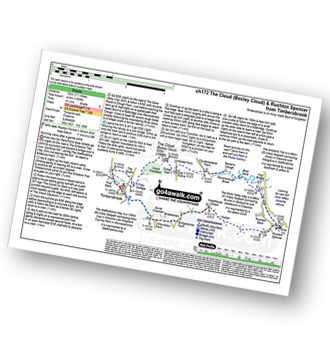
Route Summary:
Timbersbrook - The Gritstone Trail - Pool Bank - The Staffordshire Way - Folly Cottage - Cloud Plantation - The Cloud (Bosley Cloud) - Avona - The Dane Valley Way - Raven's Clough - Ravensclough Brook - Rushton Spencer - Oulton - Woodhouse Green - Bridgestones Farm - Bridestones Burial Chamber - Timbersbrook
|
Vital Statistics:
| Length: | 3.75 miles (11 km) |
| Ascent: | 1,415ft (431m) |
| Time: | 4 hrs |
| Grade: | |
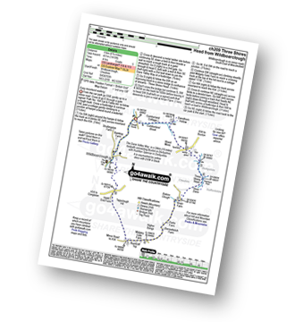
Route Summary:
Wildboarclough - Clough House - Cumberland Brook - Cumberland Cottage - Danethorn Hollow - Wood Moss - The Dane Valley Way - Three Shires Head - Knarr Farm - Robins Clough - Bennettsitch Farm - Midgley Gate Farm - Burnt Cliff Top - Tagsclough Hill - Heild End Farm - Wildboarclough
|
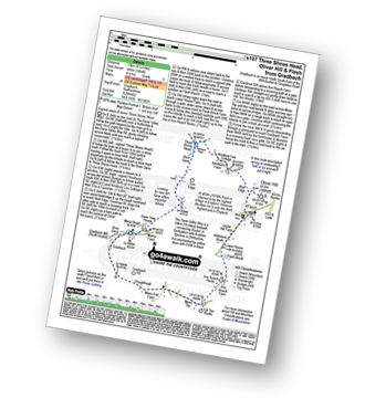
Vital Statistics:
| Length: | 8.25 miles (13 km) |
| Ascent: | 1,247ft (380m) |
| Time: | 4.25hrs |
| Grade: | |
Route Summary:
Cat and Fiddle - A537 Goyt's Moss - Whetstone Ridge - Danebower Hollow - A54 - Danebower Quarries - The River Dane - The Dane Valley Way - Orchard Farm - Three Shires Head - Panniers Pool - Cheeks Hill - Dane Head - Axe Edge (Axe Edge Moor) - A54 - Cat and Fiddle
|
Vital Statistics:
| Length: | 4.75 miles (7.5 km) |
| Ascent: | 689ft (210m) |
| Time: | 2½ hrs |
| Grade: |  |
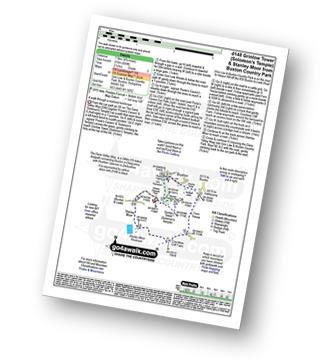
Route Summary:
Buxton and Poole's Cavern Country Park - The Dane Valley Way - Grinlow Tower - Solomon's Temple - Grin Plantation - Poole's Cavern - Fern House - Countess Cliff Farm - Stanley Moor - Stanley Moor Reservoir - Buxton and Poole's Cavern Country Park
|
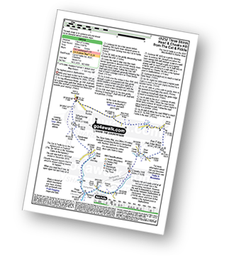
Vital Statistics:
| Length: | 8.25 miles (13 km) |
| Ascent: | 1,464ft (446m) |
| Time: | 4½ hrs |
| Grade: | |
Route Summary:
Gradbach - The Dane Valley Way - River Dane - Dane View House - Three Shires Head - Panniers Pool - Knotbury Farm - Wolf Edge - Oliver Hill - Flash - Lower House Farm - Flash Brook Farm - Ann Roach Rocks - Gib Torr Rocks - Moss Top - Cloughhead - Gradbach
|
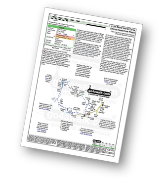
Vital Statistics:
| Length: | 11.5 miles (18.5 km) |
| Ascent: | 2,274ft (693m) |
| Time: | 6½ hrs |
| Grade: |  |
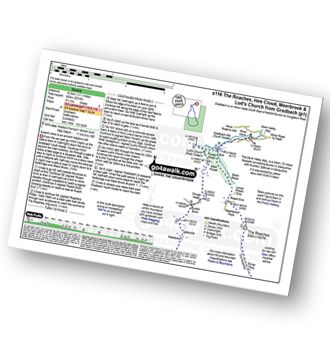
Route Summary:
Gradbach - The Dane Valley Way - Gradbach Youth Hostel - Black Brook - Forest Wood - Roach End - The Roaches - Doxey Pool - Rockhall - Hen Cloud - Well Farm - Dains Mill - Upper Hulme - Butty Fold Farm - Staffordshire Moorlands Walk - Tittesworth Reservoir - Meerbrook - Stockmeadows Farm - Meadows Farm - Buxton Brow - Clough Head - Back Forest - Lud's Church - Rock Chasm - Black Brook - Gradbach Youth Hostel - The Dane Valley Way - Gradbach
|
Vital Statistics:
| Length: | 4 miles (6.5 km) |
| Ascent: | 942ft (287m) |
| Time: | 2½ hrs |
| Grade: | |
Route Summary:
Flash - Oliver Hill - Knotbury Farm - Panniers Pool - Three Shires Head - The Dane Valley Way - River Dane - Wicken Walls Farm - Axe Edge Green Farm - Flash
|
Vital Statistics:
| Length: | 5 miles (8 km) |
| Ascent: | 1,306ft (398m) |
| Time: | 3.25hrs |
| Grade: |  |
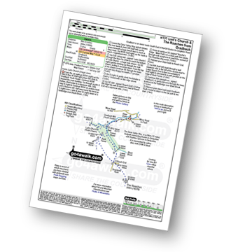
Route Summary:
Gradbach - The Dane Valley Way - Gradbach Youth Hostel - The River Dane - Black Brook - Forest Wood - Lud's Church - Back Forest - Roach End - The Roaches - Roach End - Forest Wood - Black Brook - The River Dane - Gradbach Youth Hostel - The Dane Valley Way - Gradbach
|
Vital Statistics:
| Length: | 5.5 miles (8.5 km) |
| Ascent: | 896ft (273m) |
| Time: | 3 hrs |
| Grade: | |
Route Summary:
Rushton Spencer - Oulton - Woodhouse Green - Wood Common Farm - Avona - The Staffordshire Way - The Gritstone Trail - The Cloud (Bosley Cloud) - Bosley Cloud - Avona - The Dane Valley Way - Raven's Clough - Ravensclough Brook - Rushton Spencer
|
Vital Statistics:
| Length: | 4 miles (6.5 km) |
| Ascent: | 1,306ft (398m) |
| Time: | 2½ hrs |
| Grade: | |
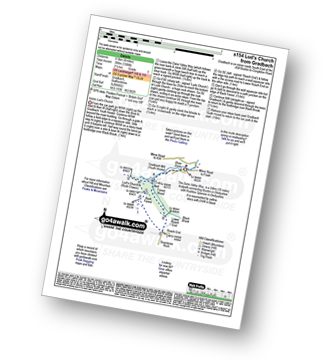
Route Summary:
Gradbach - The Dane Valley Way - Gradbach Youth Hostel - The River Dane - Black Brook - Forest Wood - Lud's Church - Back Forest - Roach End - Forest Wood - Black Brook - The River Dane - Gradbach Youth Hostel - The Dane Valley Way - Gradbach
|
Vital Statistics:
| Length: | 10 miles (16 km) |
| Ascent: | 1,953ft (595m) |
| Time: | 5.75hrs |
| Grade: | |
Route Summary:
Flash - Oliver Hill - Oxensitch - River Manifold Head - River Dove - Nether Colshaw Farm - Golling Gate Farm - Dun Cow's Grove Farm - The Manifold Trail - Blackbank Farm - Wilson Knowl Farm - Lower House Farm - Culvert Farm - Tollbridge Cottage - Gradbach - The Dane Valley Way - Dane View House - River Dane - Three Shires Head - Panniers Pool - Knotbury Farm - Wolf Edge - Flash
See this list of walks, routes & maps in:
Grade Order | Length Order | Time Order | Walk Number or Start Location Order
NB. To reverse (toggle) this order, click Grade Order again
Not familiar with The Dane Valley Way?
See these 12 walks that include part of The Dane Valley Way on an interactive Google Map