12 easy to follow walk route maps of all grades that include part of The Greensand Way
The Greensand Way is a 173km (107 miles) linear footpath connecting Haslemere in Surrey, England with Hamstreet in Kent, England.
The Greensand Way is waymarked by the letters 'GW' in Surrey and an Oast House motif in Kent.
Not familiar with The Greensand Way?
See these 12 walks that include part of The Greensand Way on an interactive Google Map
See this list of walks, routes & maps in:
Grade Order | Length Order | Time Order | Walk Number or Start Location Order
NB. To reverse (toggle) this order, click Grade Order again
   |
Vital Statistics:
| Length: | 2.75 miles (4.5 km) |
| Ascent: | 151ft (46m) |
| Time: | 1.25hrs |
| Grade: |  |
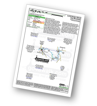
Route Summary:
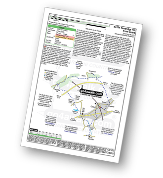
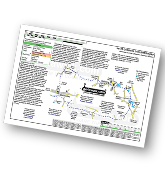
Brockham - The Greensand Way - The River Mole - St Michael's Church - Betchworth - Denby's Wood - Oldpark Wood - Brockham
|
Vital Statistics:
| Length: | 4.75 miles (7.5 km) |
| Ascent: | 466ft (142m) |
| Time: | 2.25hrs |
| Grade: |  |
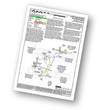
Route Summary:
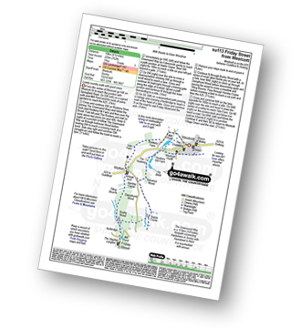
Bletchingley - The Greensand Way - Steners Hill - South Nutfield - Crabtree House - Henhaw Farm - Castlehill Farm - Bletchingley
|
Vital Statistics:
| Length: | 4 miles (6.5 km) |
| Ascent: | 420ft (128m) |
| Time: | 2 hrs |
| Grade: | |
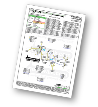
Route Summary:
Godstone - Glebe Water - Church Town - Leigh Place - Oakpark Wood - Tandridge - The Greensand Way - Enterdent - Tilburstowhill Common - Godstone
|
Vital Statistics:
| Length: | 5.5 miles (9 km) |
| Ascent: | 768ft (234m) |
| Time: | 3 hrs |
| Grade: |  |
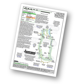
Route Summary:
Friday Street - Abinger Common - Abinger Bottom - The Greensand Way - Leith Hill - Shakes Hill - Whitberry Hill - Stable Copse - Bushy Wood - Friday Street
|
Vital Statistics:
| Length: | 6.5 miles (9.5 km) |
| Ascent: | 689ft (210m) |
| Time: | 2.75hrs |
| Grade: | |
Route Summary:
Oxted - The Greensand Way - Limpsfield - The North Downs Way - Tandridge Hill - Townland Pool - Oxted Mill - The Greensand Way - Oxted
|
Vital Statistics:
| Length: | 4.75 miles (7.5 km) |
| Ascent: | 647ft (197m) |
| Time: | 2½ hrs |
| Grade: | |
Route Summary:
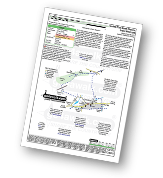
Westcott - Coomb Farm - The North Downs Way - The Rondabouts - The Spains - Ranmore Common - The Greensand Way - Westcott
|
Vital Statistics:
| Length: | 6.25 miles (10 km) |
| Ascent: | 752ft (229m) |
| Time: | 3 hrs |
| Grade: | |
Route Summary:
Westcott - Mill Pond - The Greensand Way - Sylvanus Wood - Stable Copse - Bushy Wood - Friday Street - Tilling Bourne - Horsley Copse - Wotton - Vale Farm - Westcott
|
Vital Statistics:
| Length: | 5.5 miles (9 km) |
| Ascent: | 1,001ft (305m) |
| Time: | 3 hrs |
| Grade: |  |
Route Summary:
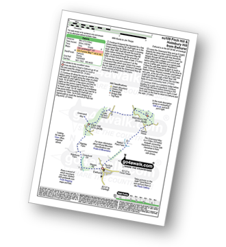
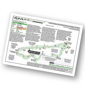
Ewhurst - Coneyhurst Gill - Rapsley Farm - Pitch Hill - The Greensand Way - Duke of Kent School - Holmbury Hill - Radnor Place Farm - Ewhurst
|
Vital Statistics:
| Length: | 7.25 miles (11.5 km) |
| Ascent: | 752ft (229m) |
| Time: | 3½ hrs |
| Grade: | |
Route Summary:
Bletchingley - The Greensand Way - Coldharbour Farm - Hobgarden Wood - Leigh Place - Glebe Water - Bay Pond - Godstone - Brewer Street - Bletchingley
|
Vital Statistics:
| Length: | 7 miles (11 km) |
| Ascent: | 962ft (293m) |
| Time: | 3½ hrs |
| Grade: | |
Route Summary:
Brockham - The Greensand Way - St Michael's Church - Betchworth - The North Downs Way - Brockham Warren - Box Hill - Betchworth Park Golf Club - Park Farm - Pondtail Farm - Brockham
|
Vital Statistics:
| Length: | 8.25 miles (13 km) |
| Ascent: | 1,634ft (498m) |
| Time: | 4½ hrs |
| Grade: |  |
Route Summary:
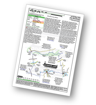
Holmbury St Mary - The Greensand Way - Holmbury Hill - Duke of Kent School - Pitch Hill - Winterfold Hill - Winterfold Wood - Hurt Wood - Holmbury St Mary
|
Vital Statistics:
| Length: | 10.25 miles (16.5 km) |
| Ascent: | 1,933ft (589m) |
| Time: | 5.75hrs |
| Grade: |  |
Route Summary:
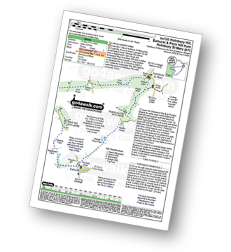
Holmbury St Mary - The Greensand Way - Holmbury Hill - Radnor Place Farm - Ewhurst - Rapsley Farm - Pitch Hill - Winterfold Hill - Winterfold Wood - Hurt Wood - Holmbury St Mary
See this list of walks, routes & maps in:
Grade Order | Length Order | Time Order | Walk Number or Start Location Order
NB. To reverse (toggle) this order, click Grade Order again
Not familiar with The Greensand Way?
See these 12 walks that include part of The Greensand Way on an interactive Google Map


