A Google Peak Bagging Map of The Berwyns area of Snowdonia in Denbighshire, Gwynedd, Powys and Wrexham,
The Berwyns area of Snowdonia National Park in Denbighshire, Gwynedd, Powys and Wrexham, is the area enclosed by:
- The A494 from Llanuwchllyn to Druid to the North West
- The A5 to Chirk (Y Waun) to the North
- The border between Wales and England to Llynclys to the East
- The A495 to Bwlch-y-cibau, the A490 to Llanfyllin, then the B4393 to Llyn Efymwy & then a minor road to Bwlch y Groes to the South
- Cwm Cynllwyd to Llanuwchllyn to the South West
If you include the Marilyns, the Bridgets (Hills) and all the Mountains, Tops, Peaks and Hills with a Trig Point on them there are 18 tops to climb, bag & conquer and the highest point is Cadair Berwyn at 832m (2,730ft).
To see these Mountains, Peaks, Tops and Hills displayed in different ways - see the options in the left-hand column and towards the bottom of this page.
LOG ON and RELOAD this page to show which Mountains, Peaks, Tops and Hills you have already climbed, bagged & conquered [. . . more details]
NB. If a Google Map does not appear below, or the icons do not respond, click here to refresh the page. If that doesn't work, try deleting your browser's cache.
View these 18 Mountains, Peaks, Tops and Hills:
- On a Downloadable PDF you can Print or Save to your Phone#
- On an Interactive Google Map (loads faster)
- On an Interactive Google Map with a list of tops below it.
(makes it easier to locate a particular top) - On a Detailed List in:
Alphabetical Order | Height Order - On one page with 'yet-to-be-bagged' listed 1st & then 'already-bagged' tops listed 2nd in:
Alphabetical Order | Height Order - On one page with 'already-bagged' tops listed 1st & then 'yet-to-be-bagged' tops listed 2nd in:
Alphabetical Order | Height Order
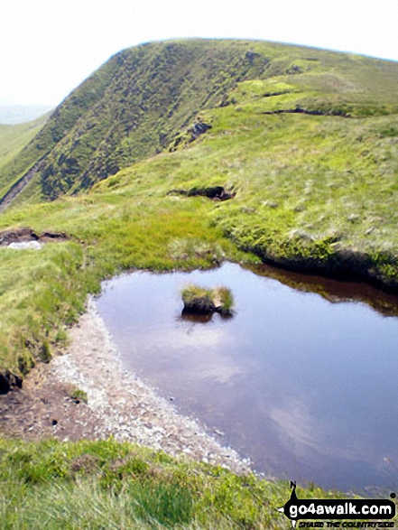
 Cadair Berwyn in The Berwyns area of Snowdonia
Photo: John Greaves
# Whether you print a copy or download it to your phone, this Peak Baggers' Map will prove incredibly useful if you want to know what's what when you are up in the mountains and cannot get a phone signal.
Is there a Mountain, Peak, Top or Hill missing from the above google map or list?
Let us know an we will add it to our database.


