
![]()
Moel Fferna
630m (2067ft)
The Berwyns, Denbighshire, Wales
*Moel Fferna is actually just outside of The National Park Boundary
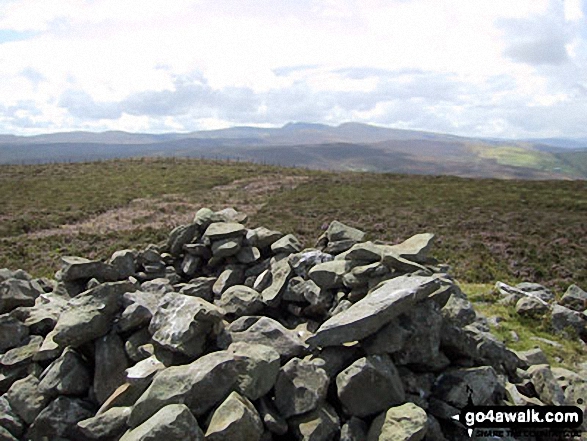
The summit of Moel Fferna is marked by a stone shelter 300m E of an Ordnance Survey Trig Point.
Not familiar with this top?
   |
|---|
Vital Statistics:
| Length: | 12.25ml (19.5km) |
|---|---|
| Ascent: | 2,356ft (718m) |
| Time: | 6.75hrs |
| Grade: |  (Hard) (Hard) |
Route Summary:
Cynwyd - Afon Trystion - Cynwyd Forest - Pen Creigiau'r Barcut - Bwlch Cynwyd - Moel Fferna - Cerrig Coediog - Pan y Ladron - Pen Bwlch Llandrillo Top - Bwlch Llandrillo Wayfarer Memorial - Nant Gwyn - Nat y Cwm - Rhos-y-maerdy - Cynwyd
|
|---|
Vital Statistics:
| Length: | 15.5ml (25km) |
|---|---|
| Ascent: | 3,157ft (962m) |
| Time: | 8.75hrs |
| Grade: |  (Hard) (Hard) |
Route Summary:
Cynwyd - Afon Trystion - Cynwyd Forest - Pen Creigiau'r Barcut - Bwlch Cynwyd - Moel Fferna - Cerrig Coediog - Pan y Ladron - Pen Bwlch Llandrillo Top - Bwlch Llandrillo Wayfarer Memorial - Blaen Llynor - Cadair Bronwen (North Top) - Cadair Bronwen - Bwlch Llandrillo Wayfarer Memorial - Nant Gwyn - Nat y Cwm - Rhos-y-maerdy - Cynwyd
See Moel Fferna and the surrounding tops on our free-to-access 'Google Style' Peak Bagging Map:
The Berwyns of Snowdonia National Park
Less data - quicker to download
See Moel Fferna and the surrounding tops on our downloadable Peak Bagging Map in PDF format:

NB: Whether you print off a copy or download it to your phone, this PDF Peak Baggers' Map might prove incredibly useful when your are up there on the tops and you cannot get a phone signal.
You can find Moel Fferna & all the walks that climb it on these unique free-to-access Interactive Walk Planning Maps:
1:25,000 scale OS Explorer Map (orange/yellow covers):
1:50,000 scale OS Landranger Map (pink/magenta covers):
 Fellow go4awalkers who have already walked, climbed, summited & bagged Moel Fferna
Daniel Moran walked up Moel Fferna on June 28th, 2025 [from/via/route] crowen [with] Frankie [weather] Windy, warm AND MUGGY, - straight up & down, pheasant farm, dead pheasant's on the floor, 6 red kites. ticks. Bagged
Melfyn Parry climbed Moel Fferna on May 12th, 2025 [from/via/route] Followed route DN103 but as I was only interested in the Nuttalls, i.e. Moel Fferna & Pen Bwlch Llandrillo Top I didn't ascend Pen Creigiau'r Barcut or Pen y Ladron. These are very quiet hills, didn't see anyone all day. The route grid references & notes are very good. [with] On my own [weather] It was a lovely day, bright & generally quite warm - Great views in all directions as mostly on open moorland. You spend quite a bit of the time walking towards the Berwyns with Cadair Bronwen at the forefront of the range from this side.
Christina Lander bagged Moel Fferna on August 1st, 2024 [from/via/route] Cynwyd - North Berwyn Way - Moel Fferna - Cerrig Coediog - Pen Bwlch Llandrillo top (Moel y Henfaes) - Wayfarer Memorial - Taith Tegid (Tegid Way) - Cynwyd [with] Dick [weather] A beautiful, hot sunny day - During our holiday staying at Y Gilfach, Bryn Melyn, Llandderfel
Mark Davidson hiked Moel Fferna on August 1st, 2003 [from/via/route] Walk dn116 Moel Fferna, Pen Bwlch Llandrillo Top & Cadair Bronwen from Cynwyd [with] Alone [weather] Beautiful & sunny
Donovan Suddell summited Moel Fferna on March 6th, 2022 [from/via/route] Cynwyd [with] wife [weather] sunny, blustery at the top
Stephanie Doyle conquered Moel Fferna on January 15th, 2021 [from/via/route] Llidiart y park [with] Mum [weather] Calm - Easy path to follow
Lucy Perchard scaled Moel Fferna on June 3rd, 2018 [from/via/route] From Carrog on day 2 of the triennial Llangollen Round challenge walk [with] Tony [weather] Sunny spells & hot at times - A great challenge walk
Trevor Williams and Paul Booth have both walked, climbed & bagged Moel Fferna.
To add (or remove) your name and experiences on this page - Log On and edit your Personal Mountain Bagging Record
More Photographs & Pictures of views from, on or of Moel Fferna
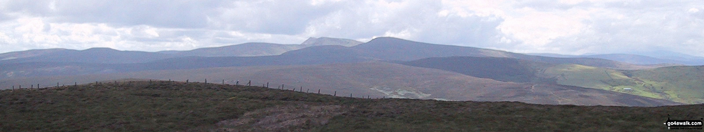
The Berwyns with Cadair Berwyn (centre left) and Cadair Bronwen (centre right) prominent from Moel Fferna
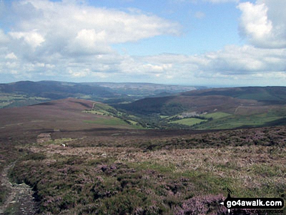
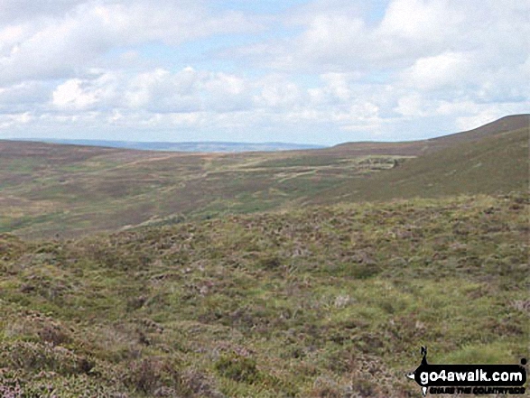
Pen Bwlch Llandrillo Top, Nant Croes-y-wernen, Pen Creigau'r, and Moel Fferna from the summit of Cerrig Coediog
Send us your photographs and pictures on, of, or from Moel Fferna
If you would like to add your walk photographs and pictures featuring views from, on or of Moel Fferna to this page, please send them as email attachments (configured for any computer) along with your name to:
and we shall do our best to publish them.
(Guide Resolution = 300dpi. At least = 660pixels (wide) x 440 pixels (high).)

You can also submit photos via our Facebook Page.
NB. Please indicate where each photo was taken and whether you wish us to credit your photos with a Username or your First Name/Last Name.
Not familiar with this top?


