The Cadair Idris area area of Snowdonia National Park - a fully detailed list of all the Mountains, Peaks, Tops and Hills
The Cadair Idris area area of Snowdonia National Park in Gwynedd is the area enclosed by:
- Afon Mawddach from Fairbourne to Dolgellau to the North West
- The A470 from Dolgellau to Mallwyd to the East
- The edge of the Snowdonia National Park from Mallwyd to Afon Dyfi to the South
- The Irish Sea from Afon Dyfi to Afon Mawddach to the West
If you count only the Deweys there are 13 tops to climb, bag & conquer and the highest point is Craig Portas at 605m (1,985ft).
To see these Mountains, Peaks, Tops and Hills displayed in different ways - see the options in the left-hand column and towards the bottom of this page.
![]() Your Personal Bagging Record for The Cadair Idris area area of Snowdonia
Your Personal Bagging Record for The Cadair Idris area area of Snowdonia
LOG ON and RELOAD this page to show which Mountains, Peaks, Tops and Hills you have already climbed, bagged & conquered [. . . more details]
See this list in: Alphabetical Order‡
| Height Order
To reverse the order select the link again.
Mountain, Peak, Top or Hill:
Bagged

![]()
1. Braich Ddu (Craig Cwm-llwyd)
546m (1,791ft)
Braich Ddu (Craig Cwm-llwyd) is on interactive maps:
Braich Ddu (Craig Cwm-llwyd) is on downloadable PDF you can Print or Save to your Phone: |
![]()
2. Ceiswyn
545m (1,789ft)
Ceiswyn is on interactive maps:
Ceiswyn is on downloadable PDF you can Print or Save to your Phone: |
![]()
3. Craig Portas
605m (1,985ft)
Craig Portas is on interactive maps:
Craig Portas is on downloadable PDF you can Print or Save to your Phone: |
![]()
4. Craig Portas (East Top)
587m (1,926ft)
Craig Portas (East Top) is on interactive maps:
Craig Portas (East Top) is on downloadable PDF you can Print or Save to your Phone: |
![]()
5. Esgair Berfa
507m (1,664ft)
Esgair Berfa is on interactive maps:
Esgair Berfa is on downloadable PDF you can Print or Save to your Phone: |
![]()
6. Foel y Geifr (Abergynolwyn)
515m (1,690ft)
Send it in and we'll publish it here.
Foel y Geifr (Abergynolwyn) is on interactive maps:
Foel y Geifr (Abergynolwyn) is on downloadable PDF you can Print or Save to your Phone: |
![]()
7. Graig Goch (Mynydd Cedris)
586m (1,923ft)
Send it in and we'll publish it here.
Graig Goch (Mynydd Cedris) is on interactive maps:
Graig Goch (Mynydd Cedris) is on downloadable PDF you can Print or Save to your Phone: |
![]()
8. Mynydd Braich-goch
597m (1,959ft)
Mynydd Braich-goch is on interactive maps:
Mynydd Braich-goch is on downloadable PDF you can Print or Save to your Phone: |
![]()
9. Mynydd Cwmeiddew
507m (1,664ft)
Mynydd Cwmeiddew is on interactive maps:
Mynydd Cwmeiddew is on downloadable PDF you can Print or Save to your Phone: |
![]()
10. Mynydd Fron-fraith
514m (1,687ft)
Mynydd Fron-fraith is on interactive maps:
Mynydd Fron-fraith is on downloadable PDF you can Print or Save to your Phone: |
![]()
11. Mynydd Rhyd-galed
502m (1,647ft)
Mynydd Rhyd-galed is on interactive maps:
Mynydd Rhyd-galed is on downloadable PDF you can Print or Save to your Phone: |
![]()
12. Pen Trum-gwr
512m (1,680ft)
Pen Trum-gwr is on interactive maps:
Pen Trum-gwr is on downloadable PDF you can Print or Save to your Phone: |
![]()
13. Tarren Cwm-ffernol
551m (1,818ft)
Tarren Cwm-ffernol is on interactive maps:
Tarren Cwm-ffernol is on downloadable PDF you can Print or Save to your Phone: |
View these 13 Mountains, Peaks, Tops and Hills:
- On a Downloadable PDF you can Print or Save to your Phone#
- On an Interactive Google Map with a list of tops below it.
(makes it easier to locate a particular top) - On a Detailed List in:
Alphabetical Order | Height Order - On one page with 'yet-to-be-bagged' listed 1st
& then 'already-bagged' tops listed 2nd in:
Alphabetical Order | Height Order - On one page with 'already-bagged' tops listed 1st
& then 'yet-to-be-bagged' tops listed 2nd in:
Alphabetical Order | Height Order
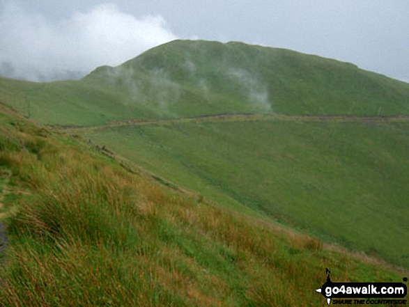
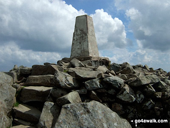 The summit of Cadair Idris (Penygadair) in The Cadair Idris area of Snowdonia
Photo: Harry Monks
# Whether you print a copy or download it to your phone, this Peak Baggers' Map will prove incredibly useful if you want to know what's what when you are up in the mountains and cannot get a phone signal.
Is there a Mountain, Peak, Top or Hill missing from the above google map or list?
Let us know an we will add it to our database.

To contribute to go4awalk.com or to contact us about anything at all - see Talk To Us.
For help see Help.
go4awalk.com and go4awalk.co.uk are registered trademarks of TMDH Limited.
Copyright © 2000-2026 TMDH Limited. All rights reserved.
Copyright Terms & Conditions Privacy Statement
A - Z Walks Home Log On/Accounts Photo Gallery Walk Ideas and Collections Fell Facts Hill Skills Walking Questions and Answers Your Stories News Competitions Product Reviews/Gear Tests Walking Gear Guides Peaks and Mountains Peak Bagging Find New Walking Friends Camping GPS Waypoints for Walking Contents Walk Search Talk To Us go4awalk.com Help Free Example Walks Newsletter


