A Google Peak Bagging Map of Northumberland National Park, England
The Northumberland National Park is located in North Eastern England and wholly within the county of Northumberland.
If you count only the Mountains (Hewitts) there are 6 tops to climb, bag & conquer and the highest point is The Cheviot at 815m (2,674ft).
To see these Mountains, Peaks, Tops and Hills displayed in different ways - see the options in the left-hand column and towards the bottom of this page.
![]() Your Personal Bagging Record for Northumberland
Your Personal Bagging Record for Northumberland
LOG ON and RELOAD this page to show which Mountains, Peaks, Tops and Hills you have already climbed, bagged & conquered [. . . more details]
NB. If a Google Map does not appear below, or the icons do not respond, click here to refresh the page. If that doesn't work, try deleting your browser's cache.
Tap/click on each name below (in blue) to locate it's position on the map above.
Mountain, Peak, Top or Hill:
Bagged

![]()
1. The Cheviot
815m (2,674ft)
Mountain (Hewitt)
See more details, photos, trip reports and easy-to-follow walks up The Cheviot
![]()
2. Hedgehope Hill
714m (2,343ft)
Mountain (Hewitt)
See more details, photos, trip reports and easy-to-follow walks up Hedgehope Hill
![]()
3. Comb Fell
652m (2,139ft)
Mountain (Hewitt)
See more details, photos, trip reports and easy-to-follow walks up Comb Fell
![]()
4. Windy Gyle
619m (2,031ft)
Mountain (Hewitt)
See more details, photos, trip reports and easy-to-follow walks up Windy Gyle
![]()
5. Cushat Law
616m (2,022ft)
Mountain (Hewitt)
See more details, photos, trip reports and easy-to-follow walks up Cushat Law
![]()
6. Bloodybush Edge
610m (2,001ft)
Mountain (Hewitt)
See more details, photos, trip reports and easy-to-follow walks up Bloodybush Edge
View these 6 Mountains, Peaks, Tops and Hills:
- On an Interactive Google Map (loads faster)
- On an Interactive Google Map with a list of tops below it.
(makes it easier to locate a particular top) - On a Detailed List in:
Alphabetical Order | Height Order - On one page with 'yet-to-be-bagged' listed 1st & then 'already-bagged' tops listed 2nd in:
Alphabetical Order | Height Order - On one page with 'already-bagged' tops listed 1st & then 'yet-to-be-bagged' tops listed 2nd in:
Alphabetical Order | Height Order
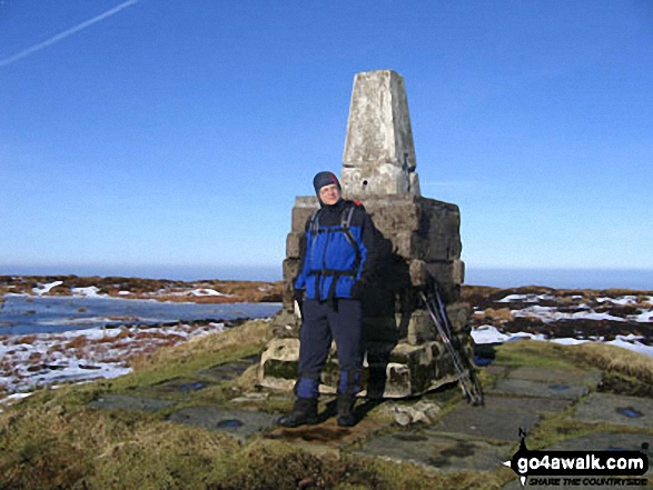 The summit of The Cheviot in Northumberland
Photo: Julian Whitley
Is there a Mountain, Peak, Top or Hill missing from the above google map or list?
Let us know an we will add it to our database.

To contribute to go4awalk.com or to contact us about anything at all - see Talk To Us.
For help see Help.
go4awalk.com and go4awalk.co.uk are registered trademarks of TMDH Limited.
Copyright © 2000-2025 TMDH Limited. All rights reserved.
Copyright Terms & Conditions Privacy Statement
A - Z Walks Home Log On/Accounts Photo Gallery Walk Ideas and Collections Fell Facts Hill Skills Walking Questions and Answers Your Stories News Competitions Product Reviews/Gear Tests Walking Gear Guides Peaks and Mountains Peak Bagging Find New Walking Friends Camping GPS Waypoints for Walking Contents Walk Search Talk To Us go4awalk.com Help Free Example Walks Newsletter


