The Brecon Beacons Area of Bannau Brycheiniog (The Brecon Beacons National Park) - a fully detailed list of all the Mountains, Peaks, Tops and Hills (Page 1 of 2)
The Brecon Beacons Area of Bannau Brycheiniog (The Brecon Beacons National Park) is the Western half of the National Park. It is enclosed by:
- the Park Boundary to the North, West & South
- the B4558 from Brecon to Talybont-on-Usk and then a minor road south past Talybont Reservoir, Pentwyn Reservoir and Pontsticill Reservoir to Pontsticill to the East
If you include the Marilyns, the Bridgets (Hills) and all the Mountains, Tops, Peaks and Hills with a Trig Point on them there are 36 tops to climb, bag & conquer and the highest point is Pen y Fan at 886m (2,907ft).
To see these Mountains, Peaks, Tops and Hills displayed in different ways - see the options in the left-hand column and towards the bottom of this page.
![]() Your Personal Bagging Record for The Brecon Beacons Area of Bannau Brycheiniog (The Brecon Beacons)
Your Personal Bagging Record for The Brecon Beacons Area of Bannau Brycheiniog (The Brecon Beacons)
LOG ON and RELOAD this page to show which Mountains, Peaks, Tops and Hills you have already climbed, bagged & conquered [. . . more details]
Page 1 of 2 Go to page: 1 2 |
See this list in: Alphabetical Order‡
| Height Order
To reverse the order select the link again.
Mountain, Peak, Top or Hill:
Bagged

![]()
1. Brecon Camp (Pen y Crug)
331m (1,086ft)
Send it in and we'll publish it here.
Brecon Camp (Pen y Crug) is on interactive maps:
Brecon Camp (Pen y Crug) is on downloadable PDF you can Print or Save to your Phone: |
![]()
2. Cadair Fawr
485m (1,592ft)
Cadair Fawr is on interactive maps:
Cadair Fawr is on downloadable PDF you can Print or Save to your Phone: |

![]()
3. Carn Pen-y-clogau
523m (1,716ft)
Carn Pen-y-clogau is on interactive maps:
Carn Pen-y-clogau is on downloadable PDF you can Print or Save to your Phone: |

![]()
4. Carreg Yr Ogof
585m (1,920ft)
Carreg Yr Ogof is on interactive maps:
Carreg Yr Ogof is on downloadable PDF you can Print or Save to your Phone: |
![]()
5. Cefn Cantref
293m (962ft)
Cefn Cantref is on interactive maps:
Cefn Cantref is on downloadable PDF you can Print or Save to your Phone: |
![]()
6. Cefn Carn Fadog
512m (1,680ft)
Cefn Carn Fadog is on interactive maps:
Cefn Carn Fadog is on downloadable PDF you can Print or Save to your Phone: |
![]()
7. Cefn Cilsanws
460m (1,510ft)
Cefn Cilsanws is on interactive maps:
Cefn Cilsanws is on downloadable PDF you can Print or Save to your Phone: |
![]()
8. Cefn Llechid
400m (1,313ft)
Cefn Llechid is on interactive maps:
Cefn Llechid is on downloadable PDF you can Print or Save to your Phone: |
![]()
9. Cribarth
423m (1,388ft)
Cribarth is on interactive maps:
Cribarth is on downloadable PDF you can Print or Save to your Phone: |

![]()
10. Fan Brycheiniog (Twr y Fan Foel)
802m (2,632ft)
Fan Brycheiniog (Twr y Fan Foel) is on interactive maps:
Fan Brycheiniog (Twr y Fan Foel) is on downloadable PDF you can Print or Save to your Phone: |
![]()
11. Fan Fawr
734m (2,409ft)
Fan Fawr is on interactive maps:
Fan Fawr is on downloadable PDF you can Print or Save to your Phone: |
![]()
12. Fan Foel
780m (2,559ft)
Fan Foel is on interactive maps:
Fan Foel is on downloadable PDF you can Print or Save to your Phone: |
![]()
13. Fan Frynych
628m (2,062ft)
Fan Frynych is on interactive maps:
Fan Frynych is on downloadable PDF you can Print or Save to your Phone: |
![]()
14. Fan Gyhirych
725m (2,379ft)
Fan Gyhirych is on interactive maps:
Fan Gyhirych is on downloadable PDF you can Print or Save to your Phone: |
![]()
15. Fan Nedd
663m (2,175ft)
Fan Nedd is on interactive maps:
Fan Nedd is on downloadable PDF you can Print or Save to your Phone: |
![]()
16. Fforest Fach
381m (1,250ft)
Fforest Fach is on interactive maps:
Fforest Fach is on downloadable PDF you can Print or Save to your Phone: |
![]()
17. Foel Draw
424m (1,392ft)
Foel Draw is on interactive maps:
Foel Draw is on downloadable PDF you can Print or Save to your Phone: |
![]()
18. Gwaun Cefngarreg
371m (1,218ft)
Gwaun Cefngarreg is on interactive maps:
Gwaun Cefngarreg is on downloadable PDF you can Print or Save to your Phone: |
![]()
19. Gwaun y Pant
528m (1,733ft)
Gwaun y Pant is on interactive maps:
Gwaun y Pant is on downloadable PDF you can Print or Save to your Phone: |
![]()
20. Heol Senni (Fan Bwlch Chwyth)
603m (1,979ft)
Heol Senni (Fan Bwlch Chwyth) is on interactive maps:
Heol Senni (Fan Bwlch Chwyth) is on downloadable PDF you can Print or Save to your Phone: |
![]()
21. Moel Fenni Fach
290m (951ft)
Moel Fenni Fach is on interactive maps:
|
![]()
22. Moel Gornach (Garreg Lwyd)
616m (2,021ft)
Moel Gornach (Garreg Lwyd) is on interactive maps:
Moel Gornach (Garreg Lwyd) is on downloadable PDF you can Print or Save to your Phone: |
![]()
23. Moel Penderyn
371m (1,218ft)
Moel Penderyn is on interactive maps:
Moel Penderyn is on downloadable PDF you can Print or Save to your Phone: |
![]()
24. Mynydd Myddfai
440m (1,444ft)
Mynydd Myddfai is on interactive maps:
Mynydd Myddfai is on downloadable PDF you can Print or Save to your Phone: |
![]()
25. Ollwyn
420m (1,378ft)
Ollwyn is on interactive maps:
Ollwyn is on downloadable PDF you can Print or Save to your Phone: |
![]()
26. Pant y Creigiau
565m (1,854ft)
Pant y Creigiau is on interactive maps:
Pant y Creigiau is on downloadable PDF you can Print or Save to your Phone: |
![]()
27. Pen y Fan
886m (2,907ft)
Pen y Fan is on interactive maps:
Pen y Fan is on downloadable PDF you can Print or Save to your Phone: |
![]()
28. Rhiwan
354m (1,162ft)
Rhiwan is on interactive maps:
Rhiwan is on downloadable PDF you can Print or Save to your Phone: |
![]()
29. Tairn Carn Uchaf
482m (1,582ft)
Tairn Carn Uchaf is on interactive maps:
Tairn Carn Uchaf is on downloadable PDF you can Print or Save to your Phone: |
![]()
30. Traeth-bach
374m (1,227ft)
Traeth-bach is on interactive maps:
Traeth-bach is on downloadable PDF you can Print or Save to your Phone: |
Page 1 of 2 Go to page: 1 2 |
View these 36 Mountains, Peaks, Tops and Hills:
- On a Downloadable PDF you can Print or Save to your Phone#
- On an Interactive Google Map with a list of tops below it.
(makes it easier to locate a particular top) - On a Detailed List in:
Alphabetical Order | Height Order - On one page with 'yet-to-be-bagged' listed 1st
& then 'already-bagged' tops listed 2nd in:
Alphabetical Order | Height Order - On one page with 'already-bagged' tops listed 1st
& then 'yet-to-be-bagged' tops listed 2nd in:
Alphabetical Order | Height Order
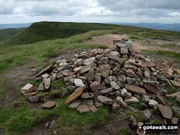
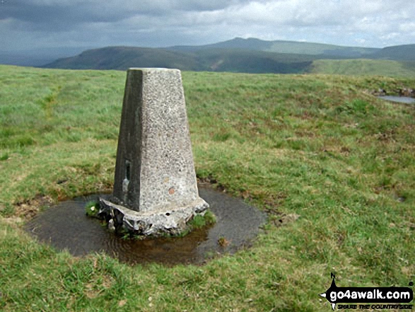
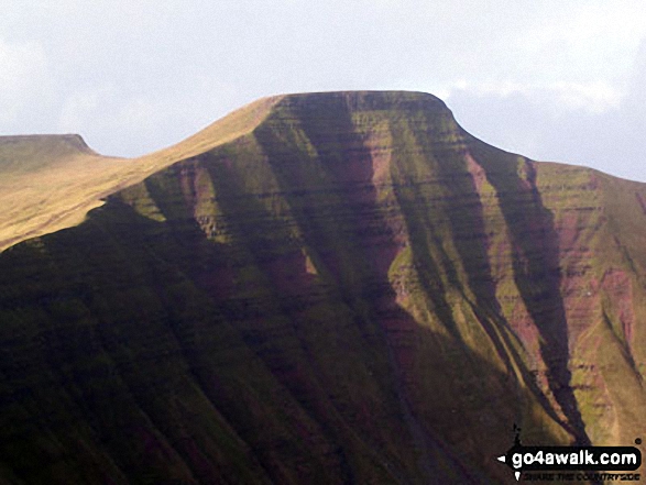 Pen y Fan in The Brecon Beacons Area of The Brecon Beacons
Photo: Paul Holroyd
Is there a Mountain, Peak, Top or Hill missing from the above google map or list?
Let us know an we will add it to our database.
To contribute to go4awalk.com or to contact us about anything at all - see Talk To Us.
For help see Help.
go4awalk.com and go4awalk.co.uk are registered trademarks of TMDH Limited.
Copyright © 2000-2026 TMDH Limited. All rights reserved.
Copyright Terms & Conditions Privacy Statement
A - Z Walks Home Log On/Accounts Photo Gallery Walk Ideas and Collections Fell Facts Hill Skills Walking Questions and Answers Your Stories News Competitions Product Reviews/Gear Tests Walking Gear Guides Peaks and Mountains Peak Bagging Find New Walking Friends Camping GPS Waypoints for Walking Contents Walk Search Talk To Us go4awalk.com Help Free Example Walks Newsletter