4 easy to follow walk route maps of all grades that include part of The North Bucks Way
Four easy-to-follow walk route maps of all grades that include part of The North Bucks Way in Walk Grade Order
The North Bucks Way is a 56km (35 miles) linear footpath connecting Chequer's Knap, Great Kimble in Buckinghamshire, England with Wolverton in Buckinghamshire, England.
The North Bucks Way is waymarked by orange arrows.
Tap/mouse over a coloured circle (1-3 easy walks, 4-6 moderate walks, 7-9 hard walks) and click to select.
Scroll down the list of walks below & click on each walk title (in blue) to locate it on the map above.
   |
Vital Statistics:
| Length: | 6.5 miles (10.5 km) |
| Ascent: | 230ft (70m) |
| Time: | 2½ hrs |
| Grade: |  |
Route Summary:
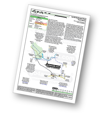
Stone - Hartwell Church - Upper Hartwell - Whaddon Hill Farm - The North Bucks Way - River Thame - Thame Valley Walk - The Midshires Way - Weir Lodge - Bridge Lodge - Eythrope Park - Beachendon Cottages - Eythrope House - Aylesbury Ring - Stone
|
Vital Statistics:
| Length: | 4.5 miles (7 km) |
| Ascent: | 693ft (211m) |
| Time: | 2½ hrs |
| Grade: |  |
Route Summary:
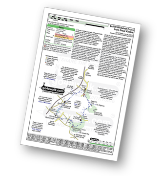
Great Kimble - The North Bucks Way - Askett - Monks Risborough - Whiteleaf - The Icknield Way - The Ridgeway - Whiteleaf Cross - Cadsden - Grangelands And Pulpit Hill Nature Reserve - Chequer's Knap - The North Bucks Way - Great Kimble
|
Vital Statistics:
| Length: | 5.5 miles (9 km) |
| Ascent: | 853ft (260m) |
| Time: | 3 hrs |
| Grade: | |
Route Summary:
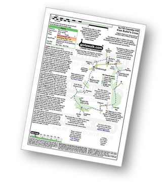
Butler's Cross - Monument Hill (Coombe Hill) - The Ridgeway - Linton's Wood - Goodmerhill Wood - Chisley Wood - The Icknield Way - Chequers - Pond Wood - Pulpit Wood - The North Bucks Way - The Midshires Way - Chequers Knap - Whorley Wood - Ellesborough Warren - Boxtree Wood - Beacon Hill (Ellesborough) - Ellesborough - The Aylesbury Ring - Springs Farm - Butler's Cross
|
Vital Statistics:
| Length: | 9 miles (14.5 km) |
| Ascent: | 328ft (100m) |
| Time: | 3½ hrs |
| Grade: | |
Route Summary:
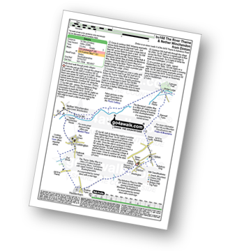
Dinton - Upton - The Aylsebury Ring - Dinton Castle - Starveall Farm - Eythrope Park - The Midshires Way - The North Bucks Way - The Swans Way - Bridge Lodge - The River Thame - The Bernwood Jubilee Way - The Thame Valley Way - Nether Winchendon - Lower Winchendon - Cuddington - Haddenham - Dad Brook - Townsend - Haddenham - Westington - Dinton


