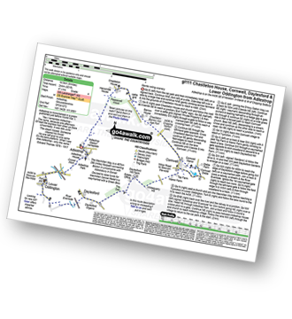
12 easy to follow walk route maps of all grades that include part of The Macmillan Way
Twelve easy-to-follow walk route maps of all grades that include part of The Macmillan Way in Walk Grade Order
The Macmillan Way is a 467km (290 miles) linear footpath connecting Boston in Lincolnshire, England with Abbotsbury in Dorset, England.
The Macmillan Way is waymarked by a green bow.
Tap/mouse over a coloured circle (1-3 easy walks, 4-6 moderate walks, 7-9 hard walks) and click to select.
You can use these checkboxes to show only the grades of walk you are interested in:-
See this list of walks, routes & maps in:
Grade Order |
Length Order |
Time Order |
Walk Number or Start Location Order
NB. To reverse (toggle) this order, click Grade Order again
Scroll down the list of walks below & click on each walk title (in blue) to locate it on the map above.
   |
Vital Statistics:
| Length: | 5 miles (8 km) |
| Ascent: | 558ft (170m) |
| Time: | 2½ hrs |
| Grade: |  |
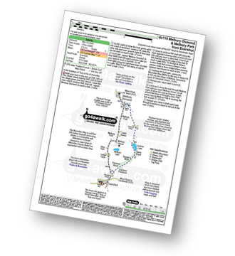
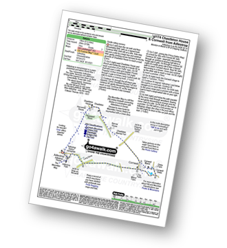
Route Summary:
Evershot - Paradise Wood - Evershot Plantation - Banger's Moor - Sares Wood - Lucerne Lake - Melbury Park - The Macmillan Way - Melbury Osmond - Lower Barton - Melbury House - Evershot
|
Vital Statistics:
| Length: | 6.25 miles (10 km) |
| Ascent: | 994ft (303m) |
| Time: | 3.25hrs |
| Grade: |  |
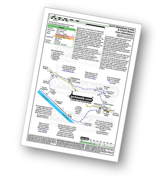
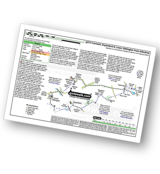
Route Summary:
Abbotsbury - The Macmillan Way - Abbotsbury Plain - The South Dorset Ridgeway - Abbotsbury Castle (Iron Age Fort) - Tulks Hill - Labour in Vain Farm - East Bexington Farm - The South West Coast Path - Chesil Beach - Abbotsbury
|
Vital Statistics:
| Length: | 7.25 miles (11.5 km) |
| Ascent: | 1,158ft (353m) |
| Time: | 3.75hrs |
| Grade: | |
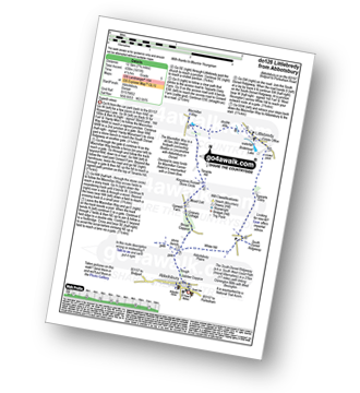
Route Summary:
Abbotsbury - The Macmillan Way - Abbotsbury Plains - Borad Coppice - Gorwell Farm - Kingstone Russel Stone Circle - Tenants Hill - Littlebredy - Topparts Dairy - The South Dorset Ridgeway - White Hill (Abbotsbury) - Abbotsbury
|
Vital Statistics:
| Length: | 8.25 miles (13 km) |
| Ascent: | 1,070ft (326m) |
| Time: | 4 hrs |
| Grade: | |
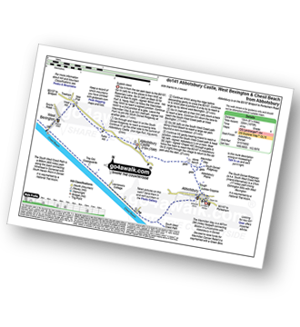
Route Summary:
Abbotsbury - The Macmillan Way - Abbotsbury Plain - The South Dorset Ridgeway - Abbotsbury Castle (Iron Age Fort) - Tulks Hill - West Bexington - The South West Coast Path - Chesil Beach - Abbotsbury
|
Vital Statistics:
| Length: | 9 miles (14.5 km) |
| Ascent: | 801ft (244m) |
| Time: | 4.25hrs |
| Grade: | |
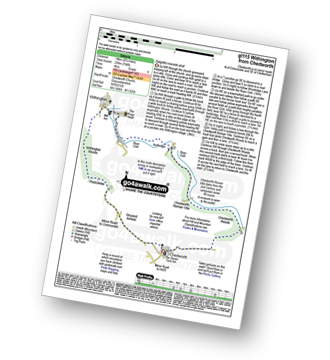
Route Summary:
Adlestrop - The Macmillan Way - Chastleton - Chastleton House - Chastleton Barrow Iron Age Fort - Cornwell - Daylesford - The Macmillan Way - Lower Oddington - Adlestrop Park - Adlestrop
|
Vital Statistics:
| Length: | 9 miles (14.5 km) |
| Ascent: | 754ft (230m) |
| Time: | 4 hrs |
| Grade: | |
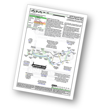
Route Summary:
Chedworth - Woodlands Farm - Postcombe - Withington Woods - Withington - River Coln - Woodbridge - Cassey Compton - Turpin's Green - Hutnage - Chedworth Roman Villa - The Monarch's Way - The Macmillan Way - Yanworth Mill - Chedworth Woods - Chedworth
|
Vital Statistics:
| Length: | 3.75 miles (6 km) |
| Ascent: | 394ft (120m) |
| Time: | 1.75hrs |
| Grade: |  |
Route Summary:
Adlestrop - The Macmillan Way - Chastleton - Chastleton House - Chastleton Barrow Iron Age Fort - Long Drive - Adlestrop
|
Vital Statistics:
| Length: | 5.75 miles (9 km) |
| Ascent: | 571ft (174m) |
| Time: | 2.75hrs |
| Grade: | |
Route Summary:
Chedworth Roman Villa - The Macmillan Way - River Coln - Yanworth Common - Yanworth Wood - Streetfold - Yanworth - Dean Grove - Sheep Wash - Oxpens Farm - The Monarch's Way - Stowell Grove - Budford's Grove - Yanworth Mill - River Coln - Chedworth Woods - Chedworth Roman Villa
|
Vital Statistics:
| Length: | 6.25 miles (10 km) |
| Ascent: | 670ft (204m) |
| Time: | 3 hrs |
| Grade: | |
Route Summary:
Adlestrop - The Macmillan Way - Chastleton - Chastleton House - Chastleton Barrow Iron Age Fort - Cornwell - Adlestrop
|
Vital Statistics:
| Length: | 8.25 miles (13 km) |
| Ascent: | 696ft (212m) |
| Time: | 3.75hrs |
| Grade: | |
|
Vital Statistics:
| Length: | 5 miles (8 km) |
| Ascent: | 345ft (105m) |
| Time: | 2.25hrs |
| Grade: | |
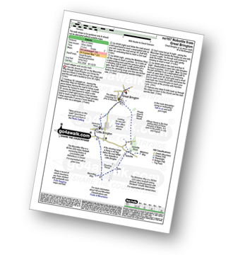
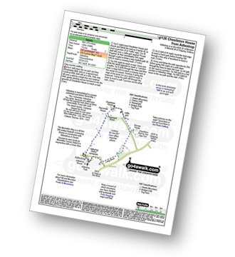
Route Summary:
Great Brington - Nobottle Wood - The Midshires Way - Nobottle - The Macmillan Way - Little Brington - Great Brington
|
Vital Statistics:
| Length: | 5.75 miles (9.5 km) |
| Ascent: | 600ft (183m) |
| Time: | 2.75hrs |
| Grade: | |
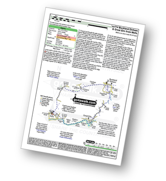
Route Summary:
Mells - Wadbury Hill Fort - Mells Stream - Wadbury Valley - Great Elm - The Macmillan Way - Buckland Brook - Buckland Dinham - Clareham Lane - Hill House Farm - Conduit Bridge - Mells
See this list of walks, routes & maps in:
Grade Order |
Length Order |
Time Order |
Walk Number or Start Location Order
NB. To reverse (toggle) this order, click Grade Order again


