5 easy to follow walk route maps of all grades that include part of The Jack Mytton Way
Five easy-to-follow walk route maps of all grades that include part of The Jack Mytton Way in Walk Grade Order
The Jack Mytton Way is a 116km (72 miles) linear footpath connecting Billingsley in Shropshire, England with Llanfair Waterdine in Shropshire, England.
The Jack Mytton Way is waymarked by a horse and rider motif.
Tap/mouse over a coloured circle (1-3 easy walks, 4-6 moderate walks, 7-9 hard walks) and click to select.
You can use these checkboxes to show only the grades of walk you are interested in:-
See this list of walks, routes & maps in:
Grade Order |
Length Order |
Time Order |
Walk Number or Start Location Order
NB. To reverse (toggle) this order, click Grade Order again
Scroll down the list of walks below & click on each walk title (in blue) to locate it on the map above.
   |
Vital Statistics:
| Length: | 8.75 miles (14 km) |
| Ascent: | 1,387ft (423m) |
| Time: | 4.75hrs |
| Grade: |  |
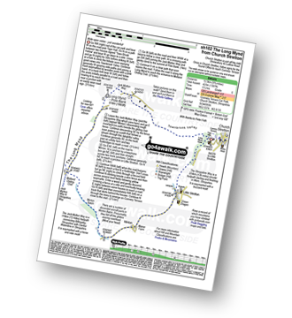
Route Summary:
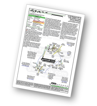
Church Stretton - Town Brook - The Jack Mytton Way - The Long Mynd - Pole Bank (Long Mynd) - Midland Gliding Club - Minton Bach - Minton - Little Stretton - Chruch Stretton.
|
Vital Statistics:
| Length: | 10.25 miles (16.5 km) |
| Ascent: | 2,435ft (742m) |
| Time: | 6.25hrs |
| Grade: |  |
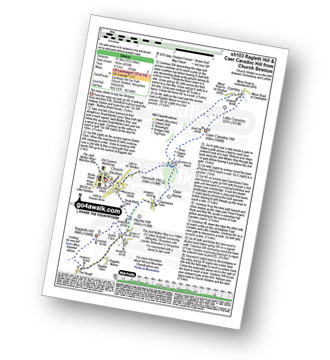
Route Summary:
Church Stretton - The Jack Mytton Way - Snatchfield Farm - Clemcroft - Ragleth Hill - Ragdon Manor - Gaerstones Farm - Caer Caradoc Hill - Little Caradoc - Church Stretton
|
Vital Statistics:
| Length: | 5.25 miles (8.5 km) |
| Ascent: | 532ft (162m) |
| Time: | 2½ hrs |
| Grade: |  |
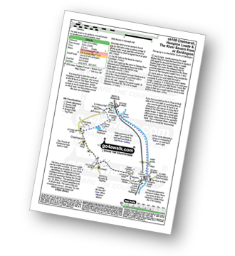
Route Summary:
Eardington - Dinney Barn - The Jack Mytton Way - Chelmarsh Reservoir - Chelmarsh - Hampton - The Jack Mytton Way - The Severn Valley Railway - Hampton Loade - The Hampton Loade Ferry - The River Severn - The Severn Way - Eardington
|
Vital Statistics:
| Length: | 5.25 miles (8.5 km) |
| Ascent: | 945ft (288m) |
| Time: | 3 hrs |
| Grade: | |
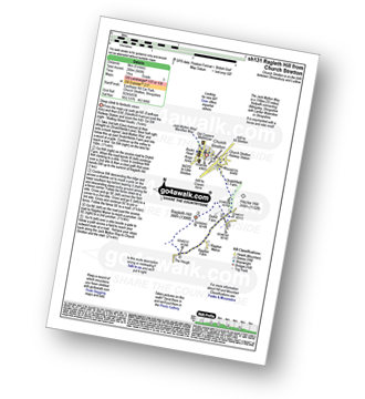
Route Summary:
Church Stretton - The Jack Mytton Way - Snatchfield Farm - Clemcroft - Ragleth Hill - Ragdon Manor - Church Stretton
|
Vital Statistics:
| Length: | 5.75 miles (9 km) |
| Ascent: | 1,027ft (313m) |
| Time: | 3.25hrs |
| Grade: |  |
Route Summary:
Church Stretton - The Jack Mytton Way - Snatchfield Farm - Clemcroft - Ragleth Hill - Little Stretton - Church Stretton
See this list of walks, routes & maps in:
Grade Order |
Length Order |
Time Order |
Walk Number or Start Location Order
NB. To reverse (toggle) this order, click Grade Order again


