The Mountains, Peaks, Tops and Hills in The Northern Dales Area of The Yorkshire Dales, Cumbria and North Yorkshire with all the tops you have already bagged in first & then the ones you are yet to climb second.
The Northern Dales Area of The Yorkshire Dales National Park, Cumbria and North Yorkshire is the area:
- Within the National Park north of the A684 from Sedbergh to Leyburn via Hawes, Bainbridge and Aysgarth
- East of the A683 from Sedbergh to Brough via Kirkby Stephen
If you count only the Deweys there are 5 tops to climb, bag & conquer and the highest point is Blackstone Edge (Oxnop Common) at 584m (1,917ft).
To see these Mountains, Peaks, Tops and Hills displayed in different ways - see the options in the left-hand column and towards the bottom of this page.
![]() Your Personal Bagging Record for The Northern Dales Area of The Yorkshire Dales
Your Personal Bagging Record for The Northern Dales Area of The Yorkshire Dales
LOG ON and RELOAD this page to show which Mountains, Peaks, Tops and Hills you have already climbed, bagged & conquered [. . . more details]
Scroll down this list of mountains, peaks, tops & hills below and tap/click on each name (in blue) to locate it on the map above.
See this list in: Alphabetical Order‡ | Height Order
To reverse the order select the link again.
Mountain, Peak, Top or Hill already bagged:
Bagged
Top yet to be climbed, bagged & conquered:
Bagged

![]()
1. Blackstone Edge (Oxnop Common)
584m (1917ft)
Dewey
See more details, photos, trip reports and easy-to-follow walks up Blackstone Edge (Oxnop Common)
![]()
2. Great Pinseat (Whaw Moor)
583m (1913ft)
Dewey
See more details, photos, trip reports and easy-to-follow walks up Great Pinseat (Whaw Moor)
![]()
3. Hoove Faggergill
554m (1818ft)
Dewey
See more details, photos, trip reports and easy-to-follow walks up Hoove Faggergill
![]()
4. Pickerstone Ridge
565m (1854ft)
Dewey
See more details, photos, trip reports and easy-to-follow walks up Pickerstone Ridge
![]()
5. The Fleak (Conny Tammy Currack)
551m (1808ft)
Dewey
See more details, photos, trip reports and easy-to-follow walks up The Fleak (Conny Tammy Currack)
![]() Your Personal Bagging Record for The Northern Dales Area of The Yorkshire Dales
Your Personal Bagging Record for The Northern Dales Area of The Yorkshire Dales
LOG ON and RELOAD this page to show which Mountains, Peaks, Tops and Hills you have already climbed, bagged & conquered [. . . more details]
View these 5 Mountains, Peaks, Tops and Hills:
- On a Downloadable PDF you can Print or Save to your Phone#
- On an Interactive Google Map (loads faster)
- On an Interactive Google Map with a list of tops below it.
(makes it easier to locate a particular top) - On a Detailed List in:
Alphabetical Order | Height Order - On one page with 'yet-to-be-bagged' listed 1st & then 'already-bagged' tops listed 2nd in:
Alphabetical Order | Height Order - On one page with 'already-bagged' tops listed 1st & then 'yet-to-be-bagged' tops listed 2nd in:
Alphabetical Order | Height Order
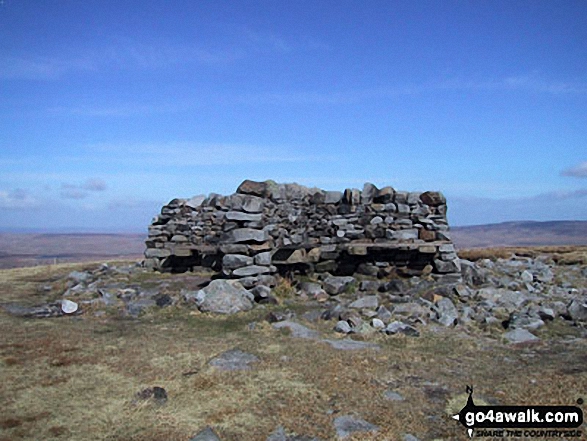 The summit of Great Shunner Fell in The Northern Dales Area of The Yorkshire Dales
Photo: Paul Harrison
# Whether you print a copy or download it to your phone, this Peak Baggers' Map will prove incredibly useful if you want to know what's what when you are up in the mountains and cannot get a phone signal.
Is there a Mountain, Peak, Top or Hill missing from the above google map or list?


