
![]()
Ben More (The Crianlarich Hills)
1174m (3853ft)
The Crianlarich Hills, Loch Lomond and The Trossachs to Loch Tay, Loch Lomond and The Trossochs, Stirlingshire, Scotland
The summit of Ben More (The Crianlarich Hills) is marked by an Ordnance Survey Trig Point.
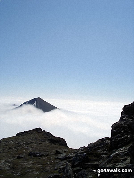
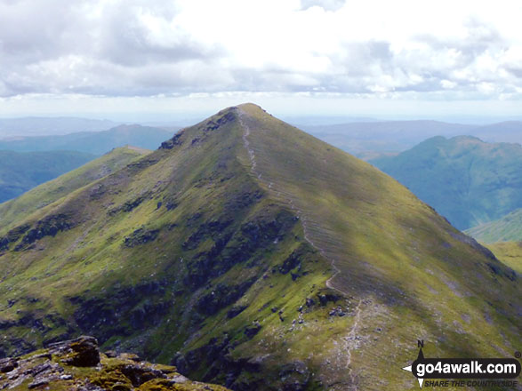
Stob Binnein (front) and Stob Coire an Lochain (Stob Binnein) poking through the clouds during a temperature inversion - viewed from the summit of Ben More (The Crianlarich Hills)
Not familiar with this top?
See Ben More (The Crianlarich Hills) and the surrounding tops on our free-to-access 'Google Style' Peak Bagging Maps:
The Crianlarich Hills area of Scottish Region 1: The Firth of Clyde to Strath Tay
Less data - quicker to download
Scottish Region 1: Loch Lomond and The Trossachs to Loch Tay
Less data - quicker to download
A go4awalk.com downloadable Peak Bagging Map in PDF format featuring Ben More (The Crianlarich Hills) should be available soon.
Free-to-access Interactive Walk Planning Maps:
1:25,000 scale OS Explorer Map (orange/yellow covers):
1:50,000 scale OS Landranger Map (pink/magenta covers):
An Interactive Walk Planning Map for OS Landranger 51 Loch Tay & Glen Dochart is not currently available
 Fellow go4awalkers who have already walked, climbed, summited & bagged Ben More (The Crianlarich Hills)
David Peebles walked up Ben More (The Crianlarich Hills) on June 26th, 2024 [from/via/route] Parked at Loch Lubhair [with] Solo walk [weather] Low cloud. Wet & Raining - Very steep & challenging. Great walk.
Daniel Moran climbed Ben More (The Crianlarich Hills) on May 16th, 2024 [weather] Great day - Devils ridge
Mark Davidson bagged Ben More (The Crianlarich Hills) on February 20th, 2015 [with] Simon
Ron Blundell hiked Ben More (The Crianlarich Hills) on May 17th, 2017 [from/via/route] Ben More Farm [with] my Patterdale Terrier Ruby [weather] Warm & Dry most of the way. Very Strong Wind hit at 950 metres. Summit clear & sunny. - Very Steep & Hard going. My 50th Munro.
Andrew Edwards summited Ben More (The Crianlarich Hills) on May 13th, 2016 [from/via/route] From Ben more farm [with] Myself [weather] Good but poor visibility on summit - In memory of John cousin
Frances Ipson conquered Ben More (The Crianlarich Hills) on August 5th, 2014 [from/via/route] Ben More farm [with] Stan [weather] cloudy, lifting gradually from summit. Clear by the time we reached the tops. - Reached summit by 13.15 so continued on to Stobh Beinn, which didn't look so bad but made it a tougher day for us.
Simon Lewis scaled Ben More (The Crianlarich Hills) on September 21st, 2012 [from/via/route] NE ridge [with] Solo [weather] Clear - Molly's first munro, 6hrs
Louise Sandwith, Mike Walker, Mr M A Blanchard, Mark Hanley, Roderick Devall, Simon Duerden, Ceri Murray, Trevor Williams, Elise Gibbons, Geert Gritter and Adam Shewry have all walked, climbed & bagged Ben More (The Crianlarich Hills).
To add (or remove) your name and experiences on this page - Log On and edit your Personal Mountain Bagging Record
More Photographs & Pictures of views from, on or of Ben More (The Crianlarich Hills)
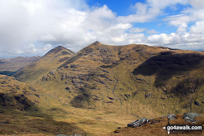
Ben More (The Crianlarich Hills) and Stob Bennein from the summit of Beinn Tulaichean
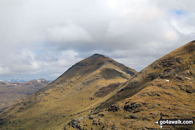
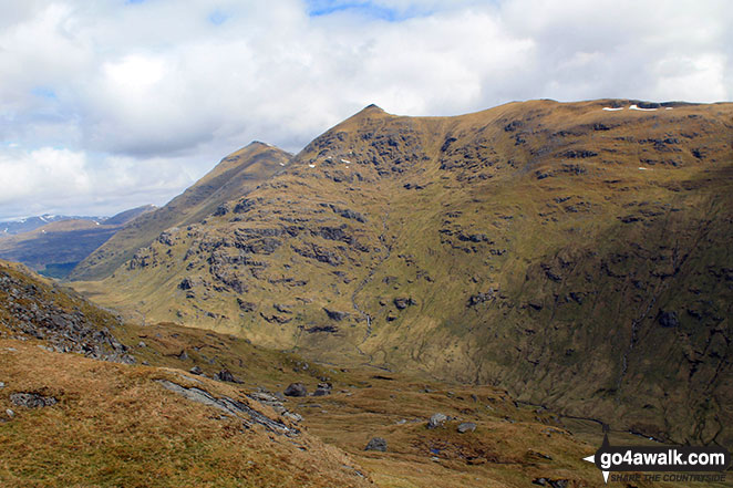
Ben More (The Crianlarich Hills), Stob Binnein and Stob Coire an Lochain from Beinn Tulaichean
Send us your photographs and pictures on, of, or from Ben More (The Crianlarich Hills)
If you would like to add your walk photographs and pictures featuring views from, on or of Ben More (The Crianlarich Hills) to this page, please send them as email attachments (configured for any computer) along with your name to:
and we shall do our best to publish them.
(Guide Resolution = 300dpi. At least = 660pixels (wide) x 440 pixels (high).)

You can also submit photos via our Facebook Page.
NB. Please indicate where each photo was taken and whether you wish us to credit your photos with a Username or your First Name/Last Name.
Not familiar with this top?


