All the Mountains, Peaks, Tops and Hills in The South Eastern Marches area of The Lake District, Cumbria, England on a Google Map
The South Eastern Marches area of The Lake District National Park, Cumbria is the area enclosed by:
- The A591 from Ambleside towards Kendal to the North
- The new National Park boundary to Morecambe Bay to the East
- Morecambe Bay to the A590 at Greenodd to the South
- The A590 to Newby Bridge and then the shore of Lake Winderemere to Ambleside to the West
If you count only the Nuttalls there are 0 tops to climb, bag & conquer.
To see these Mountains, Peaks, Tops and Hills displayed in different ways - see the options in the left-hand column and towards the bottom of this page.
![]() Your Personal Bagging Record for The South Eastern Marches area of The Lake District
Your Personal Bagging Record for The South Eastern Marches area of The Lake District
LOG ON and RELOAD this page to show which Mountains, Peaks, Tops and Hills you have already climbed, bagged & conquered [. . . more details]
NB. If a Google Map does not appear below, or the icons do not respond, click here to refresh the page. If that doesn't work, try deleting your browser's cache.
View these Mountains, Peaks, Tops and Hills:
- On an Interactive Google Map (loads faster)
- On an Interactive Google Map with a list of tops below it.
(makes it easier to locate a particular top) - On a Detailed List in:
Alphabetical Order | Height Order - On one page with 'yet-to-be-bagged' listed 1st & then 'already-bagged' tops listed 2nd in:
Alphabetical Order | Height Order - On one page with 'already-bagged' tops listed 1st & then 'yet-to-be-bagged' tops listed 2nd in:
Alphabetical Order | Height Order
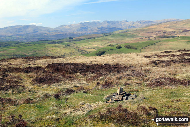 The summit of Brunt Knott (South Top) in The South Eastern Marches area of The Lake District
Photo: Andy Lyons
Is there a Mountain, Peak, Top or Hill missing from the above google map or list?


