The Mountains, Peaks, Tops and Hills in The Western Fells area of The Lake District, Cumbria with all the tops you are yet to climb first & then the ones you have already bagged in second.
The Western Fells area of The Lake District National Park, Cumbria is enclosed by:
- The edge of The Lake District National Park from Egremont to Cockermouth to the North West
- Lorton Vale, Crummock Water, Buttermere and Honister Pass to the North East
- Sty Head Pass and Wasdale to the South East
- An imaginary line from the Southern Tip of Wast Water to Egremont to the South West
If you count only the Wainwright Outlying Fells there are 4 tops to climb, bag & conquer and the highest point is Dent (Long Barrow) at 352m (1,155ft).
To see these Mountains, Peaks, Tops and Hills displayed in different ways - see the options in the left-hand column and towards the bottom of this page.
![]() Your Personal Bagging Record for The Western Fells area of The Lake District
Your Personal Bagging Record for The Western Fells area of The Lake District
LOG ON and RELOAD this page to show which Mountains, Peaks, Tops and Hills you have already climbed, bagged & conquered [. . . more details]
Scroll down this list of mountains, peaks, tops & hills below and tap/click on each name (in blue) to locate it on the map above.
See this list in: Alphabetical Order‡ | Height Order
To reverse the order select the link again.
Top yet to be climbed, bagged & conquered:
Bagged

![]()
1. Cold Fell (Cleator Moor)
293m (961ft)
Wainwright Outlying Fell
See more details, photos, trip reports and easy-to-follow walks up Cold Fell (Cleator Moor)
![]()
2. Dent (Long Barrow)
352m (1155ft)
Wainwright Outlying Fell
See more details, photos, trip reports and easy-to-follow walks up Dent (Long Barrow)
![]()
3. Flat Fell
272m (892ft)
Wainwright Outlying Fell
See more details, photos, trip reports and easy-to-follow walks up Flat Fell
![]()
4. Ponsonby Fell
311m (1020ft)
Wainwright Outlying Fell
See more details, photos, trip reports and easy-to-follow walks up Ponsonby Fell
Mountain, Peak, Top or Hill already bagged:
Bagged
![]() Your Personal Bagging Record for The Western Fells area of The Lake District
Your Personal Bagging Record for The Western Fells area of The Lake District
LOG ON and RELOAD this page to show which Mountains, Peaks, Tops and Hills you have already climbed, bagged & conquered [. . . more details]
View these 4 Mountains, Peaks, Tops and Hills:
- On a Downloadable PDF you can Print or Save to your Phone#
- On an Interactive Google Map (loads faster)
- On an Interactive Google Map with a list of tops below it.
(makes it easier to locate a particular top) - On a Detailed List in:
Alphabetical Order | Height Order - On one page with 'yet-to-be-bagged' listed 1st & then 'already-bagged' tops listed 2nd in:
Alphabetical Order | Height Order - On one page with 'already-bagged' tops listed 1st & then 'yet-to-be-bagged' tops listed 2nd in:
Alphabetical Order | Height Order
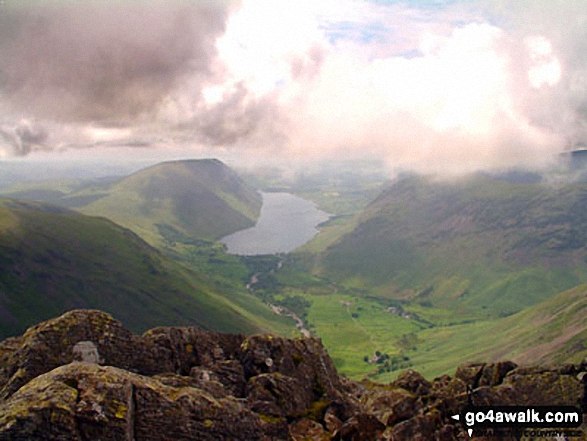 The view from Great Gable in The Western Fells area of The Lake District
Photo: Ian Mansell
# Whether you print a copy or download it to your phone, this Peak Baggers' Map will prove incredibly useful if you want to know what's what when you are up in the mountains and cannot get a phone signal.
Is there a Mountain, Peak, Top or Hill missing from the above google map or list?


