The Mountains, Peaks, Tops and Hills in The Central Fells area of The Lake District, Cumbria with all the tops you have already bagged in first & then the ones you are yet to climb second.
The Central Fells area of The Lake District National Park, Cumbria is enclosed by:
- Keswick to the North
- Derwent Water and Borrowdale to the West
- The Langdale Valley to the South
- Thirlmere, Grasmere and Ambleside to the East
If you count only the Deweys there are 6 tops to climb, bag & conquer and the highest point is High Seat (Ashness Fell) at 608m (1,995ft).
To see these Mountains, Peaks, Tops and Hills displayed in different ways - see the options in the left-hand column and towards the bottom of this page.
![]() Your Personal Bagging Record for The Central Fells area of The Lake District
Your Personal Bagging Record for The Central Fells area of The Lake District
LOG ON and RELOAD this page to show which Mountains, Peaks, Tops and Hills you have already climbed, bagged & conquered [. . . more details]
Scroll down this list of mountains, peaks, tops & hills below and tap/click on each name (in blue) to locate it on the map above.
See this list in: Alphabetical Order | Height Order‡
To reverse the order select the link again.
Mountain, Peak, Top or Hill already bagged:
Bagged
Top yet to be climbed, bagged & conquered:
Bagged

![]()
1. High Seat (Ashness Fell)
608m (1995ft)
Dewey
See more details, photos, trip reports and easy-to-follow walks up High Seat (Ashness Fell)
![]()
2. Bleaberry Fell
590m (1936ft)
Dewey
See more details, photos, trip reports and easy-to-follow walks up Bleaberry Fell
![]()
3. Sergeant's Crag
571m (1874ft)
Dewey
See more details, photos, trip reports and easy-to-follow walks up Sergeant's Crag
![]()
4. Bell Crags (Watendlath Fell)
558m (1831ft)
Dewey
See more details, photos, trip reports and easy-to-follow walks up Bell Crags (Watendlath Fell)
![]()
5. Steel Fell (Dead Pike)
553m (1815ft)
Dewey
See more details, photos, trip reports and easy-to-follow walks up Steel Fell (Dead Pike)
![]()
6. Calf Crag
537m (1762ft)
Dewey
See more details, photos, trip reports and easy-to-follow walks up Calf Crag
![]() Your Personal Bagging Record for The Central Fells area of The Lake District
Your Personal Bagging Record for The Central Fells area of The Lake District
LOG ON and RELOAD this page to show which Mountains, Peaks, Tops and Hills you have already climbed, bagged & conquered [. . . more details]
View these 6 Mountains, Peaks, Tops and Hills:
- On a Downloadable PDF you can Print or Save to your Phone#
- On an Interactive Google Map (loads faster)
- On an Interactive Google Map with a list of tops below it.
(makes it easier to locate a particular top) - On a Detailed List in:
Alphabetical Order | Height Order - On one page with 'yet-to-be-bagged' listed 1st & then 'already-bagged' tops listed 2nd in:
Alphabetical Order | Height Order - On one page with 'already-bagged' tops listed 1st & then 'yet-to-be-bagged' tops listed 2nd in:
Alphabetical Order | Height Order
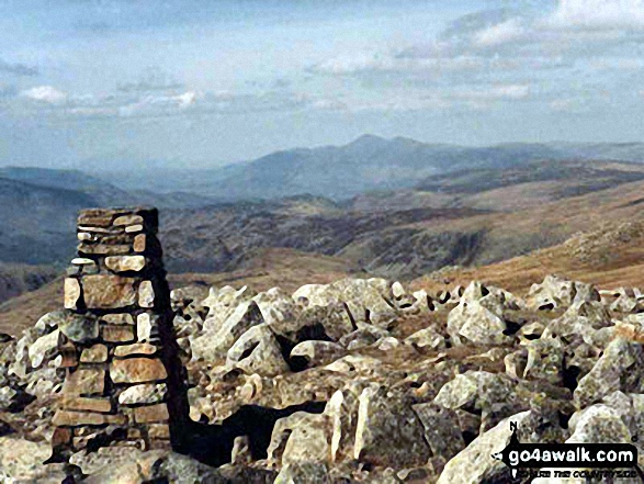 The summit of High Raise (Langdale) in The Central Fells area of The Lake District
Photo: Hugh Turner
# Whether you print a copy or download it to your phone, this Peak Baggers' Map will prove incredibly useful if you want to know what's what when you are up in the mountains and cannot get a phone signal.
Is there a Mountain, Peak, Top or Hill missing from the above google map or list?


